
Marche · Ascoli Piceno
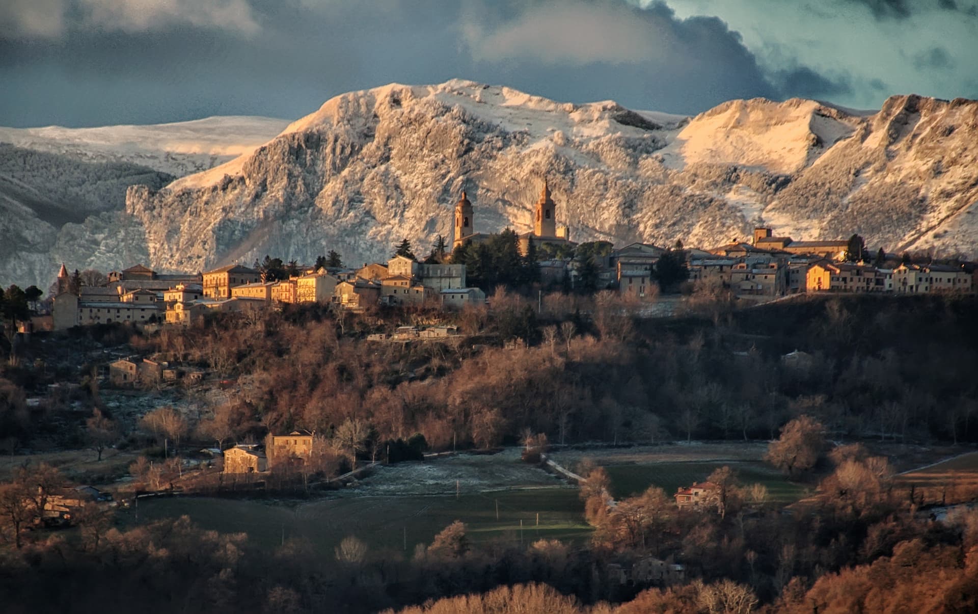
Arquata del Tronto
At 777 meters between two national parks, the Marche commune levelled by the 2016 earthquakes and still rebuilding nine years on.
Known for
2016 EARTHQUAKES
Forty-nine deaths in the commune across the 24 August and 30 October 2016 shocks; Pescara del Tronto was levelled in the first.
TWO NATIONAL PARKS
The only European commune with territory inside two national parks: Sibillini to the north and Gran Sasso e Laga to the south.
MONTE VETTORE
At 2,476 meters, the highest Sibillini peak, accessed from the western trails of the commune via Forca di Presta.
When to visit
Best · May–Oct
- J
- F
- M
- A
- M
- J
- J
- A
- S
- O
- N
- D
- Best
- Hot or crowded
- Quiet
- Mostly closed
Why come
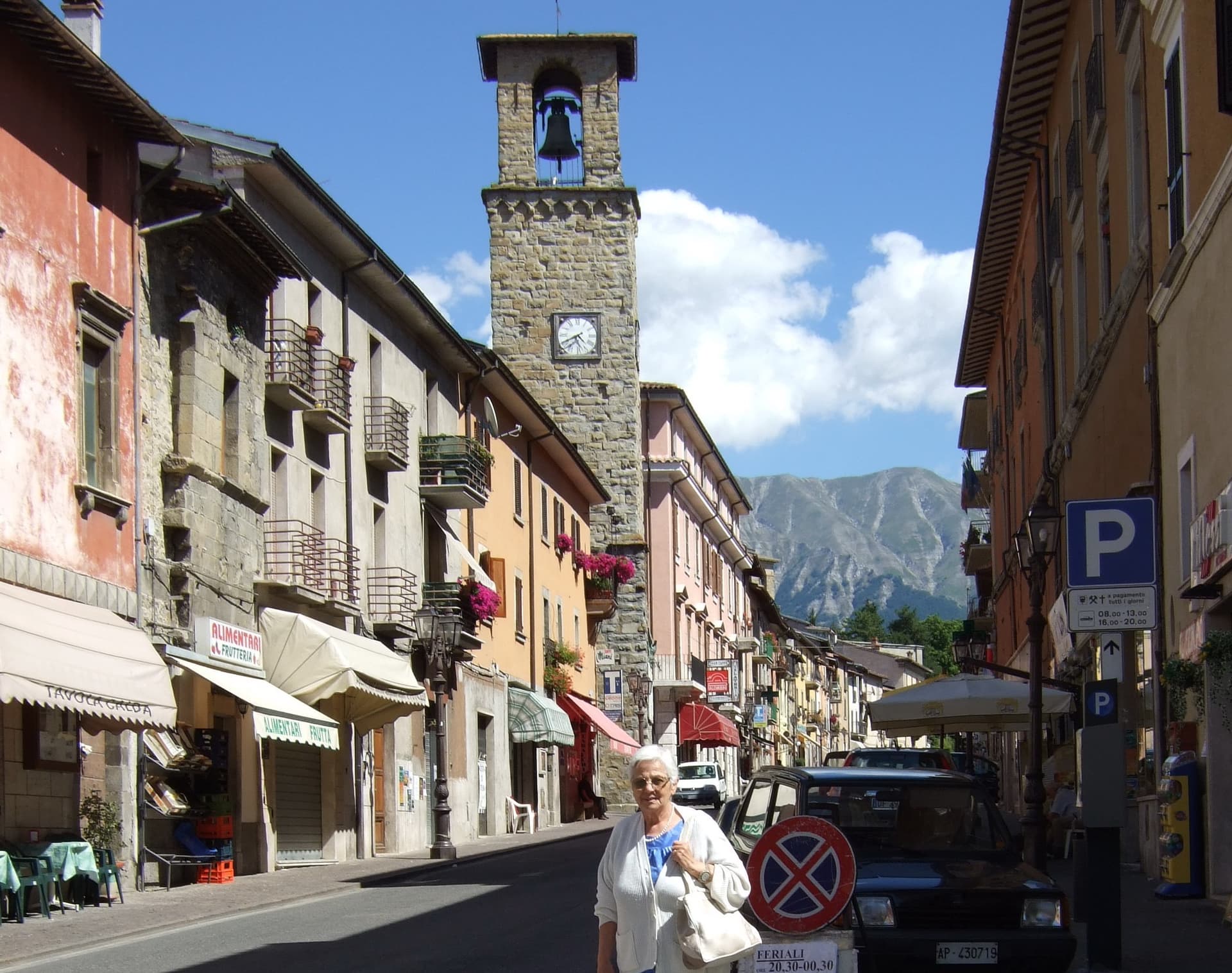
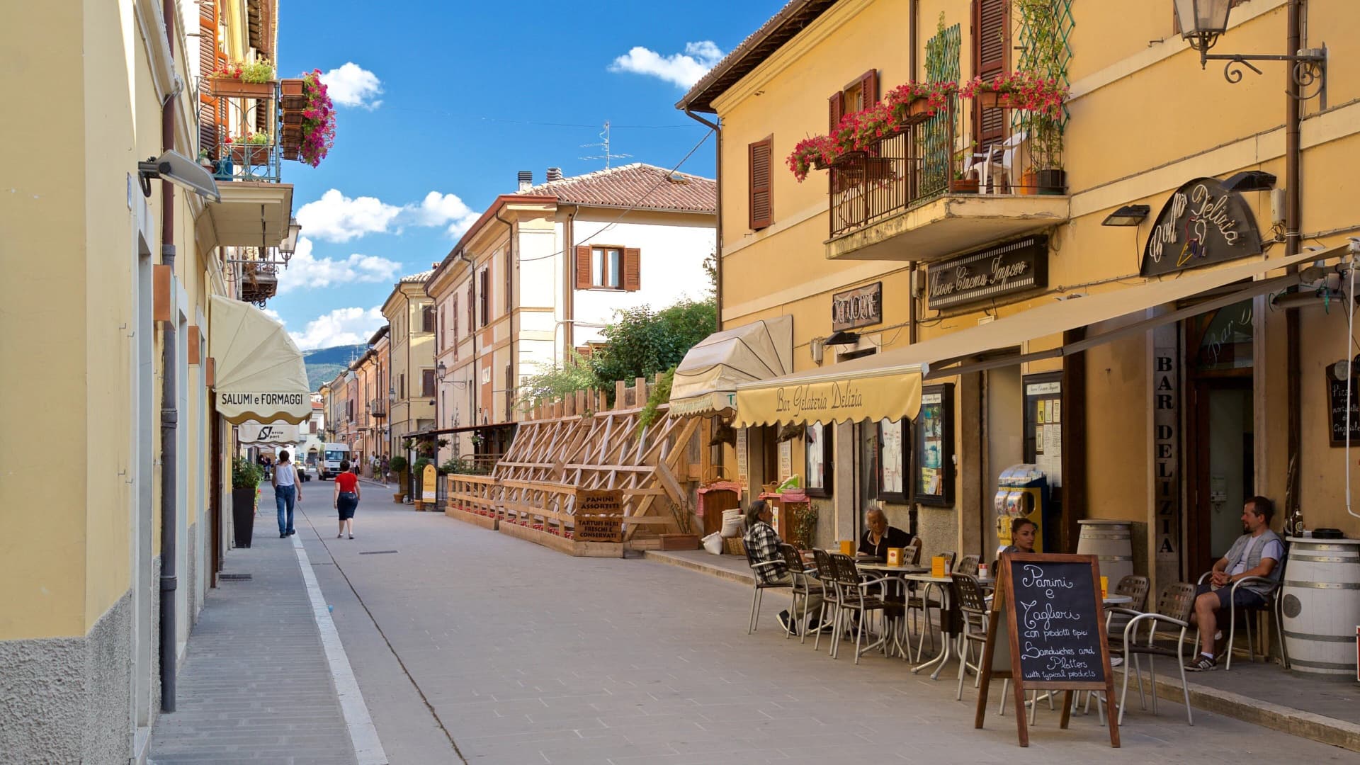
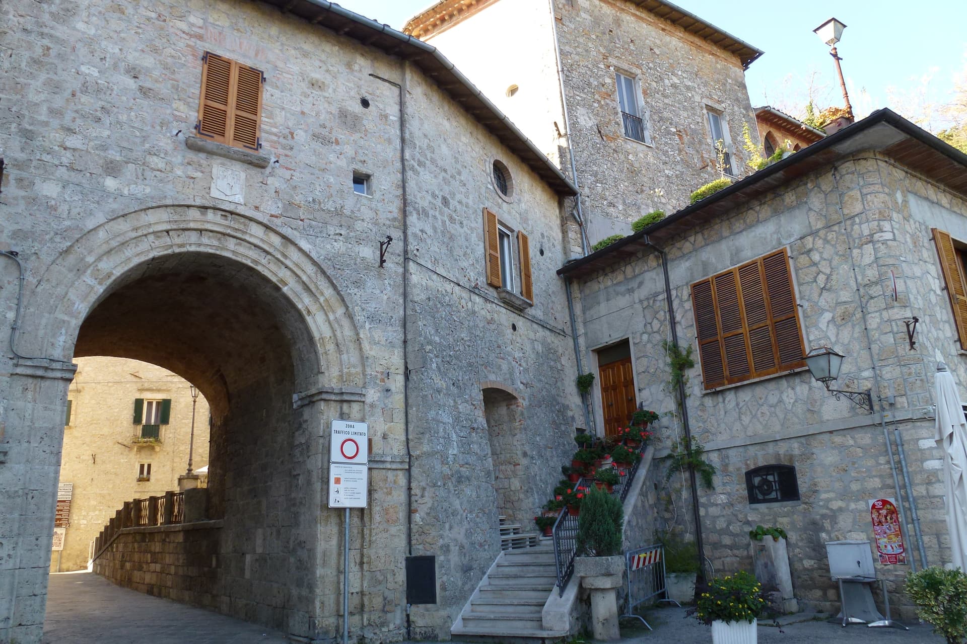
Arquata del Tronto sits at 777 meters in the upper Tronto valley, the only European commune whose territory falls inside two national parks: Gran Sasso e Monti della Laga to the south, Monti Sibillini to the north. The capoluogo runs up a ridge between the two, with the Rocca of Arquata, originally a thirteenth-century watchtower of the Norcia road, on the highest point. The earthquakes of 24 August and 30 October 2016 killed 49 people in the commune, mostly in the frazione of Pescara del Tronto which was destroyed at 3:36 in the morning when the first 6.
0 shock struck. Many of the other twelve frazioni, including Borgo, Trisungo and Capodacqua, suffered heavy damage. Reconstruction has been slow: temporary housing remains in place for most displaced residents, and several frazioni are still closed to entry. The population, 973 at the 2023 count, is roughly half of what it was in 2015.
The Sunday letter
We haven’t written Arquata del Tronto’s letter yet.
One town every Sunday, with the photo, the food, the festa. Be there when this one comes up. Free, by Peter & Sophia from Pietrasanta.
By subscribing you agree to Substack’s Terms of Use, our Privacy Policy and our Information collection notice.


What to see
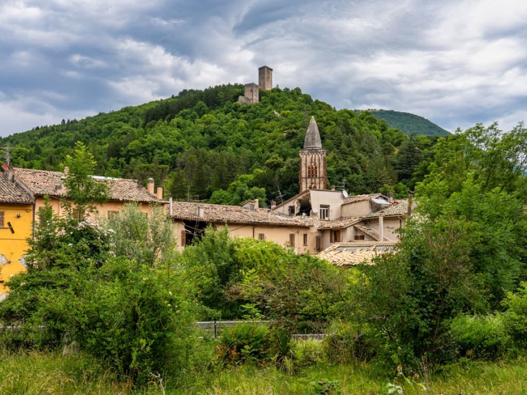
Rocca di Arquata
Thirteenth-century watchtower-fortress on the highest point of the capoluogo, controlling the Tronto road toward Norcia.
Pescara del Tronto
Frazione destroyed by the 24 August 2016 earthquake at magnitude 6.0; the site remains closed and is marked by a memorial.
Monte Vettore
At 2,476 meters, the highest peak of the Sibillini, accessed from Arquata's western trails toward the Forca di Presta saddle.
Parco Nazionale dei Monti Sibillini
The commune's northern half lies inside the Sibillini park, with hiking routes from Forca di Presta to Castelluccio di Norcia.
Parco Nazionale del Gran Sasso e Monti della Laga
The southern half sits inside the Gran Sasso e Laga park, with woodland trails across the Laga ridge toward Acquasanta Terme.
The slow-trip planner
Building a trip? Find where Arquata del Tronto fits in a slow Italy circuit.
Answer five questions. We will shape a geographically coherent slow trip from the 1,000 Italian towns most travelers skip. Yours to save and share.
Living here
- Population 973
- In-betweeni
- Pharmacy in town
- High school within a 30-minute drive
- Nearest airport Ancona / Pescara, 1 h 59 min drive
- Regional capital Ancona, 1 h 53 min drive
Tags & datadesignations · numbers · sources
Recognised as
The numbers
- Elevation: 777 m
- Population: 973
- Surface area: 92.23 km²
These figures were compiled from public directories — ISTAT, OpenStreetMap, Wikidata — and from the official listings of the guides named on this page. Town details change; verify with official sources before you travel.
Close by
More towns near Arquata del Tronto

Acquasanta Terme
Province: Ascoli Piceno
A sulphur-spring spa at 392 meters in the upper Tronto valley, used for cures since the Roman consul Lucio Munazio Planco around 50 AD.
Amatrice
Province: Rieti
A 955-meter Apennine town leveled by the 24 August 2016 earthquake, slowly rebuilding the streets that gave amatriciana its name.

Ascoli Piceno
Province: Ascoli Piceno
The travertine city at 154 meters where the Tronto meets the Castellano, capital of the Piceni and host of the Quintana joust.
Norcia
Province: Perugia
Birthplace of San Benedetto at 604 meters on a Sibillini plateau, leveled by the 2016 earthquake and rebuilt stone by stone.
Civitella del Tronto
Province: Teramo
A rocky crest at 589 meters above the Tronto valley, crowned by the last Bourbon fortress to surrender to united Italy in March 1861.
🌲 Parco Nazionale
More Parco Nazionale towns in Marche
Amandola
Province: Fermo
A Sibillini gateway at 550 meters on three hills above the Tenna valley, founded 1248 and damaged but not levelled in 2016.
San Ginesio
Province: Macerata
The Balcony of the Sibillini at 680 meters, with a 1295 pilgrim hospital and the only flowery gothic collegiate church in the Marche.

Valfornace
Province: Macerata
A 909-resident Sibillini commune at 441 meters in the upper Chienti valley, born in 2017 from the merger of Pievebovigliana and Fiordimonte.
Visso
Province: Macerata
The northern Sibillini gate at 607 meters where the Nera meets the Ussita, holding one of two surviving manuscripts of Leopardi's L'Infinito.