
Marche · Macerata
Valfornace
A 909-resident Sibillini commune in the upper Chienti valley, born in 2017 from the merger of Pievebovigliana and Fiordimonte.
Known for
BELDILETTO
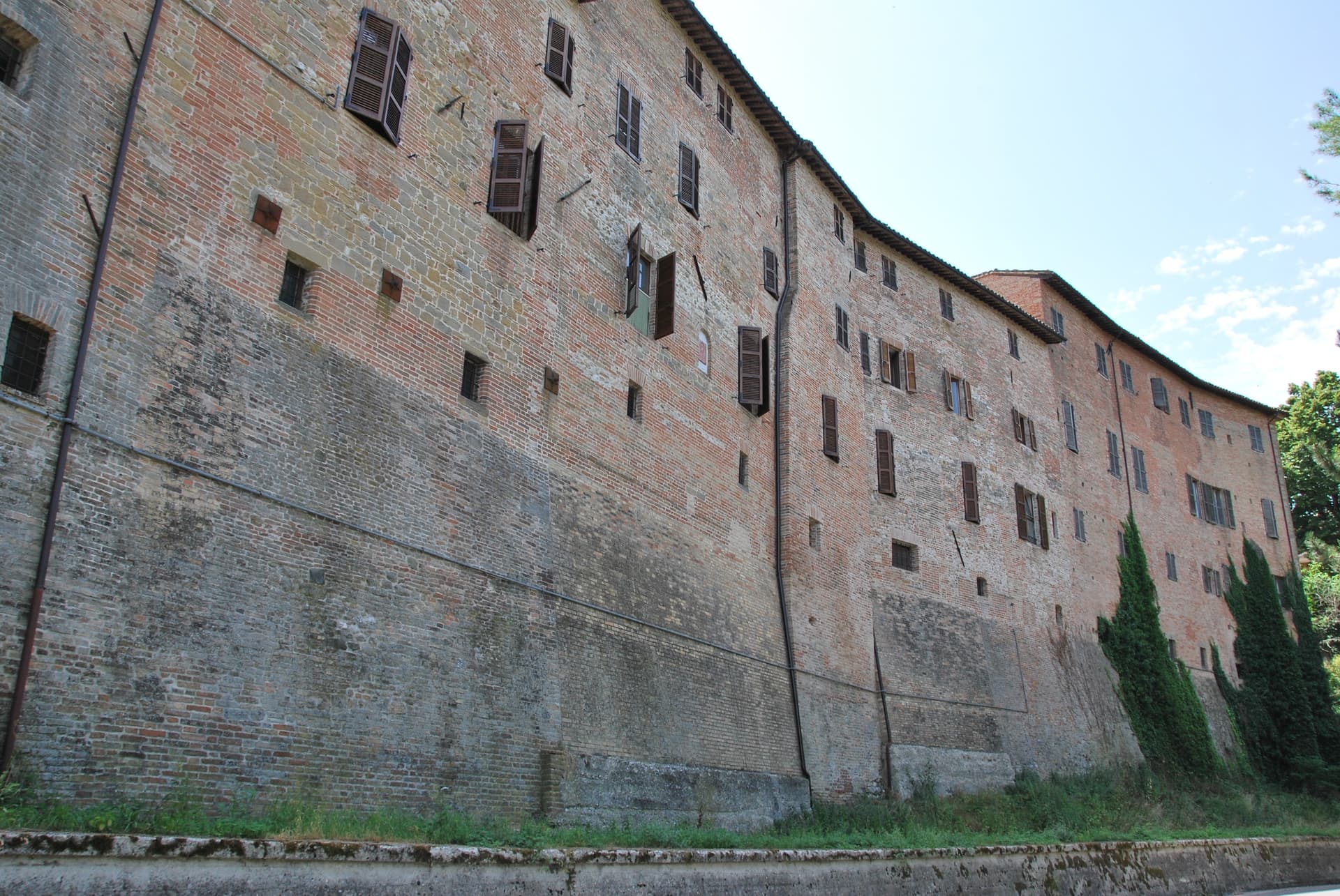
Da Varano summer castle of 1371 turned into a Renaissance villa, the architectural anchor of the Pontelatrave frazione.
SAN GIUSTO
Ninth-century Romanesque church at the foot of Monte Fiegni, one of the most important pre-Romanesque buildings in the region.
HONEY AND LIQUORS
Beekeepers and small distillers across the frazioni, with Città del Miele and Città dei Liquori signals to the commune.
When to visit
Best · Apr–Oct
- J
- F
- M
- A
- M
- J
- J
- A
- S
- O
- N
- D
- Best
- Hot or crowded
- Quiet
- Mostly closed
Why come
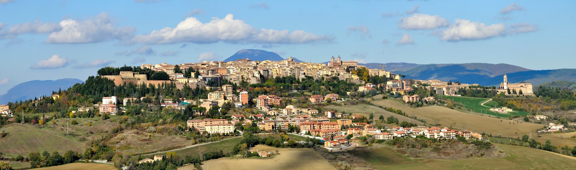
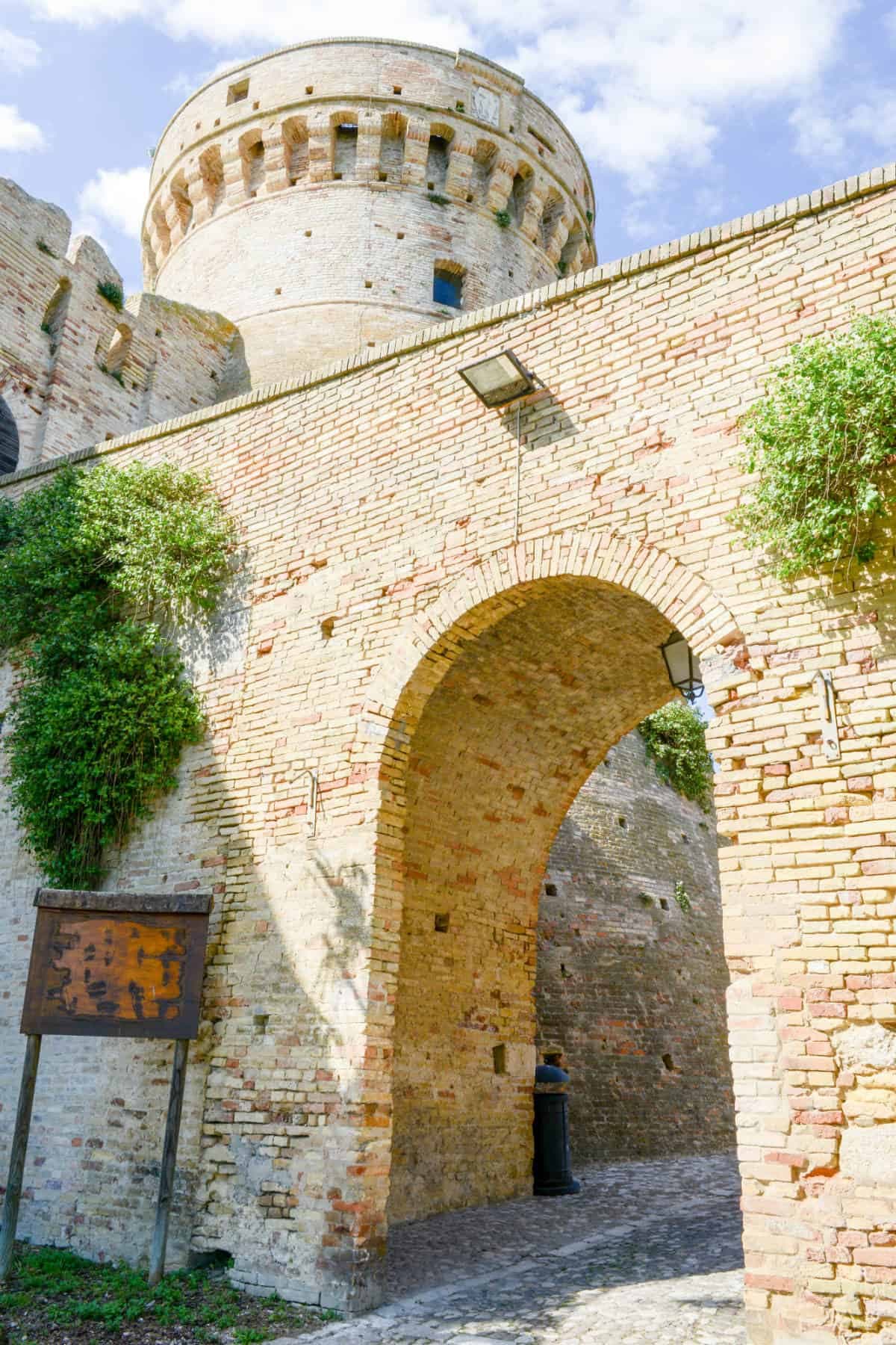
Valfornace was created on 1 January 2017 from the merger of Pievebovigliana and Fiordimonte, two small communes in the upper Chienti valley inside the Monti Sibillini National Park. The capoluogo is Pievebovigliana, with the territory spreading west toward Monte Fiegni and the park boundary. The Castello di Beldiletto, in the frazione of Pontelatrave, was commissioned in 1371 by the Da Varano family of Camerino as a summer residence and converted into a Renaissance villa in the fifteenth century.
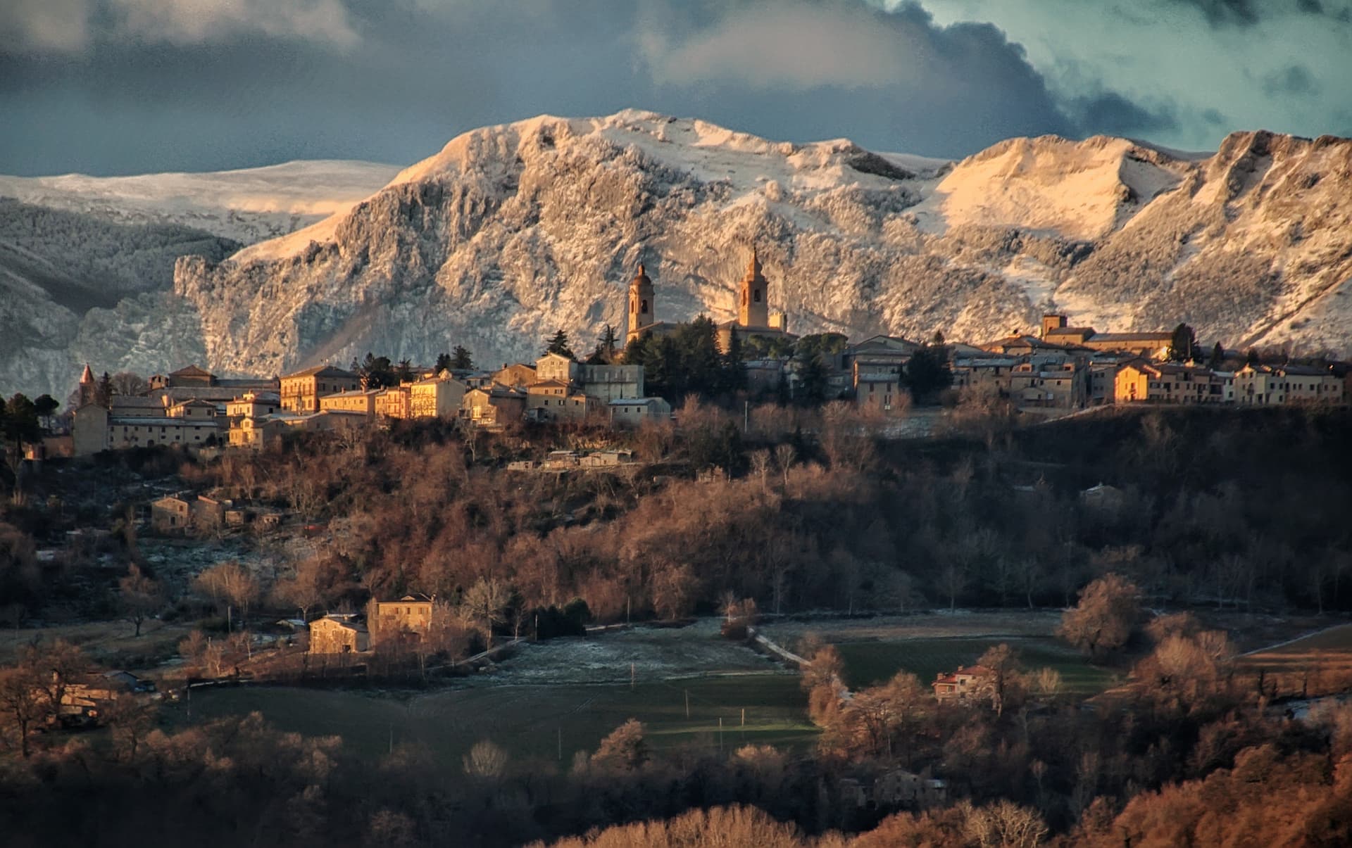
The Chiesa di San Giusto, at the foot of Monte Fiegni, is one of the most important Romanesque buildings in the Marche, with origins in the ninth century. The Chiesa di Santa Maria Assunta in Pievebovigliana has a medieval Romanesque crypt. The 2016 earthquakes damaged many of these structures and reconstruction continues. Honey and herb liquors, beekeepers and producers scattered through the frazioni, are the local trades that earned the Città del Miele and Città dei Liquori signals.
The Sunday letter
We haven’t written Valfornace’s letter yet.
One town every Sunday, with the photo, the food, the festa. Be there when this one comes up. Free, by Peter & Sophia from Pietrasanta.
By subscribing you agree to Substack’s Terms of Use, our Privacy Policy and our Information collection notice.


What to see
Castello di Beldiletto
Da Varano summer residence commissioned 1371 in the Pontelatrave frazione, converted into a Renaissance villa in the fifteenth century.
Chiesa di San Giusto
Ninth-century Romanesque church at the foot of Monte Fiegni (1,324 m), considered one of the most important pre-Romanesque buildings in the Marche.
Chiesa di Santa Maria Assunta
Medieval church in Pievebovigliana with a Romanesque crypt, the parish anchor of the capoluogo.
Parco Nazionale dei Monti Sibillini
The commune sits on the park's eastern edge, with trail access from Fiordimonte toward Monte Fiegni and the Sibillini high ridges.
The slow-trip planner
Building a trip? Find where Valfornace fits in a slow Italy circuit.
Answer five questions. We will shape a geographically coherent slow trip from the 1,000 Italian towns most travelers skip. Yours to save and share.
Living here
- Population 909
- In-betweeni
- Pharmacy in town
- High school within a 30-minute drive
- Nearest airport Ancona / Pescara, 1 h 41 min drive
- Regional capital Ancona, 1 h 36 min drive
Tags & datadesignations · numbers · sources
The numbers
- Elevation: 441 m
- Population: 909
- Surface area: 48.61 km²
These figures were compiled from public directories — ISTAT, OpenStreetMap, Wikidata — and from the official listings of the guides named on this page. Town details change; verify with official sources before you travel.
Close by
More towns near Valfornace
Camerino
Province: Macerata
A university city at 661 meters on the ridge between the Chienti and Potenza, Da Varano capital from 1259 to 1539, rebuilding after 2016.
San Ginesio
Province: Macerata
The Balcony of the Sibillini at 680 meters, with a 1295 pilgrim hospital and the only flowery gothic collegiate church in the Marche.
Foligno
Province: Perugia
A valley town at 235 meters on the Topino, where Dante's Divine Comedy was first printed in 1472.

Sarnano
Province: Macerata
A 539-meter medieval borgo of baked brick at the foot of the Sibillini, with thermal springs that ran for 84 years until the 2016 earthquake.

Matelica
Province: Macerata
A Verdicchio town at 354 meters in the upper Esino valley, with a Roman marble globe in its archaeological museum.
🟠 Bandiera Arancione
More Bandiera Arancione towns in Marche
Acquaviva Picena
Province: Ascoli Piceno
A walled hill borgo at 359 meters six kilometers from the Adriatic, anchored by a Baccio Pontelli fortress and the surviving pajarola craft.
Amandola
Province: Fermo
A Sibillini gateway at 550 meters on three hills above the Tenna valley, founded 1248 and damaged but not levelled in 2016.
Cantiano
Province: Pesaro e Urbino
A border borgo at 374 meters under Monte Catria on the old Via Flaminia, known for the Good Friday Turba and the sour-cherry visciola harvest.
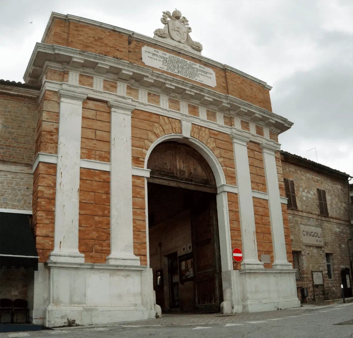
Cingoli
Province: Macerata
The Balcone delle Marche at 631 meters, a hilltop borgo where on clear days the view runs from the Sibillini to the Croatian coast.
Corinaldo
Province: Ancona
A walled hill borgo at 203 meters with 912 meters of intact medieval walls, the birthplace of Saint Maria Goretti and the Pozzo della Polenta.