
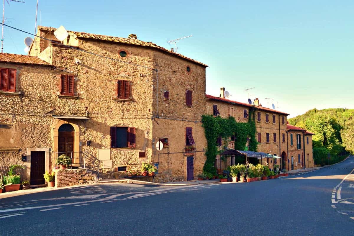
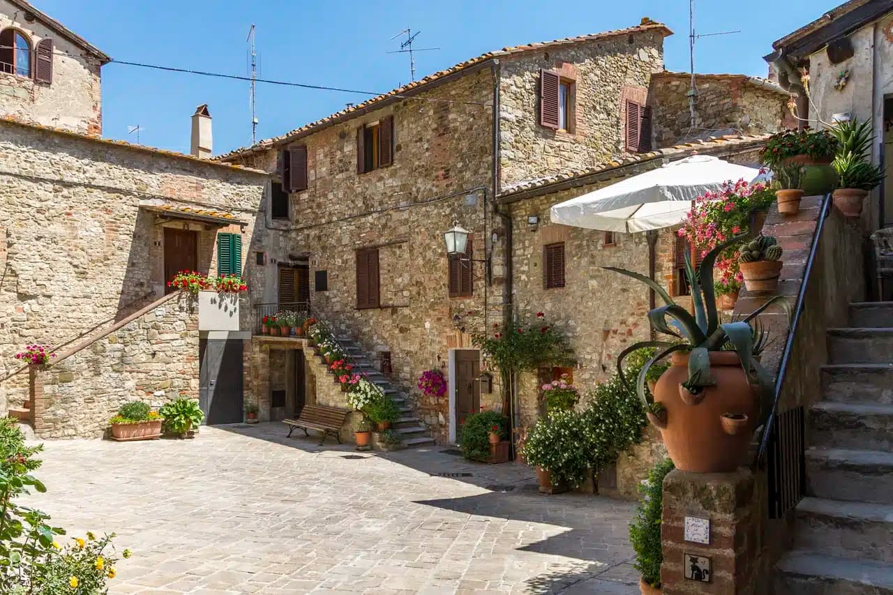
Tuscany · Siena
Chiusi
The Etruscan city of King Porsenna above the Val di Chiana, with one of Italy's major Etruscan museums and tunnels carved beneath the streets.
Known for
ETRUSCAN CAPITAL
One of the twelve cities of the Etruscan League, ruled at its sixth-century BC peak by Lars Porsenna who led the alliance against Rome around 508 BC.
MUSEO NAZIONALE
National Etruscan Museum since 1963, founded 1871, one of the most important repositories of Etruscan material in Italy, with painted tombs in the Poggio Renzo necropolis.
LABIRINTO DI PORSENNA
Network of sixth and fifth-century BC tunnels under the town, originally drainage works, claimed by Pliny the Elder as part of the king's sepulchre.
When to visit
Best · Apr–Oct
- J
- F
- M
- A
- M
- J
- J
- A
- S
- O
- N
- D
- Best
- Hot or crowded
- Quiet
- Mostly closed
The festa: Santa Mustiola, 3 July
Why come
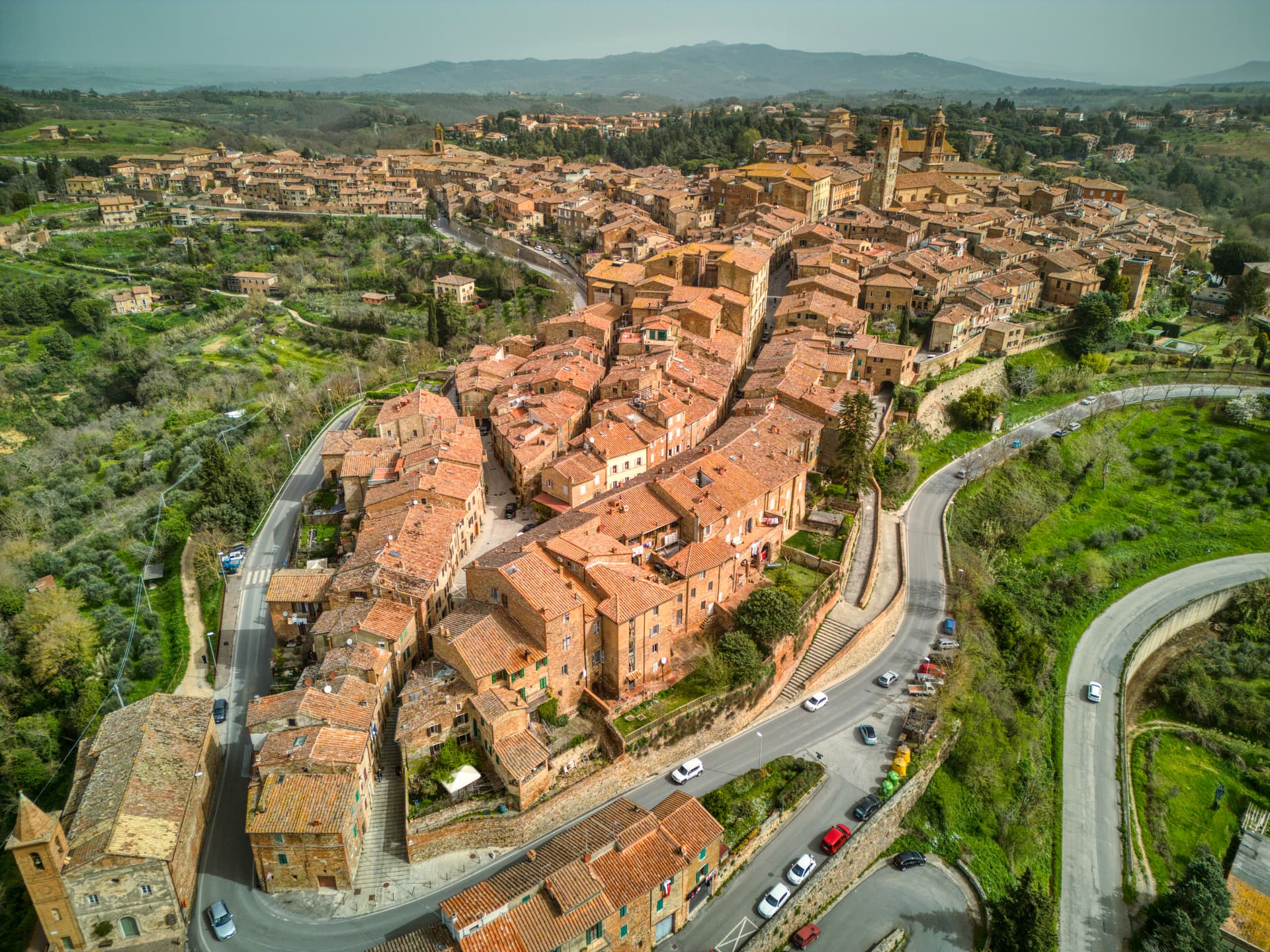
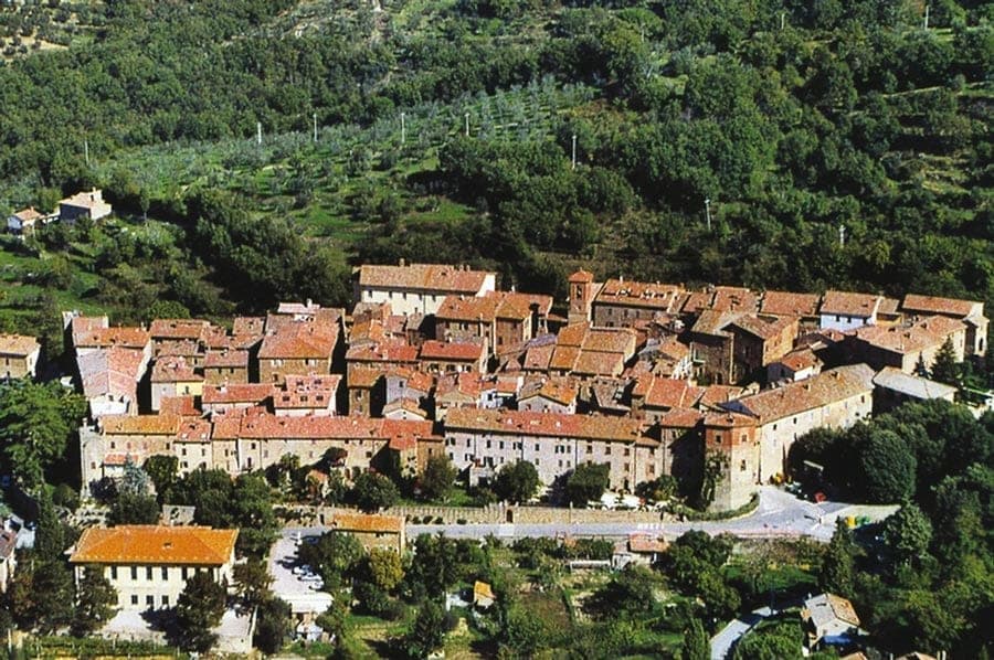
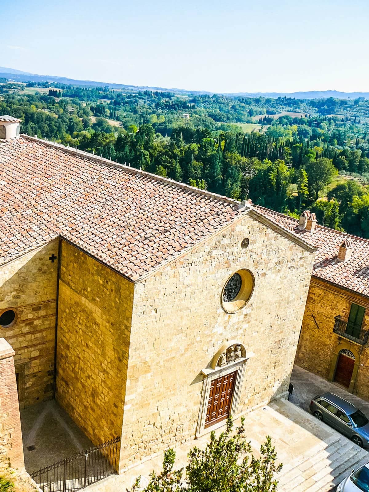
Chiusi sits on a hilltop above the Val di Chiana, one of the twelve cities of the Etruscan League and at its sixth-century BC peak ruled by Lars Porsenna, the king who led the brief siege of Rome around 508 BC. The Museo Nazionale Etrusco di Chiusi, founded in 1871 and made national in 1963, holds one of the most important collections of Etruscan material in Italy, with canopic urns, alabaster sarcophagi and bucchero pottery from the surrounding necropolises. The Duomo di San Secondiano, built around 560 AD over a pre-existing basilica and renovated in the thirteenth century, runs nave and two aisles on antique marble columns taken from earlier Roman buildings.
The Labirinto di Porsenna, a network of sixth and fifth-century BC tunnels under the town, was probably built as a rainwater drainage system; Pliny the Elder claimed it was part of the king's sepulchre. The painted Etruscan tombs of Poggio Renzo, including the Tomba della Scimmia discovered in 1846, sit a few kilometers from town.
The Sunday letter
We haven’t written Chiusi’s letter yet.
One town every Sunday, with the photo, the food, the festa. Be there when this one comes up. Free, by Peter & Sophia from Pietrasanta.
By subscribing you agree to Substack’s Terms of Use, our Privacy Policy and our Information collection notice.


What to see
Museo Nazionale Etrusco
National museum founded 1871 holding canopic urns, alabaster sarcophagi, bucchero pottery and grave goods from the Chiusi necropolises, made national in 1963.
Duomo di San Secondiano
Cathedral built around 560 AD over an earlier basilica, renovated in the thirteenth century, nave and two aisles on antique marble columns from Roman buildings.
Labirinto di Porsenna
Network of sixth and fifth-century BC tunnels beneath the town, probably built for rainwater drainage, visited from the Museo della Cattedrale.
Tomba della Scimmia
Painted Etruscan tomb in the Poggio Renzo necropolis dated 480-470 BC, discovered by Alessandro François in 1846, with funeral games and a monkey on the walls.
Museo della Cattedrale
Diocesan museum with Romanesque sculpture, illuminated choir books from Monte Oliveto Maggiore, and access to the Labirinto di Porsenna and bell tower.
Lago di Chiusi
Small natural lake five kilometers north of town, a reed-fringed basin used since Etruscan times, with traditional fishing in flat-bottomed barchini.
The slow-trip planner
Building a trip? Find where Chiusi fits in a slow Italy circuit.
Answer five questions. We will shape a geographically coherent slow trip from the 1,000 Italian towns most travelers skip. Yours to save and share.
We recommend
Where to eat and stay
Not our picks, but places the guides put their name to — a Michelin star, a Gambero Rosso fork, a Slow Food snail, a Michelin Key for the hotels. Worth a table, a counter, or a night when you pass through.
La Solita ZuppaRistorante
A Michelin Bib Gourmand for La Solita Zuppa, and a Slow Food snail.
I SalottiRistorante
I Salotti holds a spot in the Michelin Guide.
Il Grillo è BuoncantoreRistorante
Il Grillo è Buoncantore carries a Slow Food snail.
Living here
- Population 8,093
- In-betweeni
- Pharmacy in town
- High school within a 30-minute drive
- Train station in the comune
- Nearest airport Bologna, 2 h 22 min drive
- Regional capital Firenze, 1 h 23 min drive
Tags & datadesignations · numbers · sources
Recognised as
The numbers
- Elevation: 398 m
- Population: 8,093
- Surface area: 58.15 km²
These figures were compiled from public directories — ISTAT, OpenStreetMap, Wikidata — and from the official listings of the guides named on this page. Town details change; verify with official sources before you travel.
Close by
More towns near Chiusi
Città della Pieve
Province: Perugia
A red-brick hill town at 508 meters above the Valdichiana, the birthplace of Perugino and the home of Italy's narrowest alley.
Paciano
Province: Perugia
Walled hill town of 957 people at 391 meters above Lake Trasimeno, three parallel streets, eight towers and three medieval gates intact.
Montepulciano
Province: Siena
A Renaissance hill town at 605 meters on a limestone ridge, where Vino Nobile is aged in vaulted cellars beneath the palazzi of Piazza Grande.
Castiglione del Lago
Province: Perugia
Trasimeno's western promontory, once the lake's fourth island, fortified by Federico II in 1247 and frescoed by Pomarancio for the Corgna marquises.
Cetona
Province: Siena
A medieval borgo at 384 meters below Monte Cetona, sold by Cosimo I to the Vitelli in 1556 and the centro storico still shaped by their fortress reconstruction.
🟠 Bandiera Arancione
More Bandiera Arancione towns in Tuscany
Abetone Cutigliano
Province: Pistoia
The Apennine ski pass at 1,388 meters where the Granduca's two stone pyramids of 1778 mark the old Tuscan-Modenese border.
Anghiari
Province: Arezzo
A walled medieval town at 430 meters over the upper Tiber valley, where Florence beat Milan in 1440 and Leonardo started the fresco he never finished.
Barga
Province: Lucca
A medieval hilltop town at 410 meters in the Serchio valley between the Apuan Alps and the Apennines, where Giovanni Pascoli wrote his last poems and the August festival serves fish and chips.
Casale Marittimo
Province: Pisa
A concentric stone borgo at 214 meters above the Val di Cecina, built where a seventh-century BC Etruscan outpost of Volterra once stood.
Castelnuovo Berardenga
Province: Siena
A Chianti Classico commune at 351 meters between the Ombrone and the Crete Senesi, the last castle Siena built against Florence, in 1366.