Calabria · Cosenza
Mormanno
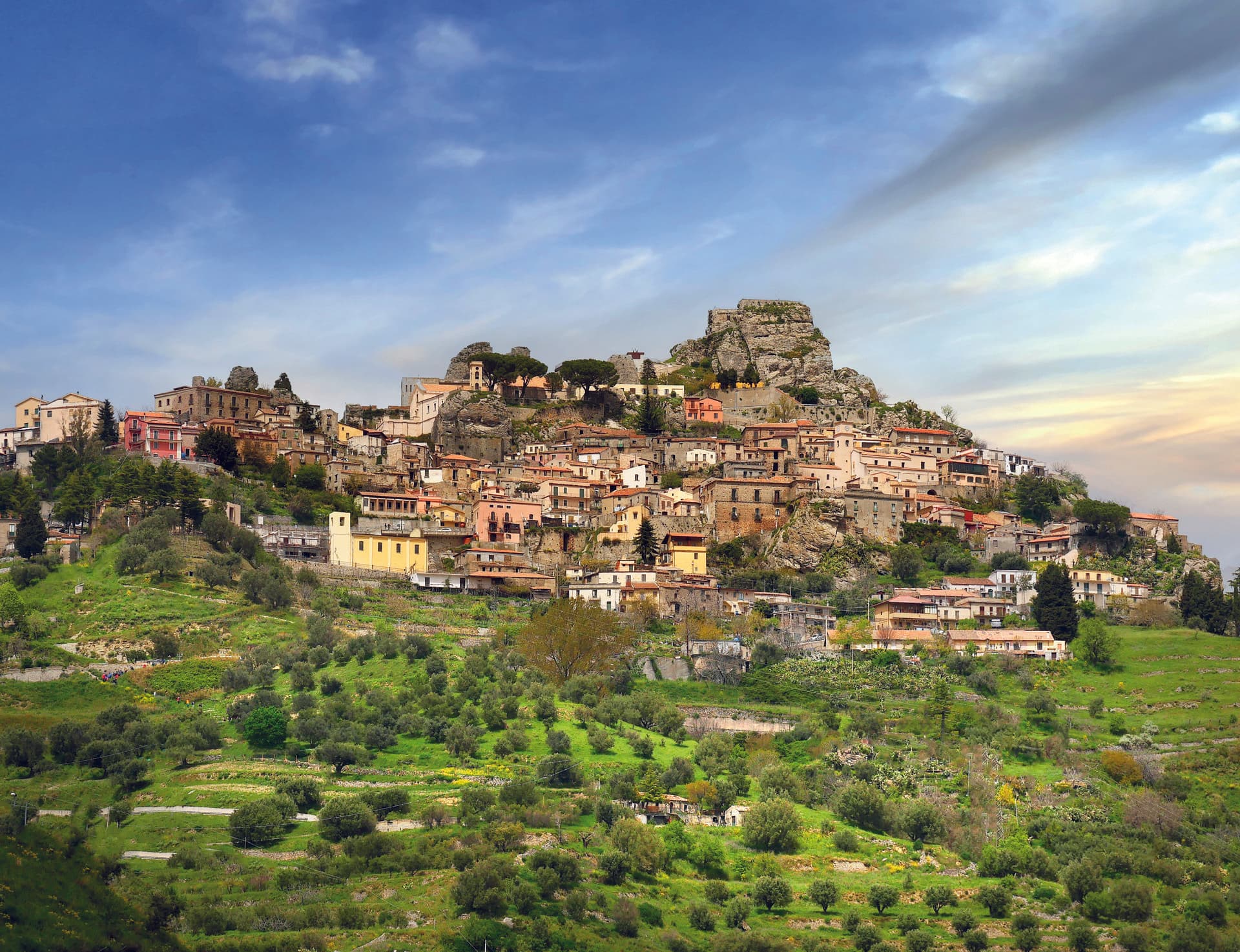
A Pollino mountain borgo at 840 meters between the Costa and Vernita ridges, known for lentils, white poverelli beans and the bocconotto pastry.
Known for
BOCCONOTTO
Single-bite shortcrust pastry filled with mostarda or grape jam, the town's signature sweet, recognized as a Calabrian PAT product.
BEANS AND LENTILS
White poverelli beans and lentils grown on the Pollino slopes, the agricultural backbone alongside the bocconotto.
POLLINO
Mountain borgo inside Pollino National Park, between the Costa and Vernita ridges in the Calabrian half of the massif.
When to visit
Best · May–Oct
- J
- F
- M
- A
- M
- J
- J
- A
- S
- O
- N
- D
- Best
- Hot or crowded
- Quiet
- Mostly closed
Why come
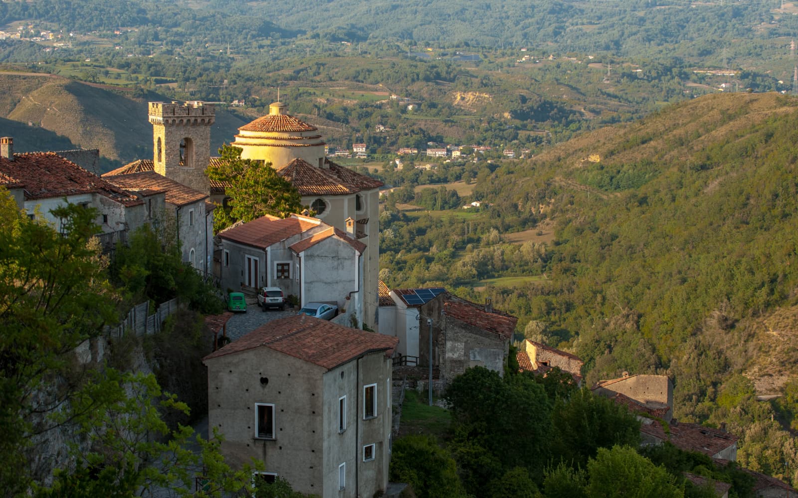
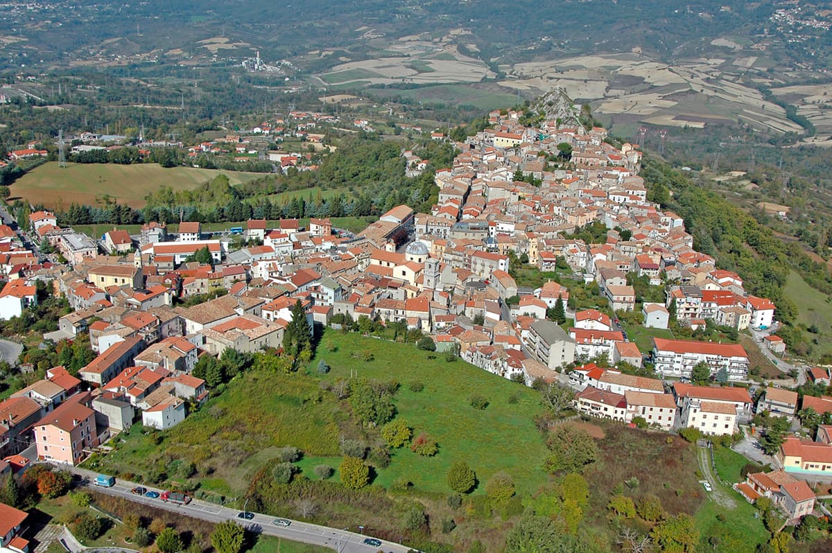
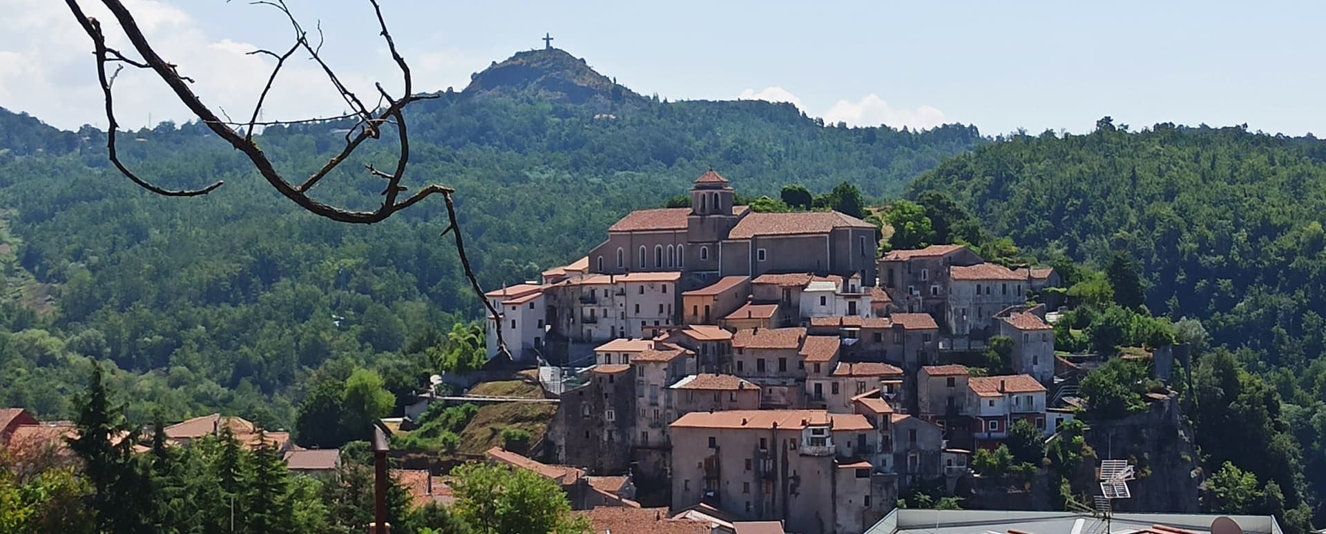
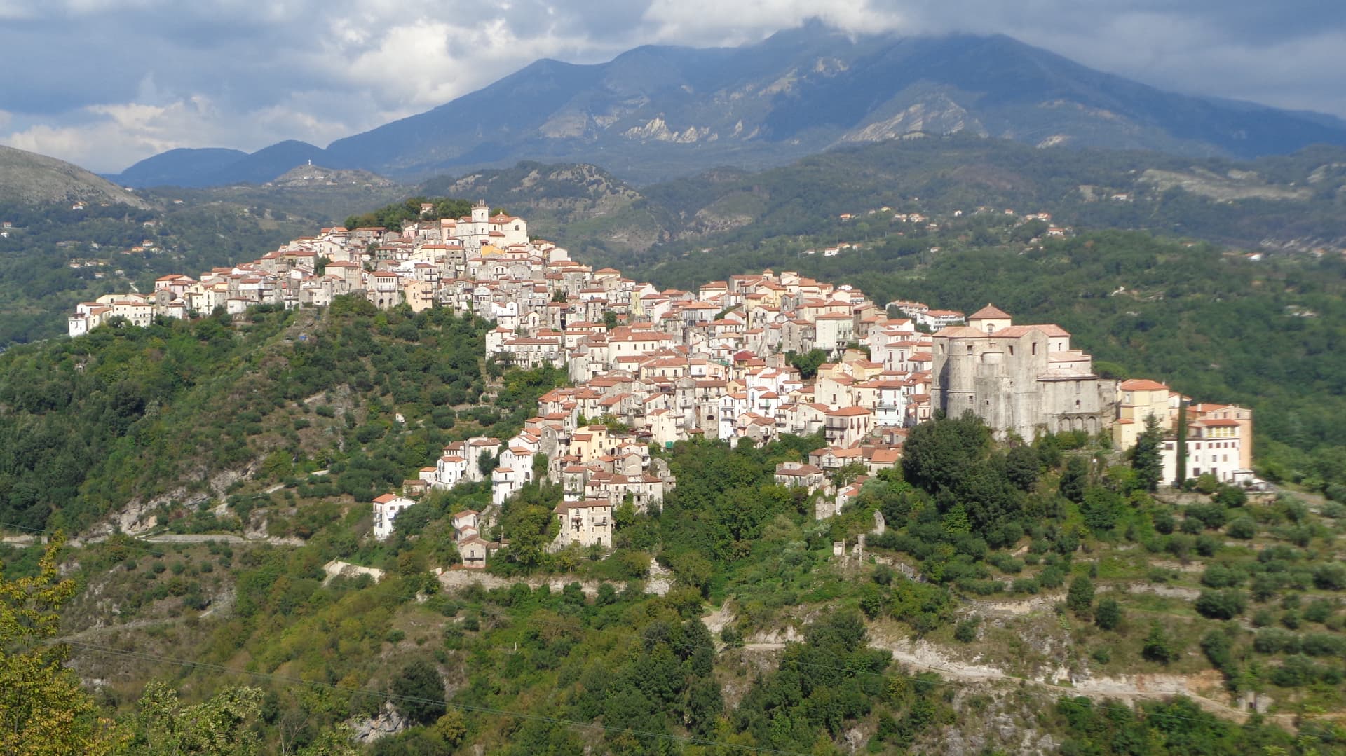
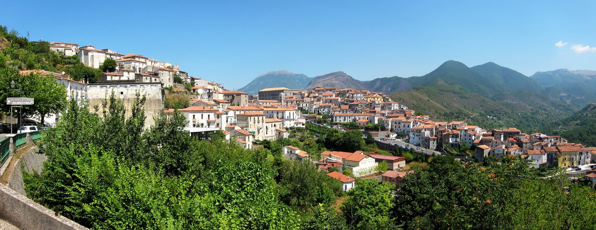
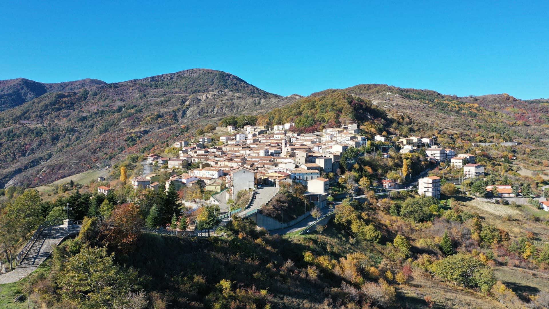
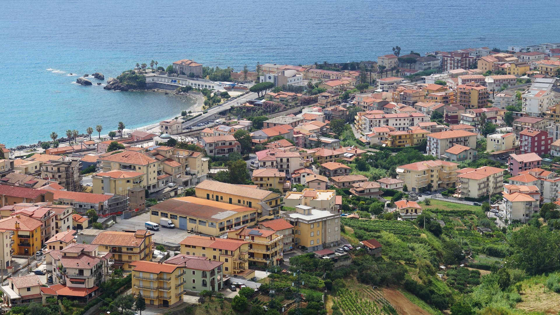
Mormanno sits at 840 meters in Pollino National Park, in the Calabrian half of the massif, between the opposing ridges of Costa and Vernita and within reach of the Lao river valley. The Pellegrino group rises immediately above the town, Monte Palanuda at 1,632 meters and Monte Cerviero at 1,443. Local historians read its origins back to the Lombard era; the first surviving document, a Greek-language deed of donation, dates to 1092.
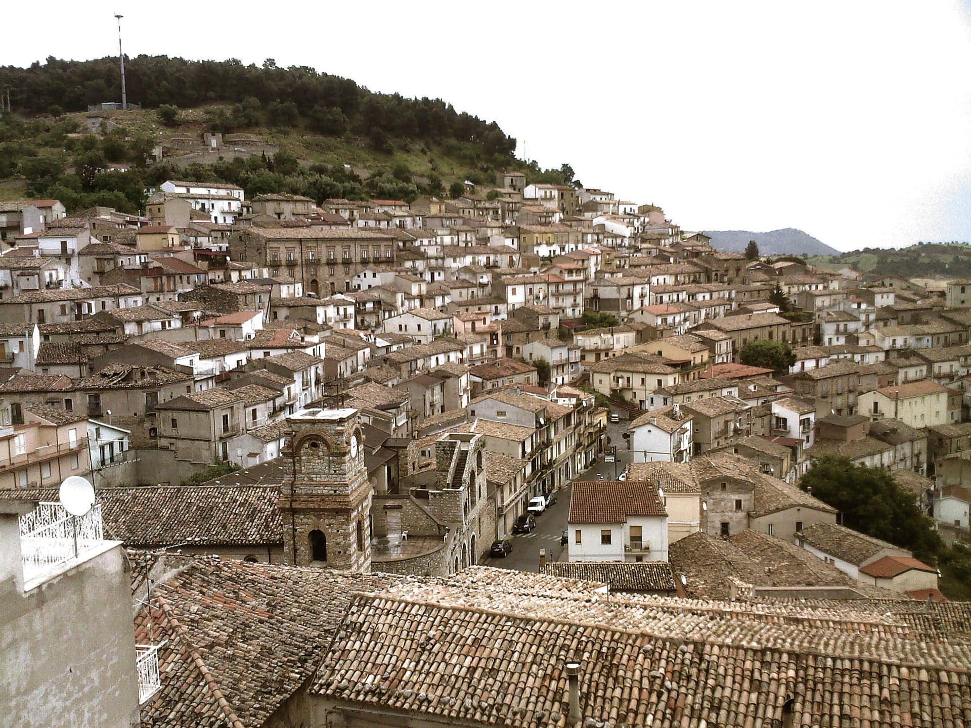
The Sanseverino of Bisignano held the fief until 1612. The eighteenth-century Neapolitan-Baroque cathedral sits at the center of a historic plan organized into four quarters: Costa to the west, Capo lo Serro to the east, Casalicchio south, Torretta north. The town is in the Città del Vino network and is known across Calabria for two products: white poverelli beans and lentils grown on the surrounding slopes, and the bocconotto di Mormanno, a single-bite shortcrust pastry filled with mostarda or grape jam.
The Sunday letter
We haven’t written Mormanno’s letter yet.
One town every Sunday, with the photo, the food, the festa. Be there when this one comes up. Free, by Peter & Sophia from Pietrasanta.
By subscribing you agree to Substack’s Terms of Use, our Privacy Policy and our Information collection notice.


What to see
Cattedrale di Santa Maria del Colle
Eighteenth-century Neapolitan-Baroque cathedral on the high point of the borgo, the architectural anchor of the historic plan.
Centro storico
Historic plan organized into four named quarters, Costa, Capo lo Serro, Casalicchio and Torretta, each named for its position around the cathedral.
Parco Nazionale del Pollino
Calabrian sector of Italy's largest national park surrounds the town, with the Pellegrino massif rising directly above the houses.
Monte Cerviero
1,443-meter peak immediately above the borgo, paired with Monte Palanuda at 1,632 meters in the Pellegrino group.
The slow-trip planner
Building a trip? Find where Mormanno fits in a slow Italy circuit.
Answer five questions. We will shape a geographically coherent slow trip from the 1,000 Italian towns most travelers skip. Yours to save and share.
Living here
- Population 2,631
- Off the beaten pathi
- Pharmacy in town
- High school within a 30-minute drive
- Nearest airport Lamezia / Reggio, 2 h 10 min drive
- Regional capital Catanzaro, 2 h 25 min drive
Tags & datadesignations · numbers · sources
Recognised as
The numbers
- Elevation: 840 m
- Population: 2,631
- Surface area: 78.88 km²
These figures were compiled from public directories — ISTAT, OpenStreetMap, Wikidata — and from the official listings of the guides named on this page. Town details change; verify with official sources before you travel.
Close by
More towns near Mormanno
Laino Borgo
Province: Cosenza
Southern Italy's only Sacro Monte, sixteen pilgrimage chapels begun in 1557, on the Lao river canyon that made it Calabria's rafting capital.
Morano Calabro
Province: Cosenza
A conical hill of stone houses stacked under a Norman-Swabian castle at the southern gate of the Pollino, called Italy's nativity village.
Rotonda
Province: Potenza
The Pollino park's Lucanian gateway — a 3,171-resident borgo at 626m on the Basilicata/Calabria border, headquartered HQ for the Parco Nazionale del Pollino (Italy's largest national park), with the Fagiolo Bianco Poverello + Melanzana Rossa di Rotonda DOP slow-food products, the Borgo Autentico mark, and the Loricato pine forests immediately above town.
Lagonegro
Province: Potenza
A 666-meter Valle del Noce town founded by Byzantine monks, where local legend places the burial of Lisa del Giocondo, Leonardo's Mona Lisa.
Rivello
Province: Potenza
A 479-meter ridge above the Noce valley where Lombards and Byzantines lived side by side, holding Latin and Greek rites until the seventeenth century.
🌲 Parco Nazionale
More Parco Nazionale towns in Calabria
Aieta
Province: Cosenza
An eagle's-nest village in the western Pollino, with one of the few sixteenth-century Renaissance palazzi standing in Calabria.
Alessandria del Carretto
Province: Cosenza
The highest village in the Pollino at 1,043 meters, the only Italian commune carrying its founder's full name, with a fir-tree ritual every 3 May.
Belvedere Marittimo
Province: Cosenza
A Riviera dei Cedri town on the Tyrrhenian, its Aragonese castle on the highest coastal hill and the relics of San Valentino in the Capuchin convent for three centuries.
Bova
Province: Reggio di Calabria
The capital of the Bovesìa — a 416-resident Aspromonte hilltop borgo at 820m that is the cultural centre of the Grecanic minority, where the Calabrian-Greek dialect (a direct descendant of Byzantine-era Greek) is still spoken by elders, with the triple Borghi più belli + Bandiera Arancione + Parco Nazionale dell'Aspromonte signal.
Cerchiara di Calabria
Province: Cosenza
A Città del Pane at 650 meters under Mount Sellaro, with a rock sanctuary at 1,015 meters and a sulphurous Cave of the Nymphs feeding the thermal springs.