Sardinia · Nuoro
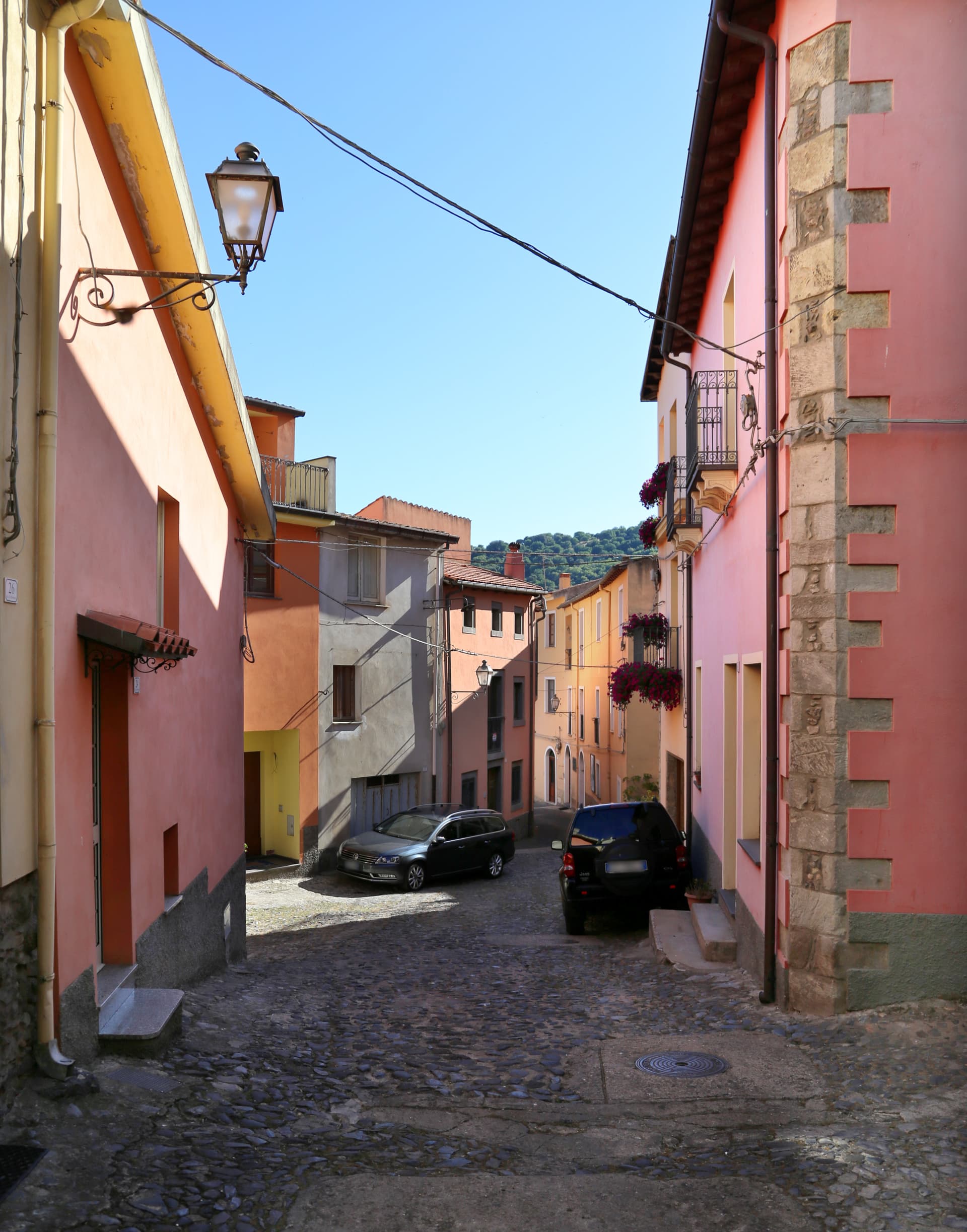
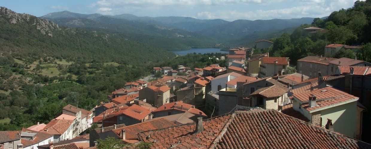
Bolotana
A Marghine hill village between mountain and Tirso valley, with a Welsh railway engineer's villa hidden in a four-hectare exotic garden.
Known for
VILLA PIERCY
Welsh engineer Benjamin Piercy's 1880s residence above the village, built while he was designing Sardegna's railway network.
SARDINIAN CARPETS
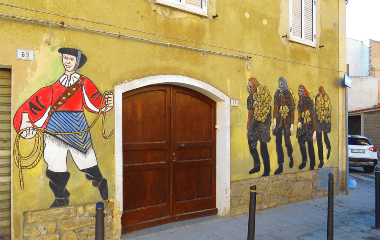
Yellow, black and red geometric rugs on horizontal looms, the Bolotana variant of one of the island's main weaving traditions.
MARGHINE OIL
Member of the Città dell'Olio network, producing extra-virgin olive oil from the slopes between mountain and Tirso valley.
When to visit
Best · Apr–Jun, Sep–Nov
- J
- F
- M
- A
- M
- J
- J
- A
- S
- O
- N
- D
- Best
- Hot or crowded
- Quiet
- Mostly closed
The festa: Pietro, 29 June
Why come
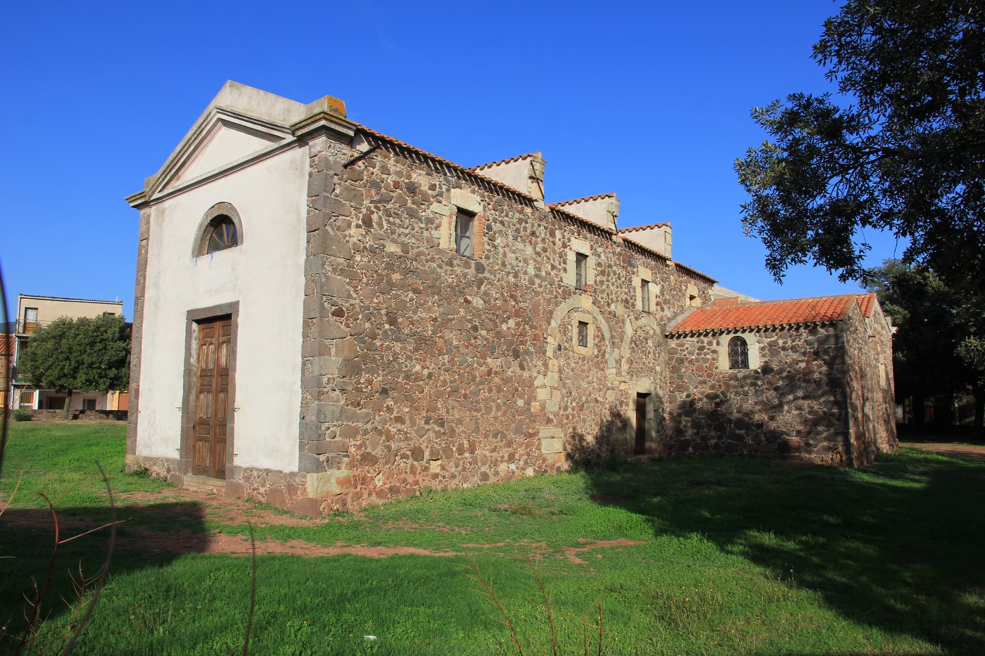
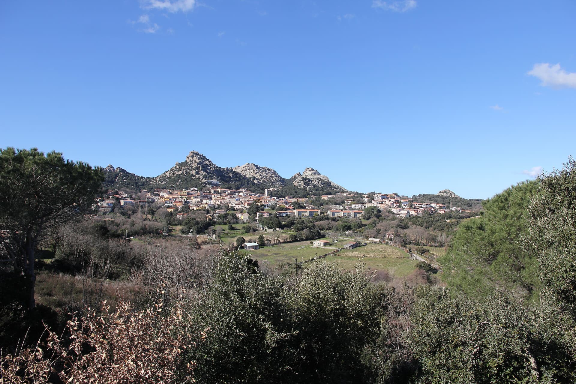
Bolotana sits on a hill between the Marghine range and the middle valley of the Tirso, fifty-five kilometers from Sassari and thirty from Nuoro. The municipal territory runs from 1,200 meters at Punta Palai down to 144 meters in the valley below. Above the village, the Badde Salighes forest holds Villa Piercy, the rural residence Benjamin Piercy built between 1879 and 1882.
Piercy was the Welsh engineer who designed Sardegna's railway network from 1863 onward. He turned a thousand hectares here into the largest livestock operation in the Mediterranean and laid out a four-hectare garden with native maples and oaks alongside Himalayan thuja, Spanish fir, and Lawson cypress. The villa, with four corner towers under metal domes, reopened to visits after a 2010 restoration.
The pre-Nuragic ritual circles of Ortachis sit higher on the mountain. The weaving tradition, yellow, black, and red geometric carpets on horizontal looms, made Bolotana one of the principal producers of Sardinian rugs.
The Sunday letter
We haven’t written Bolotana’s letter yet.
One town every Sunday, with the photo, the food, the festa. Be there when this one comes up. Free, by Peter & Sophia from Pietrasanta.
By subscribing you agree to Substack’s Terms of Use, our Privacy Policy and our Information collection notice.


What to see
Villa Piercy
1879-82 rural residence of Welsh railway engineer Benjamin Piercy in the Badde Salighes forest, with four hectares of garden mixing native and exotic species.
Foresta di Badde Salighes
Mountain forest above the village holding Villa Piercy and walking trails toward Punta Palai at 1,200 meters.
Circoli rituali di Ortachis
Pre-Nuragic ritual circles and standing stones from the Neolithic period, at around 1,000 meters on the mountain.
Punta Palai
Highest peak of the Marghine at 1,200 meters, marking the upper boundary of the Bolotana territory and the surrounding pasture country.
Nuraghi and Tombe dei Giganti
About forty nuraghi and protonuraghi, plus dolmens, domus de Janas, tombs of giants, and sacred wells across the municipal territory.
The slow-trip planner
Building a trip? Find where Bolotana fits in a slow Italy circuit.
Answer five questions. We will shape a geographically coherent slow trip from the 1,000 Italian towns most travelers skip. Yours to save and share.
Living here
- Population 2,358
- Off the beaten pathi
- Pharmacy in town
- Nearest high school over ~30 minutes away
- Train station in the comune
- Nearest airport Sardinia, 2 h 34 min drive
- Regional capital Cagliari, 2 h 21 min drive
Tags & datadesignations · numbers · sources
Recognised as
The numbers
- Elevation: 472 m
- Population: 2,358
- Surface area: 108.44 km²
These figures were compiled from public directories — ISTAT, OpenStreetMap, Wikidata — and from the official listings of the guides named on this page. Town details change; verify with official sources before you travel.
Close by
More towns near Bolotana
Santu Lussurgiu
Province: Oristano
A Montiferru village at 503 meters where the Carnival horse race runs through a steep stone street and saddlery has been made since 1923.
Gavoi
Province: Nuoro
A 777-meter Barbagia hilltop village above Lake Gusana with a Bandiera Arancione of the Touring Club, the country's most-attended summer literary festival (L'Isola delle Storie), and the PDO Fiore Sardo pecorino made here for at least three centuries.
Mamoiada
Province: Nuoro
The Barbagia village where the Mamuthones come out on January 17, twelve men in black sheepskins carrying thirty kilos of cowbells.
Seneghe
Province: Oristano
An olive-oil village on the eastern slope of Montiferru, 25 km from Oristano, that doubles as Sardegna's poetry capital each September.

Oristano
Province: Oristano
The old capital of the Giudicato di Arborea, city of Eleonora and the Carta de Logu, host of Sa Sartiglia equestrian joust at Carnival.
💎 Borghi Autentici
More Borghi Autentici towns in Sardinia
Aggius
Province: Sassari
A Gallura granite village at 514 meters under the Monti di Aggius, with the largest ethnographic museum in Sardegna and three centuries of bandit history.
Aritzo
Province: Nuoro
A Mandrolisai mountain village at 800 meters in chestnut and hazelnut forest, where snow once travelled out in straw and came back as lemon sorbet.
Cuglieri
Province: Oristano
A Montiferru town at 428 meters, with the first minor basilica in Sardegna above it and the ruins of Punic Cornus below.

Galtellì
Province: Nuoro
Grazia Deledda's 'Canne al vento' set — a 2,354-resident Baronia borgo under the Monte Tuttavista in Sardinia's northeast, with the triple Borghi Autentici + Bandiera Arancione + Città del Vino signal, the 11th-c Cattedrale di San Pietro (Sardinia's first), and the entire centro recognised as the Parco Letterario Grazia Deledda for being the literal setting of her 1913 Nobel-trajectory novel.
Masullas
Province: Oristano
A Marmilla village at 129 meters where a 17th-century Capuchin convent houses fossils, minerals, and the volcanic history of Monte Arci.