
Tuscany · Lucca
Castiglione di Garfagnana
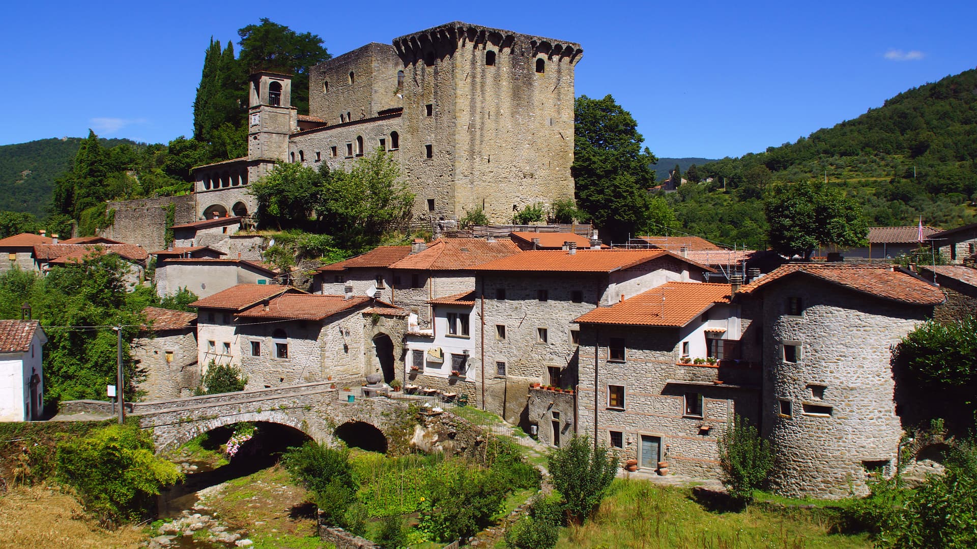
A walled medieval town at 540 meters in the Garfagnana, the Lucca outpost that refused to submit to the Este and held the pass to San Pellegrino.
Known for
LUCCHESE OUTPOST
The Garfagnana town that stayed loyal to the Republic of Lucca through the Este wars, besieged unsuccessfully in 1603 and 1613.
CHESTNUT POLENTA
Winter dish of chestnut flour polenta with boiled pig bones, served in local trattorie when the Garfagnana woods come into harvest.
SAN PELLEGRINO PASS
Medieval route over the Apennines to Modena that the Castrum Leonis was built to control, still the main road north out of the valley.
When to visit
Best · May–Oct
- J
- F
- M
- A
- M
- J
- J
- A
- S
- O
- N
- D
- Best
- Hot or crowded
- Quiet
- Mostly closed
Why come
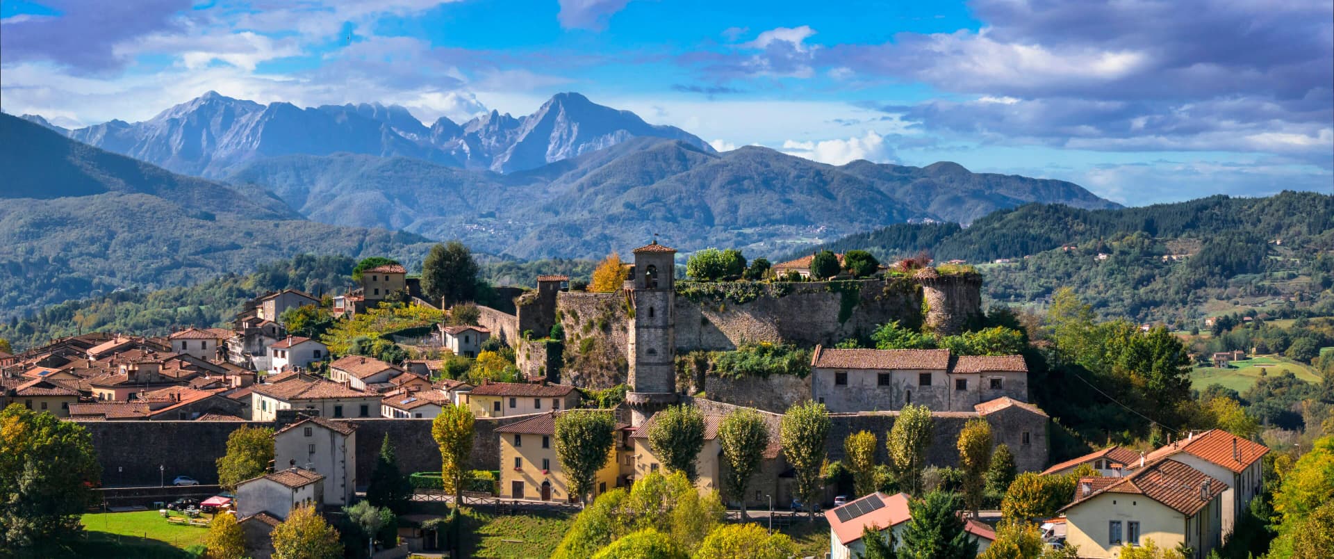
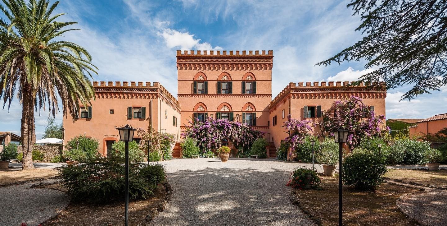
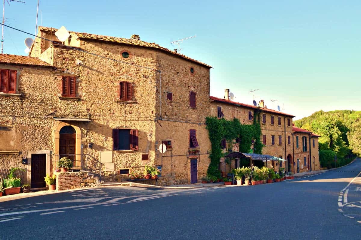
Castiglione di Garfagnana sits at 540 meters on the road to the San Pellegrino pass, in the upper Serchio valley, surrounded by chestnut woods and the Apuan and Apennine ridges. The Romans built a castrum here, the Castrum Leonis, to command the route between Lucca and Modena; what stands now is the thirteenth-century walled town, with three Torrioni and a Rocca that still anchor the south flank. Through the fifteenth and sixteenth centuries, while the rest of the Garfagnana fell to the Este of Ferrara and was administered by Ariosto from nearby Castelnuovo, Castiglione held for the Republic of Lucca.
The Estensi besieged it in 1603 and 1613 without taking it. The Pieve di San Pietro Apostolo, the oldest church in the borgo, was first built in 723 by two Lombard brothers and rebuilt in the twelfth century. In winter the trattorie serve chestnut polenta with boiled pork bones, the standard cold-weather dish of the valley.

What to see
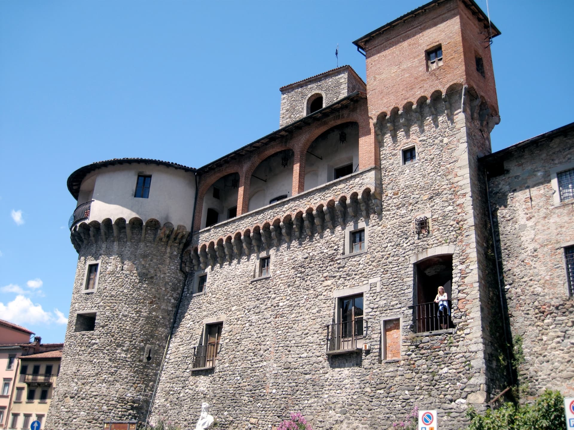
Rocca medievale
Thirteenth-century fortress with three Torrioni, the symbol of Castiglione and the anchor of the medieval walls.
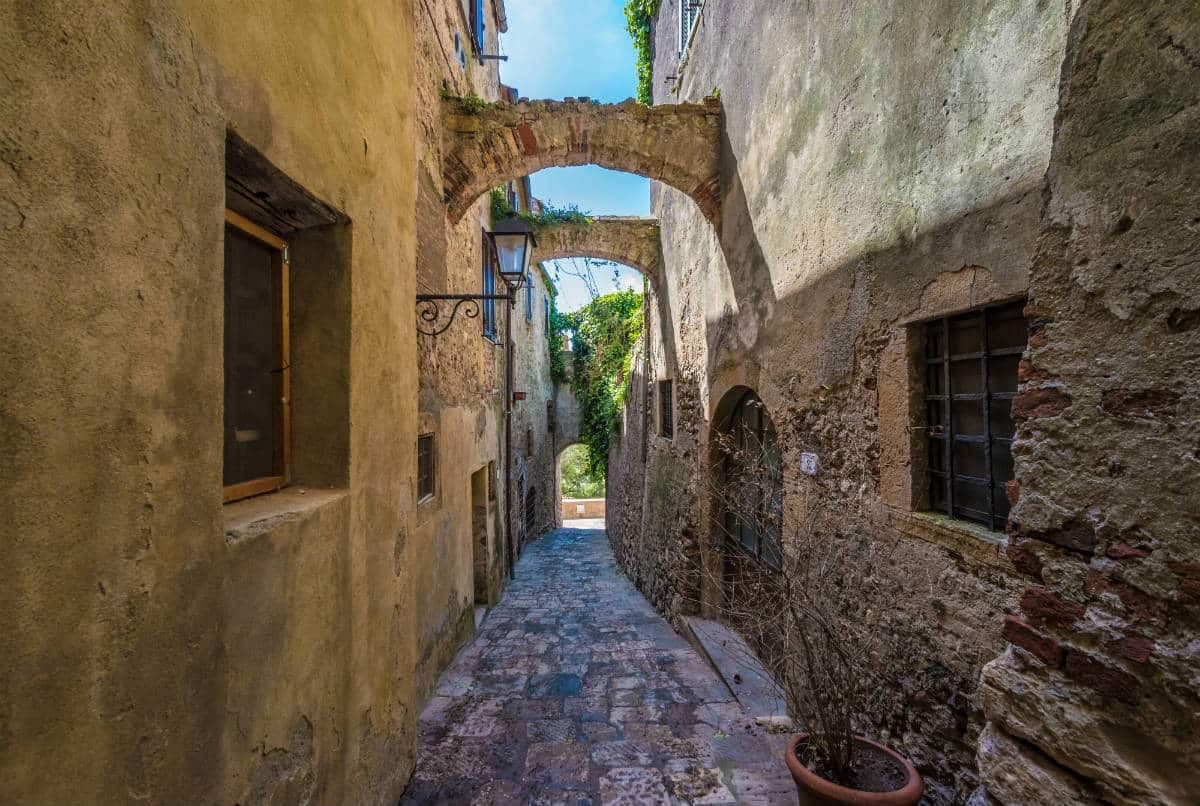
Mura medievali
Well-preserved thirteenth-century walls with large defensive towers ringing the borgo, intact for most of their length.
Pieve di San Pietro Apostolo
Oldest church in town, first built in 723 by two Lombard brothers and rebuilt in the twelfth century by Bishop Guido III of Lucca.
Chiesa di San Michele
Smaller medieval church inside the walls, with stone façade and a single nave preserved through later modifications.
The slow-trip planner
Building a trip? Find where Castiglione di Garfagnana fits in a slow Italy circuit.
Answer five questions. We will shape a geographically coherent slow trip from the 1,000 Italian towns most travelers skip. Yours to save and share.
The Sunday letter
Castiglione di Garfagnana got its letter. One town every Sunday, free — the photo, the food, the festa.
By subscribing you agree to Substack’s Terms of Use, our Privacy Policy and our Information collection notice.
Living here
- Population 1,705
- Off the beaten pathi
- Pharmacy in town
- High school within a 30-minute drive
- Nearest airport Florence / Pisa, 1 h 52 min drive
- Regional capital Firenze, 2 h 6 min drive
Tags & datadesignations · numbers · sources
Recognised as
The numbers
- Elevation: 540 m
- Population: 1,705
- Surface area: 48.53 km²
These figures were compiled from public directories — ISTAT, OpenStreetMap, Wikidata — and from the official listings of the guides named on this page. Town details change; verify with official sources before you travel.
Close by
More towns near Castiglione di Garfagnana
Castelnuovo di Garfagnana
Province: Lucca
The Garfagnana capital where Ariosto served as Este governor — a fortified medieval borgo at the confluence of the Serchio and the Turrite where the Tuscan Apennines meet the Alpi Apuane, and where the local farro IGP and chestnut flour are the foundation of one of Italy's most distinctive mountain kitchens.
Barga
Province: Lucca
A medieval hilltop town at 410 meters in the Serchio valley between the Apuan Alps and the Apennines, where Giovanni Pascoli wrote his last poems and the August festival serves fish and chips.
Fiumalbo
Province: Modena
A 935-meter stone village in the Modenese Apennines on the Tuscan border, at the confluence of two rivers under Monte Cimone.
Abetone Cutigliano
Province: Pistoia
The Apennine ski pass at 1,388 meters where the Granduca's two stone pyramids of 1778 mark the old Tuscan-Modenese border.
Fivizzano
Province: Massa-Carrara
Don't come for Fivizzano-the-town — come for the frazioni: Equi Terme with its thermal grotto-and-cave complex, Verrucola's intact Malaspina fortress, Gassano's mountain panorama, and a 264 km² Lunigiana commune covering 92 hamlets inside the Parco Nazionale dell'Appennino Tosco-Emiliano.
🎨 Borghi più belli d'Italia
More Borghi più belli d'Italia towns in Tuscany
Anghiari
Province: Arezzo
A walled medieval town at 430 meters over the upper Tiber valley, where Florence beat Milan in 1440 and Leonardo started the fresco he never finished.
Buonconvento
Province: Siena
The walled brick borgo in the Crete Senesi where Emperor Henry VII died in 1313, on the Via Cassia at the confluence of the Arbia and Ombrone.
Campiglia Marittima
Province: Livorno
A walled hilltop borgo above the Val di Cornia, where the Rocca tower watches a mining landscape worked from the Etruscans to 1976.
Capalbio
Province: Grosseto
A walled hilltop borgo at 217 meters in the southern Maremma, donated to the Abbey of Tre Fontane by Charlemagne and home of Niki de Saint Phalle's Tarot Garden.
Casale Marittimo
Province: Pisa
A concentric stone borgo at 214 meters above the Val di Cecina, built where a seventh-century BC Etruscan outpost of Volterra once stood.