
Abruzzo · L'Aquila
Santo Stefano di Sessanio
A Medici outpost at 1,250 meters on the southern edge of Campo Imperatore, restored building by building since 1999 into Italy's first scattered hotel.
Known for
ALBERGO DIFFUSO
Sextantio, opened 2005, defined the scattered-hotel model in Italy: restored medieval houses with original stone, lime, and timber.
LENTICCHIE
Slow Food Presidium lentil, grown on the Campo Imperatore plateau above town, celebrated at the first-September Sagra delle Lenticchie.
MEDICI TOWER
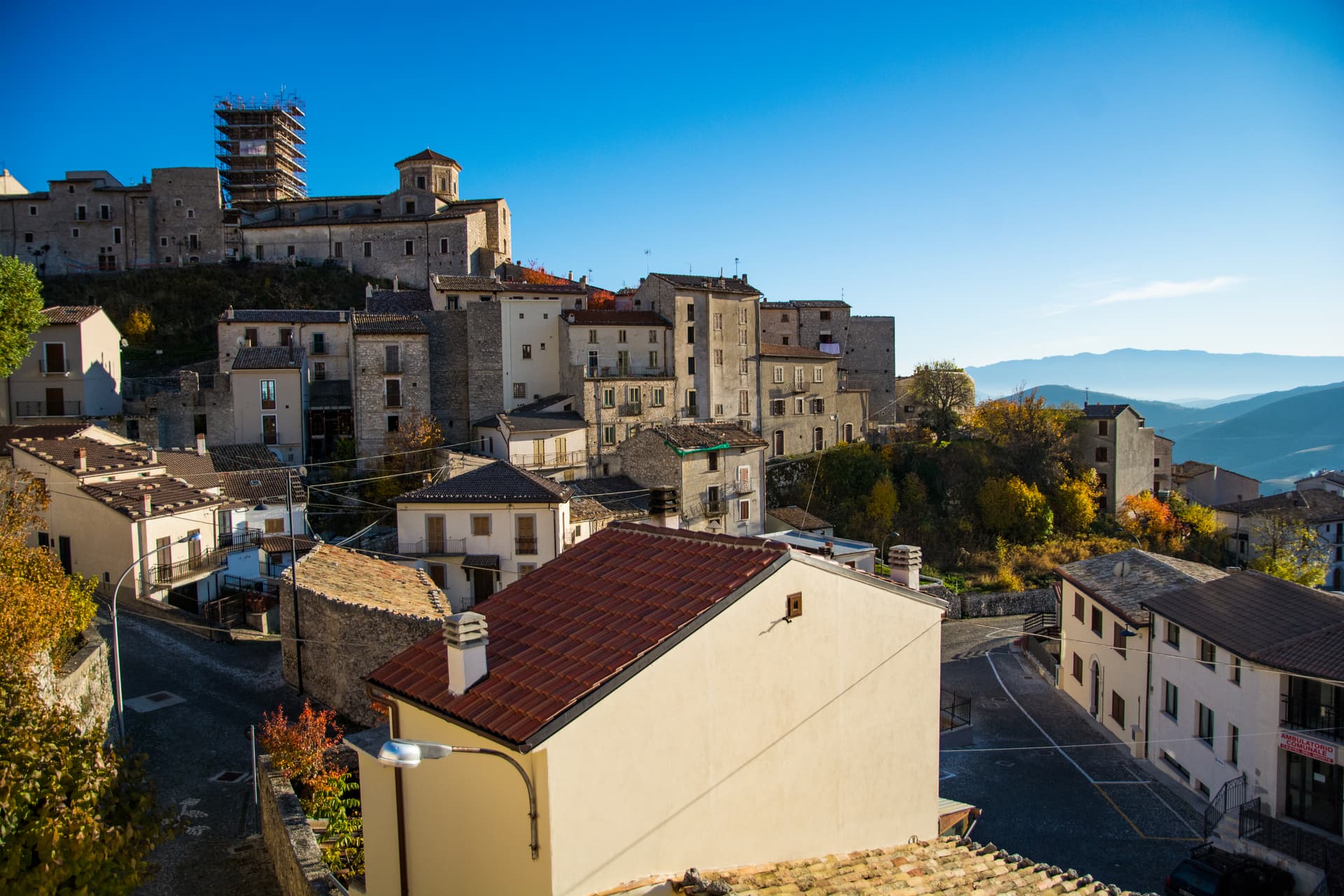
Cylindrical sixteenth-century tower built under Florentine rule, collapsed in the 2017 earthquake, currently being rebuilt.
When to visit
Best · Jun–Sep, Dec–Mar
- J
- F
- M
- A
- M
- J
- J
- A
- S
- O
- N
- D
- Best
- Hot or crowded
- Quiet
- Mostly closed
The festa: Stefano, 2 August
Why come
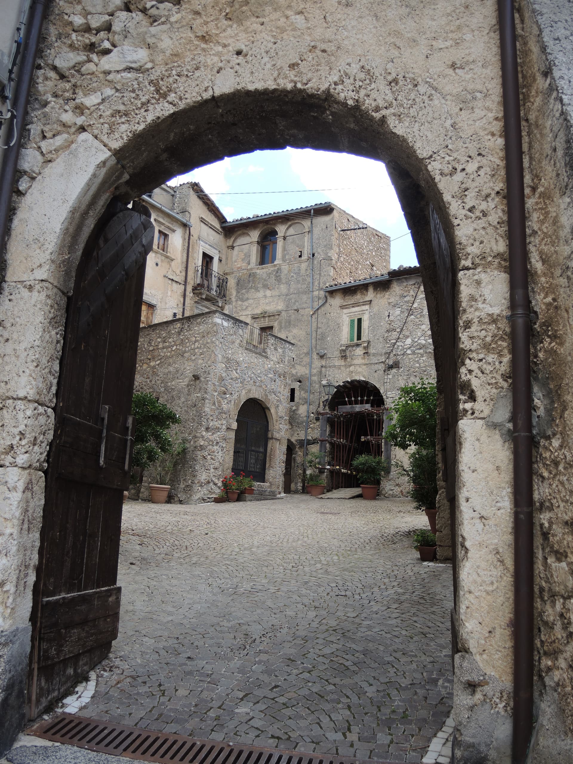
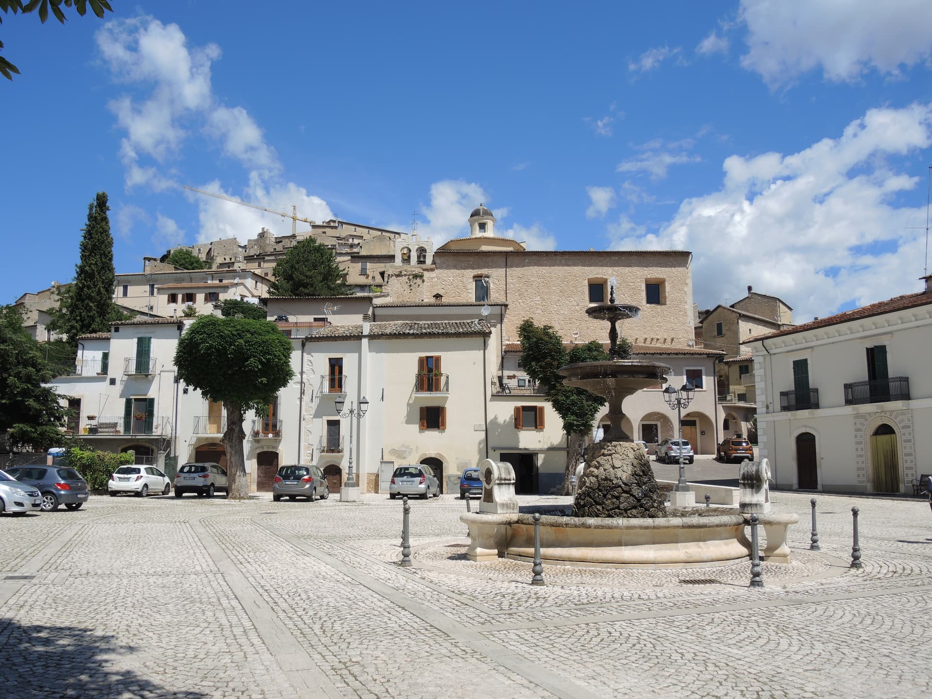
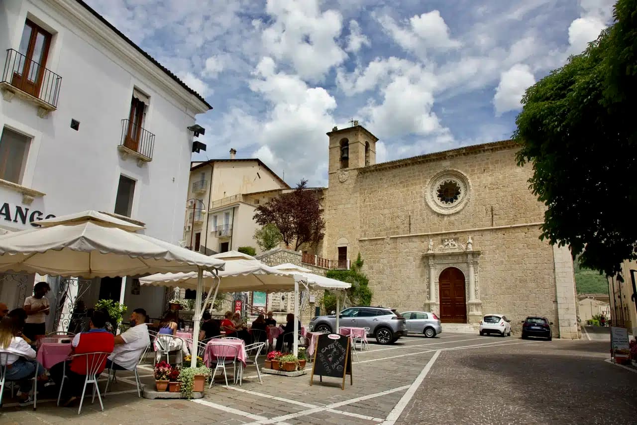
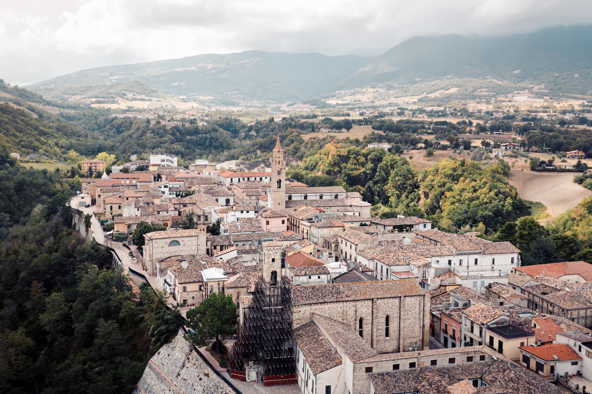
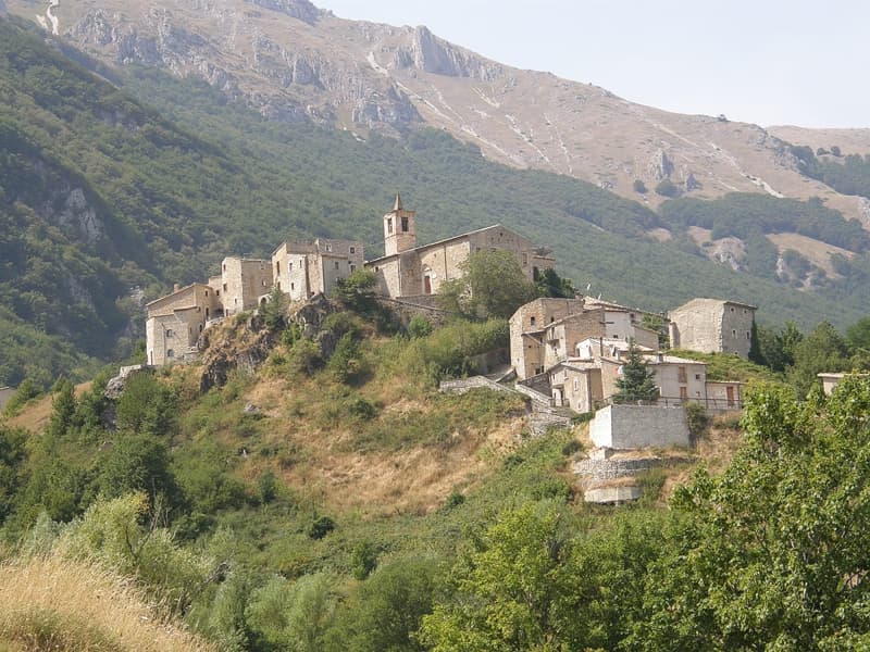
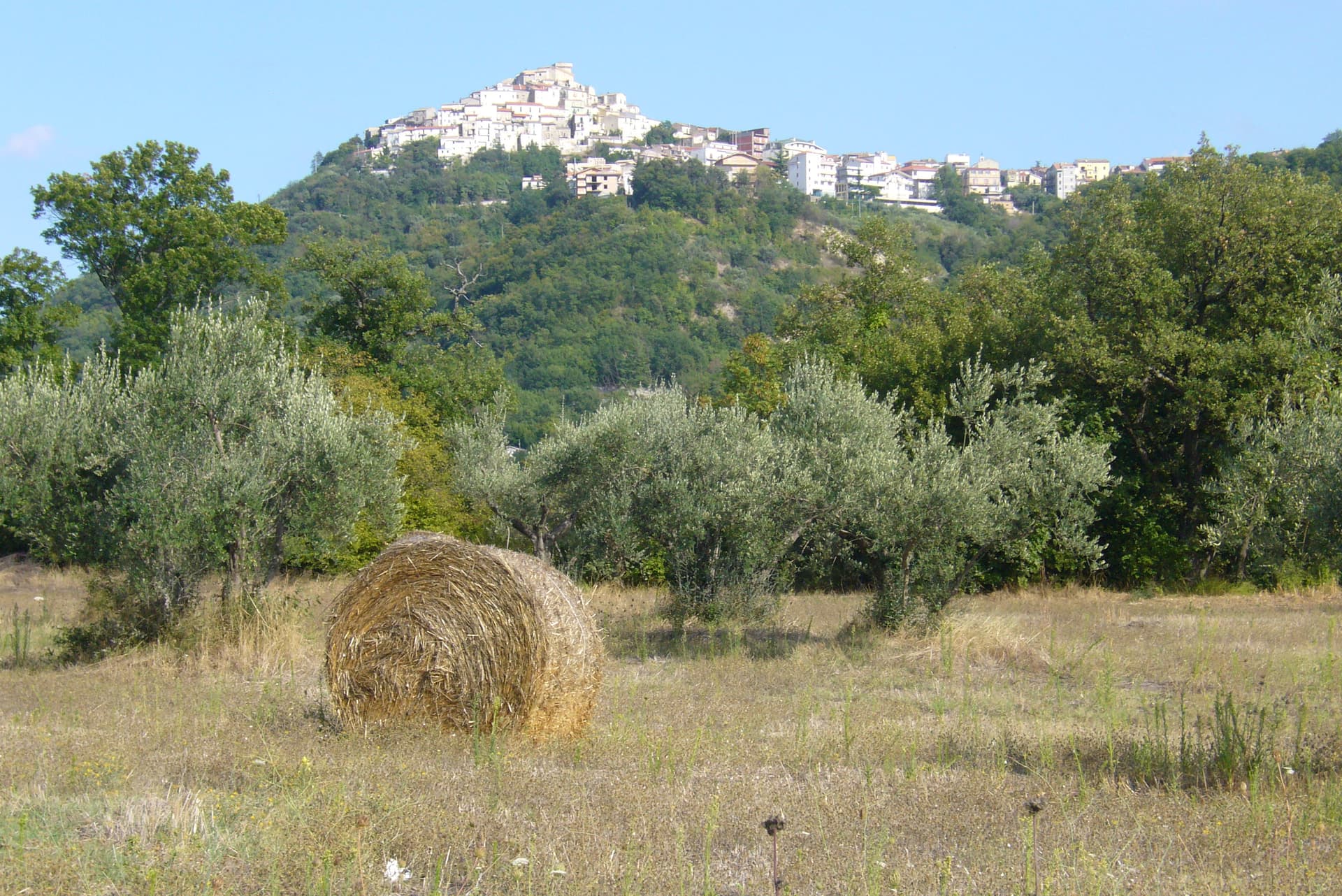
Santo Stefano di Sessanio sits at 1,250 meters on the southern rim of Campo Imperatore, the high karst plateau inside the Gran Sasso e Monti della Laga National Park. One hundred and fourteen people live in the commune. The village belonged to the Medici from 1579 to 1743, who built the Porta Medicea and the now-collapsed cylindrical tower, and ran the saffron and wool trades that gave the place its early wealth.
By the late twentieth century most of the houses were empty. In 1999 the Italian-Swedish entrepreneur Daniele Kihlgren began buying ruined buildings and restoring them as the Sextantio Albergo Diffuso, opened in 2005. It is the project that defined the albergo diffuso model in Italy: rooms scattered across the village in restored medieval houses, with the original stone, lime plaster, and timber preserved.
The 2017 earthquake brought down the surviving section of the Medici tower; reconstruction is underway. The Slow Food lentil, the lenticchia di Santo Stefano, is celebrated in the Sagra delle Lenticchie on the first weekend of September.
The Sunday letter
We haven’t written Santo Stefano di Sessanio’s letter yet.
One town every Sunday, with the photo, the food, the festa. Be there when this one comes up. Free, by Peter & Sophia from Pietrasanta.
By subscribing you agree to Substack’s Terms of Use, our Privacy Policy and our Information collection notice.


What to see
Torre Medicea (ruderi)
Sixteenth-century cylindrical tower built under Medici rule, collapsed in the 2017 earthquake, reconstruction ongoing on its original footprint.
Borgo medievale e Sextantio
Restored medieval village housing the Sextantio Albergo Diffuso, Italy's prototype scattered hotel, opened 2005.
Palazzo delle Logge
Renaissance loggia overlooking the village square and the Medici gate, evidence of the Florentine administration of the territory.
Campo Imperatore
Karst plateau at 1,500 to 1,800 meters above the village, accessed by trail, summer pasture for sheep and the location of the lentil fields.
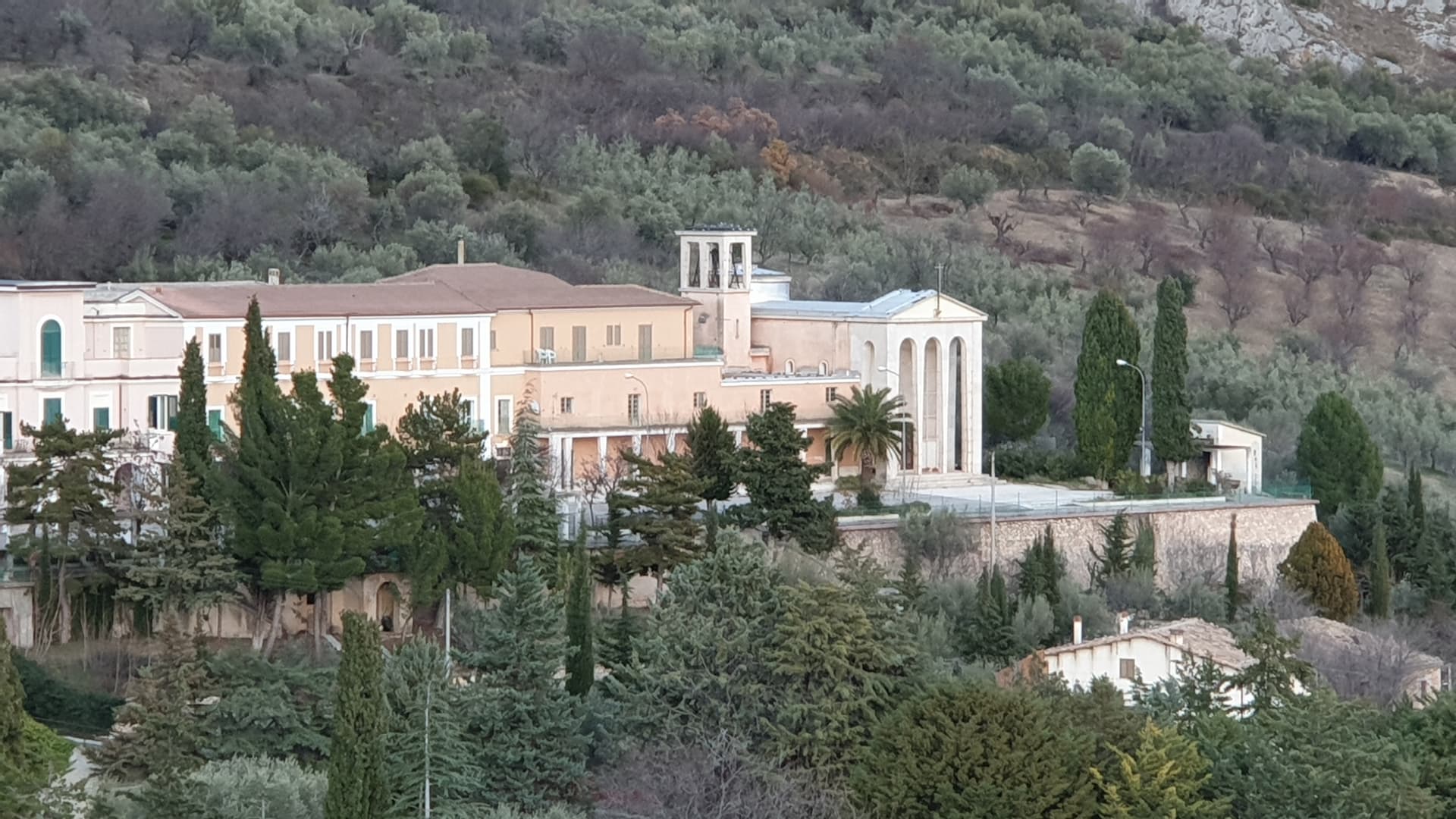
Parco Nazionale del Gran Sasso e Monti della Laga
Santo Stefano lies inside the park, with the Medici gate and the village core protected at the boundary of the Campo Imperatore zone.
The slow-trip planner
Building a trip? Find where Santo Stefano di Sessanio fits in a slow Italy circuit.
Answer five questions. We will shape a geographically coherent slow trip from the 1,000 Italian towns most travelers skip. Yours to save and share.
Living here
- Population 114
- In-betweeni
- Pharmacy: none mapped
- Nearest high school over ~30 minutes away
- Nearest airport Rome, 3 h 11 min drive
- Regional capital L'Aquila, 1 h 14 min drive
Tags & datadesignations · numbers · sources
Recognised as
The numbers
- Elevation: 1250 m
- Population: 114
- Surface area: 33.7 km²
These figures were compiled from public directories — ISTAT, OpenStreetMap, Wikidata — and from the official listings of the guides named on this page. Town details change; verify with official sources before you travel.
Close by
More towns near Santo Stefano di Sessanio
Castelvecchio Calvisio
Province: L'Aquila
118 people at 1,067 meters on a ridge above the Tirino, inside a fortified ellipse of stone walls with alleys orthogonal to its perimeter.

Calascio
Province: L'Aquila
At 1,200 meters under the highest castle in the Apennines, a village of 125 people that played the monk's refuge in Ladyhawke.

Capestrano
Province: L'Aquila
A hilltop village at 465 meters above the Tirino valley, where in 1934 a farmer turned up the 6th-century BC limestone Warrior of Capestrano.
Ofena
Province: L'Aquila
A 531-meter Vestian basin called the Forno d'Abruzzo, sealed by the Gran Sasso wall, where Montepulciano ripens on what may be the oldest of its slopes.
Navelli
Province: L'Aquila
At 760 meters above the Navelli plain, the pyramid of stone houses growing the saffron a 13th-century Dominican brought from Spain.
🎨 Borghi più belli d'Italia
More Borghi più belli d'Italia towns in Abruzzo
Anversa degli Abruzzi
Province: L'Aquila
At 604 meters above the Sagittario Gorges, the cliff village where D'Annunzio set La Fiaccola sotto il moggio in 1905.
Campli
Province: Teramo
A 393-meter town under the Monti della Laga, held by the Farnese for two centuries, with a Scala Santa carrying papal indulgence.
Caramanico Terme
Province: Pescara
A 650-meter Majella spa village at the confluence of the Orfento and Orta, with sulphurous springs whose properties were documented in 1576.
Casoli
Province: Chieti
A 378-meter hill town above the Aventino under the Maiella, with a pentagonal Norman tower where Gabriele D'Annunzio held a Renaissance court of artists.
Castel del Monte
Province: L'Aquila
At 1,346 meters under Monte Bolza facing Rocca Calascio, the capital of shepherds, whose wool reached the Medici and whose witches return each August.