
Lombardy · Brescia
Bagolino
A mountain village at 778 meters in the Valle del Caffaro, with a three-day February carnival of masked dancers and violins.
Known for
CARNEVALE
Three-day February carnival of Balari dancers in inherited costumes, led by violin and guitar Sonadur in tunes closer to Austria than Brescia.
BAGÒSS
Hard, saffron-tinted mountain cheese, made from Alpine Brown cow milk in Bagolino alone, about 10,000 wheels produced each year.
SAN GIORGIO
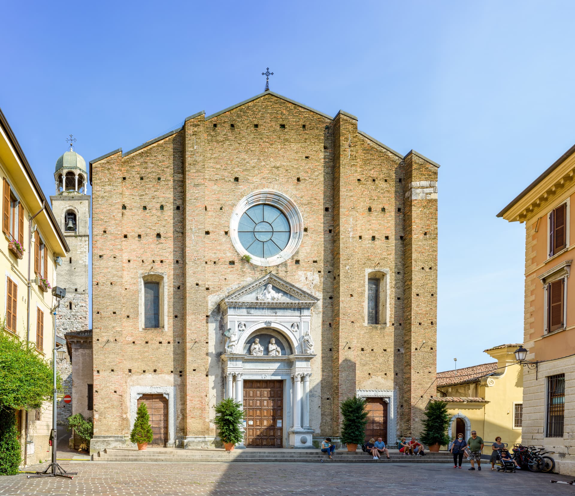
The third largest church in the province of Brescia, built in three years in the early seventeenth century, with Titian and Tintoretto inside.
When to visit
Best · May–Oct
- J
- F
- M
- A
- M
- J
- J
- A
- S
- O
- N
- D
- Best
- Hot or crowded
- Quiet
- Mostly closed
The festa: San Giorgio, 23 April
Why come
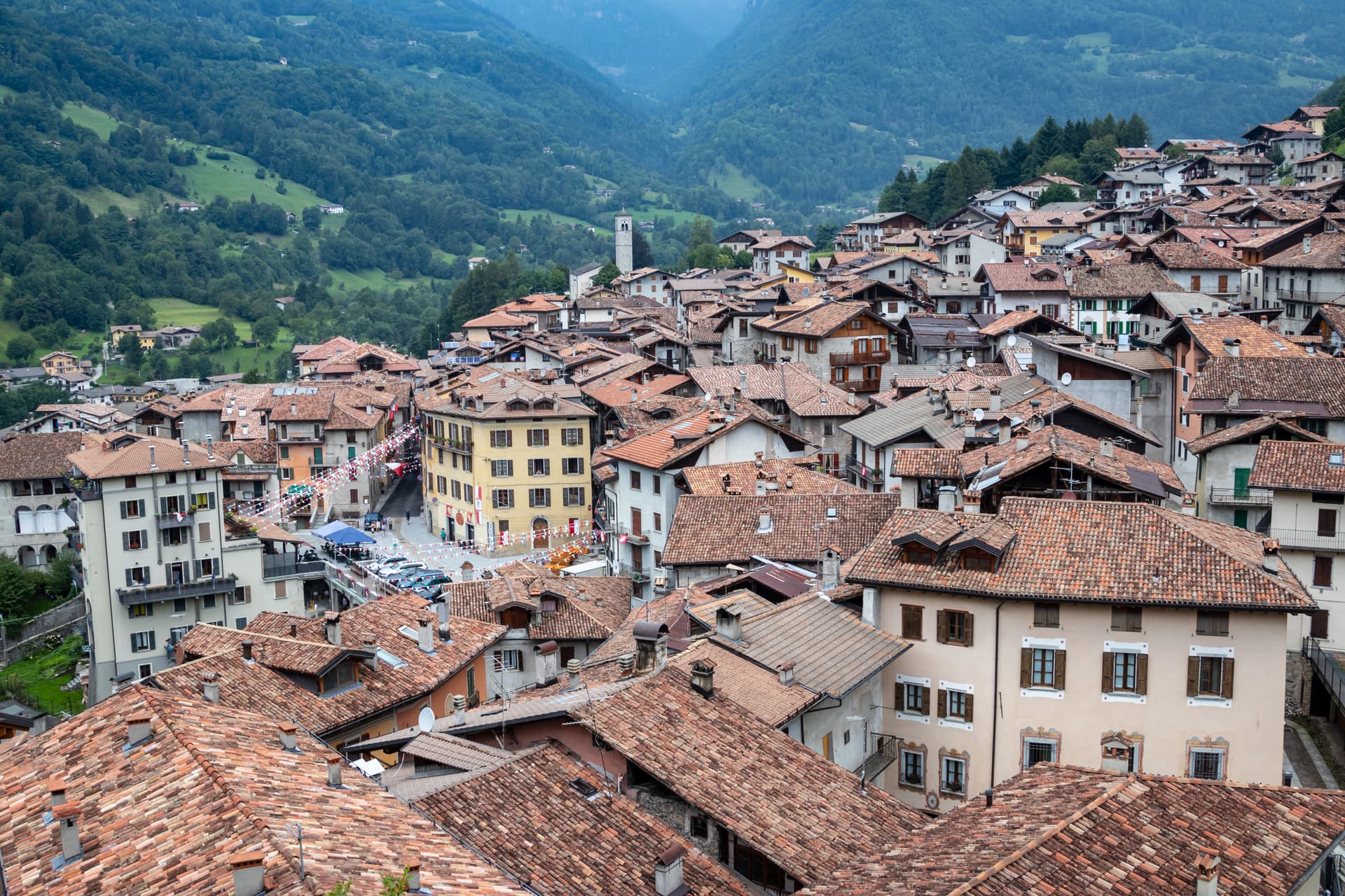
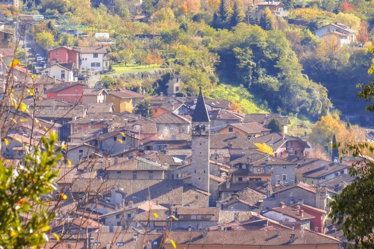
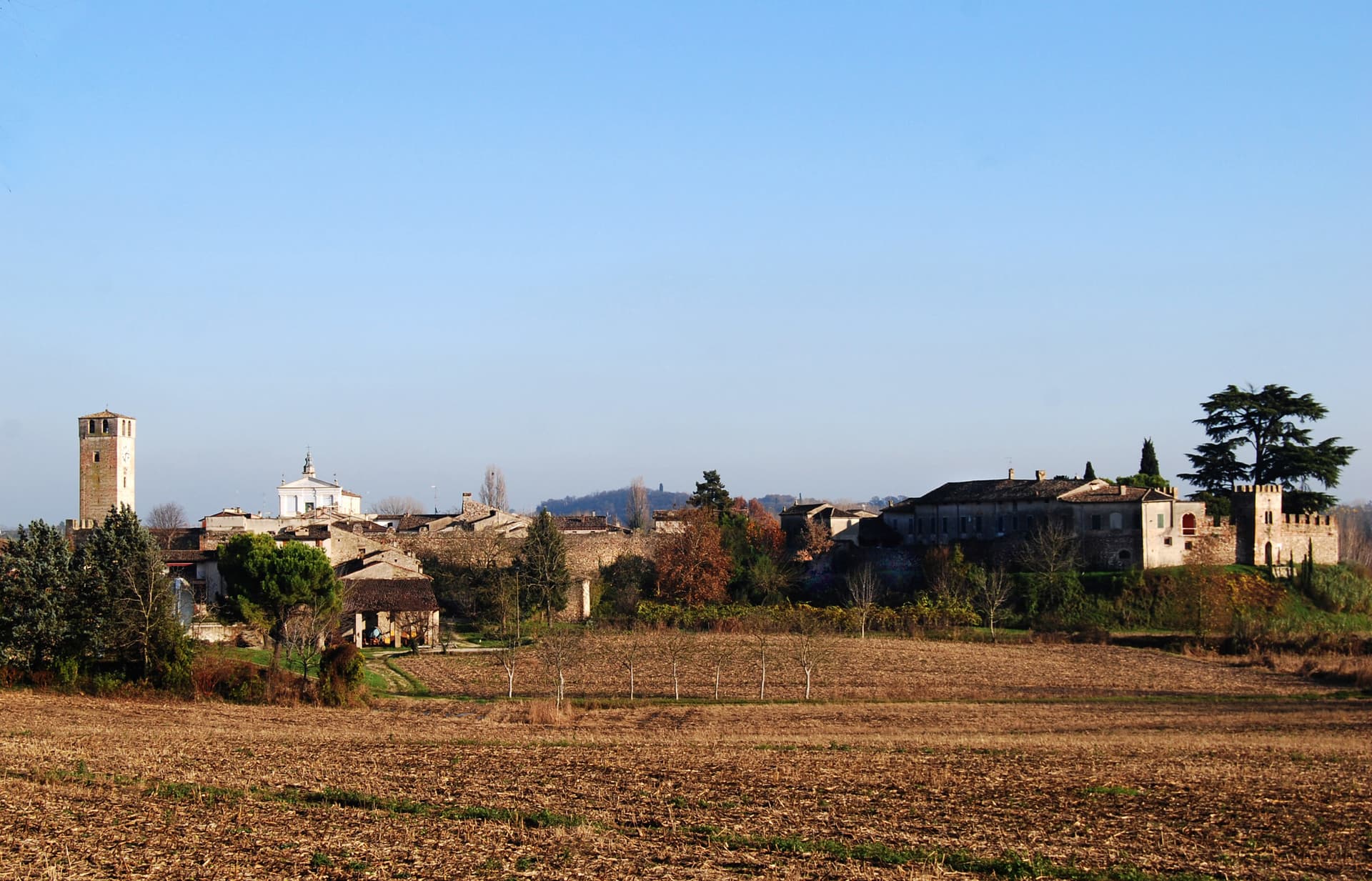
Bagolino sits at 778 meters in the Valle del Caffaro, the right flank of the Valle Sabbia, on the road that runs from Brescia to Lake Idro and over the Crocedomini pass into Val Camonica. The name probably traces to Pagolus, small village; the place was a Roman horse-changing station before anything else. From the seventh century it sat in the Lombard duchy of Trento, then under the prince-bishops of Trento until the Venetian Republic took it over.
The Chiesa di San Giorgio, designed by Giovanni Battista Lantana and built in three years in the early seventeenth century, is the third largest church in the province, with works attributed to Titian, Tintoretto, Palma il Giovane and Pietro Mera. The Carnevale di Bagolino runs three days each February: Balari in inherited costumes, dancing to the violin and guitar of the Sonadur in tunes closer to Austria than Brescia. Bagòss, the saffron-tinted hard cheese, is still made here from Alpine Brown cow milk, about 10,000 wheels a year.
The Sunday letter
We haven’t written Bagolino’s letter yet.
One town every Sunday, with the photo, the food, the festa. Be there when this one comes up. Free, by Peter & Sophia from Pietrasanta.
By subscribing you agree to Substack’s Terms of Use, our Privacy Policy and our Information collection notice.

What to see
Chiesa di San Giorgio
Third largest church in the province of Brescia, designed by Giovanni Battista Lantana and built in three years in the early seventeenth century, with works attributed to Titian and Tintoretto.
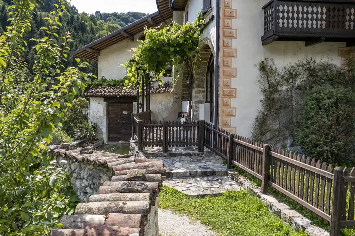
Centro storico
Stone-house medieval village stacked on the slope above the Caffaro, with covered passages and the dark wood balconies typical of the Lombard prealps.
Chiesa di San Rocco
Sixteenth-century votive church on the village edge, dedicated to the plague saint, with frescoes inside and a small porch facing the valley.
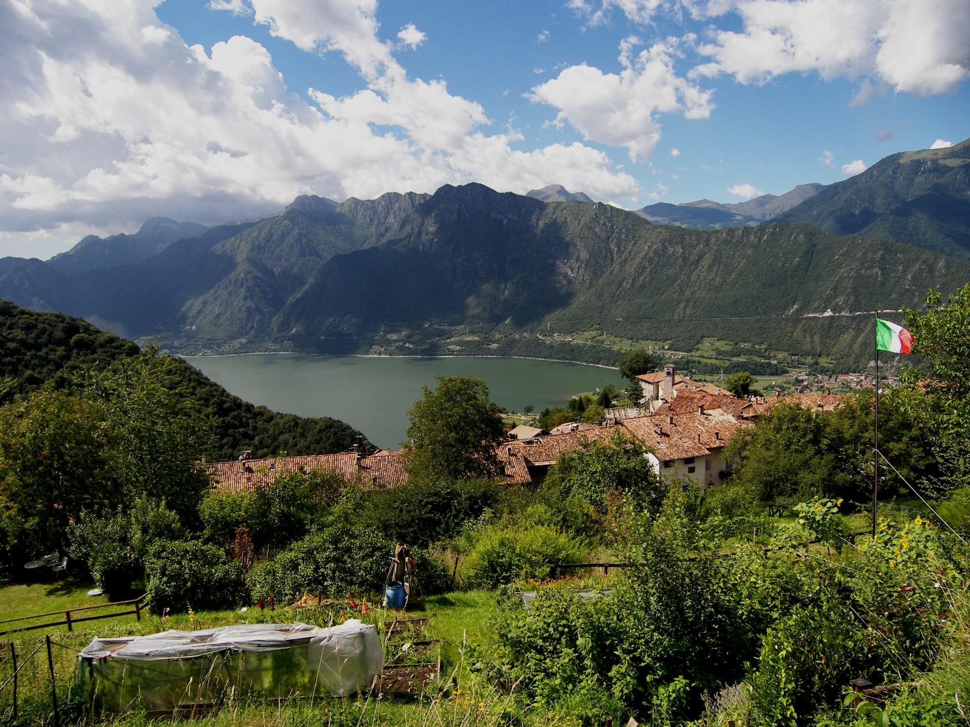
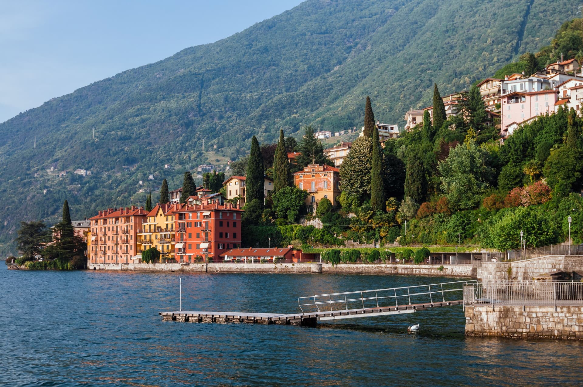
Lago d'Idro
Glacial pre-alpine lake at 368 meters, the highest of the Lombard pre-alpine lakes, reached at Ponte Caffaro, the frazione of Bagolino on the shore.
Passo del Maniva
Mountain pass at 1,664 meters above the village, leading toward Val Trompia, with summer hiking and a small winter ski station.
The slow-trip planner
Building a trip? Find where Bagolino fits in a slow Italy circuit.
Answer five questions. We will shape a geographically coherent slow trip from the 1,000 Italian towns most travelers skip. Yours to save and share.
Living here
- Population 3,761
- Very remotei
- Pharmacy in town
- High school within a 30-minute drive
- Nearest airport Milan, 1 h 44 min drive
- Regional capital Milano, 2 h 21 min drive
Tags & datadesignations · numbers · sources
Recognised as
The numbers
- Elevation: 778 m
- Population: 3,761
- Surface area: 109.21 km²
These figures were compiled from public directories — ISTAT, OpenStreetMap, Wikidata — and from the official listings of the guides named on this page. Town details change; verify with official sources before you travel.
Close by
More towns near Bagolino
Bondone
Province: Trento
A two-village commune above Lake Idro at the Lombard border, with a Lodron castle on the cliff and a Bandiera Blu shoreline below.
Darfo Boario Terme
Province: Brescia
At the mouth of the Valle Camonica, an Art Nouveau spa town next to one of the first UNESCO rock-engraving sites in Italy.
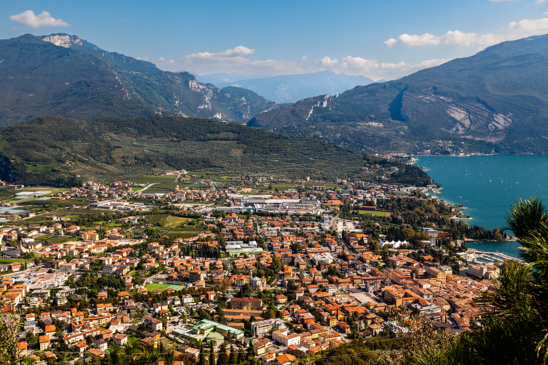
Riva del Garda
Province: Trento
The north tip of Lake Garda at 73 metres, where the Trentino mountains close in on the water and a Habsburg port town stayed bilingual into the twentieth century.
Salò
Province: Brescia
On the deepest gulf of Lake Garda, with the lake's longest waterfront promenade and the cathedral of the Riviera di Salò.
Bienno
Province: Brescia
A medieval ironworking village in the Val Camonica, where water hammers driven by the Grigna stream have shaped wrought iron since the 1200s.
🎨 Borghi più belli d'Italia
More Borghi più belli d'Italia towns in Lombardy
Bellano
Province: Lecco
An eastern Lake Como town where the Pioverna cut a gorge through fifteen million years of rock before reaching the lake.
Cassinetta di Lugagnano
Province: Milano
A Naviglio Grande commune west of Milan with fifteen ville di delizia and Italy's first zero-growth urban plan, adopted in 2007.
Castellaro Lagusello
Province: Mantova
A walled medieval borgo south of Lake Garda, ringed by 13th-century stone walls and overlooking a small heart-shaped natural lake that gives the village its second name and most-photographed silhouette.

Clusone
Province: Bergamo
At 648 meters in upper Val Seriana, capital of the macabre fresco and the 1583 planetary clock above its civic tower.
Cornello dei Tasso
Province: Bergamo
A car-free medieval frazione of Camerata Cornello in the Val Brembana, accessible only on foot, anchored by the Museo dei Tasso e della Storia Postale — birthplace of the family that ran the European postal network from the 16th century onward.