
Apulia · Foggia
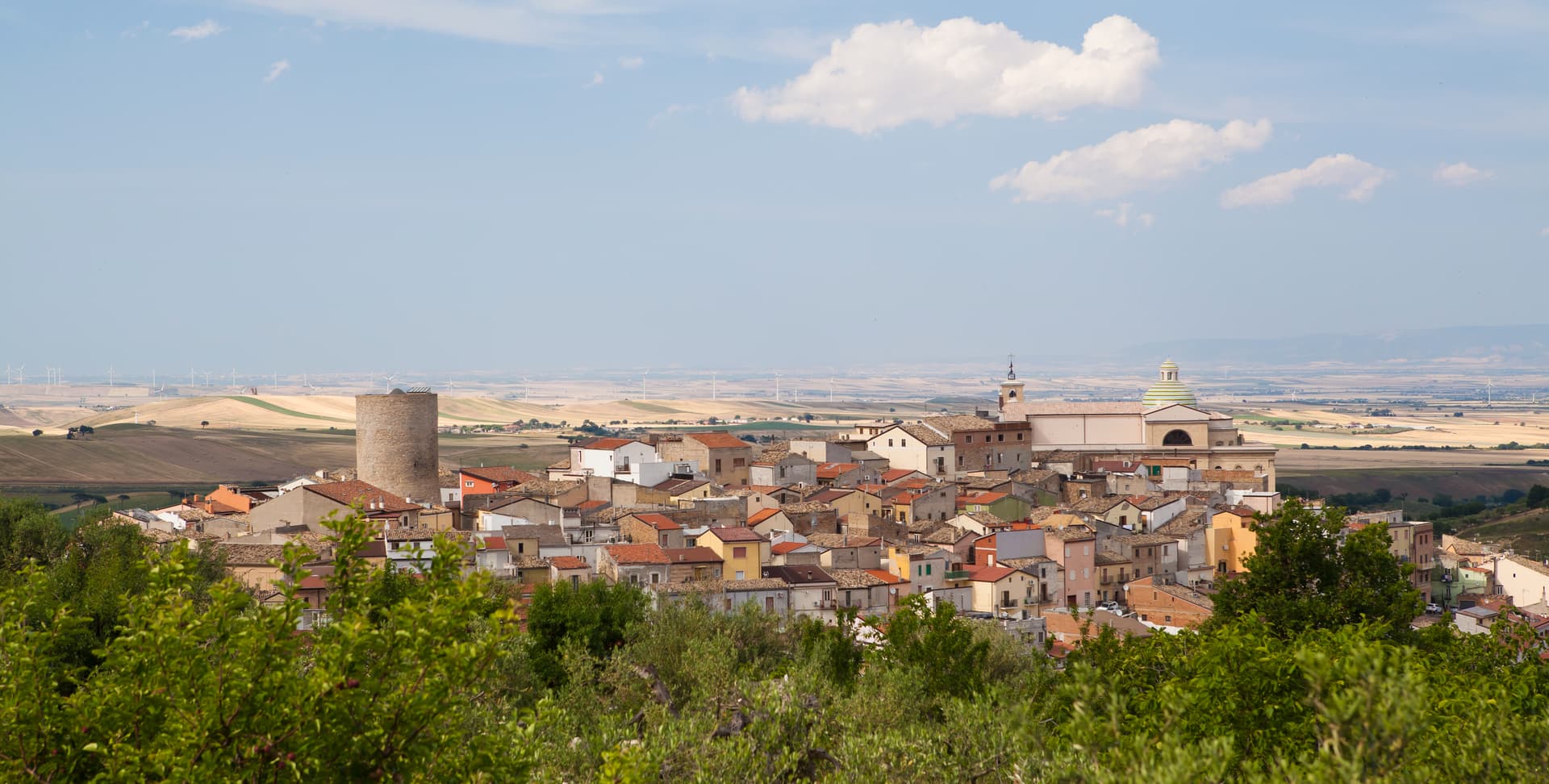
Roseto Valfortore
A Daunian Mountain stone village at 658 meters near the Fortore springs, named for the wild roses and known for black and white truffles.
Known for
TRUFFLES
Black, white and bianchetto truffles from the surrounding Daunian forests, the basis for the Città del Tartufo listing and two annual sagre.
STONE VILLAGE
Lombard-pattern stréttole and stone houses cut by local stonemasons, the basis for the Borghi più belli d'Italia listing on the Fortore slope.
ROSETO PENNSYLVANIA
The first emigrants left for the Lehigh Valley slate quarries in 1883, founding Roseto, Pennsylvania, an enclave named after the home village.
When to visit
Best · May–Oct
- J
- F
- M
- A
- M
- J
- J
- A
- S
- O
- N
- D
- Best
- Hot or crowded
- Quiet
- Mostly closed
The festa: Filippo Neri, 26 May
Why come
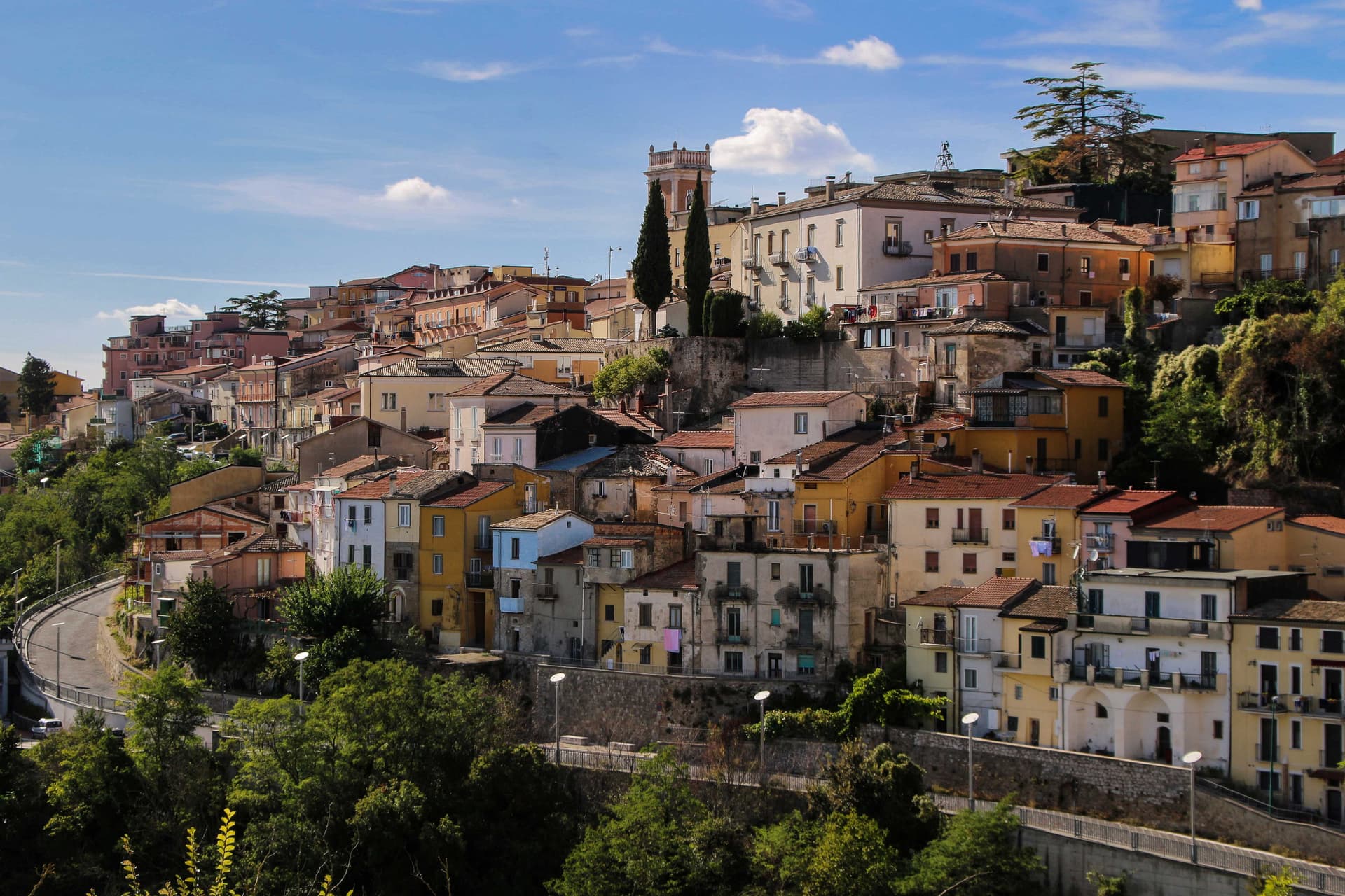
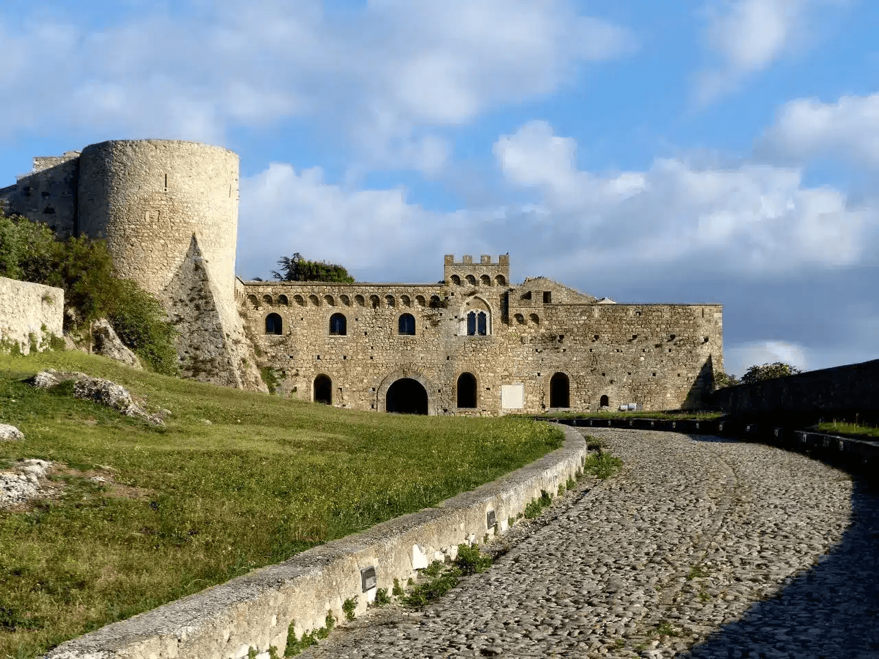
Roseto Valfortore sits at 658 meters on a steep slope of the Fortore valley in the Daunian Mountains, below Monte Cornacchia, the highest peak in Puglia at 1,151 meters. The name records the wild roses that cover the slopes and the Fortore river whose springs rise east of the village. Urban planning follows a Lombard pattern: stréttole, the narrow alleys, fan out from Piazza Vecchia, alternating wider stepped lanes with narrower channels that collect rainwater.
The stone houses, the sculpted balustrades, and the decorated doorways were cut by generations of local stonemasons. Acacia honey and truffles, black and white plus bianchetto, come out of the surrounding beech and oak forests; annual truffle fairs run on both sides of autumn. Roseto Valfortore carries Borghi più belli d'Italia and Città del Tartufo, with a population under a thousand and falling. The first immigrants to Roseto, Pennsylvania, left in 1883 for the slate quarries of the Lehigh Valley.
The Sunday letter
We haven’t written Roseto Valfortore’s letter yet.
One town every Sunday, with the photo, the food, the festa. Be there when this one comes up. Free, by Peter & Sophia from Pietrasanta.
By subscribing you agree to Substack’s Terms of Use, our Privacy Policy and our Information collection notice.


What to see
Piazza Vecchia
Medieval origin square at the foot of the village, from which the stréttole fan out, the Lombard core of the urban layout.
Centro storico in pietra
Stone-cut village on the Fortore slope, narrow stepped lanes, balustrades and portals shaped by generations of local stonemasons.
Chiesa Madre di Santa Maria Assunta
Mother church in the upper village, rebuilt over the centuries above the medieval core, the religious anchor of the borgo.
Monte Cornacchia
Highest peak in Puglia at 1,151 meters, immediately above the village, the centre of the Daunian Mountains massif.
Sagre del Tartufo
Annual truffle fairs around the autumn harvest, black, white and bianchetto pulled out of the surrounding beech and oak forests.
The slow-trip planner
Building a trip? Find where Roseto Valfortore fits in a slow Italy circuit.
Answer five questions. We will shape a geographically coherent slow trip from the 1,000 Italian towns most travelers skip. Yours to save and share.
Living here
- Population 993
- Off the beaten pathi
- Pharmacy: none mapped
- High school within a 30-minute drive
- Nearest airport Naples / Salerno, 2 h 18 min drive
- Regional capital Bari, 2 h 25 min drive
Tags & datadesignations · numbers · sources
Recognised as
The numbers
- Elevation: 658 m
- Population: 993
- Surface area: 50.06 km²
These figures were compiled from public directories — ISTAT, OpenStreetMap, Wikidata — and from the official listings of the guides named on this page. Town details change; verify with official sources before you travel.
Close by
More towns near Roseto Valfortore

Faeto
Province: Foggia
The highest village in Puglia at 820 meters, Franco-Provençal-speaking since 1266, on a Monti Dauni ridge below Monte Cornacchia.

Celle di San Vito
Province: Foggia
The smallest commune in Puglia, 148 residents at 726 meters in the Monti Dauni, one of two Franco-Provençal-speaking villages in the south.
Biccari
Province: Foggia
A Subappennino Dauno borgo at 450 meters under Monte Cornacchia, the highest peak in Puglia at 1,151 meters, with a Byzantine tower at its core.

Savignano Irpino
Province: Avellino
A 718-meter stone borgo above the Cervaro valley on the Campania-Apulia border, called Savignano di Puglia until 1963.
Ariano Irpino
Province: Avellino
The City of the Three Hills at 788 meters, where Roger II promulgated the Assizes of 1140 and majolica kilns still fire.
🎨 Borghi più belli d'Italia
More Borghi più belli d'Italia towns in Apulia
Bovino
Province: Foggia
A Daunian Mountains hill town at 646 meters above the Cervaro valley, Roman Vibinum, with a Norman-Swabian castle later turned into a Guevara ducal palace.
Cisternino
Province: Brindisi
An Itria valley borgo on the southern Murgia at 394 meters, whitewashed, Cittaslow since 2003 and Cittaslow City of the Year in 2014.
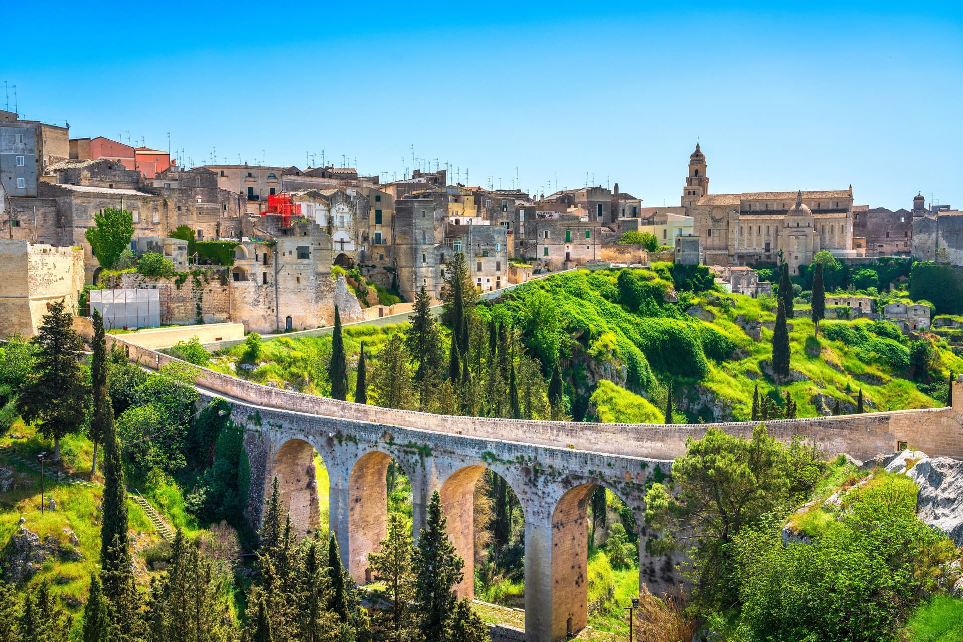
Gravina in Puglia
Province: Bari
Puglia's deepest gravina — a 42,700-resident Bari-province town built on the lip of a 100m-deep limestone canyon, with the 18th-c Ponte Acquedotto walkway across the gorge that James Bond crossed in No Time to Die, a network of rupestrian cave churches in the cliff face, and the four-signal BPB + Cittaslow + Via Francigena + Parco Nazionale combination.
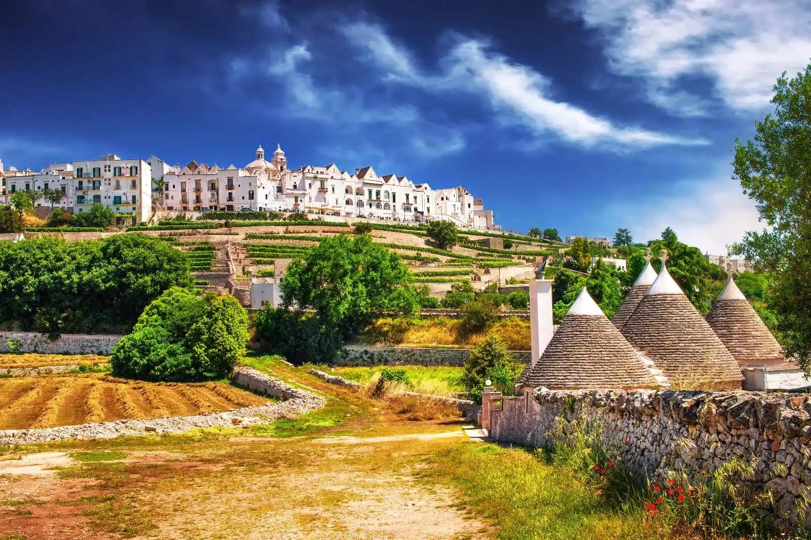
Locorotondo
Province: Bari
The round white town on the Itria valley ridge at 410 meters, with cummerse roofs the rest of Puglia does not have.
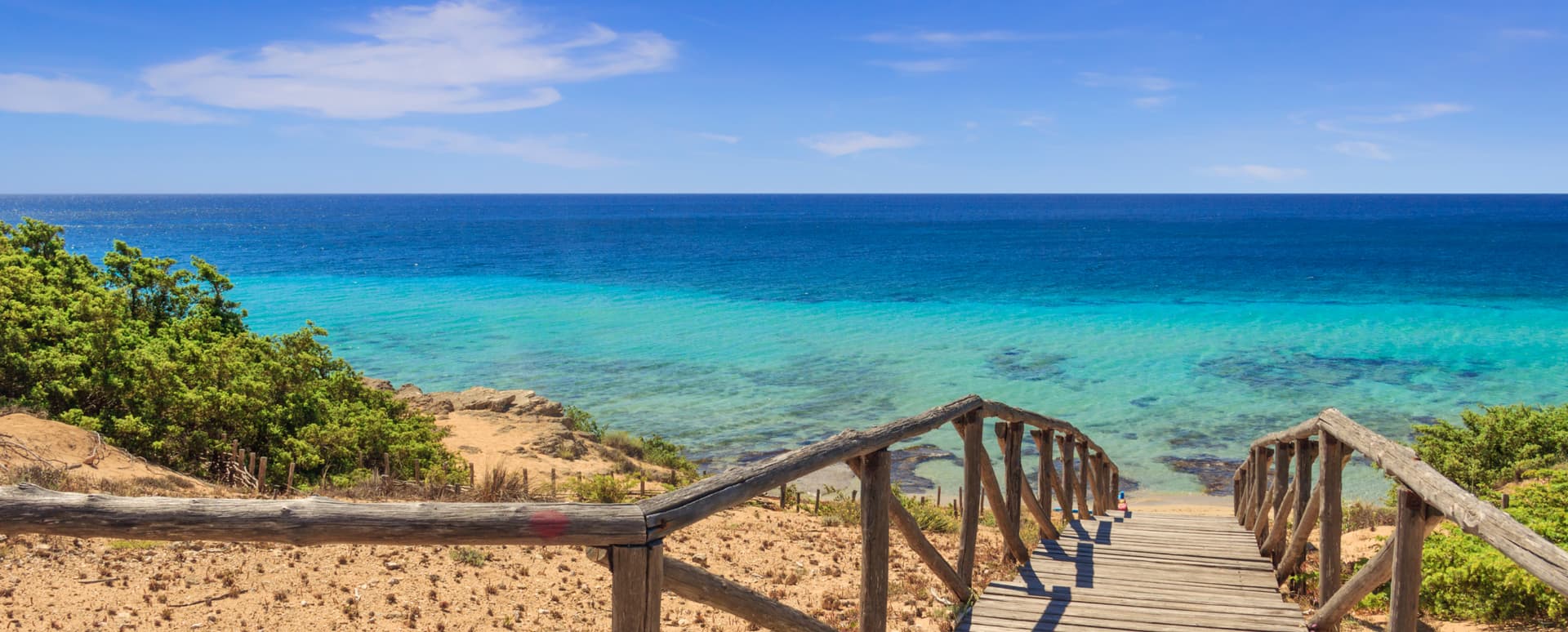
Maruggio
Province: Taranto
Salento's Knights of Malta borgo — a fortified Borgo più Bello on a low Ionian hill with 11 km of Bandiera Blu coast at Campomarino, Negroamaro and Primitivo vines pressing into the centro, and a unique commanderie history that made it the Order's southern Italian headquarters for 600 years.