
Sicily · Trapani
Salemi
The Belice Valley town where Garibaldi raised the tricolor on 14 May 1860 and proclaimed Salemi the capital of Italy for a day.
Known for
CAPITAL FOR A DAY
On 14 May 1860, Garibaldi raised the tricolor on the castle and proclaimed Salemi the capital of the new Italy, holding the title for less than two weeks.
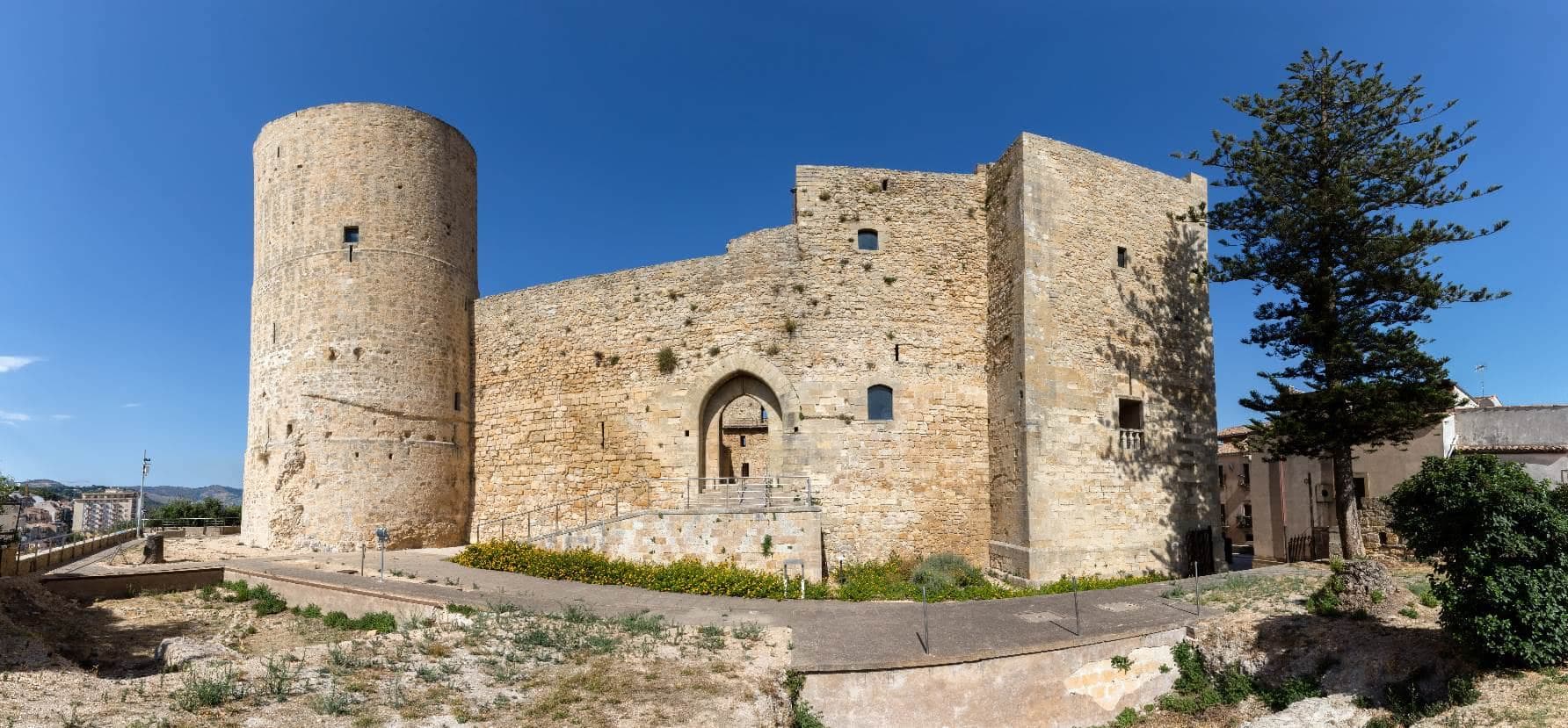
NORMAN CASTLE
Built by Roger I in 1077 on Greek-Roman foundations, rebuilt by Frederick II, the round tower still dominates the Belice Valley.
1968 BELICE
The January 1968 earthquake destroyed the medieval Mother Church and parts of the Rabato quarter, marked today by stabilized ruins and memorial squares.
When to visit
Best · Apr–Jun, Sep–Nov
- J
- F
- M
- A
- M
- J
- J
- A
- S
- O
- N
- D
- Best
- Hot or crowded
- Quiet
- Mostly closed
The festa: Nicola di Bari, 6 December
Why come
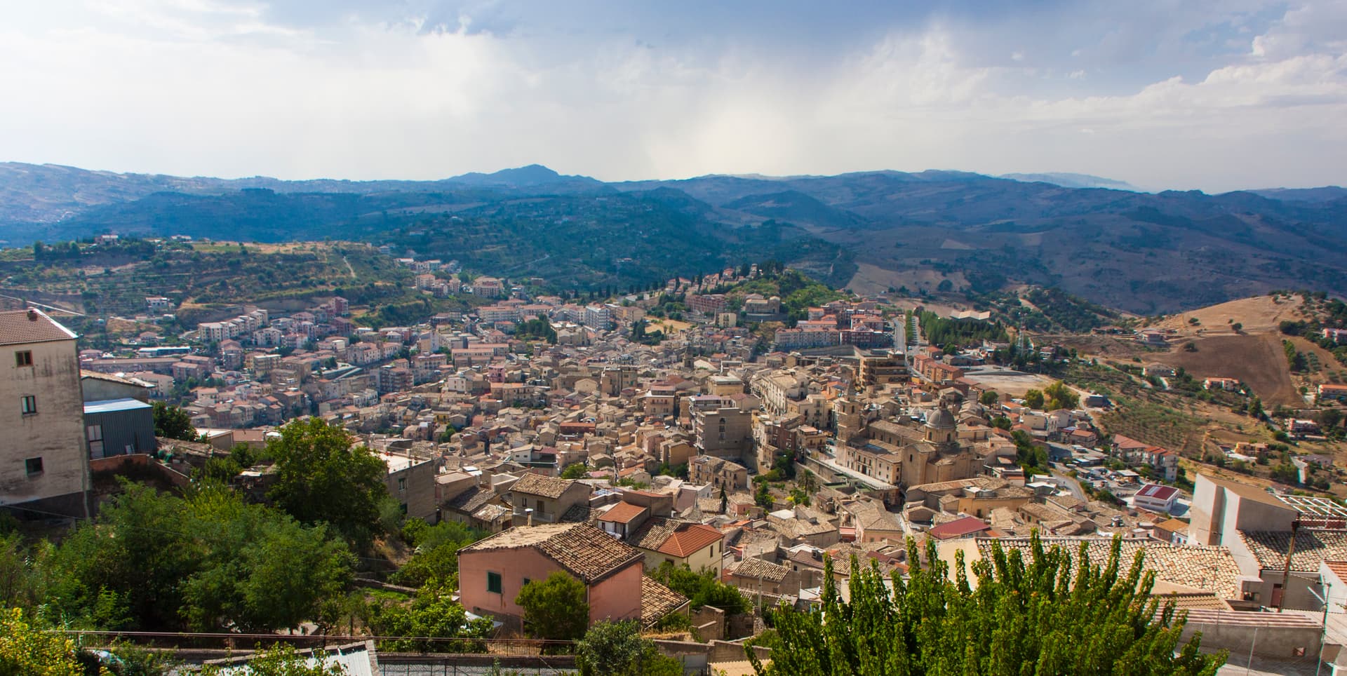
Salemi sits above the Belice Valley in the Trapani interior, on the ridge of Monte delle Rose between two rivers. The Elymians built the city of Halyciae here, conquered by Rome in 272 BC and granted freedom from taxes for its voluntary submission. Roger I built the castle in 1077 on Greek-Roman foundations, and Frederick II of Swabia rebuilt it in the thirteenth century.
On 14 May 1860, two days after landing at Marsala with the Thousand, Giuseppe Garibaldi raised the tricolor on the castle's round tower and proclaimed Salemi the capital of Italy for a single day, while he prepared the march on Calatafimi and Palermo. The Belice earthquake of 1968 destroyed much of the centro storico; the medieval Mother Church beside the castle was demolished and its remains preserved as a memorial. The Jewish quarter of Rabato survives, along with palaces built in the local Campanella stone.
The Sunday letter
We haven’t written Salemi’s letter yet.
One town every Sunday, with the photo, the food, the festa. Be there when this one comes up. Free, by Peter & Sophia from Pietrasanta.
By subscribing you agree to Substack’s Terms of Use, our Privacy Policy and our Information collection notice.

What to see
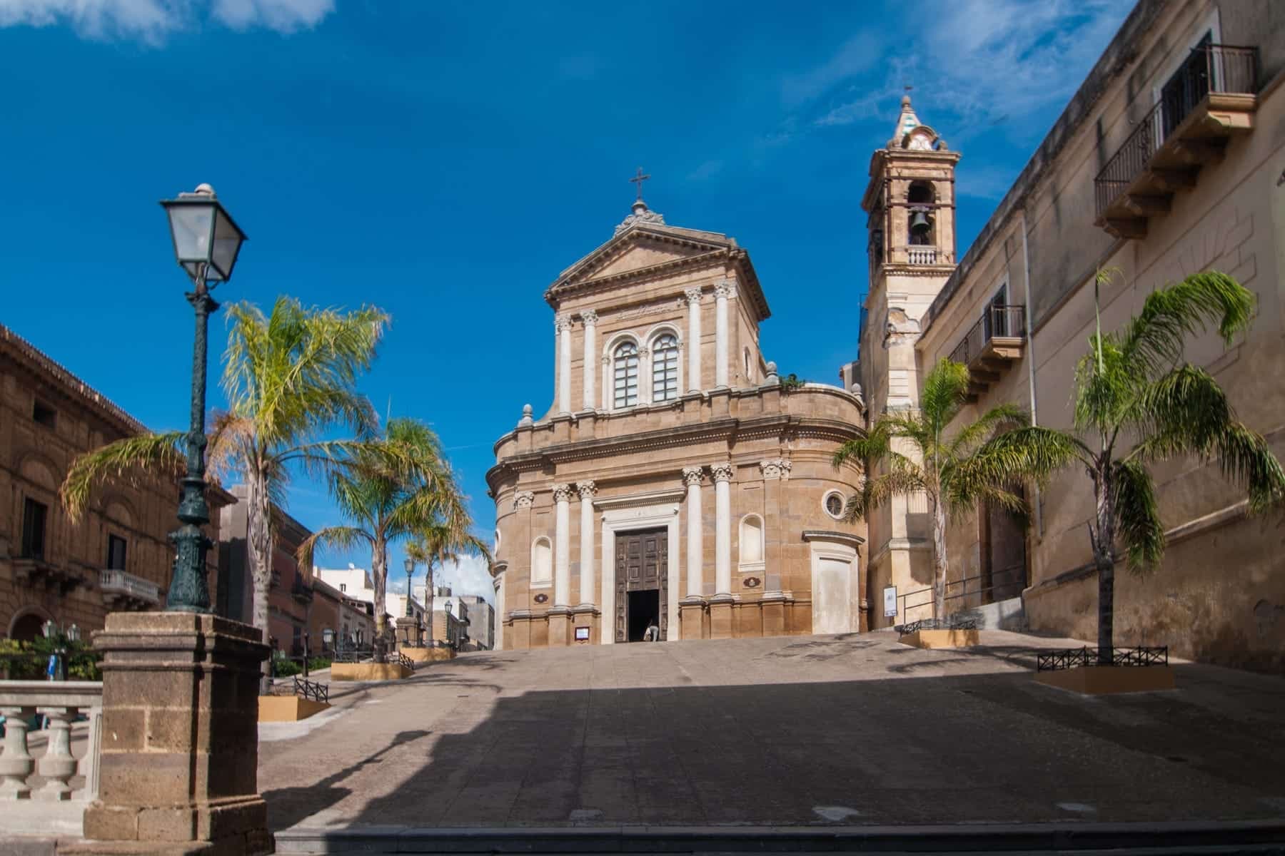
Castello Normanno-Svevo
Hilltop castle built by Roger I in 1077 on Greek-Roman foundations, rebuilt by Frederick II, where Garibaldi raised the Italian tricolor on 14 May 1860.
Basilica di San Miceli
Early Christian basilica on the edge of the commune, the oldest surviving religious building in the area with sixth-century mosaic fragments.
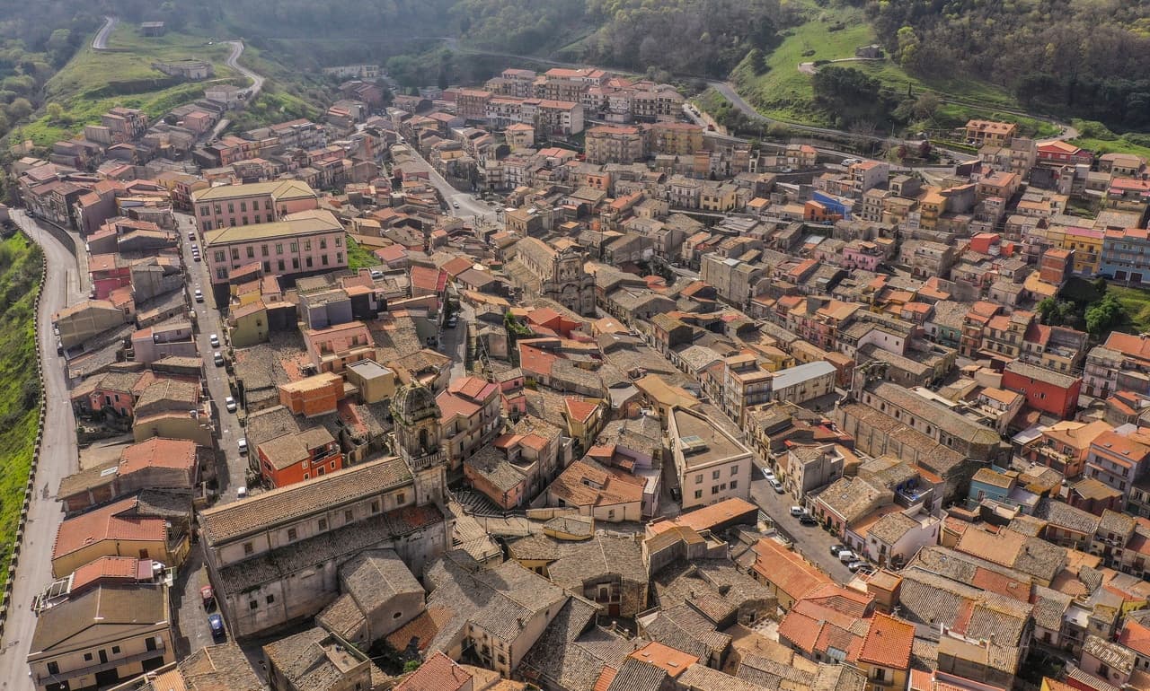
Rabato
Former Jewish and Arab quarter of low stone houses and narrow lanes, partly damaged by the 1968 Belice earthquake.
Ruderi della Chiesa Madre
Stabilized ruins of the seventeenth-century Mother Church beside the castle, demolished after the 1968 earthquake and kept as a memorial.
Piazza Alicia
Main piazza of the centro storico in Campanella stone, with a panorama over the Belice Valley and the Egadi islands on a clear day.
The slow-trip planner
Building a trip? Find where Salemi fits in a slow Italy circuit.
Answer five questions. We will shape a geographically coherent slow trip from the 1,000 Italian towns most travelers skip. Yours to save and share.
Living here
- Population 9,986
- In-betweeni
- Pharmacy in town
- High school within a 30-minute drive
- Nearest airport Sicily, 4 h 2 min drive
- Regional capital Palermo, 1 h 30 min drive
Tags & datadesignations · numbers · sources
Recognised as
The numbers
- Elevation: 446 m
- Population: 9,986
- Surface area: 182.42 km²
These figures were compiled from public directories — ISTAT, OpenStreetMap, Wikidata — and from the official listings of the guides named on this page. Town details change; verify with official sources before you travel.
Close by
More towns near Salemi
Castelvetrano
Province: Trapani
The Belice valley town that owns Selinunte, the largest archaeological park in Europe, and bakes black bread from grain found in its tombs.
Marsala
Province: Trapani
Sicily's westernmost city, born from the Phoenician refugees of Mozia, where Garibaldi landed in 1860 and English merchants invented Marsala wine.
Erice
Province: Trapani
An Elymian mountaintop city at 751 meters above Trapani, with a Norman castle on the site of the temple of Venus Erycina and a Cold War physics centre.
Menfi
Province: Agrigento
Sicily's triple-signal western coast town — 11,800 residents on a low ridge above 9 km of Bandiera Blu sand at Porto Palo, with the Federico II tower, the Cantine Settesoli cooperative (Italy's largest by volume, 2,000 grower-members), and the rare Bandiera Blu + Città del Vino + Città dell'Olio combination.
Sambuca di Sicilia
Province: Agrigento
An Arab-founded hill town in the Belice valley, named Borgo dei Borghi in 2016, still called Zabut in living memory before 1923.
🎨 Borghi più belli d'Italia
More Borghi più belli d'Italia towns in Sicily
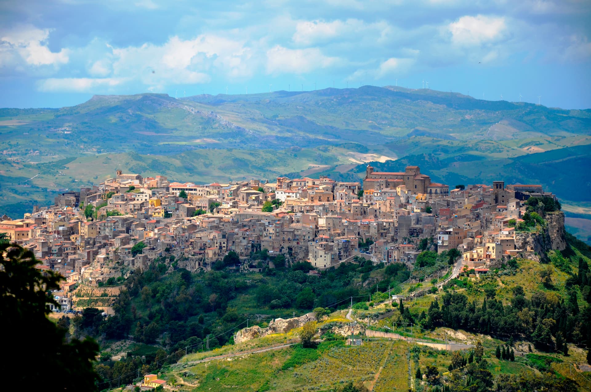
Agira
Province: Enna
On the slopes of Monte Teja at 650 meters, birthplace of the Greek historian Diodorus Siculus and burial site of 490 Canadian soldiers of the 1943 campaign.
Buccheri
Province: Siracusa
The highest village in the province of Syracuse at 820 meters on Monte Lauro, world capital of Tonda Iblea olive oil at the 2015 Sol d'Oro.
Calascibetta
Province: Enna
A promontory town at 691 meters facing Enna across a ravine, founded in the ninth century as a Muslim camp to besiege Byzantine Henna.
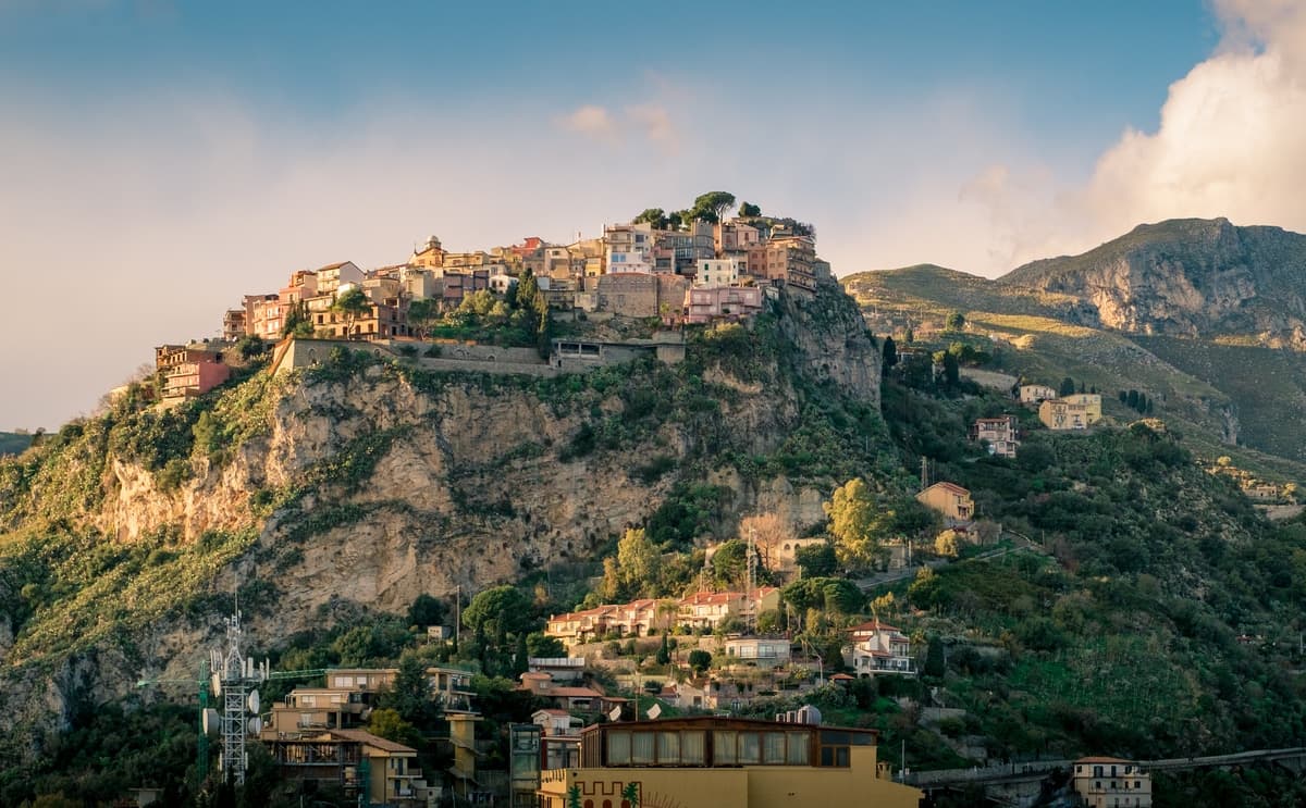
Castelmola
Province: Messina
A rock village at 529 meters directly above Taormina, the upper acropolis of ancient Tauromenium with a Norman castle and a 1947 almond-wine bar.
Castiglione di Sicilia
Province: Catania
A hill town on the north flank of Etna at 621 meters, base camp for the Alcantara valley and the volcano's most serious red wines.