
Aosta Valley · Aosta Valley
Etroubles
A 478-person village at 1,280 metres on the Via Francigena, with an open-air contemporary art museum and the region's first dairy.
Known for
OPEN-AIR MUSEUM
Contemporary sculptures and installations from international artists embedded in the streets and house façades of a 478-person Alpine village.
VIA FRANCIGENA
Last major village on the Italian descent from the Great St Bernard Pass, on the route that linked Canterbury to Rome through the Aosta Valley.
FIRST DAIRY
Valle d'Aosta's first cooperative dairy opened here on 24 July 1853, anchoring the local Fontina chain that still defines the upper valley.
When to visit
Best · Jun–Sep, Dec–Mar
- J
- F
- M
- A
- M
- J
- J
- A
- S
- O
- N
- D
- Best
- Hot or crowded
- Quiet
- Mostly closed
Why come
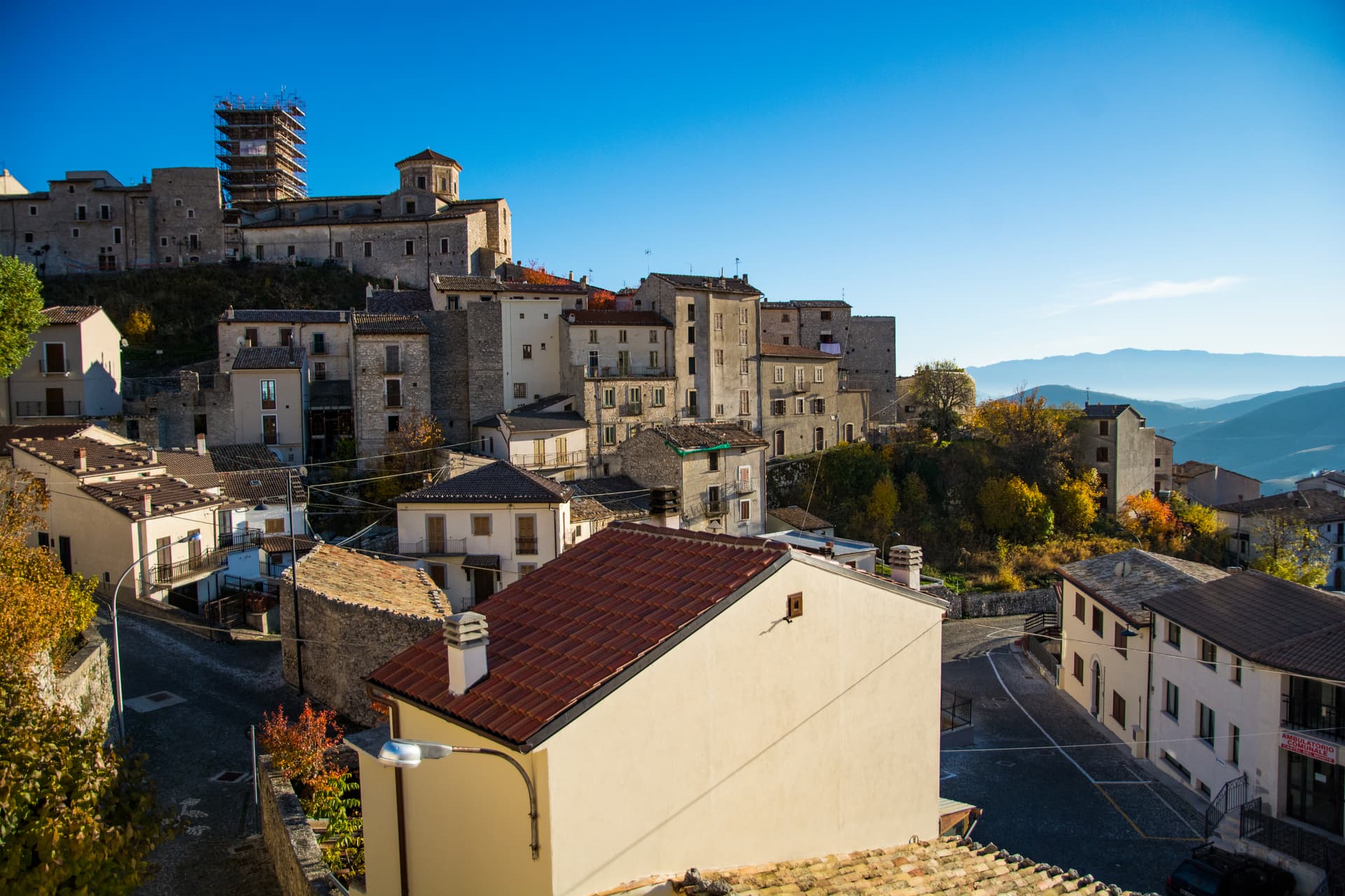
Etroubles sits at 1,280 metres on the Italian side of the Great St Bernard Pass, the last full village before the climb to the border. The Romans called it Restopolis, a transit point on the way to the Alpis Poenina, and the same route became the Via Francigena that linked Canterbury to Rome and beyond. The village holds Borghi più Belli d'Italia and Bandiera Arancione status, a rare combination for fewer than 500 inhabitants.
The historic centre is an open-air museum: sculptures, installations and contemporary works by international artists, embedded on house façades and in the squares, turn a walk through Etroubles into something closer to a curated route. On 24 July 1853, the first dairy in Valle d'Aosta opened along the road to the hamlet of Vachéry, founding the local Fontina production chain. Summer brings La Veillà, an evening of revived old trades, wheat threshing and live cheesemaking.
The Sunday letter
We haven’t written Etroubles’s letter yet.
One town every Sunday, with the photo, the food, the festa. Be there when this one comes up. Free, by Peter & Sophia from Pietrasanta.
By subscribing you agree to Substack’s Terms of Use, our Privacy Policy and our Information collection notice.


What to see
Musée à ciel ouvert
Open-air museum scattered through the village, with sculptures, installations and contemporary paintings by international artists on house façades and along the streets.
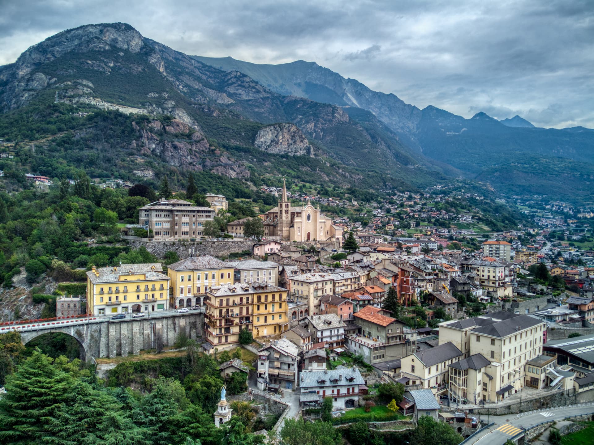
Chiesa parrocchiale di Sainte-Marie-Madeleine
Parish church at the centre of the village, dedicated to Mary Magdalene and rebuilt on earlier medieval foundations.
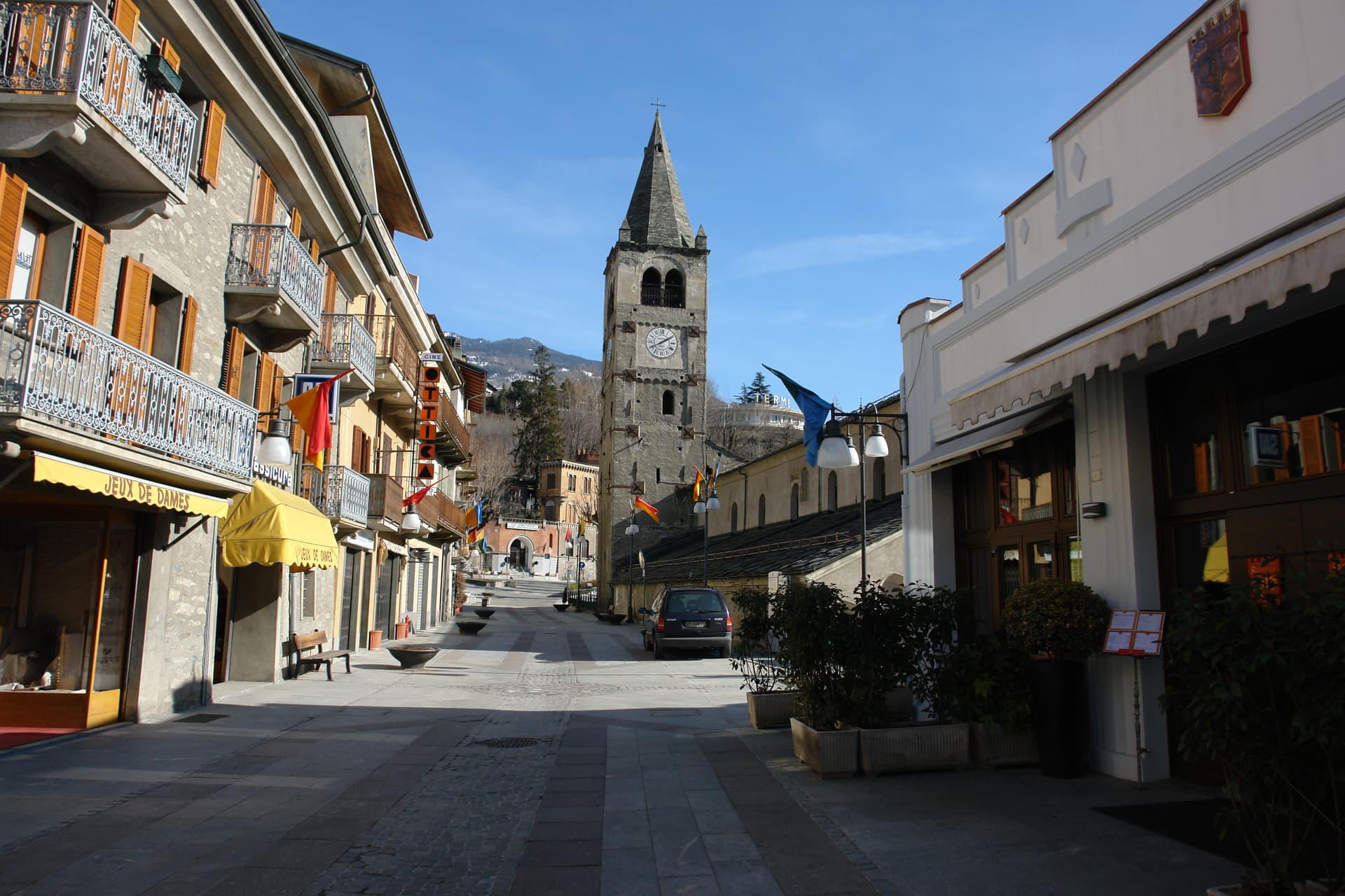
Centro storico
Stone-walled historic centre with narrow lanes, traditional Valdostan houses with wooden balconies, and the trace of the Via Francigena through the village.
Via Francigena
The Aosta Valley section of the historical pilgrimage route passes through Etroubles on its descent from the Great St Bernard Pass toward Aosta and Ivrea.
Prima latteria della Valle d'Aosta
Site of the region's first cooperative dairy, opened on 24 July 1853 along the road to the hamlet of Vachéry.
The slow-trip planner
Building a trip? Find where Etroubles fits in a slow Italy circuit.
Answer five questions. We will shape a geographically coherent slow trip from the 1,000 Italian towns most travelers skip. Yours to save and share.
Living here
- Population 478
- Commuter belti
- Pharmacy in town
- Nearest airport Turin, 2 h 4 min drive
- Regional capital Aosta, 43 min drive
Tags & datadesignations · numbers · sources
The numbers
- Elevation: 1280 m
- Population: 478
- Surface area: 39.57 km²
These figures were compiled from public directories — ISTAT, OpenStreetMap, Wikidata — and from the official listings of the guides named on this page. Town details change; verify with official sources before you travel.
Close by
More towns near Etroubles
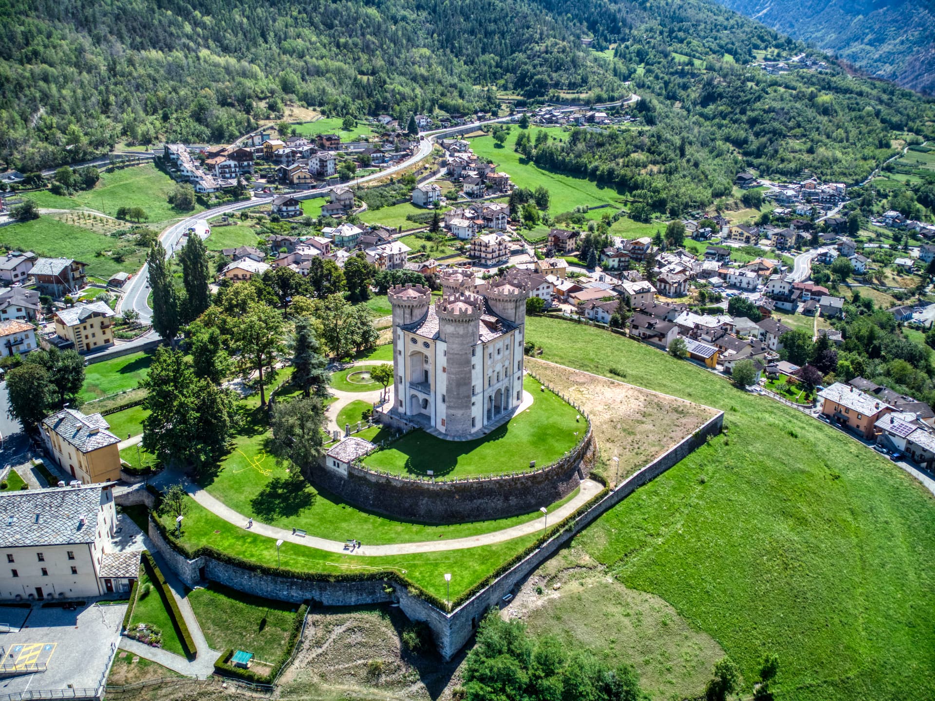
Aymavilles
Province: Aosta Valley
Gateway to the Gran Paradiso at 646 metres, with a four-towered Challant castle and a 3 BC Roman aqueduct above the Grand'Eyvia.
Châtillon
Province: Aosta Valley
The Aosta Valley's three-castle commune — a 4,358-resident town at 549m at the mouth of the Valtournenche where it meets the main valley, with the Castello Gamba (now the Valle d'Aosta regional contemporary art museum), the medieval Castello di Ussel + the Renaissance Castello Passerin d'Entrèves, and direct access up the road to the Cervino/Matterhorn at Cervinia 26 km north.
Saint-Vincent
Province: Aosta Valley
The Aosta Valley's belle-époque thermal town — a 4,400-resident commune on a sunny south-facing terrace at 575m with the Fonte Salée mineral spring (in use since 1770), the Casinò de la Vallée (Italy's second-largest legal casino since 1947), and the Matterhorn peak visible north of town.
Cogne
Province: Aosta Valley
The mining town turned capital of the Gran Paradiso, the Aosta Valley's largest commune with 95 percent of its land inside Italy's oldest park.
Fénis
Province: Aosta Valley
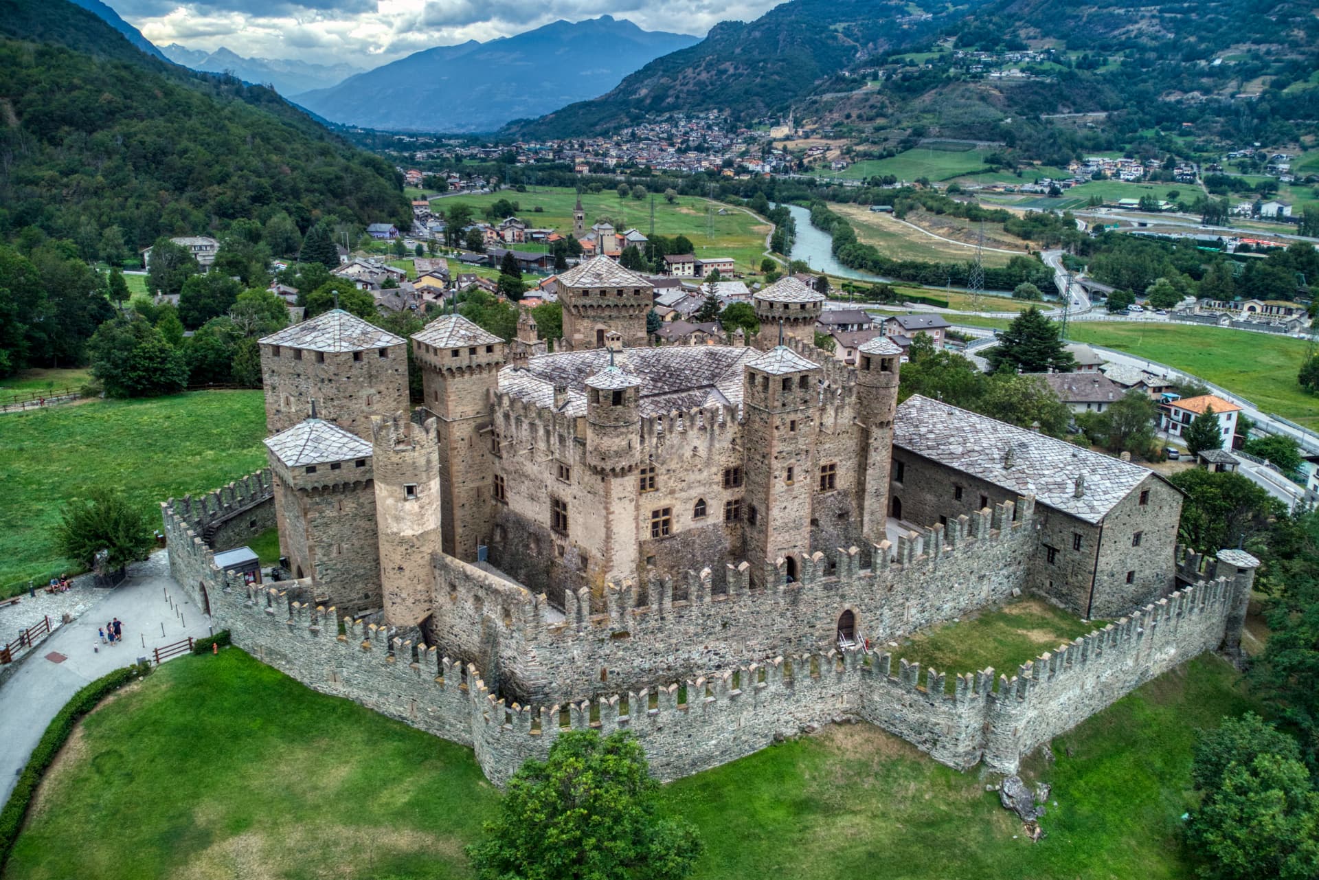
Italy's most photographed medieval castle — the Castello di Fénis (14th-c, Challant family) with its double-ring of crenellated walls, eight cylindrical towers, and frescoed inner courtyard sits at the centre of a 1,770-resident Aostan commune 18 km east of Aosta, with the Valle di Clavalité Apennine reserve climbing south to 3,000m.
🎨 Borghi più belli d'Italia
More Borghi più belli d'Italia towns
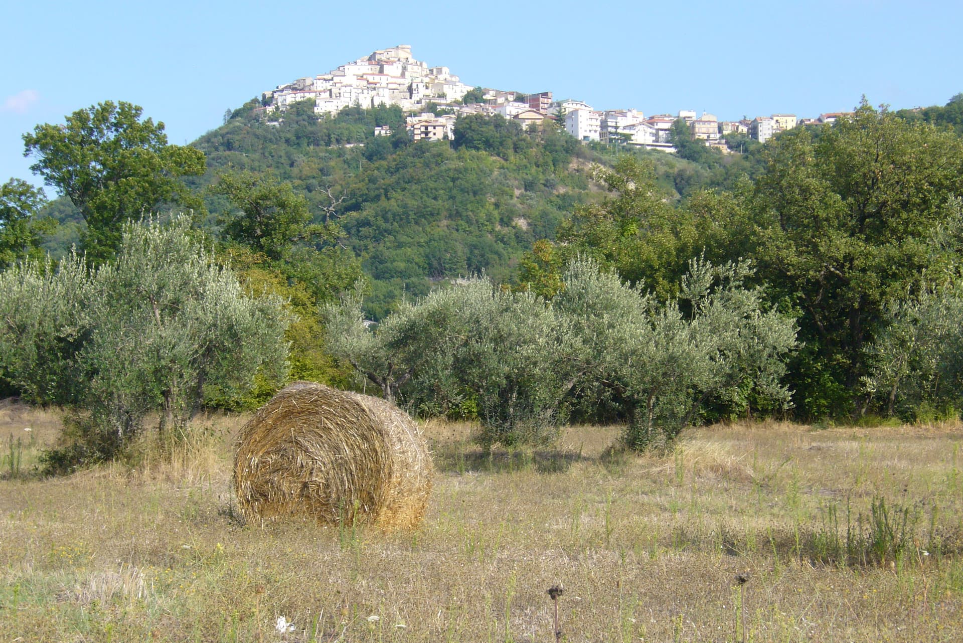
Anversa degli Abruzzi
Province: L'Aquila
At 604 meters above the Sagittario Gorges, the cliff village where D'Annunzio set La Fiaccola sotto il moggio in 1905.
Campli
Province: Teramo
A 393-meter town under the Monti della Laga, held by the Farnese for two centuries, with a Scala Santa carrying papal indulgence.
Caramanico Terme
Province: Pescara
A 650-meter Majella spa village at the confluence of the Orfento and Orta, with sulphurous springs whose properties were documented in 1576.
Casoli
Province: Chieti
A 378-meter hill town above the Aventino under the Maiella, with a pentagonal Norman tower where Gabriele D'Annunzio held a Renaissance court of artists.
Castel del Monte
Province: L'Aquila
At 1,346 meters under Monte Bolza facing Rocca Calascio, the capital of shepherds, whose wool reached the Medici and whose witches return each August.