
Umbria · Perugia
Nocera Umbra
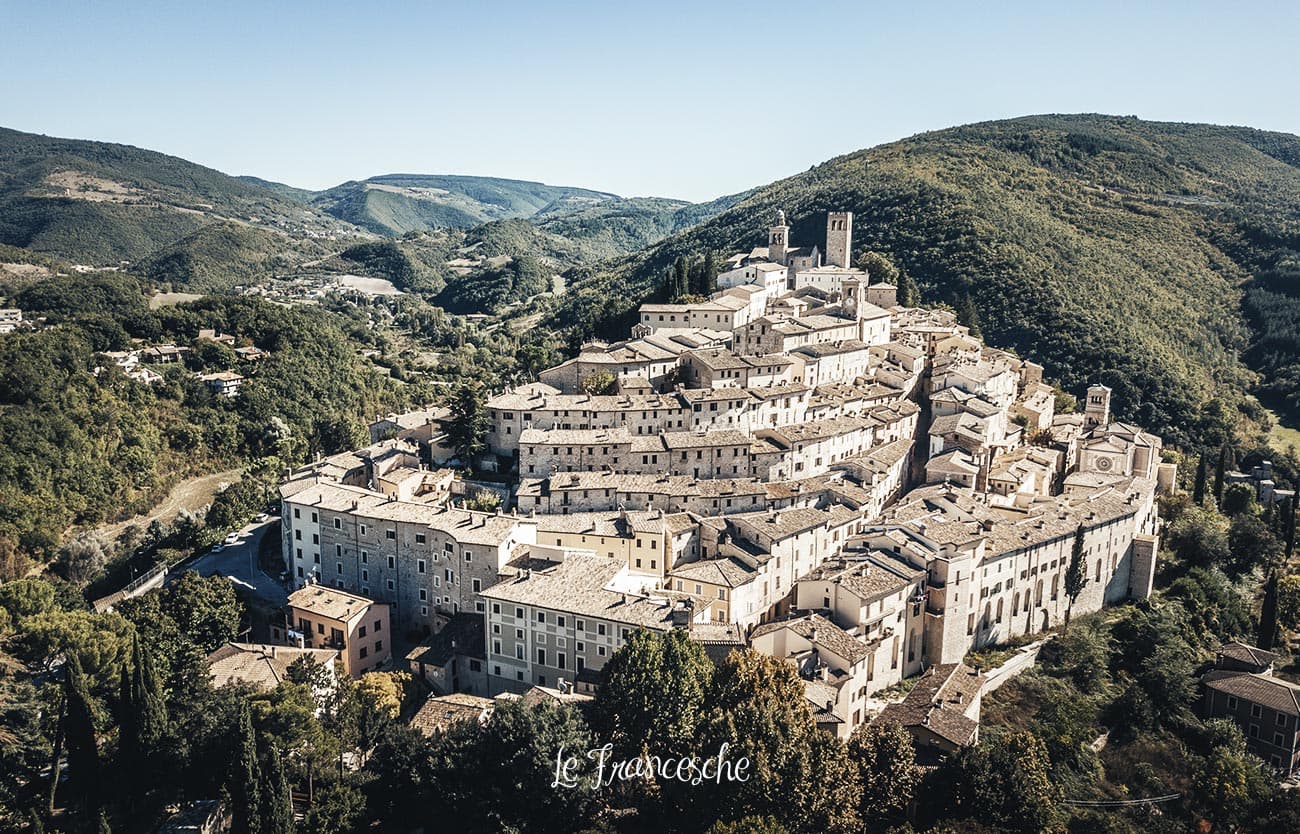
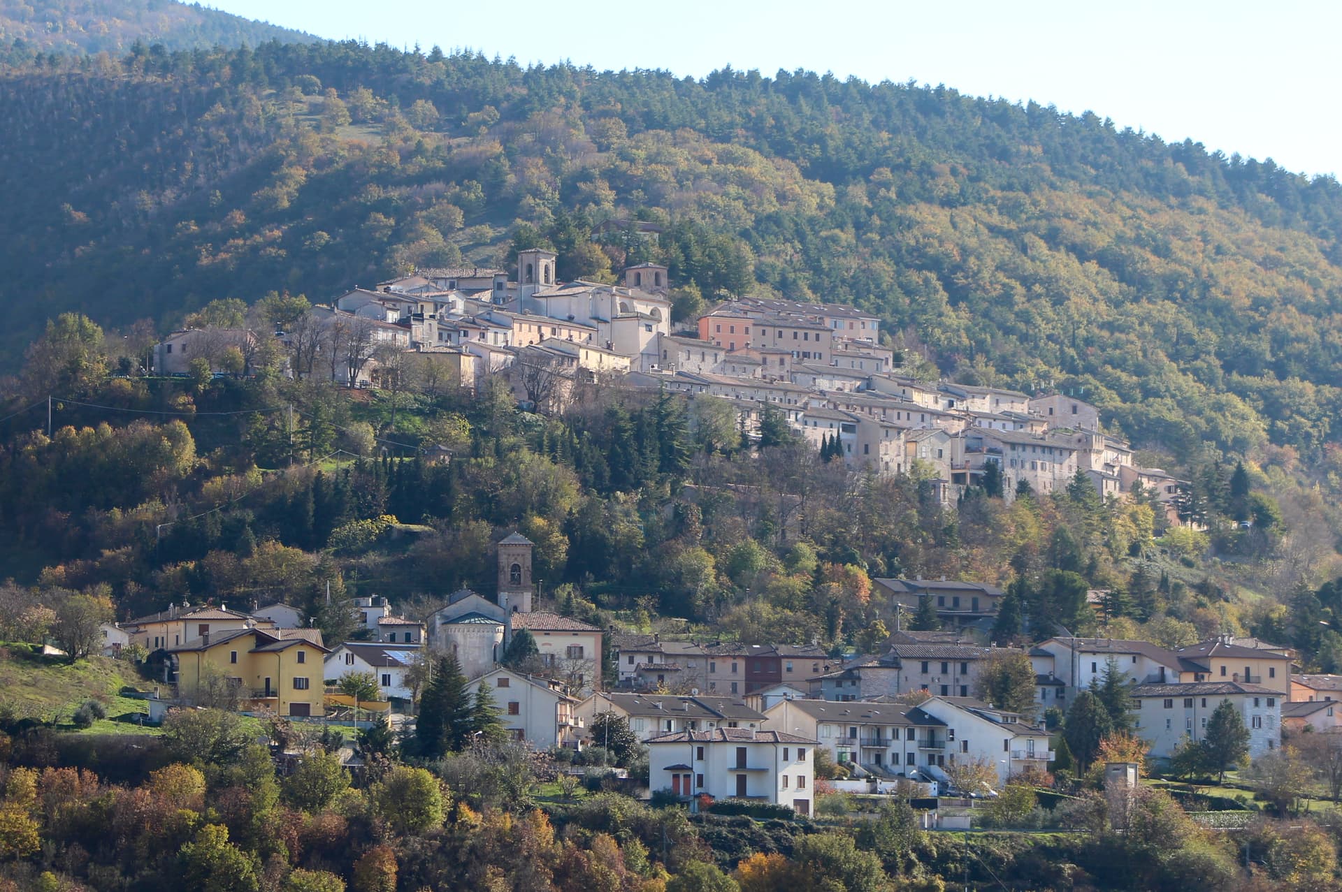
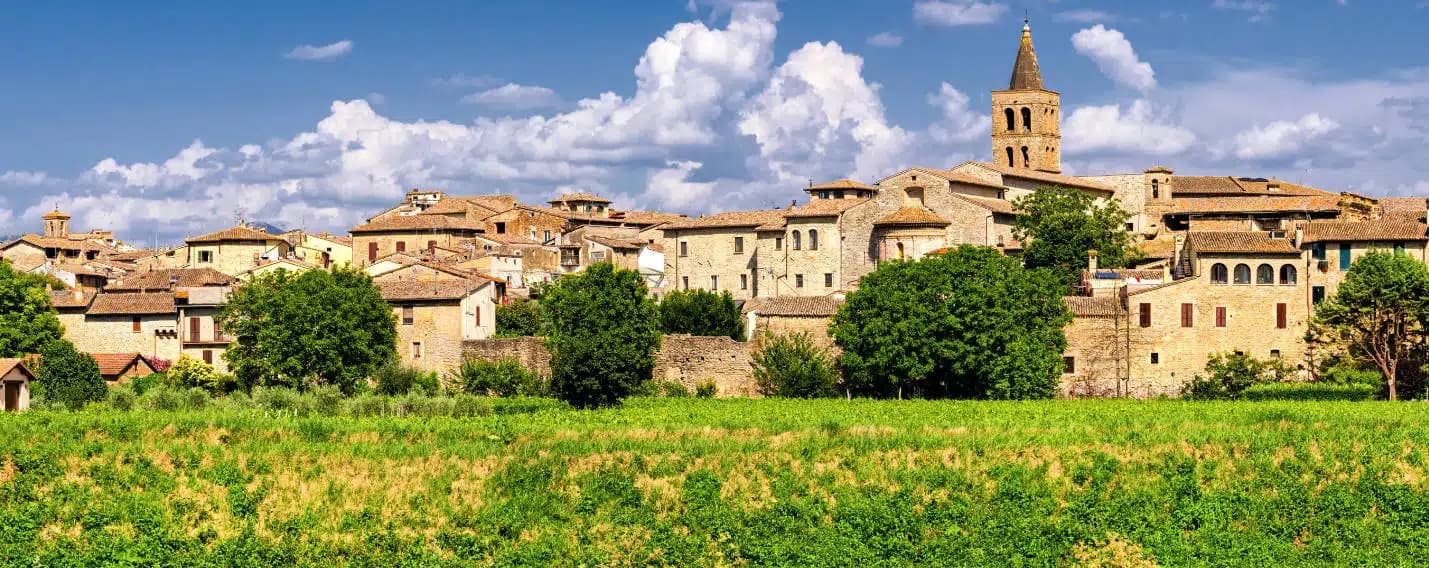
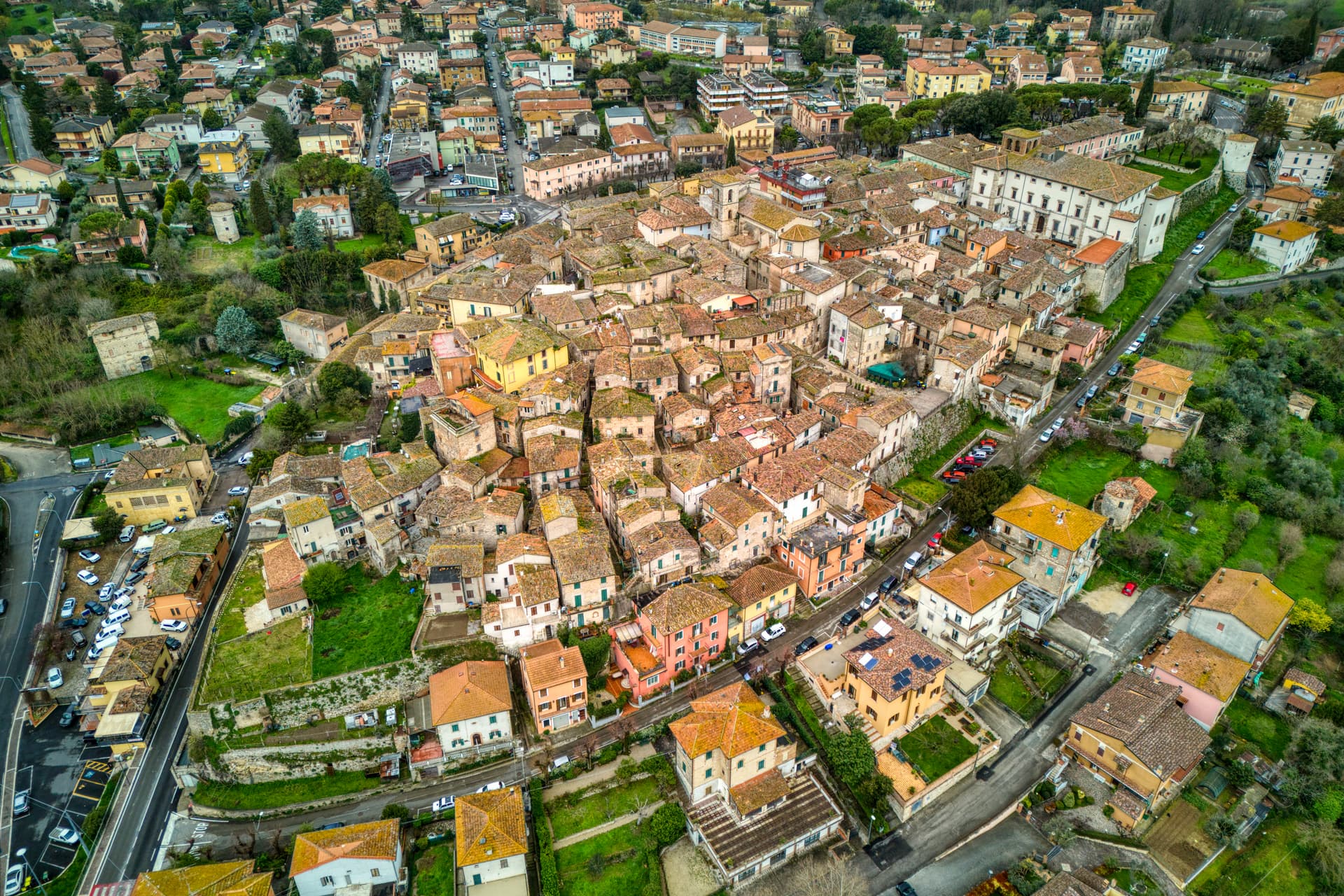
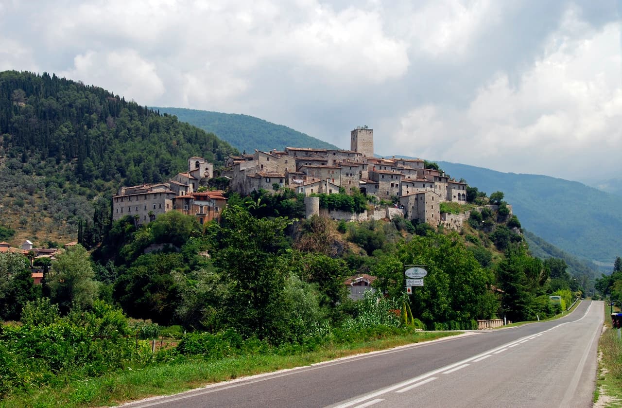
A hill town at 520 meters on the Apennine slope, leveled by the 1997 earthquake and rebuilt, with mineral springs flowing since the sixteenth century.
Known for
MINERAL WATER
Bagni di Nocera springs, used since 1500 for hydrotherapy; the Sorgente Angelica still bottles for the national market.
1997 EARTHQUAKE
The Campanaccio was almost entirely destroyed on 26 September 1997 and reconstructed across two decades, completed in 2016.
NICCOLÒ ALUNNO
Fifteenth-century Foligno school painter whose works anchor the Pinacoteca alongside Matteo da Gualdo and Cimabue-circle panels.
When to visit
Best · Apr–Oct
- J
- F
- M
- A
- M
- J
- J
- A
- S
- O
- N
- D
- Best
- Hot or crowded
- Quiet
- Mostly closed
The festa: Rinaldo di Nocera Umbra, 9 February
Why come
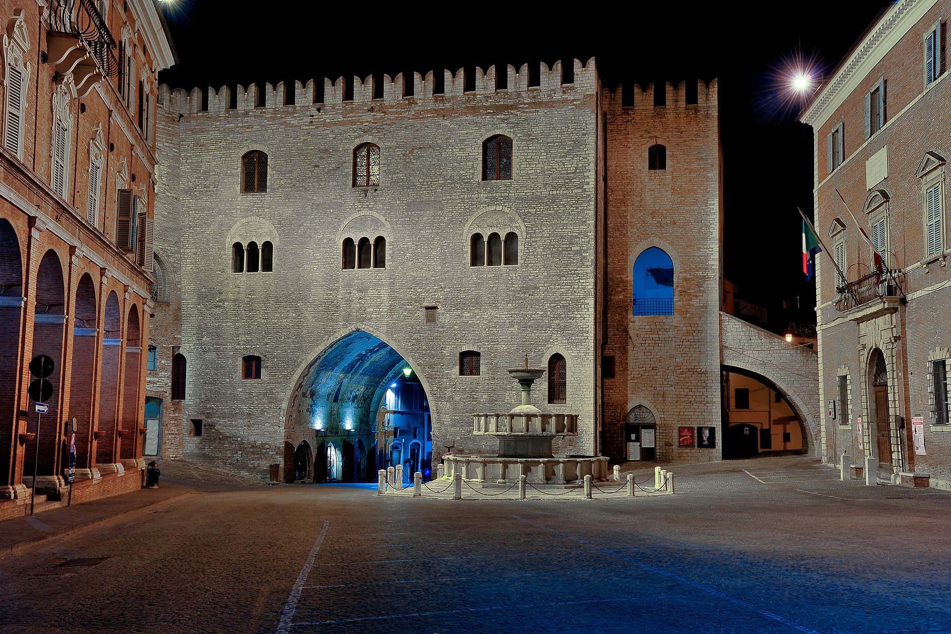
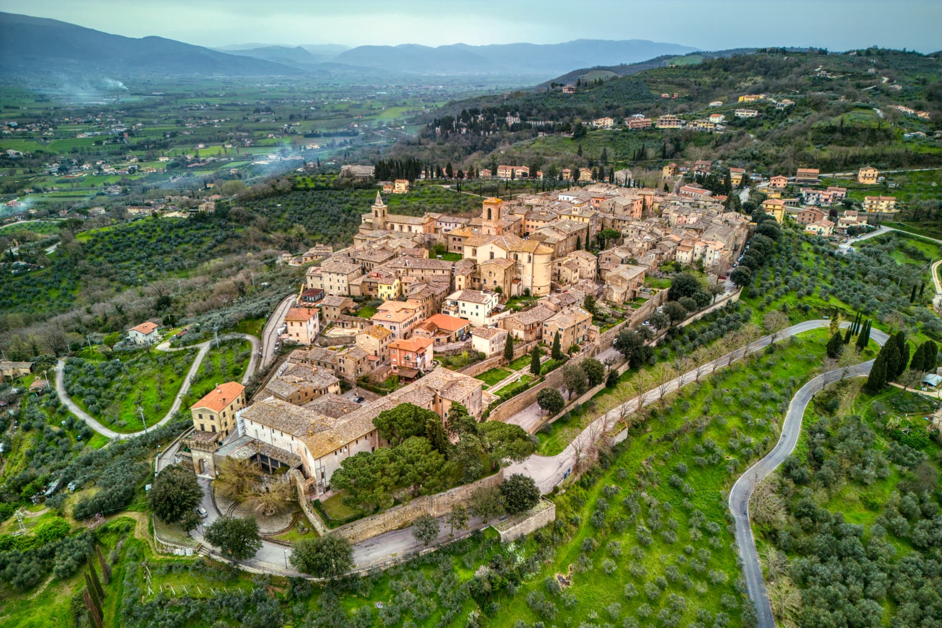
Nocera Umbra sits at 520 meters on the Apennine slope, fifteen kilometers north of Foligno. The Romans called it Nuceria; the town has its own bishopric from the early Middle Ages and was contested between Perugia, Spoleto and the Trinci of Foligno through the medieval period. The Campanaccio, the eleventh-century civic tower that is the town's symbol, was almost completely destroyed by the 26 September 1997 earthquake; only part of one side remained standing.
The reconstruction took nearly two decades and was completed in 2016. The Pinacoteca, housed in the deconsecrated Chiesa di San Francesco at the top of the centro storico, holds works by Niccolò Alunno, Matteo da Gualdo and the school of Cimabue. The town's other identity is mineral water: hydrotherapy at the Bagni di Nocera is documented from 1500 and the Sorgente Angelica bottles still circulate nationally. The Bandiera Arancione recognition was reconfirmed after reconstruction.
The Sunday letter
We haven’t written Nocera Umbra’s letter yet.
One town every Sunday, with the photo, the food, the festa. Be there when this one comes up. Free, by Peter & Sophia from Pietrasanta.
By subscribing you agree to Substack’s Terms of Use, our Privacy Policy and our Information collection notice.

What to see
Campanaccio (Torre Civica)
Eleventh-century square tower at the highest point of the borgo; almost completely destroyed in 1997 and rebuilt by 2016.
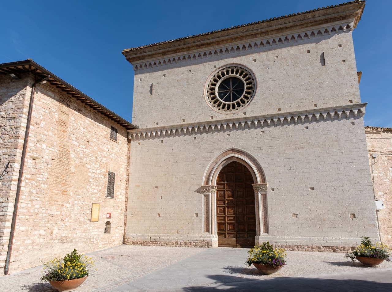
Pinacoteca e Museo Civico
Civic gallery in the deconsecrated Chiesa di San Francesco with works by Niccolò Alunno, Matteo da Gualdo, and the school of Cimabue.
Cattedrale di Santa Maria Assunta
Cathedral at the summit of the centro storico, partially damaged in 1997 and restored, set beside the Campanaccio and the former Rocca.
Sorgenti di Bagni di Nocera
Mineral springs five kilometers below the centro storico, used in hydrotherapy from 1500, with the Sorgente Angelica still bottling commercially.
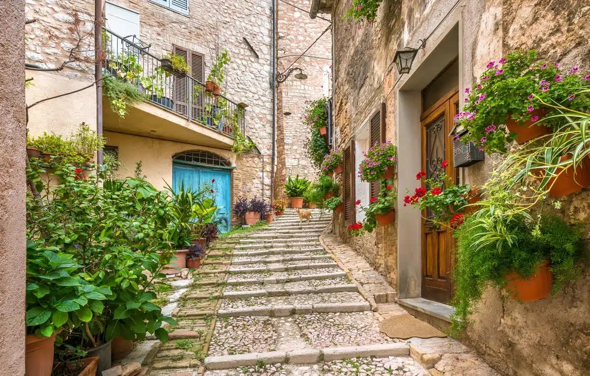
Centro storico restaurato
Medieval walled core rebuilt after the 1997 quake, with the original streetplan preserved and most masonry restored stone by stone.
The slow-trip planner
Building a trip? Find where Nocera Umbra fits in a slow Italy circuit.
Answer five questions. We will shape a geographically coherent slow trip from the 1,000 Italian towns most travelers skip. Yours to save and share.
Living here
- Population 5,511
- Commuter belti
- Pharmacy in town
- High school within a 30-minute drive
- Train station in the comune
- Nearest airport Ancona / Pescara, 1 h 29 min drive
- Regional capital Perugia, 54 min drive
This is a thermal town — terme operate here.
Tags & datadesignations · numbers · sources
The numbers
- Elevation: 520 m
- Population: 5,511
- Surface area: 157.17 km²
These figures were compiled from public directories — ISTAT, OpenStreetMap, Wikidata — and from the official listings of the guides named on this page. Town details change; verify with official sources before you travel.
Close by
More towns near Nocera Umbra
Fossato di Vico
Province: Perugia
A medieval village on Mount Mutali at 581 meters, where the Via Flaminia's Roman waystation Hellvillum became a tenth-century castle still threaded by covered alleyways.
Spello
Province: Perugia
Augustan Hispellum at 280 meters on Monte Subasio, where streets carry flower petals each Corpus Domini and Pinturicchio frescoed the Baglioni Chapel in 1501.
Trevi
Province: Perugia
A walled town at 412 meters above the Spoleto valley, ringed by 200,000 olive trees that make it the Umbrian capital of olive oil.
Bevagna
Province: Perugia
Roman Mevania on the Umbrian plain at 225 meters, four medieval quarters that compete every June in a reconstructed market of the 13th century.
Fabriano
Province: Ancona
The Italian paper town at 325 meters, making fine watermarked sheets since 1264 and a UNESCO Creative City of Crafts and Folk Art.
🎨 Borghi più belli d'Italia
More Borghi più belli d'Italia towns in Umbria
Acquasparta
Province: Terni
A hill town at 350 meters above the Naia valley, where Federico Cesi convened the first Accademia dei Lincei in his Palazzo Cesi in 1603.
Allerona
Province: Terni
A stone borgo at 472 meters between the Paglia valley and the Valdichiana, an Orvieto outpost whose Monaldeschi castle fell to Charles V.
Arrone
Province: Terni
Medieval castle village on the left bank of the Nera at 243 meters, upstream from the largest man-made waterfall in the world.
Bettona
Province: Perugia
A hill town at 353 meters between the Topino and Chiascio rivers, the only Etruscan settlement ever built east of the Tiber.
Castiglione del Lago
Province: Perugia
Trasimeno's western promontory, once the lake's fourth island, fortified by Federico II in 1247 and frescoed by Pomarancio for the Corgna marquises.