
Sicily · Siracusa
Ferla
A baroque village at 500 meters on the Monte Lauro slopes, the western gateway to the UNESCO necropolis of Pantalica eleven kilometers downhill.
Known for
PANTALICA
Western gateway to the UNESCO rock-cut necropolis, 11 km east of the village; around 4,000 chamber tombs from the thirteenth to seventh centuries BC.
BAROCCO IBLEO
Levelled by the 1693 earthquake and rebuilt in Iblei baroque between 1700 and 1750; the Basilica San Sebastiano is the rebuild's central monument.
COMUNE VIRTUOSO
Part of the Comuni Virtuosi network for waste reduction and sustainable practices, one of the few in eastern Sicily inside the program.
When to visit
Best · Apr–Jun, Sep–Nov
- J
- F
- M
- A
- M
- J
- J
- A
- S
- O
- N
- D
- Best
- Hot or crowded
- Quiet
- Mostly closed
The festa: San Sebastiano, 20 July
Why come
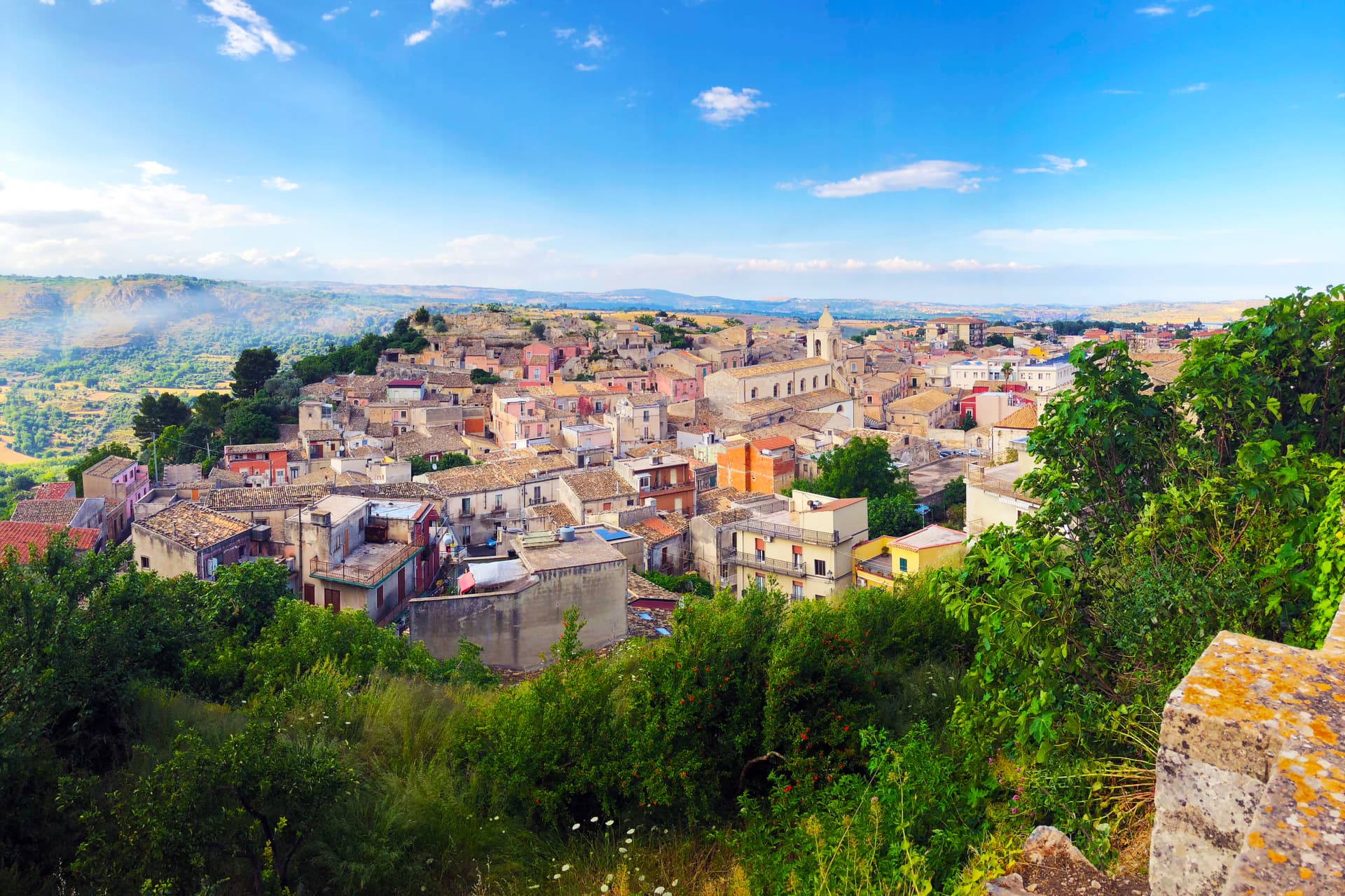
Ferla sits at 500 meters on the slopes of Monte Lauro in the Iblei, the western gateway to the rock-cut necropolis of Pantalica, eleven kilometers down the road through the Anapo valley. The Pantalica tombs, around four thousand chambers cut into the limestone between the thirteenth and seventh centuries BC, became a UNESCO World Heritage site with Syracuse in 2005. The village name dates to the Norman refoundation, possibly from the Lombard farra meaning community.
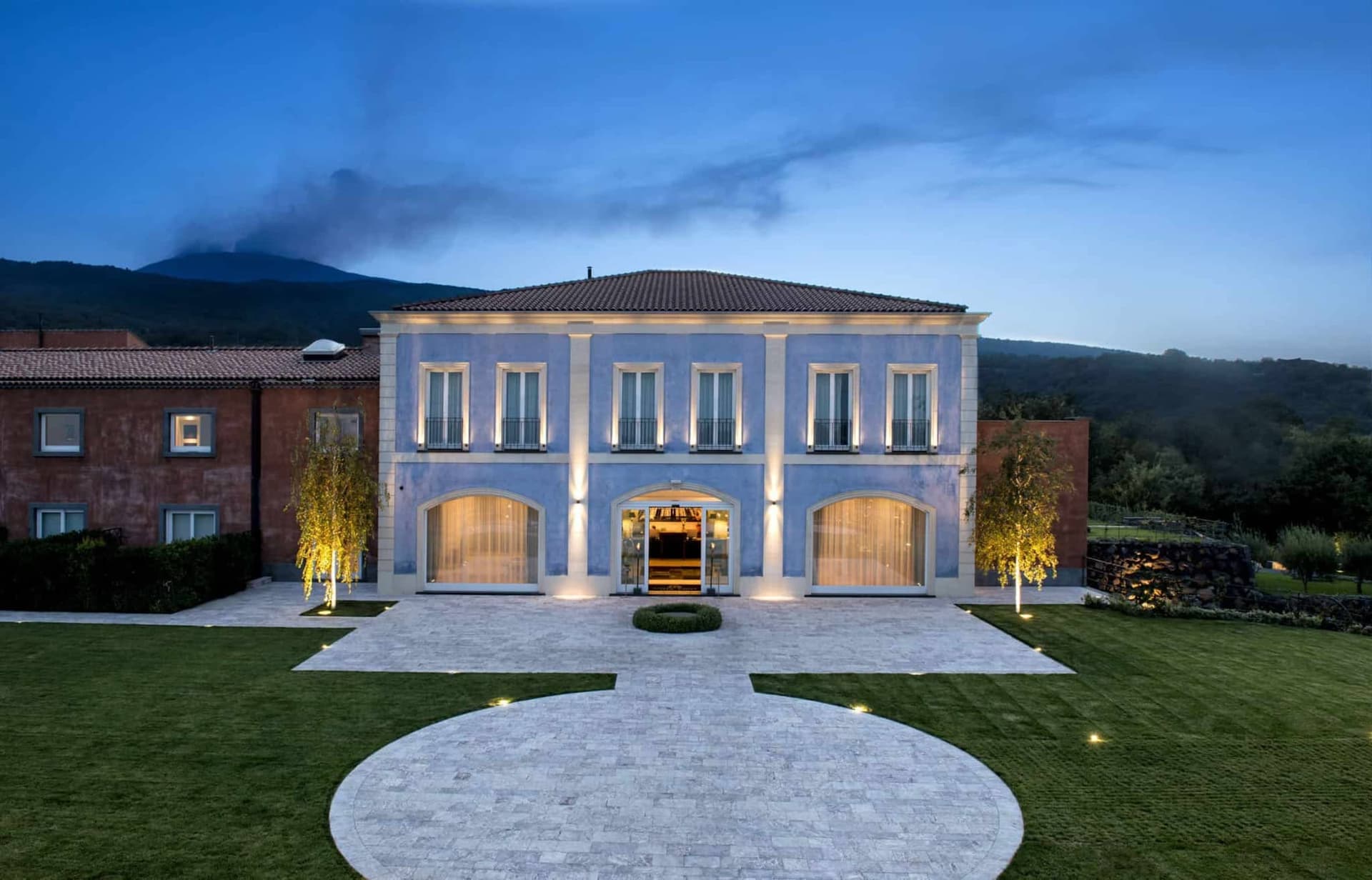
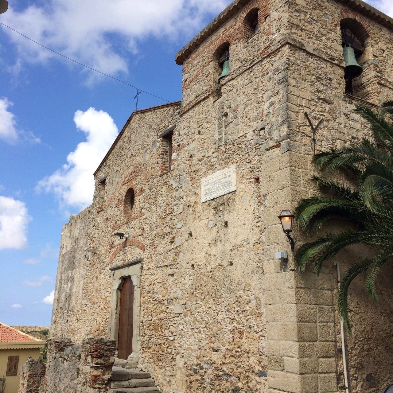
The 1693 Val di Noto earthquake leveled Ferla and the town rebuilt itself in Iblei baroque between 1700 and the 1750s. The Basilica di San Sebastiano, the largest church in the village, was begun in 1481, destroyed in 1693 and completed in its current baroque form in 1741. Ferla is a Comune Virtuoso, recognized for its waste reduction and small-scale environmental programs, one of the few in eastern Sicily inside the network.
The Sunday letter
We haven’t written Ferla’s letter yet.
One town every Sunday, with the photo, the food, the festa. Be there when this one comes up. Free, by Peter & Sophia from Pietrasanta.
By subscribing you agree to Substack’s Terms of Use, our Privacy Policy and our Information collection notice.


What to see
Basilica di San Sebastiano
Largest church in the village, founded 1481, destroyed in the 1693 earthquake and completed in 1741 in Iblei baroque; central monument of the rebuild.
Chiesa di San Giacomo
Baroque parish church on the upper square, rebuilt after 1693 with a polychrome marble altar and the village's patron statue.
Necropoli di Pantalica
Around 4,000 rock-cut chamber tombs from the thirteenth to seventh centuries BC on a limestone promontory 11 km east; UNESCO site since 2005.
Valle dell'Anapo
Limestone gorge between Ferla and Sortino with the Anapo river, lush vegetation, abandoned railway trail, and access to the Pantalica plateau.
The slow-trip planner
Building a trip? Find where Ferla fits in a slow Italy circuit.
Answer five questions. We will shape a geographically coherent slow trip from the 1,000 Italian towns most travelers skip. Yours to save and share.
Living here
- Population 2,305
- Off the beaten pathi
- Pharmacy in town
- High school within a 30-minute drive
- Nearest airport Sicily, 1 h 12 min drive
- Regional capital Palermo, 3 h 34 min drive
Tags & datadesignations · numbers · sources
The numbers
- Elevation: 500 m
- Population: 2,305
- Surface area: 24.9 km²
These figures were compiled from public directories — ISTAT, OpenStreetMap, Wikidata — and from the official listings of the guides named on this page. Town details change; verify with official sources before you travel.
Close by
More towns near Ferla
Palazzolo Acreide
Province: Siracusa
The Iblei plateau's UNESCO Baroque + Greek twin — 8,000-resident hilltop town at 670m, founded over the Greek Akrai colony (664 BC), rebuilt entirely in late Baroque after the 1693 earthquake (inscribed on the Val di Noto UNESCO listing 2002), with the original Greek theatre + the unique Santoni rock carvings of Cybele just outside the modern centro.
Sortino
Province: Siracusa
The eastern gateway to UNESCO Pantalica at 438 meters in the Iblei, Sicily's city of honey and home of the stuffed Sortino pizzolo.
Buccheri
Province: Siracusa
The highest village in the province of Syracuse at 820 meters on Monte Lauro, world capital of Tonda Iblea olive oil at the 2015 Sol d'Oro.
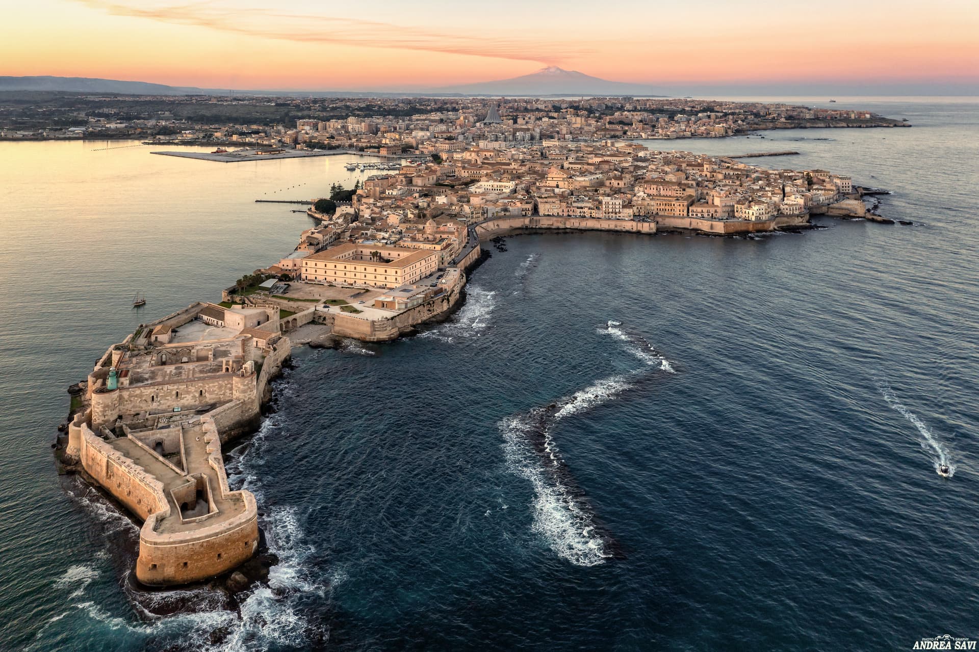
Siracusa
Province: Siracusa
The 2,700-year-old Greek city Cicero called the most beautiful in the world — Ortigia island at its heart wrapped in honey-coloured Baroque stone, the 5th-century BC Greek theatre still in use every summer, and Catania's bigger UNESCO sister on the eastern Sicilian coast.
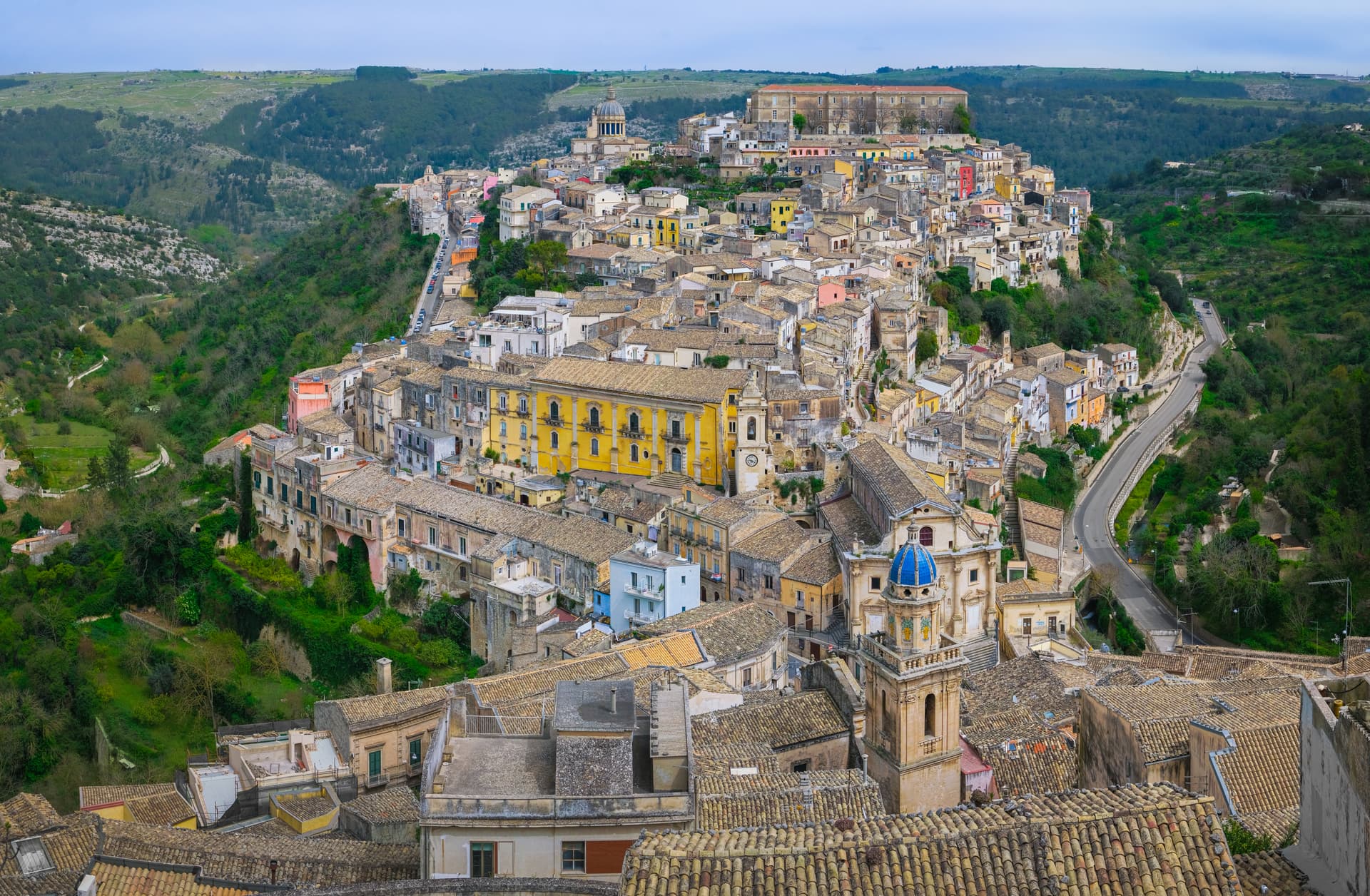
Ragusa
Province: Ragusa
Two cities in one on a Hyblean plateau at 502 meters, Ragusa Ibla and Ragusa Superiore split by a ravine after 1693, both UNESCO Baroque.
🎨 Borghi più belli d'Italia
More Borghi più belli d'Italia towns in Sicily
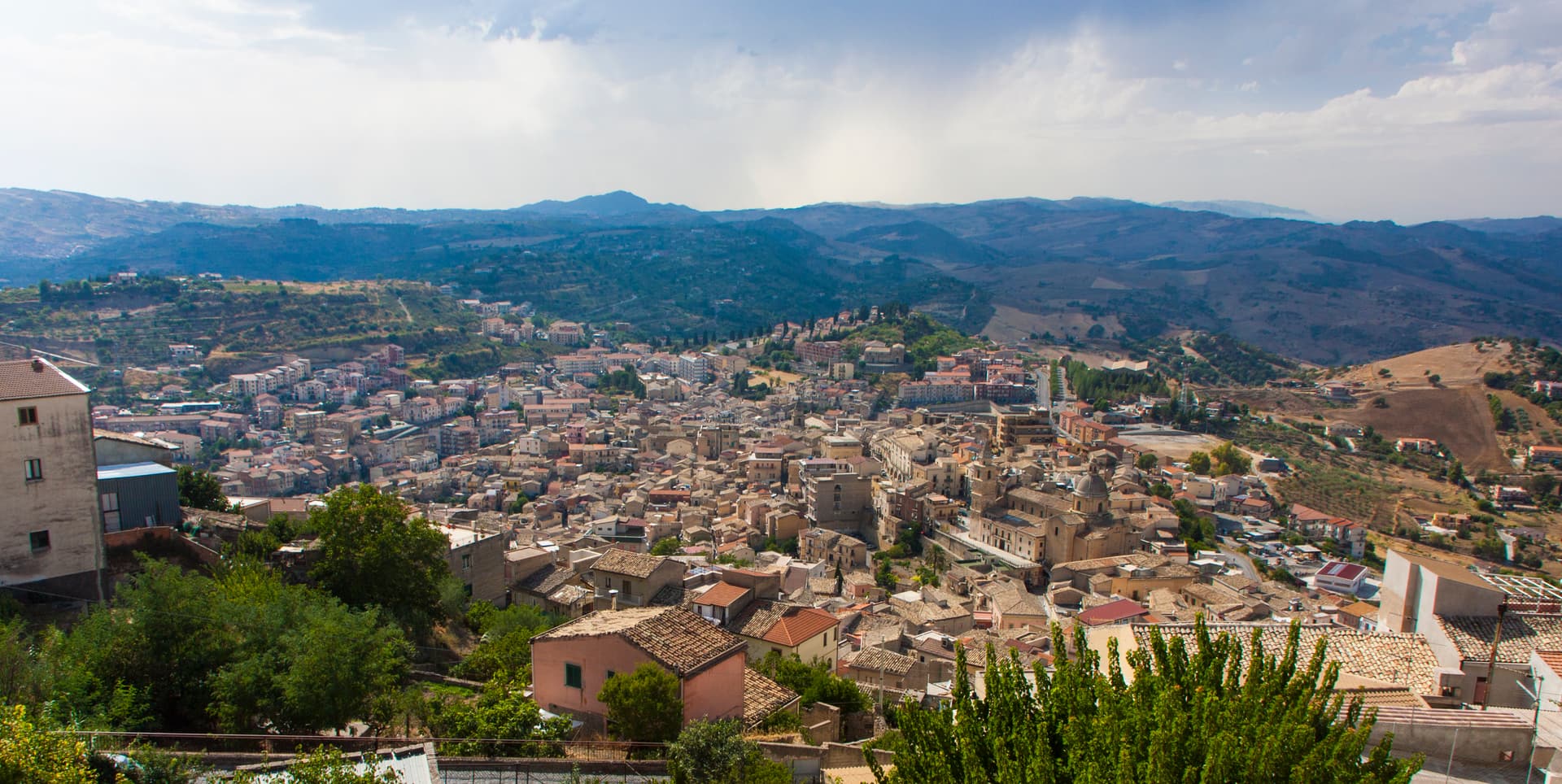
Agira
Province: Enna
On the slopes of Monte Teja at 650 meters, birthplace of the Greek historian Diodorus Siculus and burial site of 490 Canadian soldiers of the 1943 campaign.
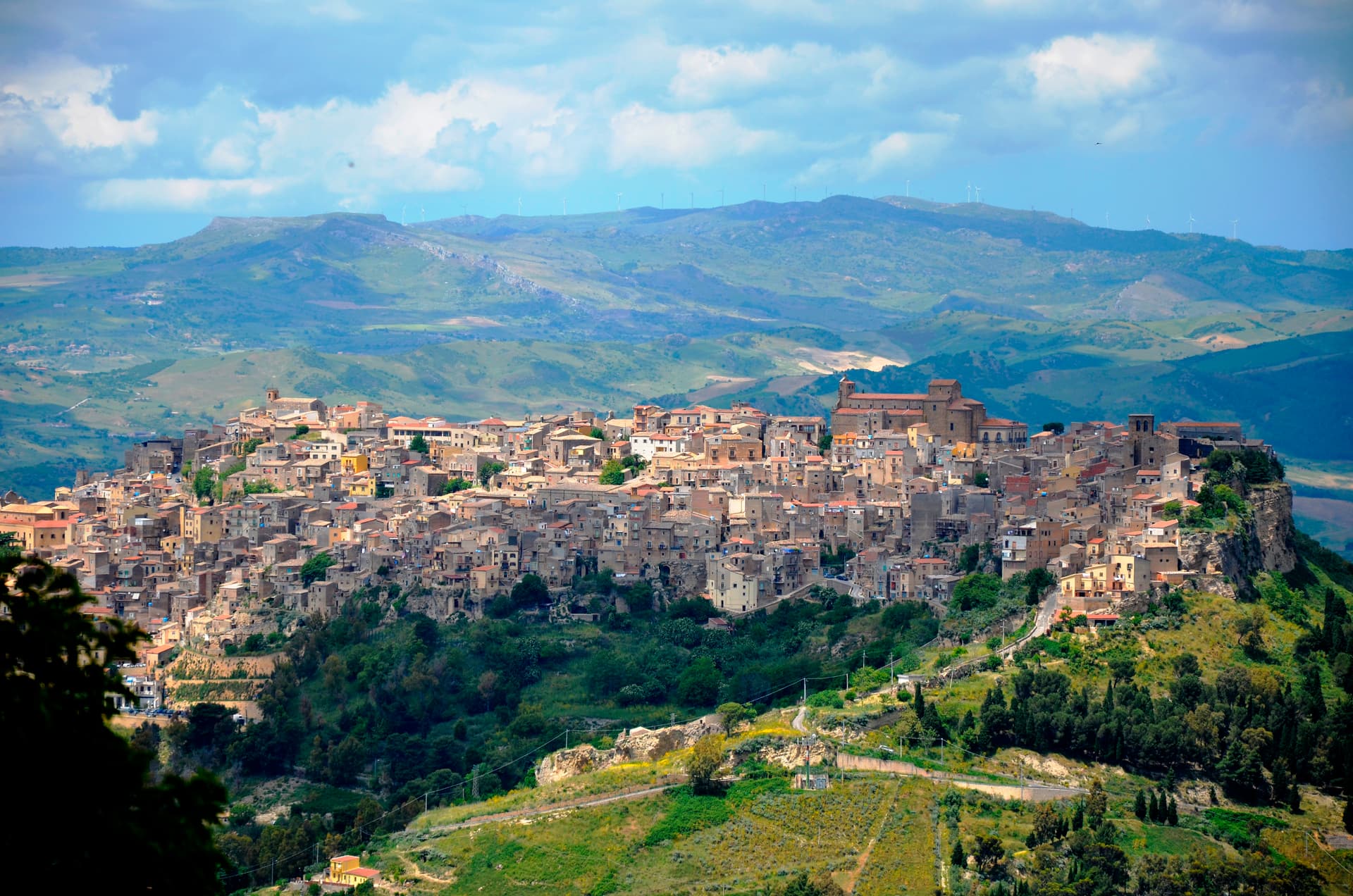
Calascibetta
Province: Enna
A promontory town at 691 meters facing Enna across a ravine, founded in the ninth century as a Muslim camp to besiege Byzantine Henna.
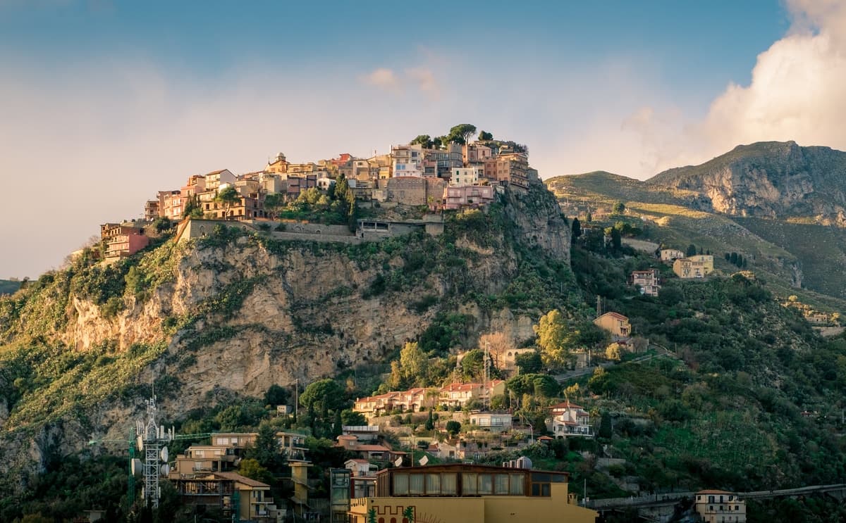
Castelmola
Province: Messina
A rock village at 529 meters directly above Taormina, the upper acropolis of ancient Tauromenium with a Norman castle and a 1947 almond-wine bar.
Castiglione di Sicilia
Province: Catania
A hill town on the north flank of Etna at 621 meters, base camp for the Alcantara valley and the volcano's most serious red wines.
Castroreale
Province: Messina
A ridge town at 394 meters above the Milazzo plain, rebuilt by Frederick II of Aragon in 1324 as a royal demesne and second in the 2018 Borgo dei Borghi.