
Abruzzo · L'Aquila
Villalago
A 930-meter village above three lakes, named for the nine that once filled the valley, with a hermit's cave on the water's edge.
Known for
THREE LAKES
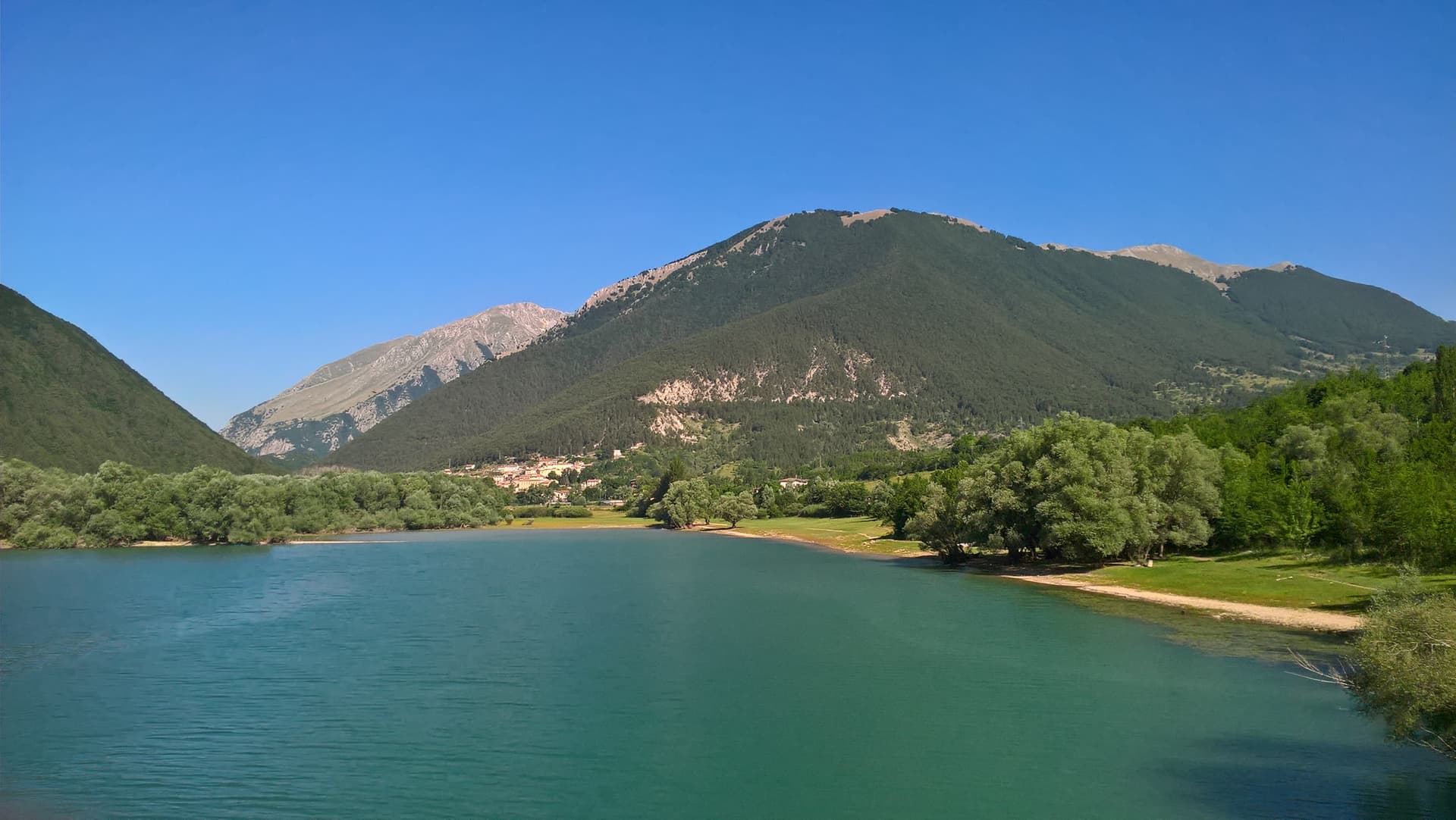
Villalago sits above Lago Pio, Lago di San Domenico, and Lago di Scanno, the heart-shaped lake to the south. Hence the name.
EREMO SAN DOMENICO
Lake-edge hermit cave where Saint Dominic of Sora lived around the year 1000, the chapel built into the rock in the 1400s.
BORGO DEI BORGHI
Finalist in the RAI Borgo dei Borghi competition, one of three Abruzzo commune to make the national final since the show began.
When to visit
Best · May–Oct
- J
- F
- M
- A
- M
- J
- J
- A
- S
- O
- N
- D
- Best
- Hot or crowded
- Quiet
- Mostly closed
Why come
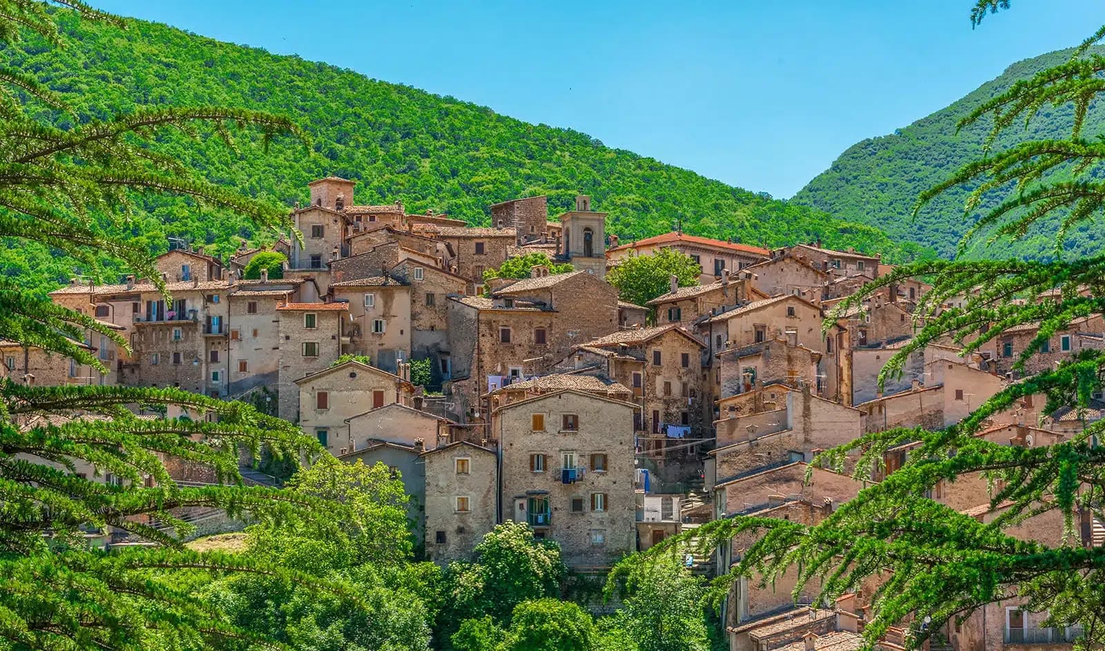
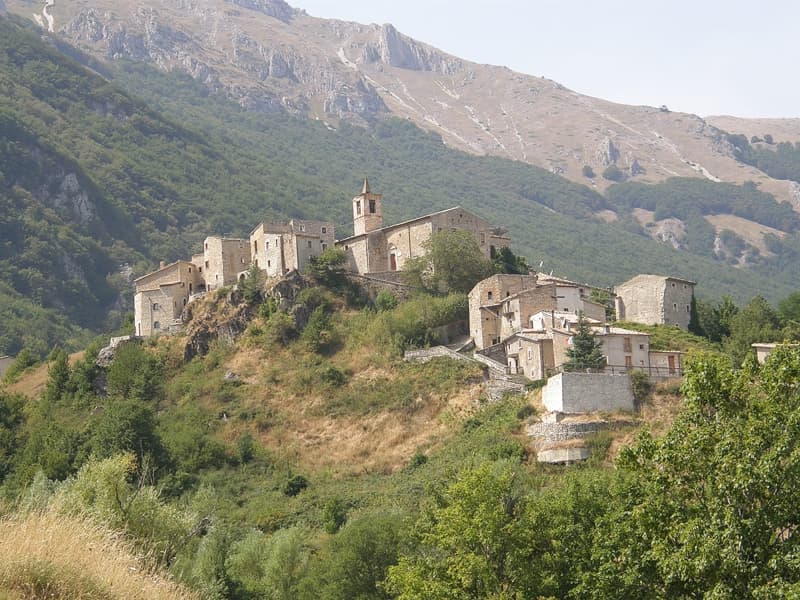
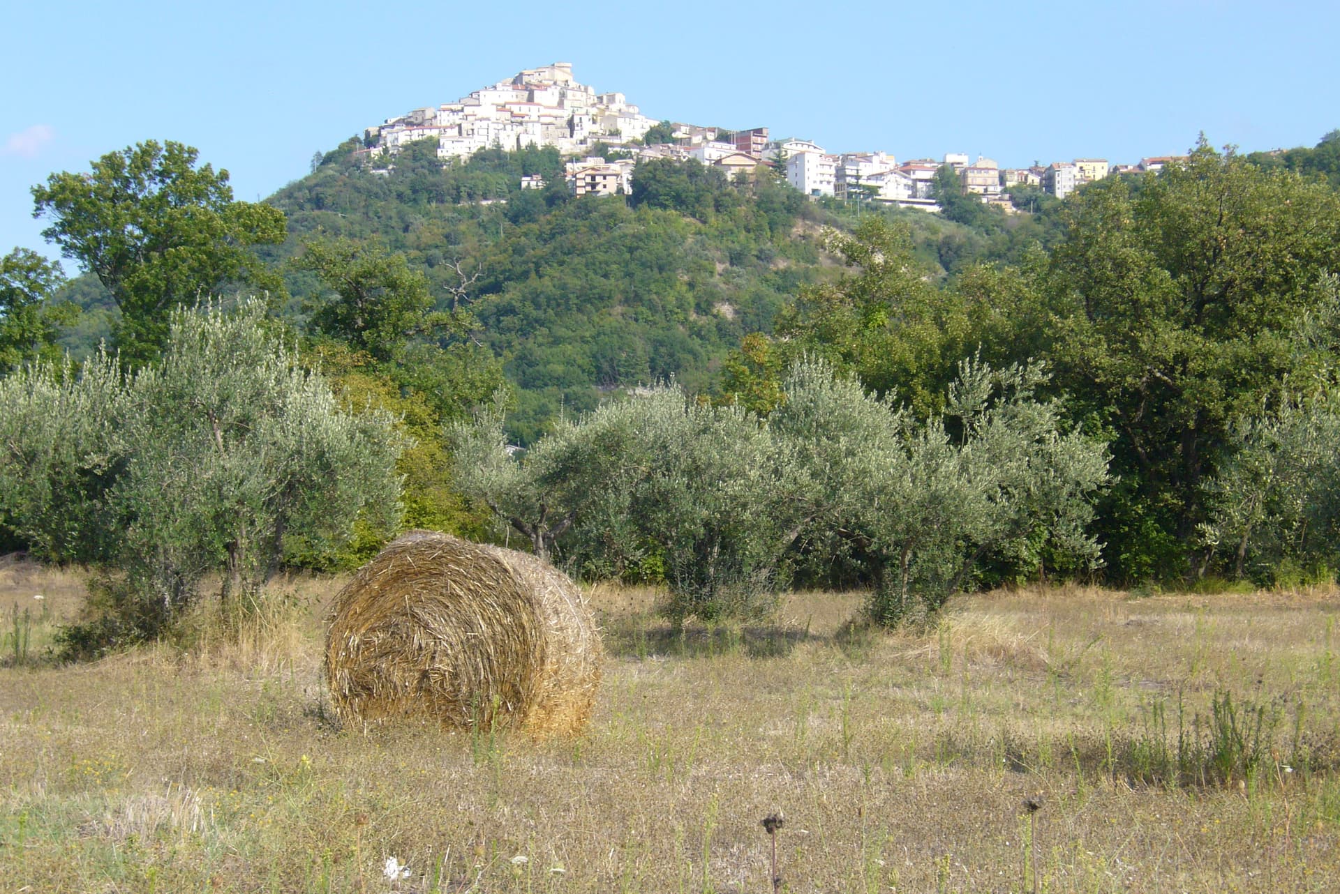
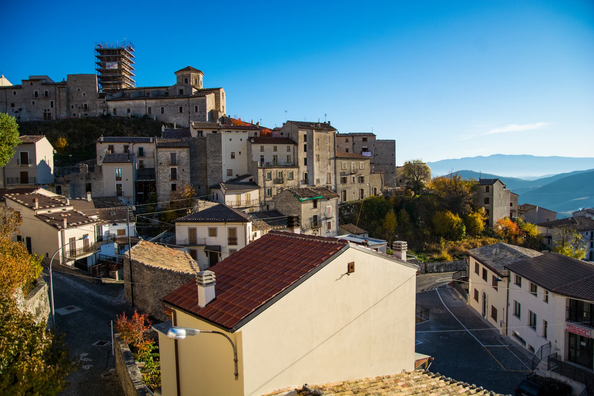
Villalago sits at 930 meters in the Sagittario valley between Scanno and Anversa degli Abruzzi, inside the Parco Nazionale d'Abruzzo, Lazio e Molise. The name comes from the vulgar Latin valle de lacu, the valley of the lake, a reference to the nine natural lakes once present in the territory, most now gone. Three remain: Lago Pio for swimming, Lago di Scanno to the south with its famous heart shape, and Lago di San Domenico to the north, the artificial reservoir completed in 1929 by the State Railways to electrify the Rome-Sulmona line.
On the lake's edge stands the Eremo di San Domenico, a small church built into a cave where, around the year 1000, the Benedictine monk Domenico di Sora lived. The actual chapel went up in the 1400s, the portico in the 1600s. The parish church holds an altar to the saint carved in stone in the 12th century. Villalago has been a Borgo dei Borghi finalist on RAI and is one of only three Bandiera Blu lake towns in Abruzzo.
The Sunday letter
We haven’t written Villalago’s letter yet.
One town every Sunday, with the photo, the food, the festa. Be there when this one comes up. Free, by Peter & Sophia from Pietrasanta.
By subscribing you agree to Substack’s Terms of Use, our Privacy Policy and our Information collection notice.


What to see
Eremo di San Domenico
Hermitage on the lake's edge, built into a cave where Saint Dominic of Sora lived around the year 1000, with the chapel added in the 15th century.
Lago di San Domenico
Artificial reservoir completed in 1929 to power the Rome-Sulmona railway, fed by the Sagittario gorge and held by a dam at the village's edge.
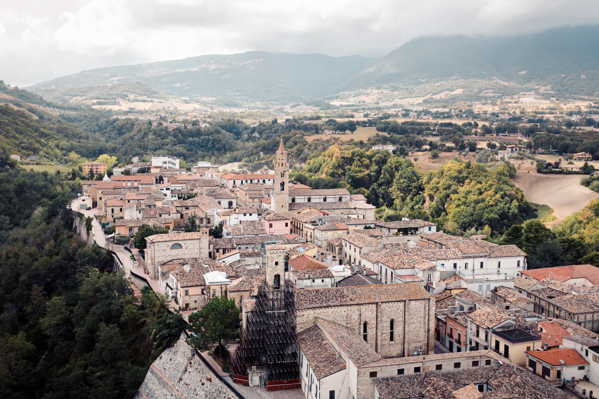
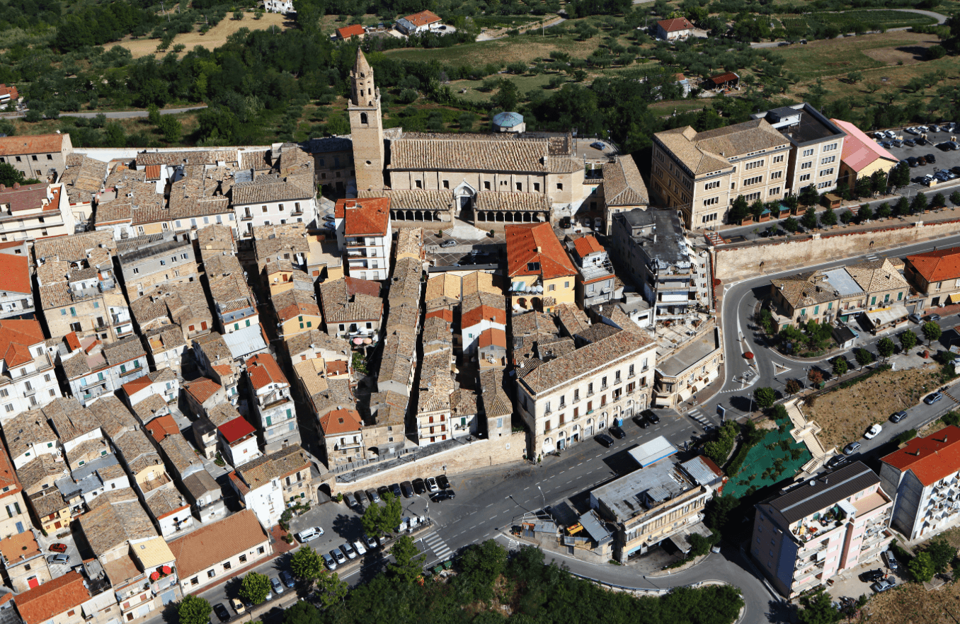
Centro storico
Stone-built medieval core at 930 meters with the parish church preserving a 1521 Madonna del Rosario and a 12th-century stone altar to San Domenico.
Chiesa della Madonna di Loreto
Small church in the lower part of the village, already documented in the early 14th century, the second religious building of medieval Villalago.
Riserva Naturale Gole del Sagittario
Gorge below the dam managed by WWF, with vertical limestone walls, vultures and Marsican brown bear sightings on the trail to Anversa.
The slow-trip planner
Building a trip? Find where Villalago fits in a slow Italy circuit.
Answer five questions. We will shape a geographically coherent slow trip from the 1,000 Italian towns most travelers skip. Yours to save and share.
Living here
- Population 511
- Off the beaten pathi
- Pharmacy: none mapped
- Nearest high school over ~30 minutes away
- Nearest airport Rome, 2 h 31 min drive
- Regional capital L'Aquila, 1 h 15 min drive
Tags & datadesignations · numbers · sources
The numbers
- Elevation: 930 m
- Population: 511
- Surface area: 33.2 km²
These figures were compiled from public directories — ISTAT, OpenStreetMap, Wikidata — and from the official listings of the guides named on this page. Town details change; verify with official sources before you travel.
Featured on
Villalago appears on this themed pick from our Collections:
Close by
More towns near Villalago
Anversa degli Abruzzi
Province: L'Aquila
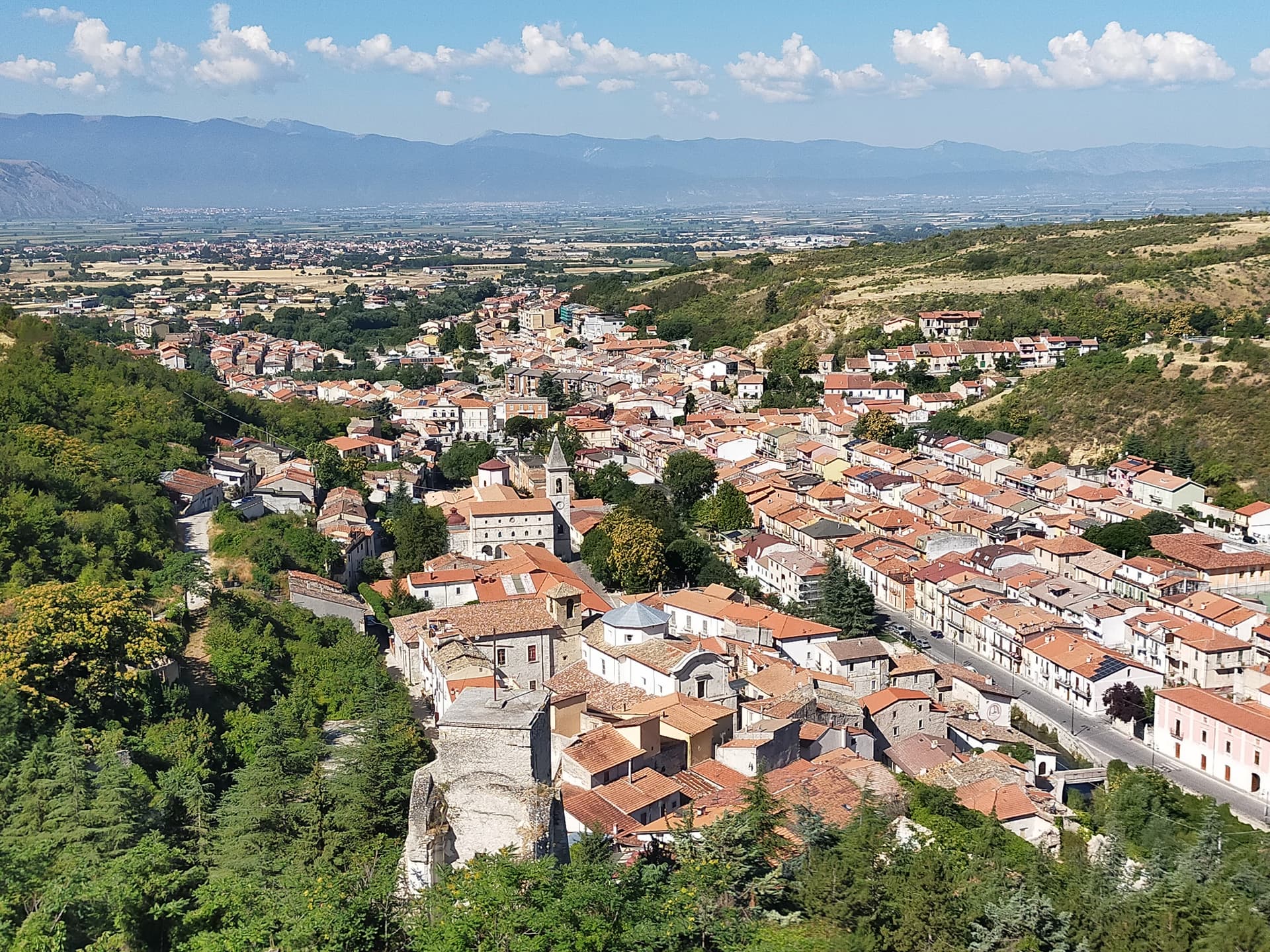
At 604 meters above the Sagittario Gorges, the cliff village where D'Annunzio set La Fiaccola sotto il moggio in 1905.
Scanno
Province: L'Aquila
A 1,057-meter Sagittario valley village photographed by Cartier-Bresson and Giacomelli, where women in black still walk the same alleys as the 1957 series.
Sulmona
Province: L'Aquila
At 405 meters in the Valle Peligna, birthplace of Ovid in 43 BC and home of the sugared-almond confetti industry since the 14th century.
Pescina
Province: L'Aquila
A Marsica town at 735 meters that lost five thousand of six thousand people in the 1915 earthquake, birthplace of Cardinal Mazarin and Ignazio Silone.
Villetta Barrea
Province: L'Aquila
At 975 meters on the shore of Lake Barrea, a village inside the Abruzzo National Park where red deer walk the streets alongside residents.
🎨 Borghi più belli d'Italia
More Borghi più belli d'Italia towns in Abruzzo
Campli
Province: Teramo
A 393-meter town under the Monti della Laga, held by the Farnese for two centuries, with a Scala Santa carrying papal indulgence.
Caramanico Terme
Province: Pescara
A 650-meter Majella spa village at the confluence of the Orfento and Orta, with sulphurous springs whose properties were documented in 1576.
Casoli
Province: Chieti
A 378-meter hill town above the Aventino under the Maiella, with a pentagonal Norman tower where Gabriele D'Annunzio held a Renaissance court of artists.
Castel del Monte
Province: L'Aquila
At 1,346 meters under Monte Bolza facing Rocca Calascio, the capital of shepherds, whose wool reached the Medici and whose witches return each August.
Città Sant'Angelo
Province: Pescara
A hilltop borgo at 320 meters between the Vestina hills and the Adriatic, named for the Archangel and known since 1352 as a Collegiata seat.