
Aosta Valley · Aosta Valley
Fontainemore
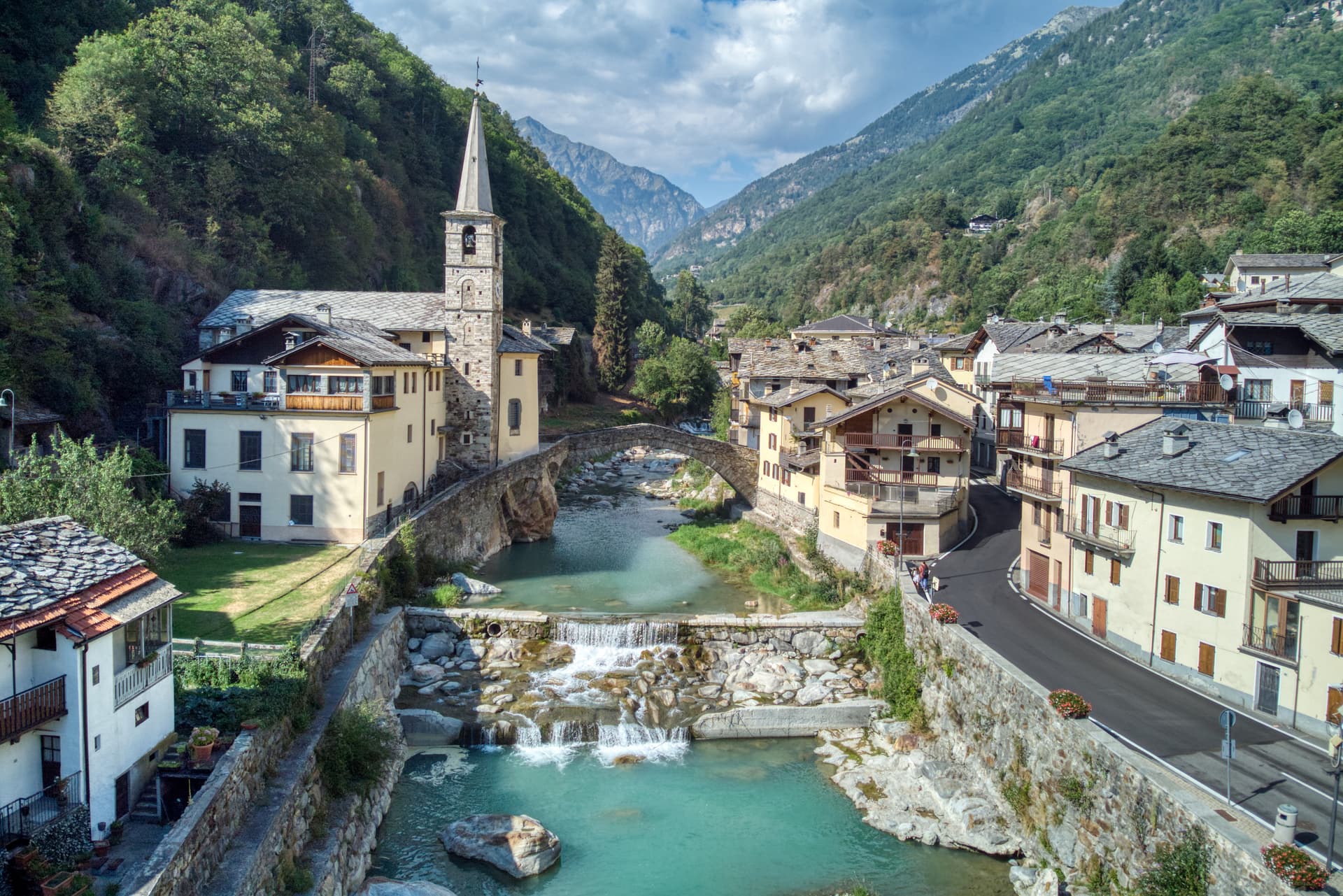
A 418-person Walser-influenced village at 760 metres in the Lys Valley, with a single-arch medieval bridge and a five-yearly pilgrimage to Oropa.
Known for
OROPA PILGRIMAGE
Five-yearly procession to the Sanctuary of Oropa over the Colle della Balma, documented since 1557, among the oldest Marian walks in the western Alps.
MEDIEVAL BRIDGE
Single-arch stone bridge from around 1200, spanning 22 metres across the Lys next to the parish church, intact and still walkable.
WALSER STONE
Walser-influenced architecture in the historic centre: stone and wood houses with flower-decked balconies, haylofts and stalls grouped in tight rows.
When to visit
Best · May–Oct
- J
- F
- M
- A
- M
- J
- J
- A
- S
- O
- N
- D
- Best
- Hot or crowded
- Quiet
- Mostly closed
The festa: Antonio abate, 17 January
Why come
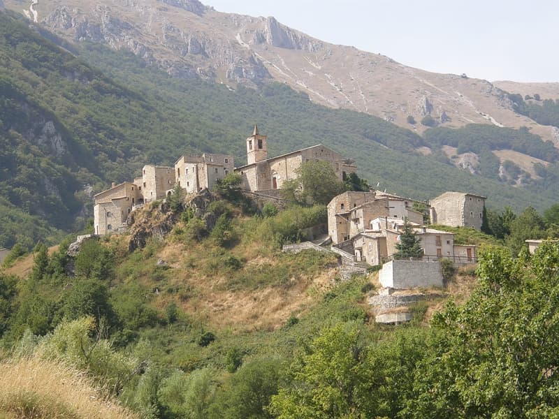
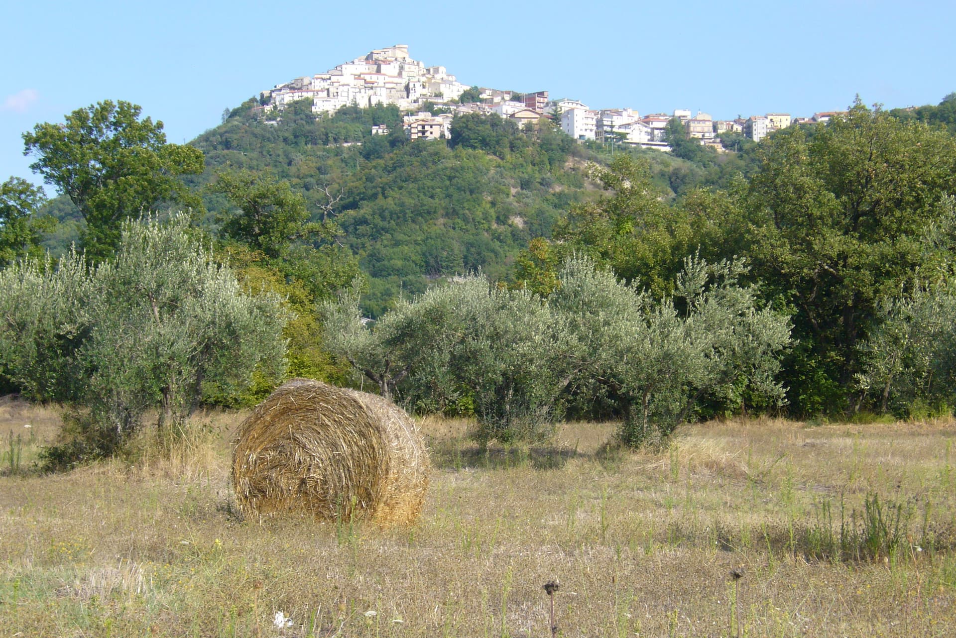
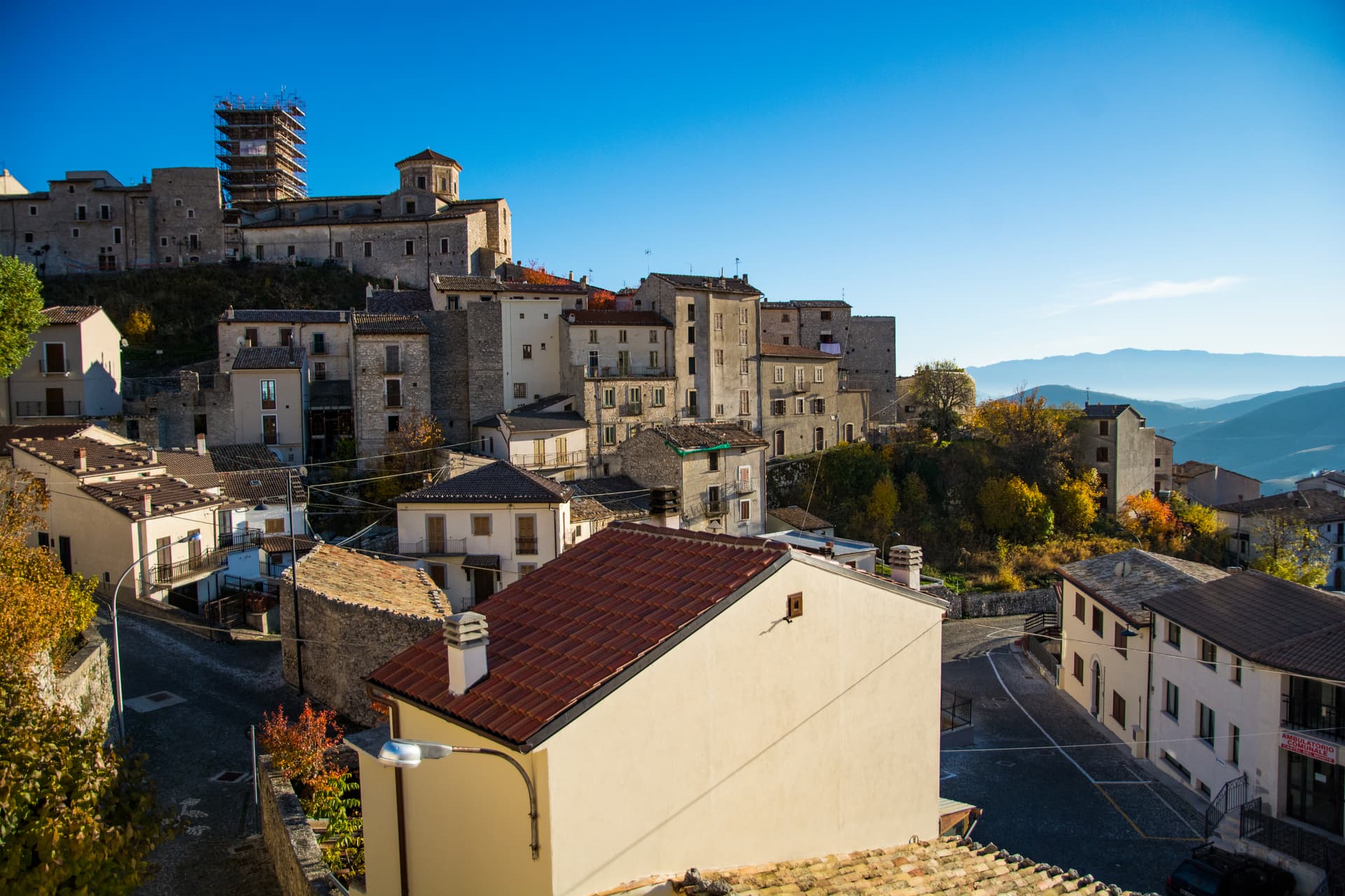
Fontainemore sits at 760 metres in the middle of the Lys Valley, the easternmost commune of the Aosta Valley, against the Mont Mars Nature Reserve. The Lys was settled in the Middle Ages by Walser communities from the upper valley, who left their mark in the stone-and-wood architecture and the surviving fragments of patois further upstream. The historic centre groups stone houses with wooden balconies around a parish church and a single-arch medieval bridge spanning 22 metres across the Lys, built around 1200.
The toponym comes from either Fontaine de Saint-Maur or Fontaine de la mort, the second tied to local legend. Every five years since 1557, residents walk the old mule track over the Colle della Balma to the Sanctuary of Oropa in Piedmont, one of the oldest documented Marian processions in the region. Fontainemore was admitted to Borghi più Belli d'Italia in September 2023.
The Sunday letter
We haven’t written Fontainemore’s letter yet.
One town every Sunday, with the photo, the food, the festa. Be there when this one comes up. Free, by Peter & Sophia from Pietrasanta.
By subscribing you agree to Substack’s Terms of Use, our Privacy Policy and our Information collection notice.

What to see
Ponte medievale sul Lys
Single-arch stone bridge from around 1200, spanning 22 metres across the Lys next to the parish church, still in service as a footbridge.
Chiesa parrocchiale di San Giovanni Battista
Parish church next to the medieval bridge, dedicated to John the Baptist and the religious centre of the village from the late Middle Ages.
Centro storico
Cluster of stone and wood houses with flower-decked balconies, stalls, haylofts and other rural buildings preserved in Walser-influenced layout.
Riserva Naturale Mont Mars
Regional nature reserve above the village, crossed by the Colle della Balma mule track used for the pilgrimage to Oropa.
Mulattiera per il Santuario di Oropa
Historic mule track over the Colle della Balma, walked every five years by villagers since 1557 in pilgrimage to the Black Madonna of Oropa.
The slow-trip planner
Building a trip? Find where Fontainemore fits in a slow Italy circuit.
Answer five questions. We will shape a geographically coherent slow trip from the 1,000 Italian towns most travelers skip. Yours to save and share.
Living here
- Population 418
- In-betweeni
- Pharmacy: none mapped
- High school within a 30-minute drive
- Nearest airport Turin, 1 h 19 min drive
- Regional capital Aosta, 1 h 1 min drive
Tags & datadesignations · numbers · sources
Recognised as
The numbers
- Elevation: 760 m
- Population: 418
- Surface area: 31.71 km²
These figures were compiled from public directories — ISTAT, OpenStreetMap, Wikidata — and from the official listings of the guides named on this page. Town details change; verify with official sources before you travel.
Featured on
Fontainemore appears on this themed pick from our Collections:
Close by
More towns near Fontainemore
Gressoney-Saint-Jean
Province: Aosta Valley
A Walser village in the Lys valley where Titsch is still spoken, Queen Margherita summered, and the Lyskamm glacier closes the view.
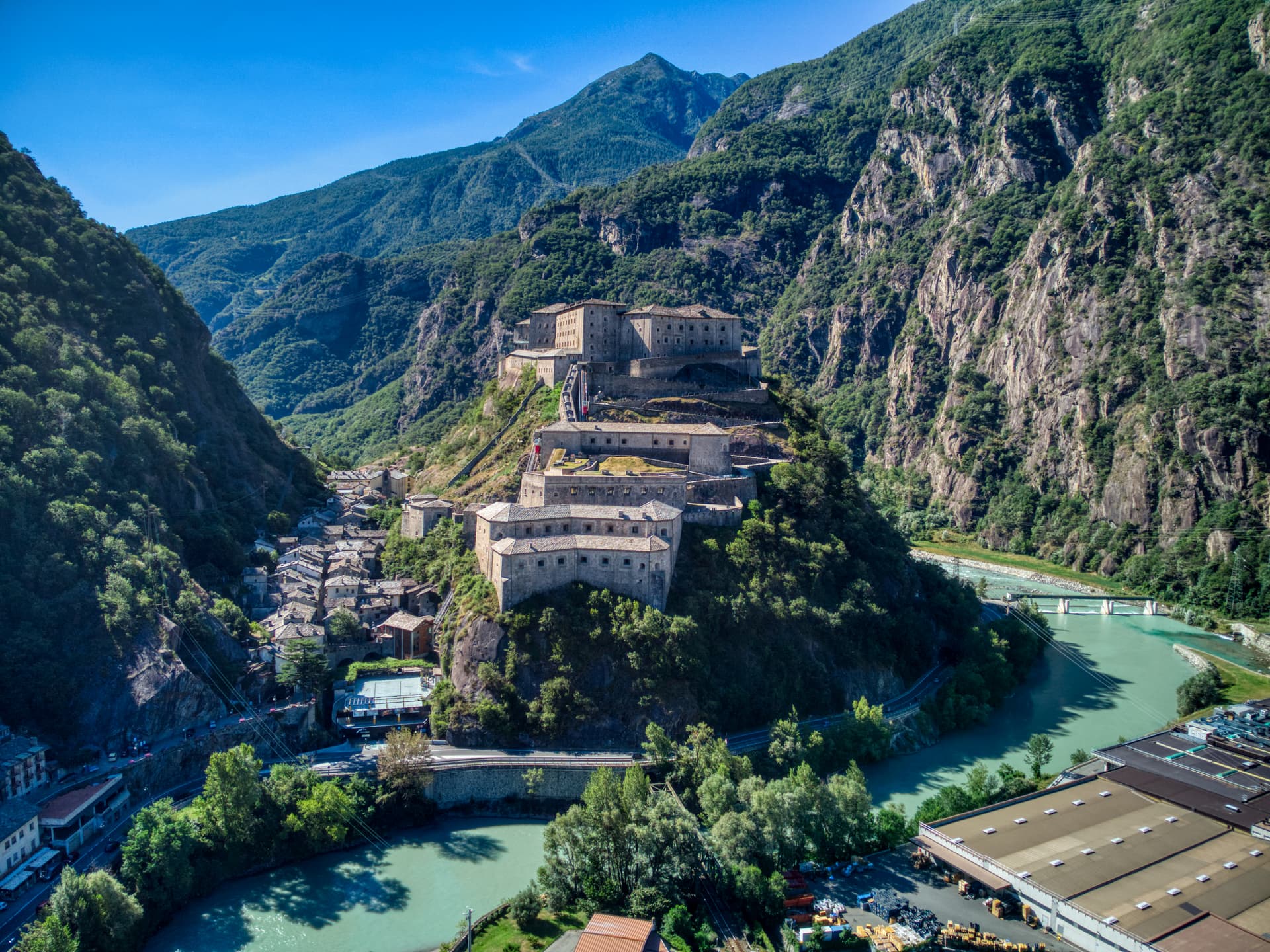
Bard
Province: Aosta Valley
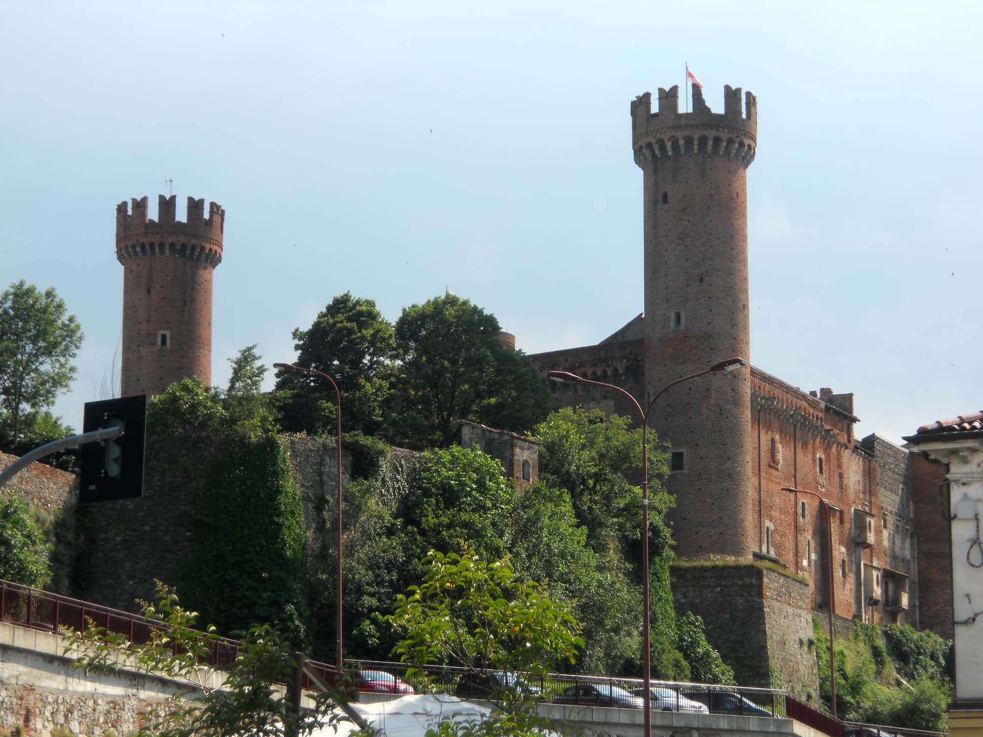
A 108-person village under the largest Savoy fortress in the Alps, where 400 soldiers held off Napoleon's 40,000 for two weeks in 1800.
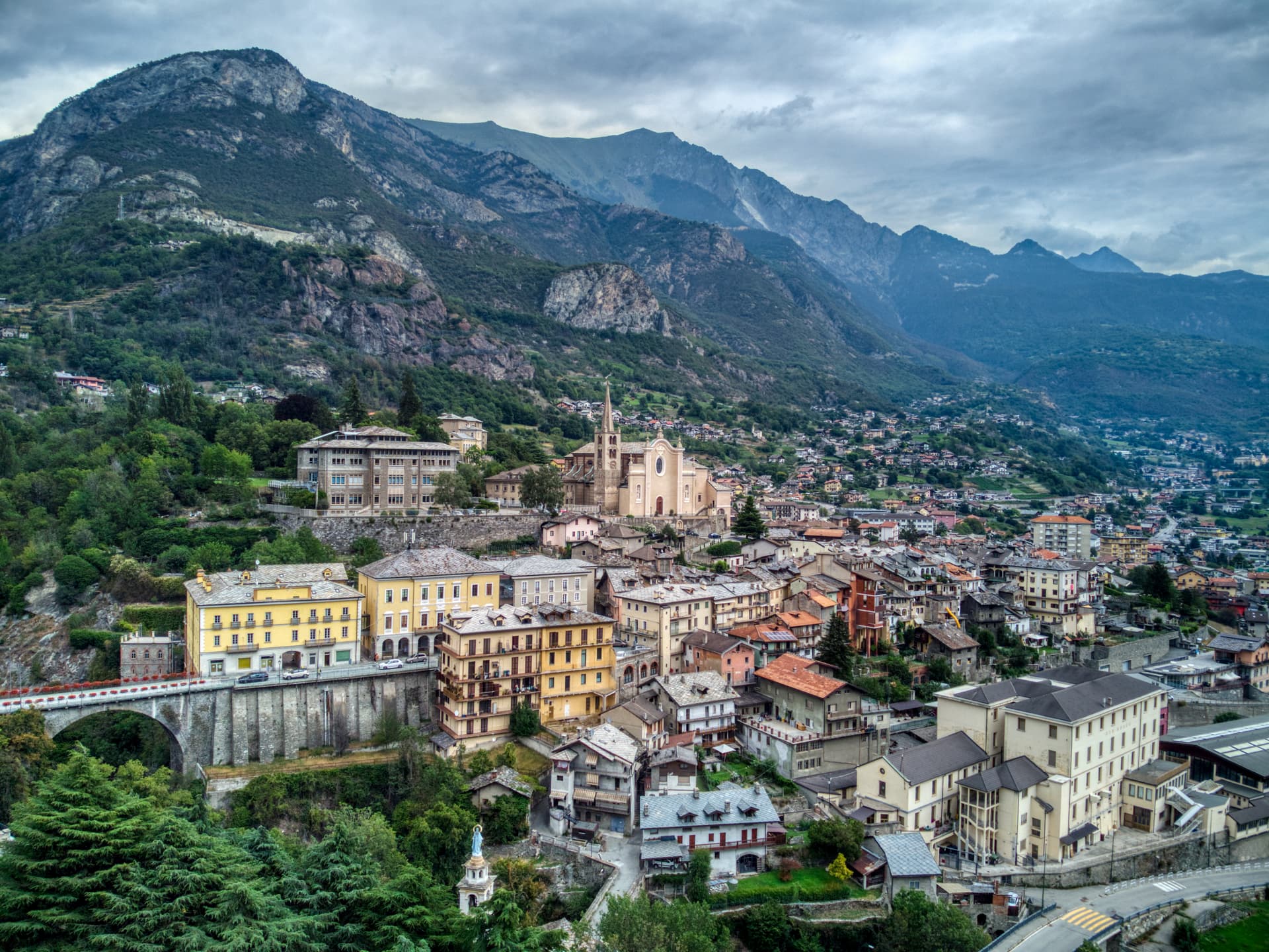
Châtillon
Province: Aosta Valley
The Aosta Valley's three-castle commune — a 4,358-resident town at 549m at the mouth of the Valtournenche where it meets the main valley, with the Castello Gamba (now the Valle d'Aosta regional contemporary art museum), the medieval Castello di Ussel + the Renaissance Castello Passerin d'Entrèves, and direct access up the road to the Cervino/Matterhorn at Cervinia 26 km north.
Ivrea
Province: Torino
Roman Eporedia on the Dora Baltea, Olivetti's twentieth-century industrial city, UNESCO since 2018, where every February three hundred tons of oranges are thrown.

Donnas
Province: Aosta Valley
The first DOC of Valle d'Aosta, a Nebbiolo-on-terraces wine town at 322 metres where the Roman Via delle Gallie was carved into living rock.
🎨 Borghi più belli d'Italia
More Borghi più belli d'Italia towns
Anversa degli Abruzzi
Province: L'Aquila
At 604 meters above the Sagittario Gorges, the cliff village where D'Annunzio set La Fiaccola sotto il moggio in 1905.
Campli
Province: Teramo
A 393-meter town under the Monti della Laga, held by the Farnese for two centuries, with a Scala Santa carrying papal indulgence.
Caramanico Terme
Province: Pescara
A 650-meter Majella spa village at the confluence of the Orfento and Orta, with sulphurous springs whose properties were documented in 1576.
Casoli
Province: Chieti
A 378-meter hill town above the Aventino under the Maiella, with a pentagonal Norman tower where Gabriele D'Annunzio held a Renaissance court of artists.
Castel del Monte
Province: L'Aquila
At 1,346 meters under Monte Bolza facing Rocca Calascio, the capital of shepherds, whose wool reached the Medici and whose witches return each August.