
Abruzzo · Teramo
Roseto degli Abruzzi
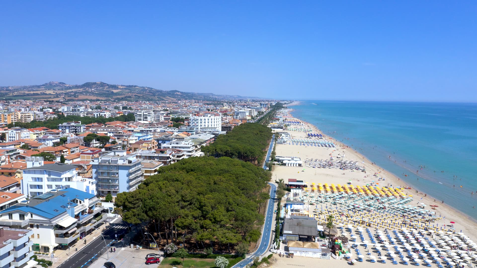
An Adriatic beach town of 25,500 with ten kilometers of low-rise sand, a hilltop frazione, and Blue Flags since 1995.
Known for
BLUE FLAG
Bandiera Blu every year since 1995, ten kilometers of low-rise Adriatic sand from the Tordino to the Vomano rivers.
LIDO DELLE ROSE
Town renamed in 1927 for the roses and oleanders along its streets, replacing the previous Austrian-sounding Rosburgo.
MONTEPAGANO
The original hilltop village at 285 meters, founded in the eleventh century, that descended to the coast in the nineteenth.
When to visit
Best · May–Sep
- J
- F
- M
- A
- M
- J
- J
- A
- S
- O
- N
- D
- Best
- Hot or crowded
- Quiet
- Mostly closed
The festa: Assunzione di Maria, 15 August
Why come
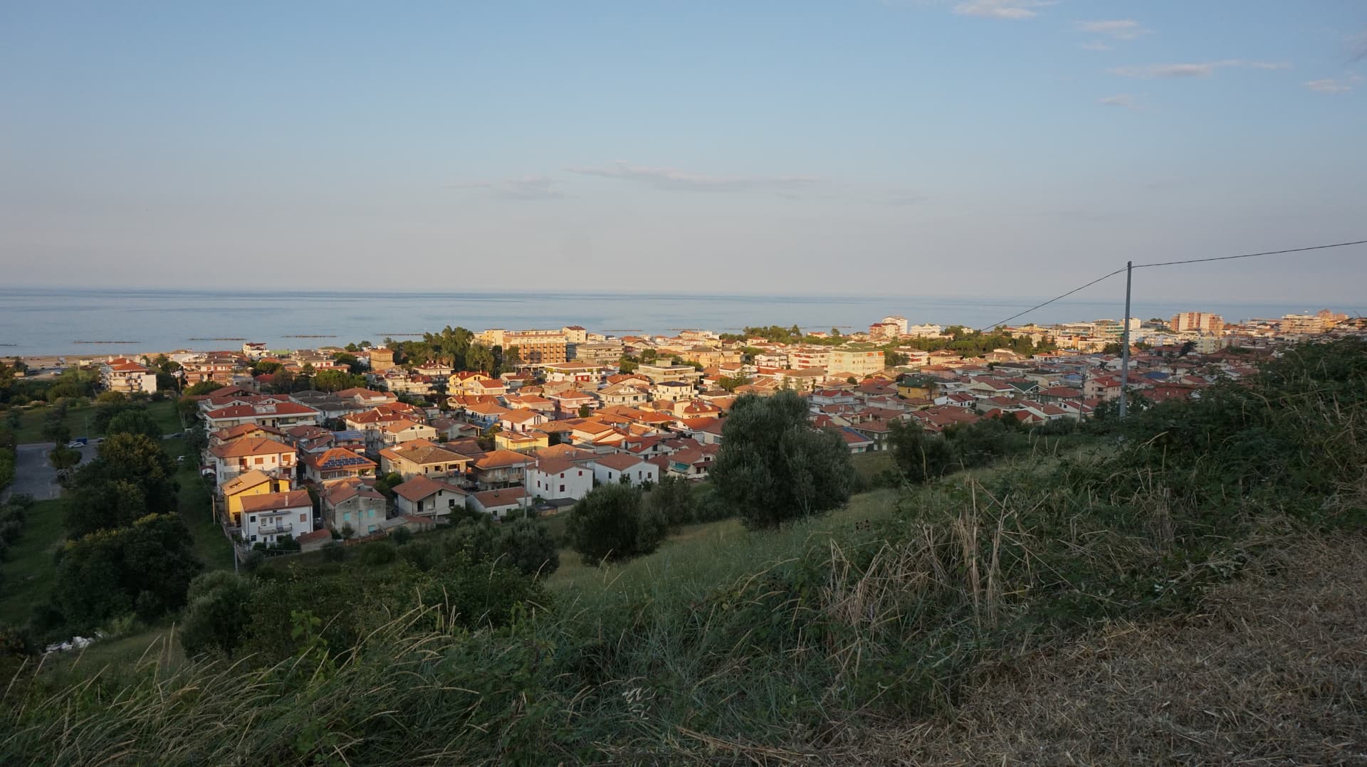
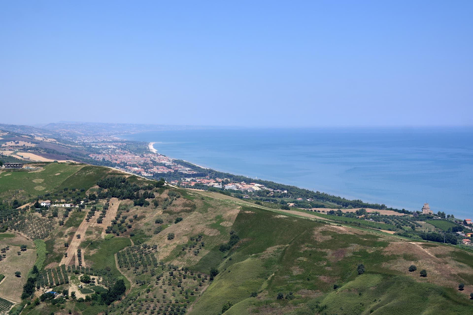
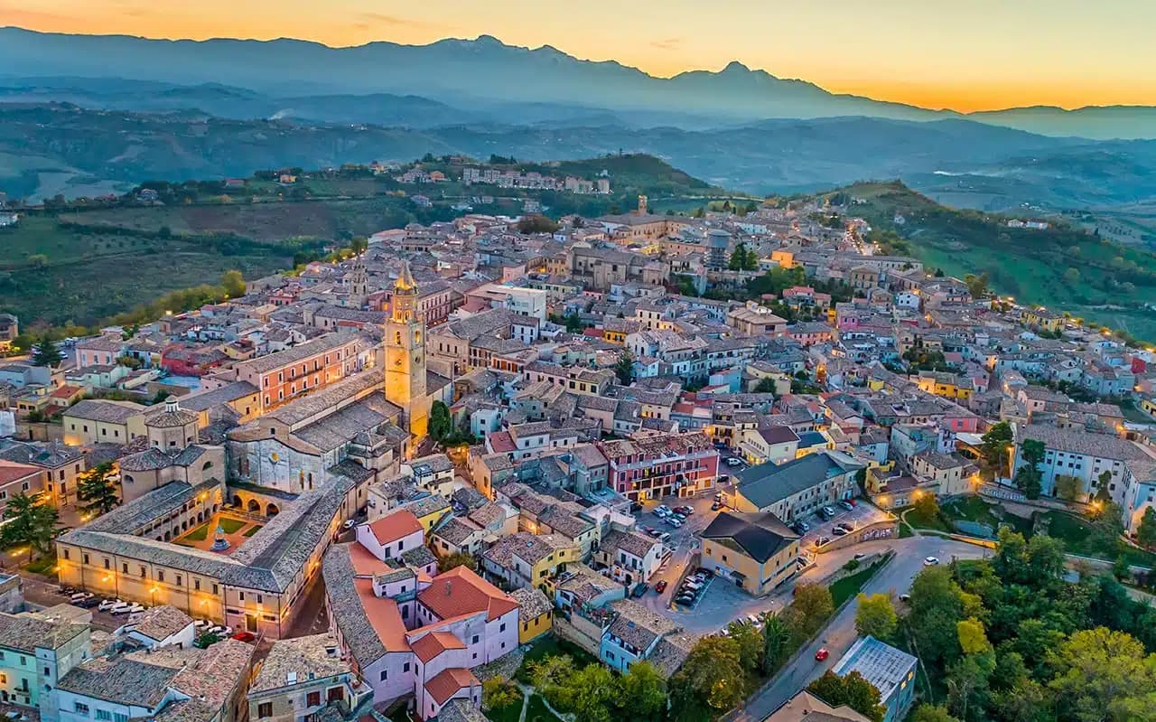
Roseto degli Abruzzi sits on the Adriatic between Giulianova and Pineto, with a flat lower town at sea level and the older nucleus of Montepagano on a hill 285 meters above. Ten kilometers of sand run continuously from the Tordino river south to the Vomano, divided into the historic lidos and the Cologna stretch. The town carried the name Rosburgo until 1927, when it was changed because the Austrian-sounding form had become unpopular after the First World War.
Rosburgo had been the local rebranding of the medieval Montepagano settlement that descended to the coast in the nineteenth century, taking its new name from the rose and oleander hedges that lined the new streets. Roseto has held a Bandiera Blu Blue Flag every year since 1995 and is a Borgo Autentico d'Italia. The Riserva Naturale del Borsacchio, at the northern edge of town, protects the last dunes and Mediterranean scrub on this stretch of coast.
The Sunday letter
We haven’t written Roseto degli Abruzzi’s letter yet.
One town every Sunday, with the photo, the food, the festa. Be there when this one comes up. Free, by Peter & Sophia from Pietrasanta.
By subscribing you agree to Substack’s Terms of Use, our Privacy Policy and our Information collection notice.

What to see
Lungomare and lidos
Ten kilometers of low-rise sand from the Tordino to the Vomano, with the Lido delle Rose, Cologna, and free-beach sections.
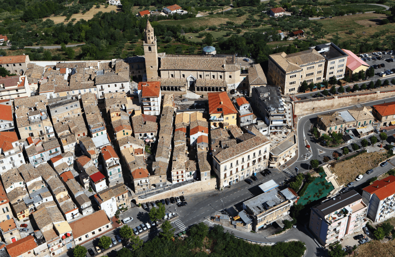
Montepagano
Original medieval village on a hill 285 meters above the coast, with walls, stone houses, and a panoramic terrace over the sea.
Riserva Naturale del Borsacchio
Coastal nature reserve at the north end of town, protecting dunes, Mediterranean scrub, and the nesting site of the Kentish plover.
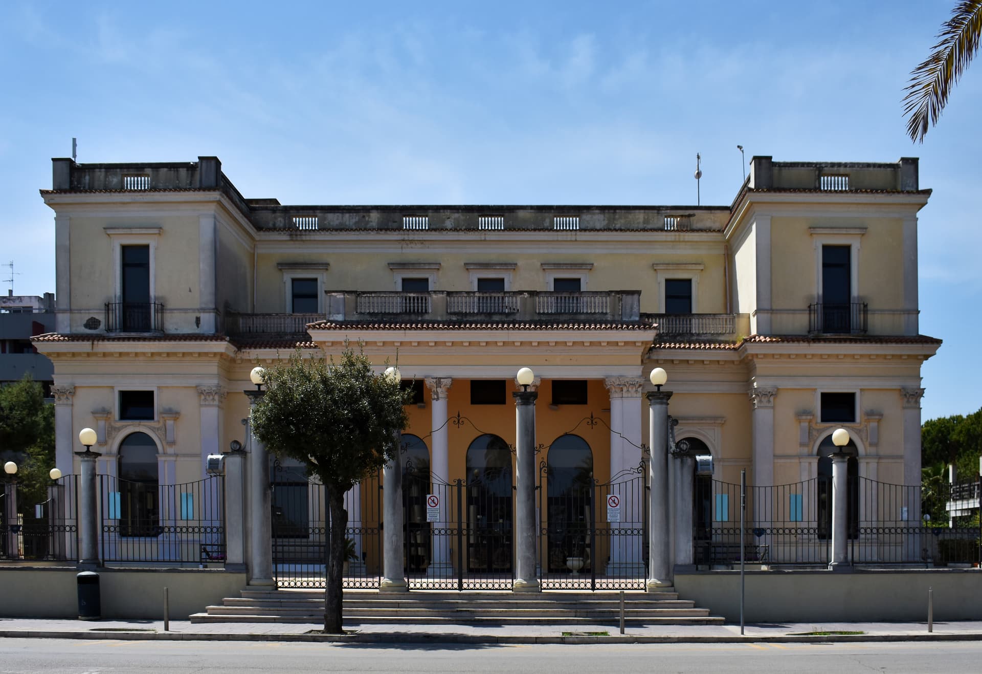
Chiesa della Madonna della Pace
Parish church on Piazza della Libertà in the lower town, central reference of the modern Roseto plan.
Belvedere di Montepagano
Panoramic terrace from the upper village, with views over the Adriatic on clear days and the Gran Sasso to the west.
The slow-trip planner
Building a trip? Find where Roseto degli Abruzzi fits in a slow Italy circuit.
Answer five questions. We will shape a geographically coherent slow trip from the 1,000 Italian towns most travelers skip. Yours to save and share.
We recommend
Where to eat and stay
Not our picks, but places the guides put their name to — a Michelin star, a Gambero Rosso fork, a Slow Food snail, a Michelin Key for the hotels. Worth a table, a counter, or a night when you pass through.
Vecchia MarinaTrattoria
A Michelin Bib Gourmand for Vecchia Marina, along with three Gambero Rosso prawns and a Slow Food snail.
D.one Ristorante DiffusoRistorante
D.one Ristorante Diffuso has one Michelin star and two Gambero Rosso forks (84/100).
ManettaRistorante
Manetta holds one Gambero Rosso fork (78/100).
Otra VezSpagnolo
Otra Vez carries two Gambero Rosso Mappamondi.
Living here
- Population 25,501
- In-betweeni
- Pharmacy in town
- High school within a 30-minute drive
- Train station in the comune
- Nearest airport Ancona / Pescara, 1 h 31 min drive
- Regional capital L'Aquila, 1 h 4 min drive
Tags & datadesignations · numbers · sources
Recognised as
The numbers
- Elevation: 8 m
- Population: 25,501
- Surface area: 53.27 km²
These figures were compiled from public directories — ISTAT, OpenStreetMap, Wikidata — and from the official listings of the guides named on this page. Town details change; verify with official sources before you travel.
Close by
More towns near Roseto degli Abruzzi
Pineto
Province: Teramo
A planned twentieth-century beach town named for D'Annunzio's poem, with the sixteenth-century Cerrano tower anchoring Abruzzo's first marine protected area.
Giulianova
Province: Teramo
Coastal town split between hilltop Paese at 68 meters and the lido, rebuilt in 1471 as a Renaissance ideal city by Giulio Antonio Acquaviva.
Alba Adriatica
Province: Teramo
The northernmost of the Teramo coast's seven sisters, a 1956 spin-off from Tortoreto with a fine-sand beach known as the Spiaggia d'Argento.
Atri
Province: Teramo
At 442 meters on three hills ten kilometers from the Adriatic, ancient Hadria, source of the emperor Hadrian's family name and the Adriatic's.
Città Sant'Angelo
Province: Pescara
A hilltop borgo at 320 meters between the Vestina hills and the Adriatic, named for the Archangel and known since 1352 as a Collegiata seat.
💎 Borghi Autentici
More Borghi Autentici towns in Abruzzo

Archi
Province: Chieti
A 492-meter rocky spur called the Terrazza sul Sangro, fief of del Balzo, Cantelmo, Colonna and Carafa, now Città del Tartufo and Città dell'Olio.

Balsorano
Province: L'Aquila
At 359 meters in the Valle Roveto, a Piccolomini castle that became the backdrop for half of 1970s Italian horror cinema.

Barrea
Province: L'Aquila
A 1,066-meter spur above an artificial lake at the heart of the Abruzzo National Park, with a Samnite necropolis and an 11th-century di Sangro castle.

Calascio
Province: L'Aquila
At 1,200 meters under the highest castle in the Apennines, a village of 125 people that played the monk's refuge in Ladyhawke.

Campo di Giove
Province: L'Aquila
At 1,064 meters under the southwestern Maiella, the highest village in the park, named for a Roman temple to Jupiter.