Lombardy · Brescia
Ponte di Legno
The uppermost commune of Valle Camonica at 1,257 meters, where the two source streams of the Oglio meet under the Adamello range.
Known for
ADAMELLO SKI
Pontedilegno-Tonale, 100 km of slopes between 1,121 and 3,016 metres, glacier skiing on the Presena into late spring.
PASSO DEL TONALE
Pass to Trentino at 1,883 m, ski-area spine and the Italian-Austrian front line during the WWI white war.
ORIGIN OF THE OGLIO
The Frigidolfo and Narcanello streams meet here, forming the river that runs the length of Valle Camonica to Lake Iseo.
When to visit
Best · Jun–Sep, Dec–Mar
- J
- F
- M
- A
- M
- J
- J
- A
- S
- O
- N
- D
- Best
- Hot or crowded
- Quiet
- Mostly closed
Why come
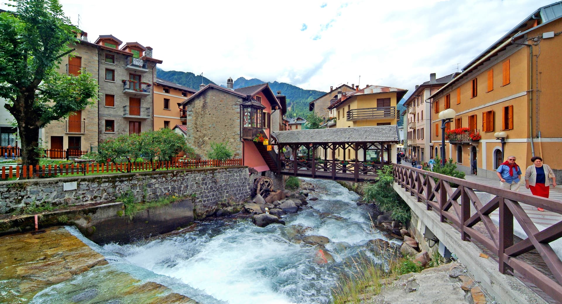
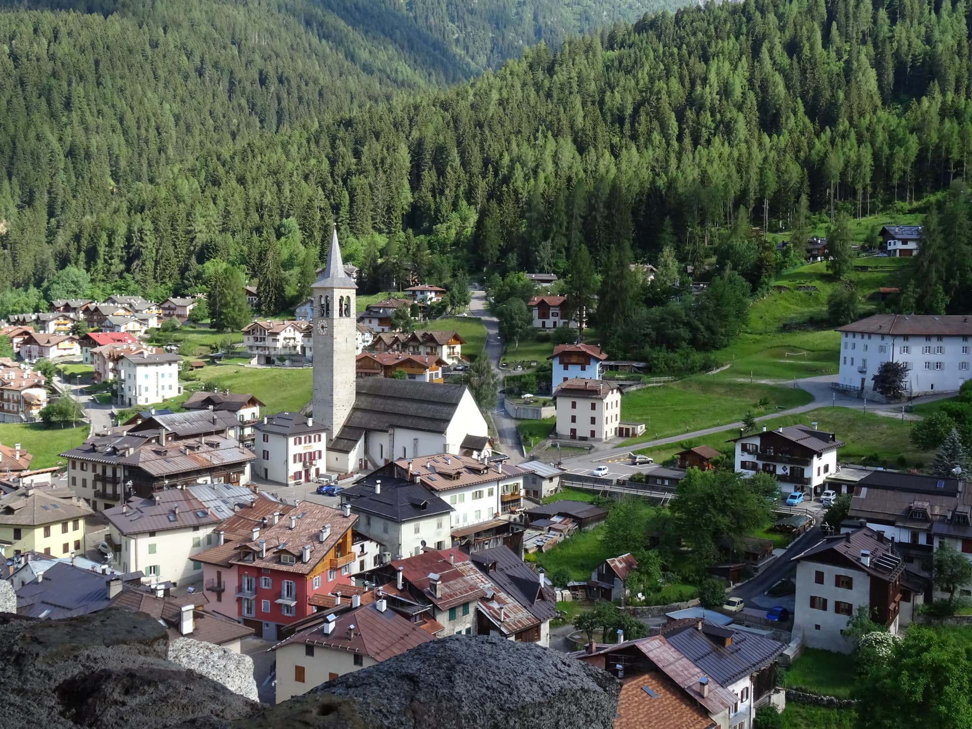
Ponte di Legno stands at 1,257 meters where the Frigidolfo and Narcanello streams join to form the Oglio, the river that runs the length of Valle Camonica down to Lake Iseo. At 100 square kilometres it is the second-largest commune in the province of Brescia after Bagolino. The town sits under the Adamello range and connects to Trentino via the Passo del Tonale, the road north over the watershed.
Ski Club Ponte di Legno was founded here in 1911, one of the first in Italy, and a hundred years of investment have turned the slopes into the Pontedilegno-Tonale ski area: forty-one runs between 1,121 and 3,016 metres, twenty-eight lifts, and the Presena glacier above the Tonale pass that keeps skiing possible from autumn into spring. In summer the same lifts carry hikers onto the Adamello plateau, and the centre on Piazza XXVII Settembre fills with tables instead of ski boots.
The Sunday letter
We haven’t written Ponte di Legno’s letter yet.
One town every Sunday, with the photo, the food, the festa. Be there when this one comes up. Free, by Peter & Sophia from Pietrasanta.
By subscribing you agree to Substack’s Terms of Use, our Privacy Policy and our Information collection notice.

What to see
Chiesa della SS. Trinità
18th-century parish church on the main square, rebuilt after fires that periodically hit the wooden upper town.
Passo del Tonale
1,883-metre pass connecting Valle Camonica to Val di Sole in Trentino, the spine of the ski area and a WWI front line.
Ghiacciaio della Presena
Glacier above the Tonale pass, the upper anchor of the ski area, accessible year-round by cable car for summer skiing.
Parco dell'Adamello
Regional park covering the Adamello massif south and east of town, with trails into the Adamello-Brenta and Stelvio parks.
Museo della Guerra Bianca
War museum at nearby Temù covering the WWI Adamello front, the highest combat zone in European history.
The slow-trip planner
Building a trip? Find where Ponte di Legno fits in a slow Italy circuit.
Answer five questions. We will shape a geographically coherent slow trip from the 1,000 Italian towns most travelers skip. Yours to save and share.
Living here
- Population 1,745
- Very remotei
- Pharmacy in town
- High school within a 30-minute drive
- Nearest airport Milan, 2 h 9 min drive
- Regional capital Milano, 2 h 55 min drive
Tags & datadesignations · numbers · sources
Recognised as
The numbers
- Elevation: 1257 m
- Population: 1,745
- Surface area: 100.43 km²
These figures were compiled from public directories — ISTAT, OpenStreetMap, Wikidata — and from the official listings of the guides named on this page. Town details change; verify with official sources before you travel.
Close by
More towns near Ponte di Legno
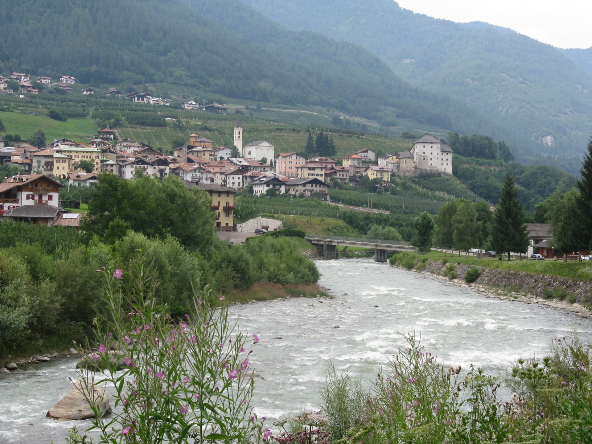
Ossana
Province: Trento
A small Val di Sole borgo at the foot of a 25-metre stone keep, with Christmas nativity scenes filling its streets every December.
Caldes
Province: Trento
A scattered Val di Sole commune on the Noce, six hamlets gathered around a thirteenth-century tower-house castle that once belonged to the Thun family.
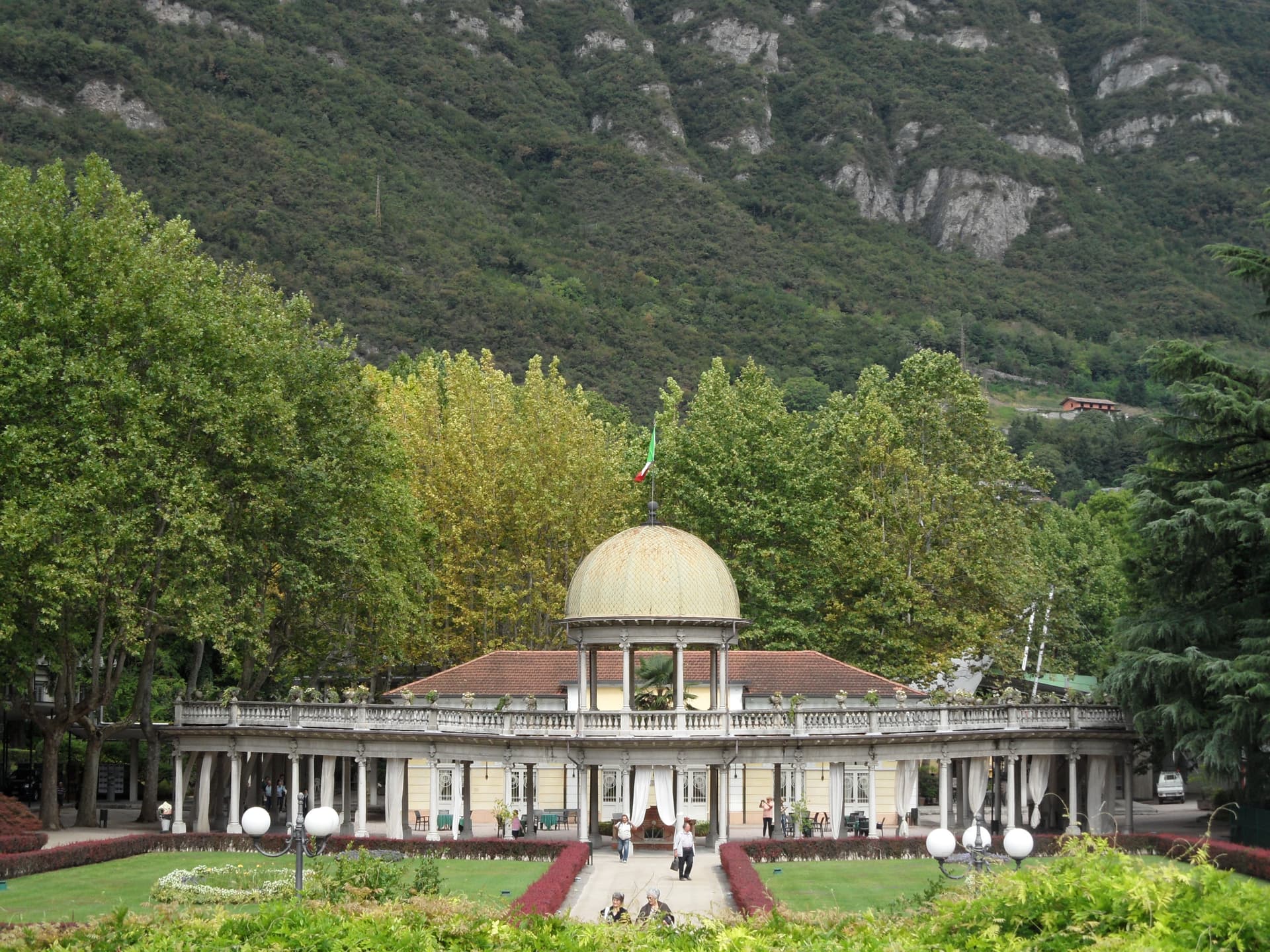
Darfo Boario Terme
Province: Brescia
At the mouth of the Valle Camonica, an Art Nouveau spa town next to one of the first UNESCO rock-engraving sites in Italy.
Tirano
Province: Sondrio
A Valtellina town at 441 meters where the Bernina railway from St Moritz reaches Italy, beneath terraced Nebbiolo vineyards.

Teglio
Province: Sondrio
A Valtellina hilltown at 856 metres that gave its name to the whole valley (Vallis Tellina = Val di Teglio), home of the Renaissance Palazzo Besta with its frescoed Italian-Renaissance cycles, and the official birthplace of pizzoccheri pasta — recognised by the Accademia del Pizzocchero.
🌲 Parco Nazionale
More Parco Nazionale towns
Alfedena
Province: L'Aquila
At 914 meters at the head of the upper Sangro valley, the Samnite Aufidena, with a 15,000-tomb necropolis and a Roman conquest in 298 BC.

Barrea
Province: L'Aquila
A 1,066-meter spur above an artificial lake at the heart of the Abruzzo National Park, with a Samnite necropolis and an 11th-century di Sangro castle.

Calascio
Province: L'Aquila
At 1,200 meters under the highest castle in the Apennines, a village of 125 people that played the monk's refuge in Ladyhawke.
Campli
Province: Teramo
A 393-meter town under the Monti della Laga, held by the Farnese for two centuries, with a Scala Santa carrying papal indulgence.

Campo di Giove
Province: L'Aquila
At 1,064 meters under the southwestern Maiella, the highest village in the park, named for a Roman temple to Jupiter.