
Calabria · Catanzaro
Taverna
The birthplace of Mattia Preti at the foot of the Sila Piccola, where the church of San Domenico holds eleven of the Cavaliere Calabrese's paintings.
Known for
MATTIA PRETI
Baroque painter born in Taverna in 1613, the Cavaliere Calabrese; eleven of his canvases hang in San Domenico.
BANDIERA ARANCIONE
Touring Club Italiano quality mark for the preserved centro storico and the cultural offering anchored on Preti.
SILA PICCOLA
The town is inside Sila National Park; the frazione of Villaggio Mancuso sits at nearly 1,400 meters on the plateau.
When to visit
Best · Apr–Oct
- J
- F
- M
- A
- M
- J
- J
- A
- S
- O
- N
- D
- Best
- Hot or crowded
- Quiet
- Mostly closed
The festa: San Sebastiano, 20 January
Why come
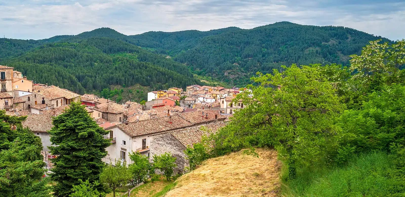
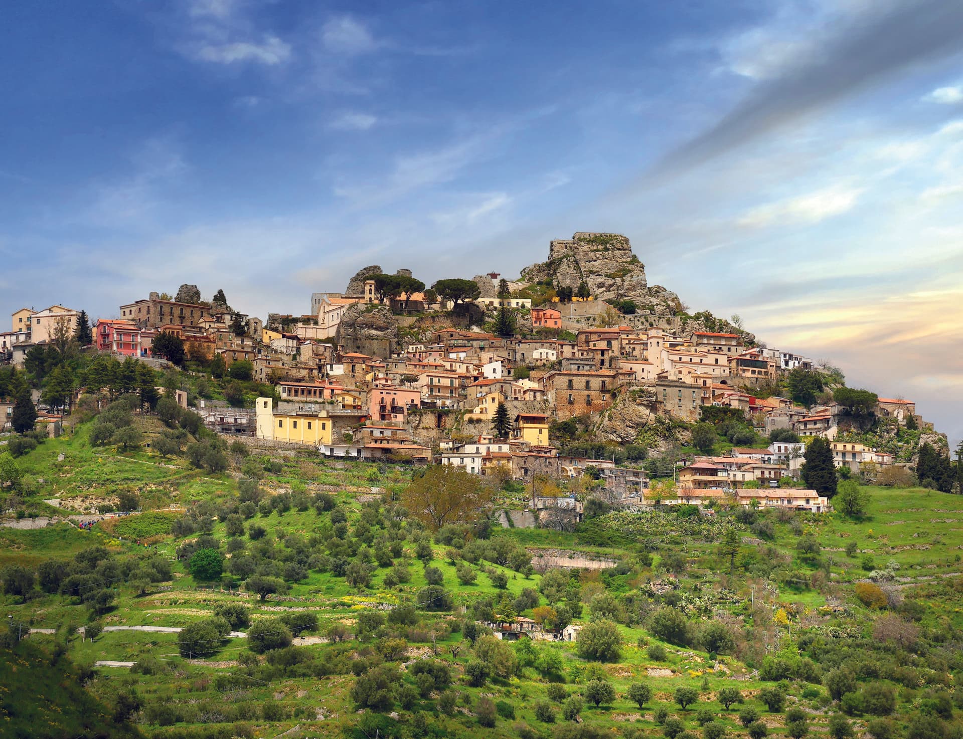
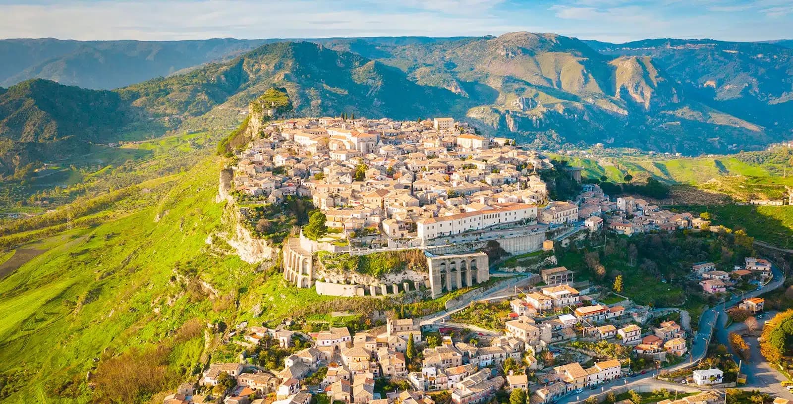
Taverna sits at around 530 meters at the foot of the Sila Piccola, inside Sila National Park. The town is best known as the birthplace of Mattia Preti, the Baroque painter born here in 1613 and known across Europe as the Cavaliere Calabrese. Preti worked in Rome, Naples and finally Malta, where he died in 1699 after decorating the conventual church of the Order of St.
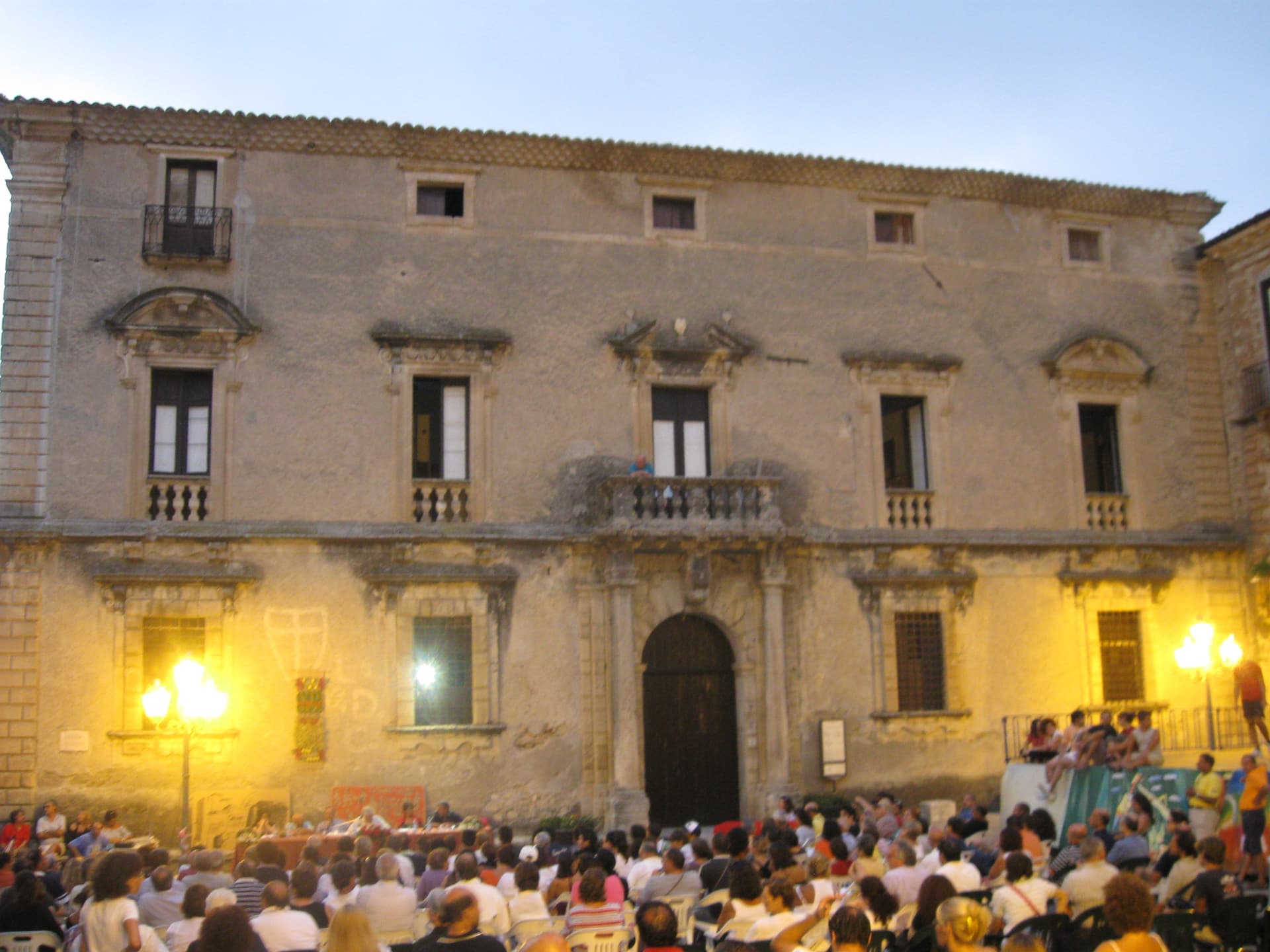
John in Valletta. He returned to Taverna repeatedly and sent paintings home. The Chiesa di San Domenico, set inside a fifteenth-century Dominican convent, holds eleven of his works, including a famous self-portrait and the cycle of frescoes on the life of San Domenico.
The convent itself houses the Museo Civico. The town carries the Bandiera Arancione from the Touring Club Italiano. Beech and pine forests of Sila Piccola climb behind the centro, the high-altitude frazione of Villaggio Mancuso sitting at nearly 1,400 meters above the town.
The Sunday letter
We haven’t written Taverna’s letter yet.
One town every Sunday, with the photo, the food, the festa. Be there when this one comes up. Free, by Peter & Sophia from Pietrasanta.
By subscribing you agree to Substack’s Terms of Use, our Privacy Policy and our Information collection notice.


What to see
Chiesa di San Domenico
Fifteenth-century Dominican church inside the centro storico, holding eleven works by Mattia Preti including the self-portrait and the cycle on the life of San Domenico.
Museo Civico di Taverna
Civic museum housed in the former fifteenth-century Dominican convent, dedicated largely to Mattia Preti and the Calabrian Baroque.
Parco Nazionale della Sila
The town falls inside Sila National Park; Sila Piccola's beech and pine forests rise directly behind the centro.
Villaggio Mancuso
Mountain frazione of Taverna at nearly 1,400 meters on the Sila Piccola plateau, used for summer escape and winter snow.
Centro storico
Bandiera Arancione hilltown of stone houses arranged around the San Domenico complex, awarded for the quality of its preserved core.
The slow-trip planner
Building a trip? Find where Taverna fits in a slow Italy circuit.
Answer five questions. We will shape a geographically coherent slow trip from the 1,000 Italian towns most travelers skip. Yours to save and share.
Living here
- Population 2,522
- In-betweeni
- Pharmacy: none mapped
- High school within a 30-minute drive
- Nearest airport Lamezia / Reggio, 1 h 30 min drive
- Regional capital Catanzaro, 1 h 4 min drive
Tags & datadesignations · numbers · sources
Recognised as
The numbers
- Elevation: 530 m
- Population: 2,522
- Surface area: 132.31 km²
These figures were compiled from public directories — ISTAT, OpenStreetMap, Wikidata — and from the official listings of the guides named on this page. Town details change; verify with official sources before you travel.
Featured on
Taverna appears on this themed pick from our Collections:
Close by
More towns near Taverna

Cicala
Province: Catanzaro
A village of 887 people at 829 meters on the western foothills of the Sila Piccola, founded in 1616 by farmers asking the Count Cigala for land.
San Giovanni in Fiore
Province: Cosenza
The capital of the Sila Grande at 1,049 meters, grown from the abbey Gioacchino da Fiore founded in 1188, Italy's most populated commune above a thousand.
Serrastretta
Province: Catanzaro
The chair town of the Reventino massif, founded in 1383 in a narrow gorge between two mountain ranges, still weaving straw seats by hand.
Caccuri
Province: Crotone
A 646-meter Presila borgo dominated by a sixth-century Byzantine castle with a cylindrical tower built in 1882, birthplace of Renaissance statesman Cicco Simonetta.
Aiello Calabro
Province: Cosenza
A hilltop borgo at 502 meters in the Tyrrhenian hinterland of Cosenza, ruled for two centuries by the Cybo-Malaspina from Massa Carrara.
🟠 Bandiera Arancione
More Bandiera Arancione towns in Calabria
Bova
Province: Reggio di Calabria
The capital of the Bovesìa — a 416-resident Aspromonte hilltop borgo at 820m that is the cultural centre of the Grecanic minority, where the Calabrian-Greek dialect (a direct descendant of Byzantine-era Greek) is still spoken by elders, with the triple Borghi più belli + Bandiera Arancione + Parco Nazionale dell'Aspromonte signal.
Gerace
Province: Reggio di Calabria
A 470-meter conglomerate rock above Locri, founded by Locri Epizefiri refugees, with Calabria's largest cathedral on Roman columns from Magna Graecia temples.
Morano Calabro
Province: Cosenza
A conical hill of stone houses stacked under a Norman-Swabian castle at the southern gate of the Pollino, called Italy's nativity village.

Oriolo
Province: Cosenza
A medieval borgo on a sandstone outcrop at 450 meters, on the eastern slopes of Pollino, twenty kilometers from the Ionian coast.