
Abruzzo · Chieti
Lama dei Peligni
A 669-meter Majella village known for chamois, the Cavallone cave, and a prehistoric burial dug from Fonterossi dated 7000 to 5000 BC.
Known for
GROTTA DEL CAVALLONE
Europe's highest accessible natural cave at 1,475 meters, 1,300 meters of karst gallery branching into three tunnels.
ABRUZZO CHAMOIS
Locati museum and fenced reserve, the centre of the chamois reintroduction program for the Majella National Park.
UOMO DELLA MAIELLA
Prehistoric burial from Fonterossi dated 7000 to 5000 BC, the oldest documented human presence on the massif.
When to visit
Best · May–Oct
- J
- F
- M
- A
- M
- J
- J
- A
- S
- O
- N
- D
- Best
- Hot or crowded
- Quiet
- Mostly closed
The festa: San Sebastiano, 20 January
Why come
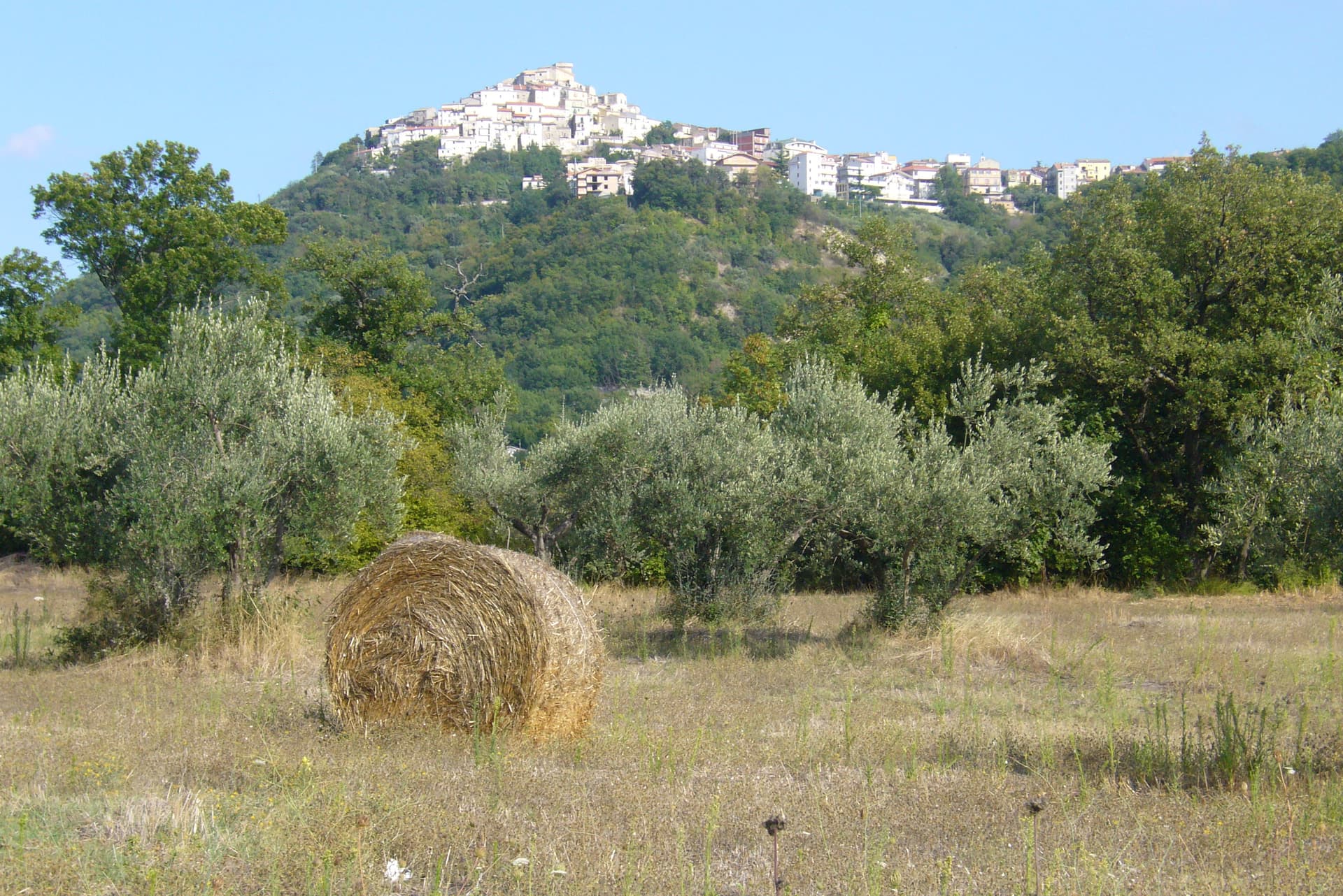
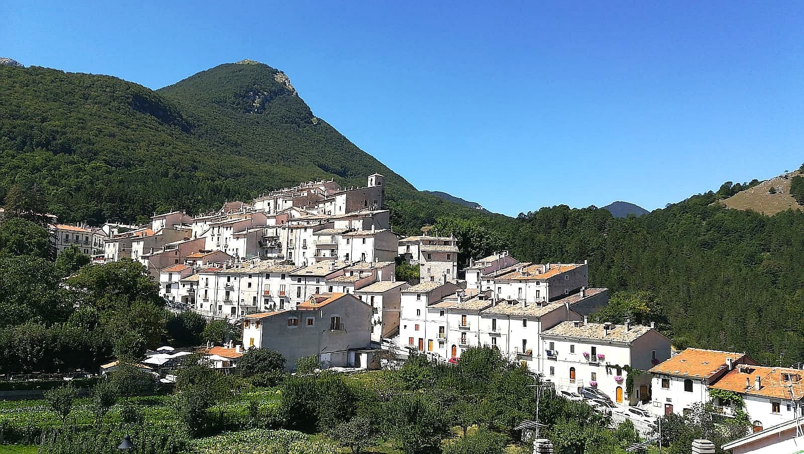
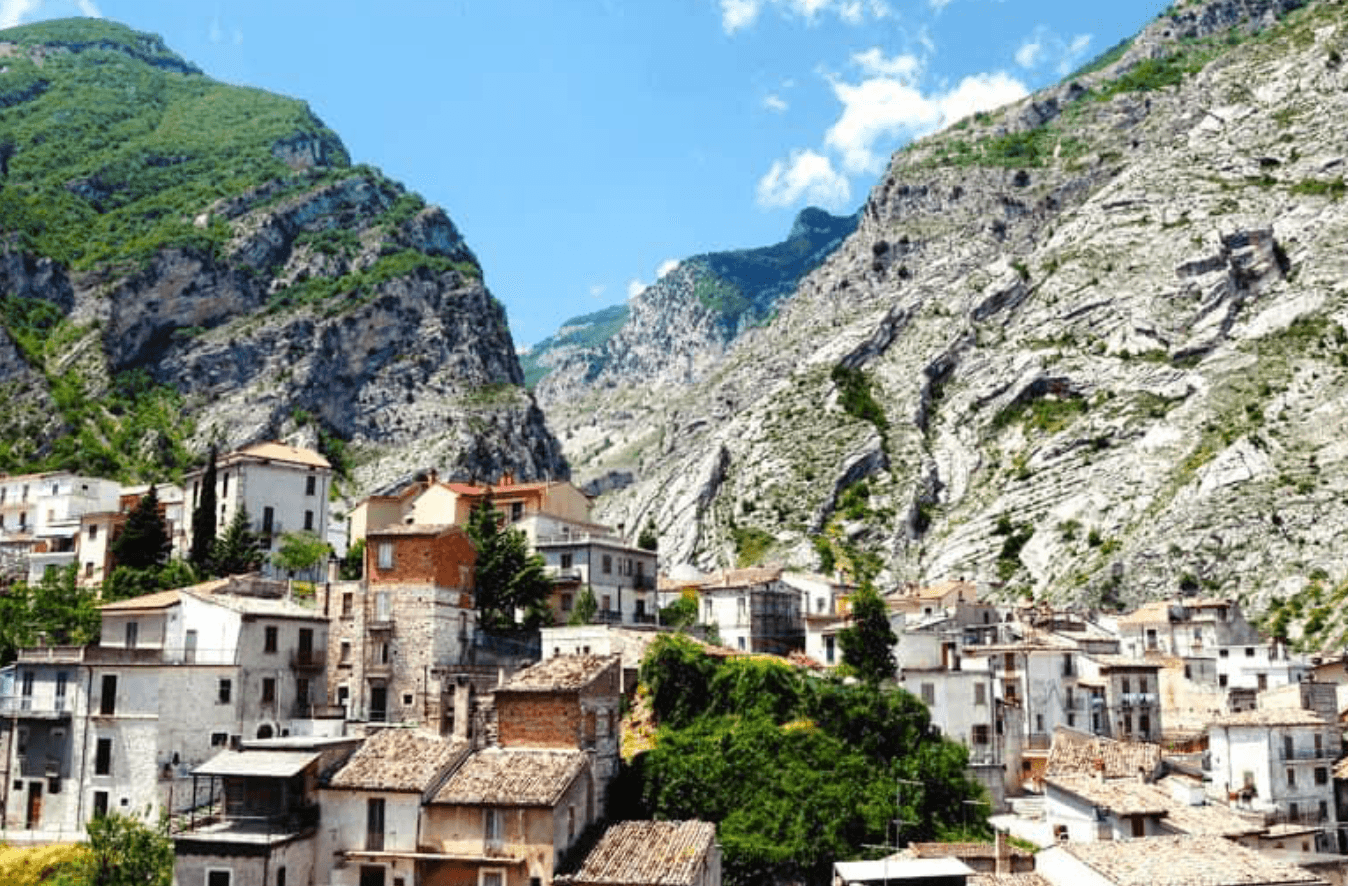
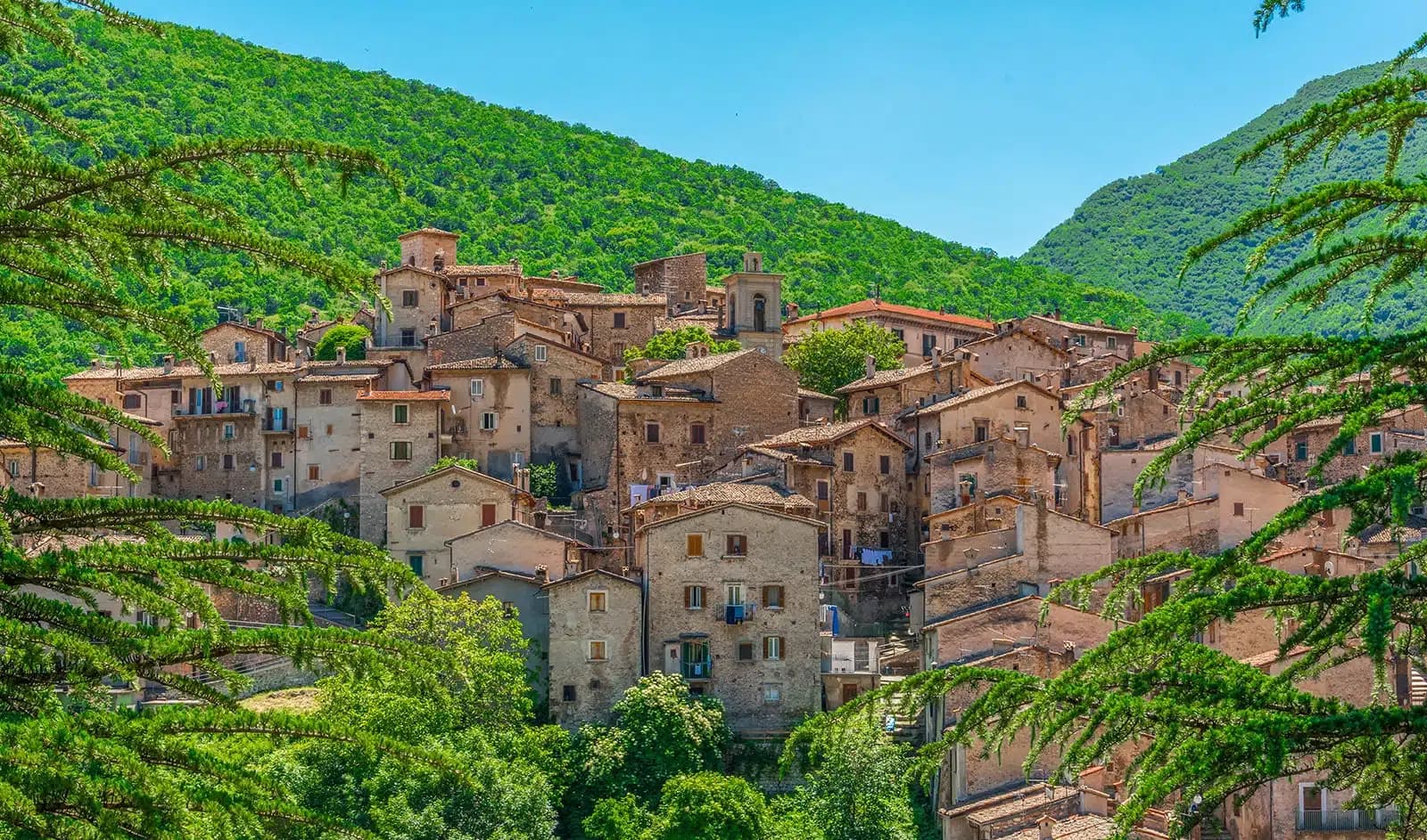
Lama dei Peligni sits at 669 meters on the southern flanks of the Majella, between the Aventino river and the massif behind it. The name comes from a pre-Latin word for ground where water pools. The earliest evidence of human use here, the so-called Uomo della Maiella, was excavated from Contrada Fonterossi at the start of the twentieth century, a burial dated between 7000 and 5000 BC.
The Grotta del Cavallone opens at 1,475 meters in the wall above town, the highest accessible natural cave in Europe, 1,300 meters of karstic gallery branching into three secondary tunnels. The Maurizio Locati museum at the entrance to the village runs a fenced reserve for the Abruzzo chamois, the species the zoologist worked to reintroduce in the Majella park. The Maiella Brigade fought partisan actions out of these slopes in 1943-44, and the obelisk at San Pietro commemorates them.
The Sunday letter
We haven’t written Lama dei Peligni’s letter yet.
One town every Sunday, with the photo, the food, the festa. Be there when this one comes up. Free, by Peter & Sophia from Pietrasanta.
By subscribing you agree to Substack’s Terms of Use, our Privacy Policy and our Information collection notice.


What to see
Grotta del Cavallone
Karst cave at 1,475 meters, 1,300 meters of gallery on the border with Taranta Peligna, the highest accessible natural cave in Europe.
Museo Naturalistico Maurizio Locati
Wildlife and archaeology museum at the village entrance, dedicated to the zoologist who reintroduced chamois in the Majella park.
Giardino Botanico Michele Tenore
Botanical garden adjacent to the museum, reconstructing Majella flora alongside a Neolithic village display and chamois enclosure.
Sito di Fonterossi
Excavation area where the so-called Uomo della Maiella, a prehistoric burial dated 7000 to 5000 BC, was discovered.
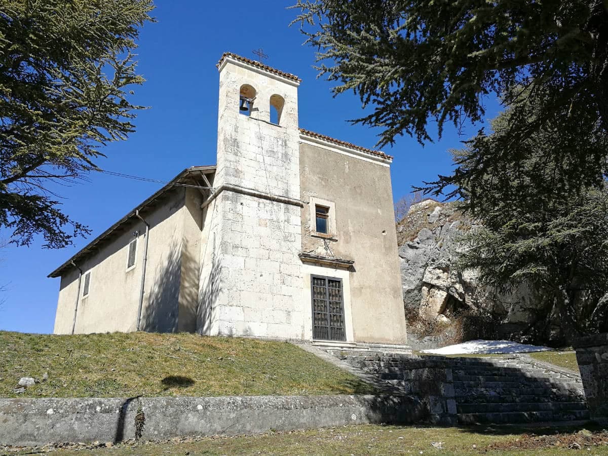
Chiesa di San Nicola
Parish church on the small piazza, with the war memorial obelisk to Maiella Brigade partisans nearby.
The slow-trip planner
Building a trip? Find where Lama dei Peligni fits in a slow Italy circuit.
Answer five questions. We will shape a geographically coherent slow trip from the 1,000 Italian towns most travelers skip. Yours to save and share.
Living here
- Population 1,057
- Off the beaten pathi
- Pharmacy: none mapped
- High school within a 30-minute drive
- Nearest airport Naples / Salerno, 2 h 43 min drive
- Regional capital L'Aquila, 2 h 7 min drive
Tags & datadesignations · numbers · sources
The numbers
- Elevation: 669 m
- Population: 1,057
- Surface area: 31.37 km²
These figures were compiled from public directories — ISTAT, OpenStreetMap, Wikidata — and from the official listings of the guides named on this page. Town details change; verify with official sources before you travel.
Close by
More towns near Lama dei Peligni
Casoli
Province: Chieti
A 378-meter hill town above the Aventino under the Maiella, with a pentagonal Norman tower where Gabriele D'Annunzio held a Renaissance court of artists.
Rivisondoli
Province: L'Aquila
At 1,320 meters on the Cinque Miglia plateau, paired with Roccaraso in the Alto Sangro ski domain and known for its Epiphany living nativity.
Roccaraso
Province: L'Aquila
At 1,236 meters in the Alto Sangro, the south of Italy's largest ski resort, leveled by the Gustav Line in 1943 and rebuilt from rubble.
Guardiagrele
Province: Chieti
The 576-meter terrazza d'Abruzzo on the Majella's foothills, hometown of fifteenth-century goldsmith Nicola da Guardiagrele and seat of the Majella park.
Pescocostanzo
Province: L'Aquila
A planned Renaissance town at 1,395 meters on the Quarto Grande plateau, with bobbin lace, wrought iron, and the wood ceilings of a five-nave church.
🟠 Bandiera Arancione
More Bandiera Arancione towns in Abruzzo
Civitella Alfedena
Province: L'Aquila
At 1,123 meters above Lake Barrea, 285 residents, the trailhead for the Camosciara reserve and home of the Apennine Wolf Museum.
Fara San Martino
Province: Chieti
The pasta capital of Italy at 440 meters, where De Cecco was founded in 1886 and the Verde river runs out of a two-meter slot in the Majella wall.
Scanno
Province: L'Aquila
A 1,057-meter Sagittario valley village photographed by Cartier-Bresson and Giacomelli, where women in black still walk the same alleys as the 1957 series.