Lazio · Frosinone
Picinisco
A medieval village at 725 meters above the Val di Comino, the source of much of Italo-Scottish emigration and of Pecorino di Picinisco DOP.
Known for
PECORINO DI PICINISCO
Raw-milk sheep cheese with DOP status since 2013, made on the Mainarde pastures above the village.
THE SCOTTISH PIPELINE
Together with Barga, the main source of Italian emigration to Scotland from the 1880s through the 20th century.
D.H. LAWRENCE
Stayed above the village in 1919 and used Picinisco as the setting for the final chapters of The Lost Girl.
When to visit
Best · May–Oct
- J
- F
- M
- A
- M
- J
- J
- A
- S
- O
- N
- D
- Best
- Hot or crowded
- Quiet
- Mostly closed
The festa: San Lorenzo, 10 August
Why come
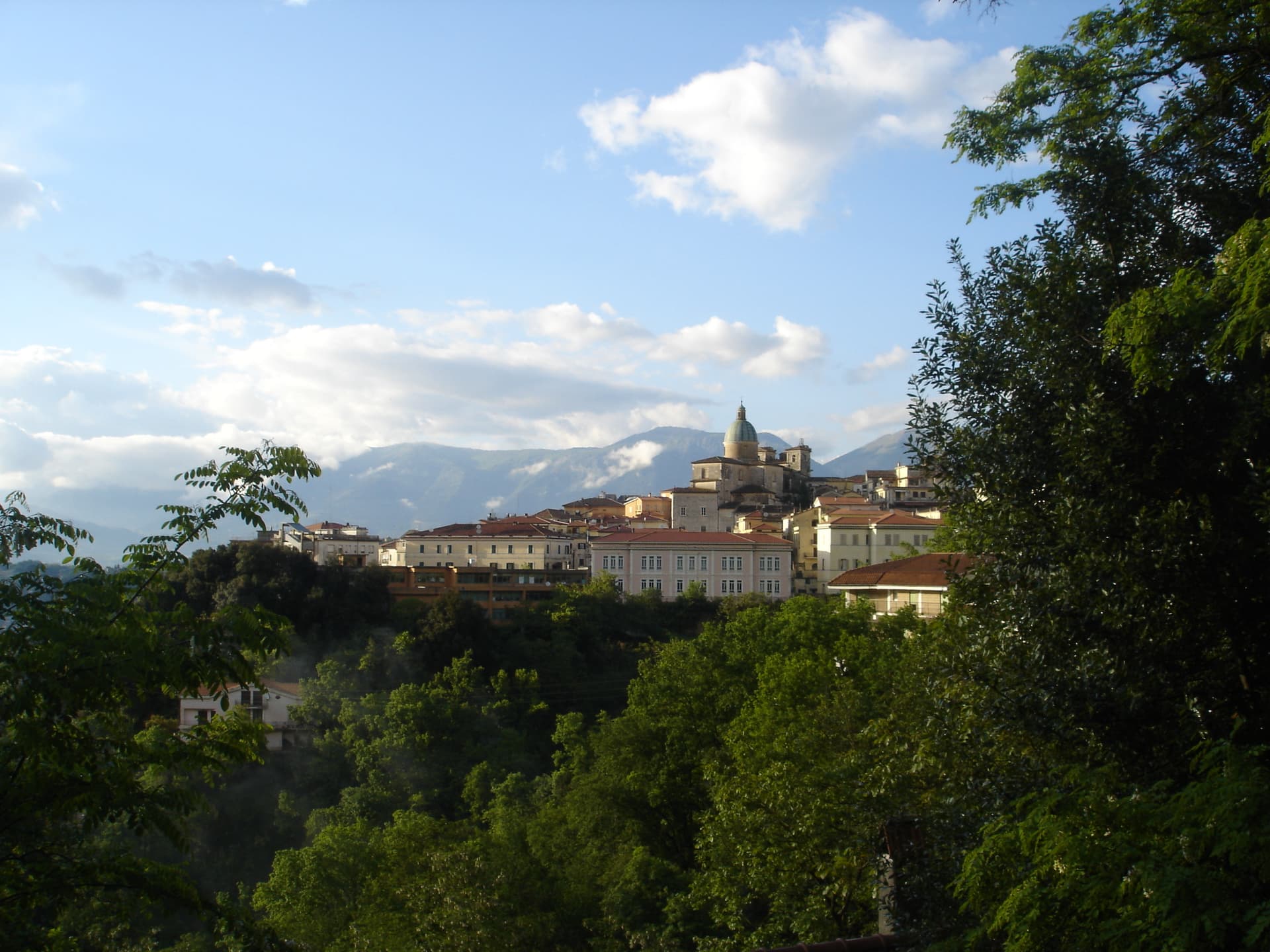
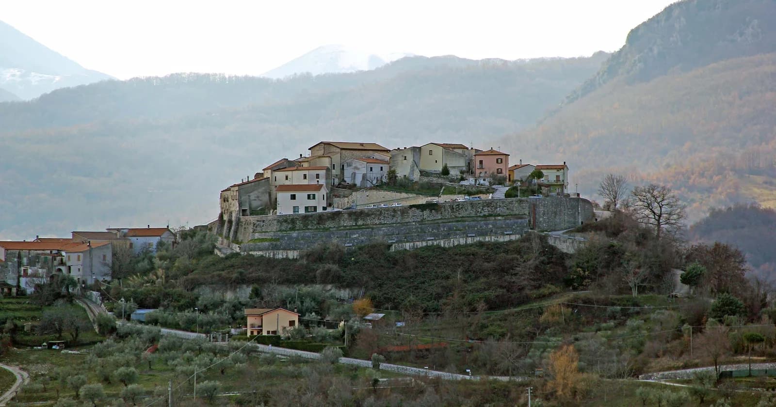
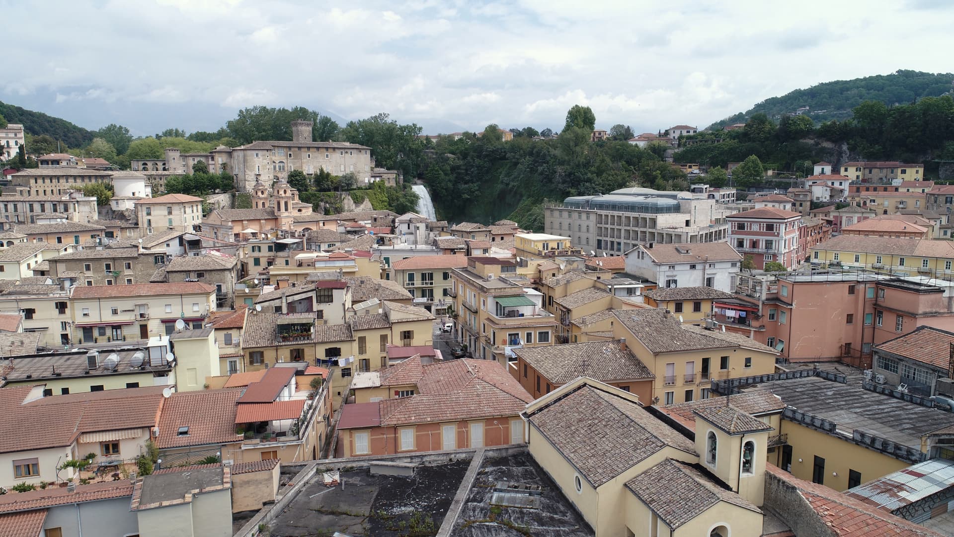
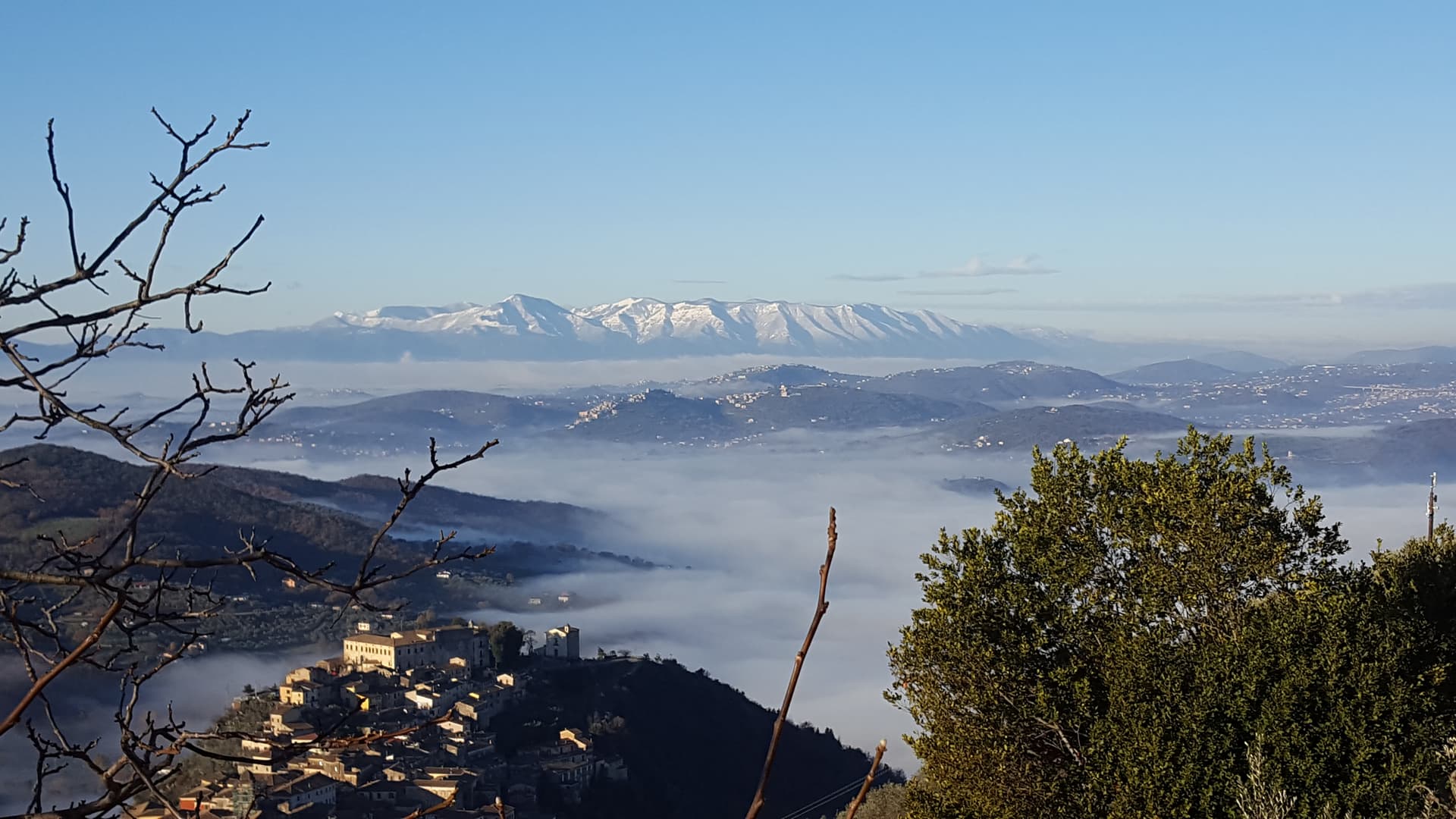
Picinisco sits at 725 meters on a fortified spur on the eastern edge of Lazio, inside the Parco Nazionale d'Abruzzo, Lazio e Molise, looking down on the Val di Comino. It is one of the two villages, together with Barga in Tuscany, that account for an estimated 60 percent of Scots-Italians: the immigration to Glasgow and Edinburgh began in the 1880s and turned into a near-permanent corridor through the 20th century. D.
H. Lawrence stayed in a country house above the village in 1919 and used Picinisco for the closing chapters of The Lost Girl. The food still defines the place: Pecorino di Picinisco DOP, made from raw sheep milk on the surrounding pastures, and Maturano, a white indigenous to the valley and almost extinct before the I Ciacca winery, founded by returning Scots-Italians, restarted it. The medieval centro storico climbs from the lower square up toward the castle ruins.
The Sunday letter
We haven’t written Picinisco’s letter yet.
One town every Sunday, with the photo, the food, the festa. Be there when this one comes up. Free, by Peter & Sophia from Pietrasanta.
By subscribing you agree to Substack’s Terms of Use, our Privacy Policy and our Information collection notice.


What to see
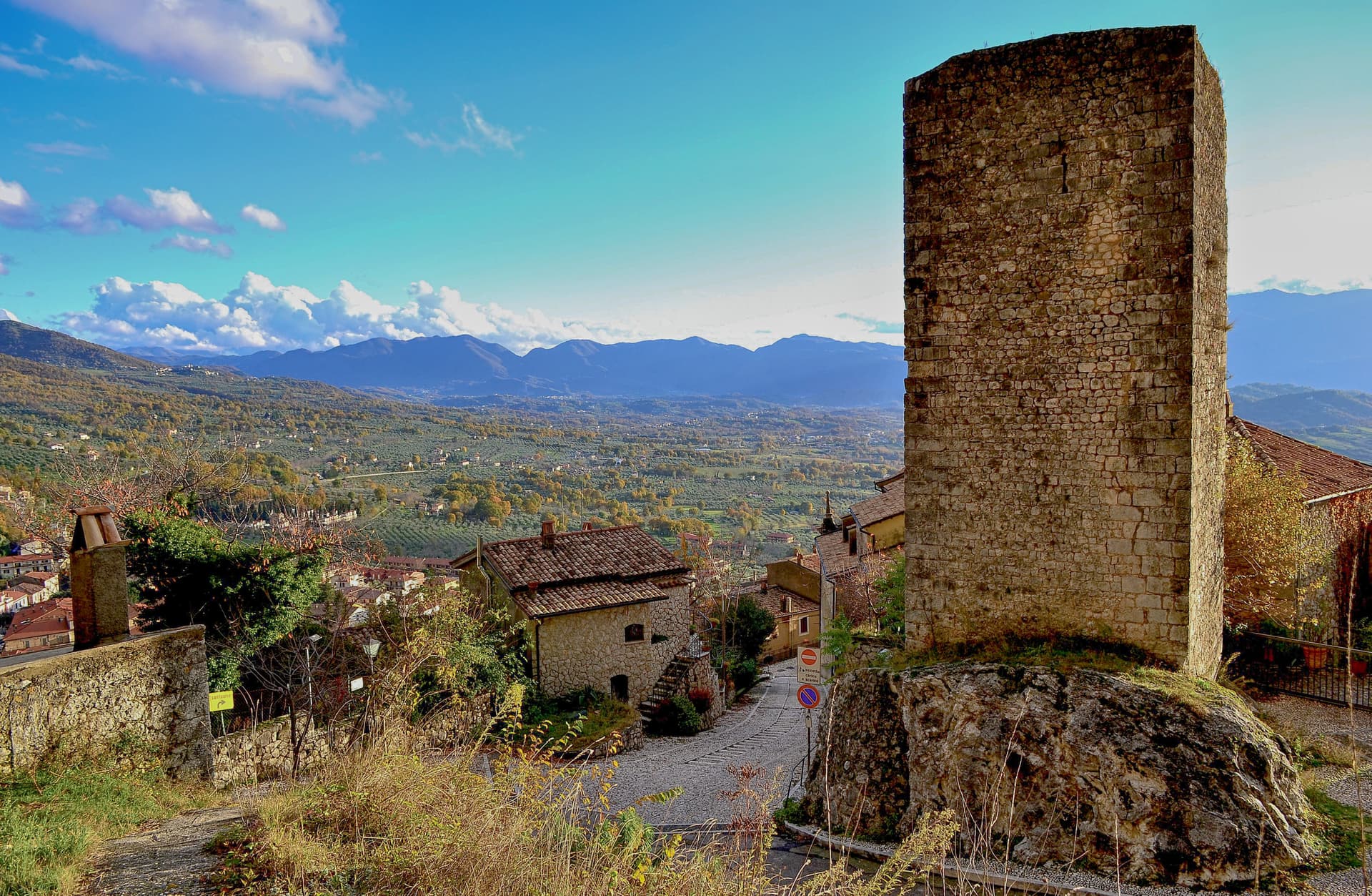
Castello medievale
Ruined medieval castle on the highest point of the village, built to control the eastern access to the Val di Comino.
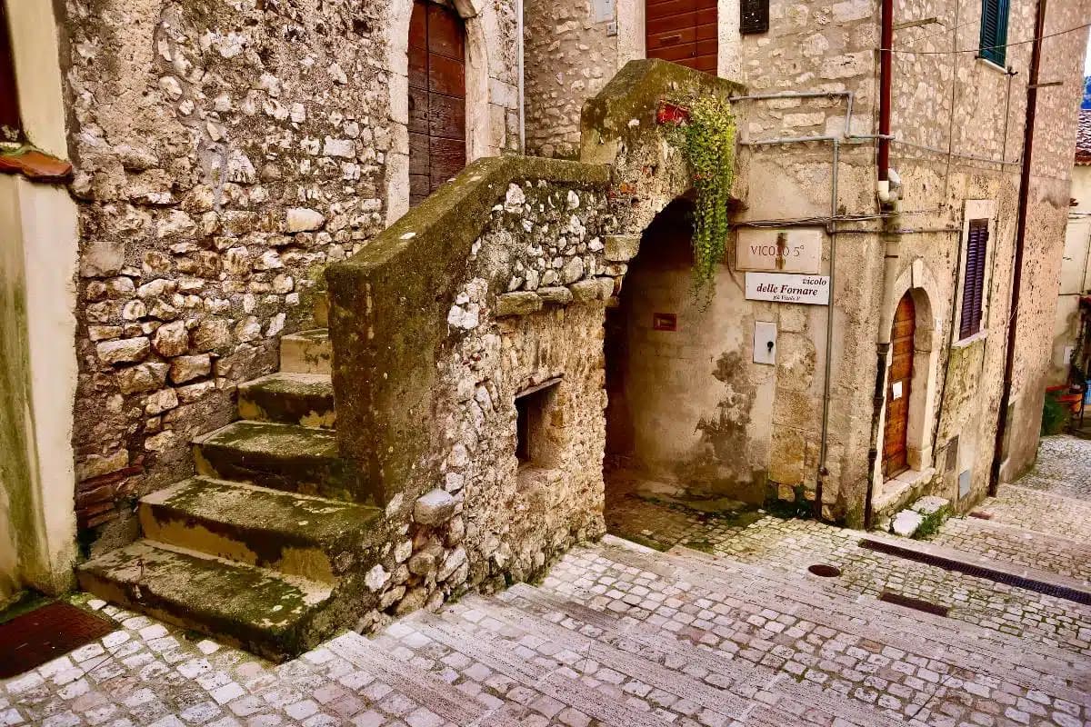
Centro storico
Fortified medieval village at 725 meters, narrow stone streets climbing from the lower piazza toward the castle.
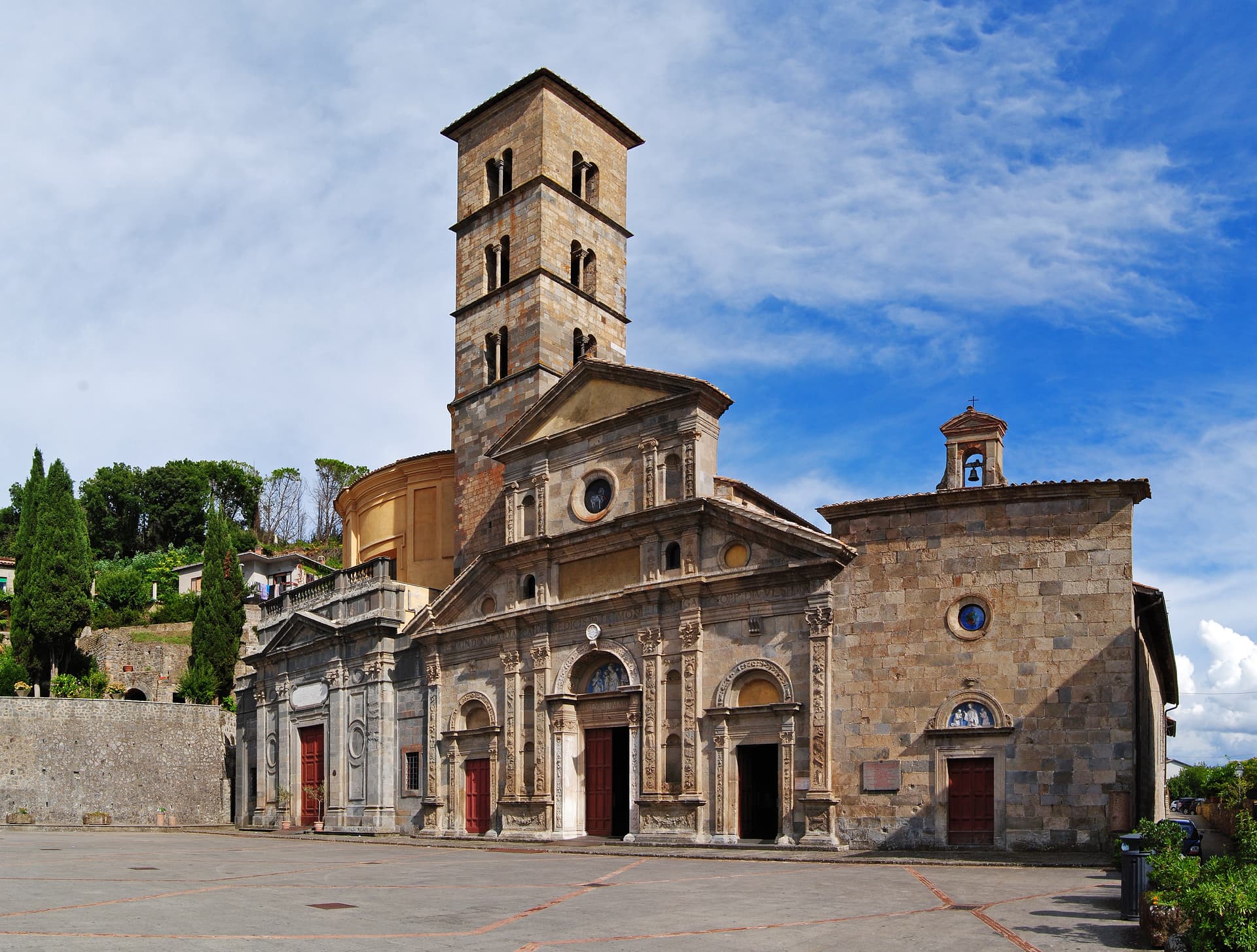
Chiesa di San Lorenzo
Parish church in the upper village, baroque interior on medieval foundations.
Parco Nazionale d'Abruzzo, Lazio e Molise
Italy's second-oldest national park, with trails leading from the village into the Mainarde range and toward Forca d'Acero.
Pastures of Prati di Mezzo
High summer pastures above the village at 1,500 meters, the source area for Pecorino di Picinisco DOP.
The slow-trip planner
Building a trip? Find where Picinisco fits in a slow Italy circuit.
Answer five questions. We will shape a geographically coherent slow trip from the 1,000 Italian towns most travelers skip. Yours to save and share.
Living here
- Population 1,098
- In-betweeni
- Pharmacy in town
- Nearest high school over ~30 minutes away
- Nearest airport Naples / Salerno, 1 h 59 min drive
- Regional capital Roma, 2 h 31 min drive
Tags & datadesignations · numbers · sources
Recognised as
The numbers
- Elevation: 725 m
- Population: 1,098
- Surface area: 62.15 km²
These figures were compiled from public directories — ISTAT, OpenStreetMap, Wikidata — and from the official listings of the guides named on this page. Town details change; verify with official sources before you travel.
Close by
More towns near Picinisco
Atina
Province: Frosinone
A polygonal-walled town in the Val di Comino at the foot of the Mainarde, and the DOC that makes Cabernet in central Italy.
San Donato Val di Comino
Province: Frosinone
A medieval village at 728 meters at the gateway to Forca d'Acero, the pass into the Abruzzo National Park.
Scapoli
Province: Isernia
Italy's zampogna bagpipe capital — a 586-resident borgo in the Mainarde at 668m, with a centuries-old tradition of hand-building the zampogna (Italian bagpipe), an annual International Bagpipe Festival in July drawing players from Galicia, Scotland, Bulgaria, and 15+ other countries, and the Bandiera Arancione + Abruzzo, Lazio e Molise national park signals.
Isola del Liri
Province: Frosinone
The Ciociaria town with a 27-meter waterfall in its centro storico and a paper-mill past once called the Manchester of Italy.
Arpino
Province: Frosinone
The Volscian-Roman hill town in the Liri valley that produced Marius and Cicero, with a pre-Roman acropolis above the modern center.
🟠 Bandiera Arancione
More Bandiera Arancione towns in Lazio
Bassiano
Province: Latina
The highest village in the province of Latina at 562 meters, birthplace of Aldo Manuzio, who shrank the book to pocket size.
Bolsena
Province: Viterbo
A medieval town at 350 meters on the eastern shore of Europe's largest volcanic lake, where a Bohemian priest reported a Eucharistic miracle in 1263.
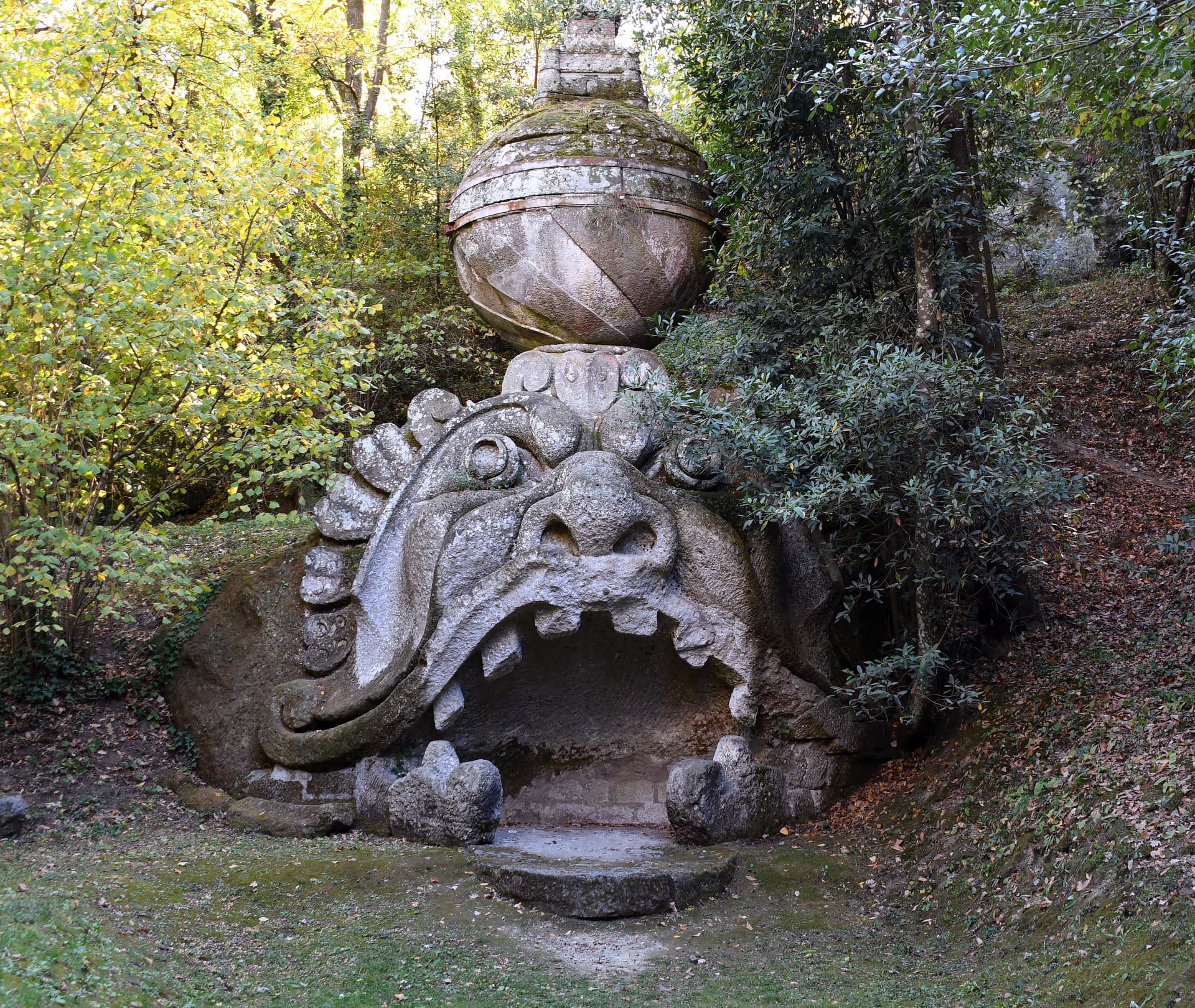
Bomarzo
Province: Viterbo
The Tuscia village below the Sacro Bosco, the 16th-century stone-monster garden built by a grieving condottiero for his dead wife.
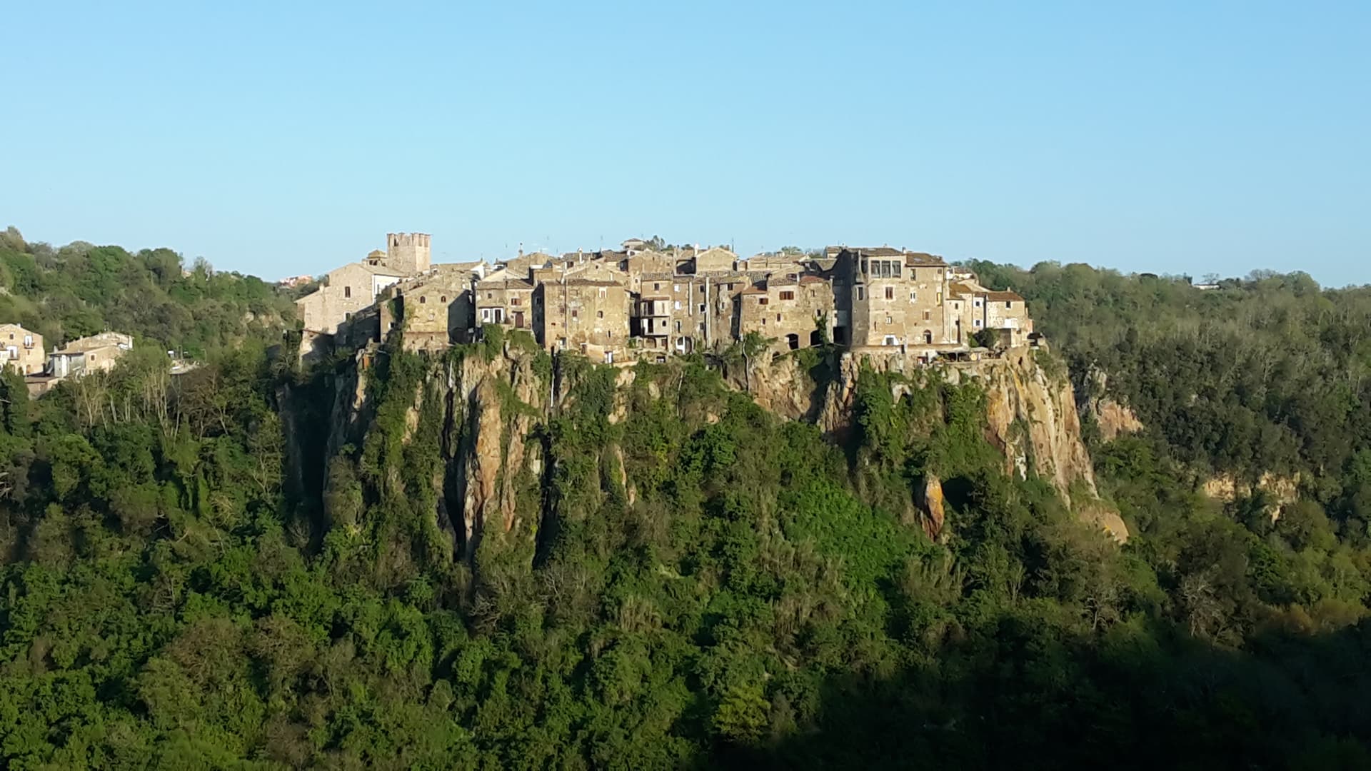
Calcata
Province: Viterbo
A tufa-cliff village forty kilometers north of Rome, condemned and abandoned in the 1930s, then occupied by artists and never left.
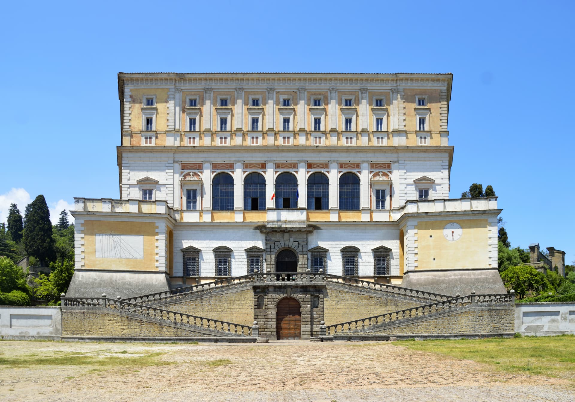
Caprarola
Province: Viterbo
A Cimini hill town above Lago di Vico, dominated by the pentagonal Villa Farnese that Vignola built for the Farnese cardinals between 1559 and 1573.