
Umbria · Perugia
Magione
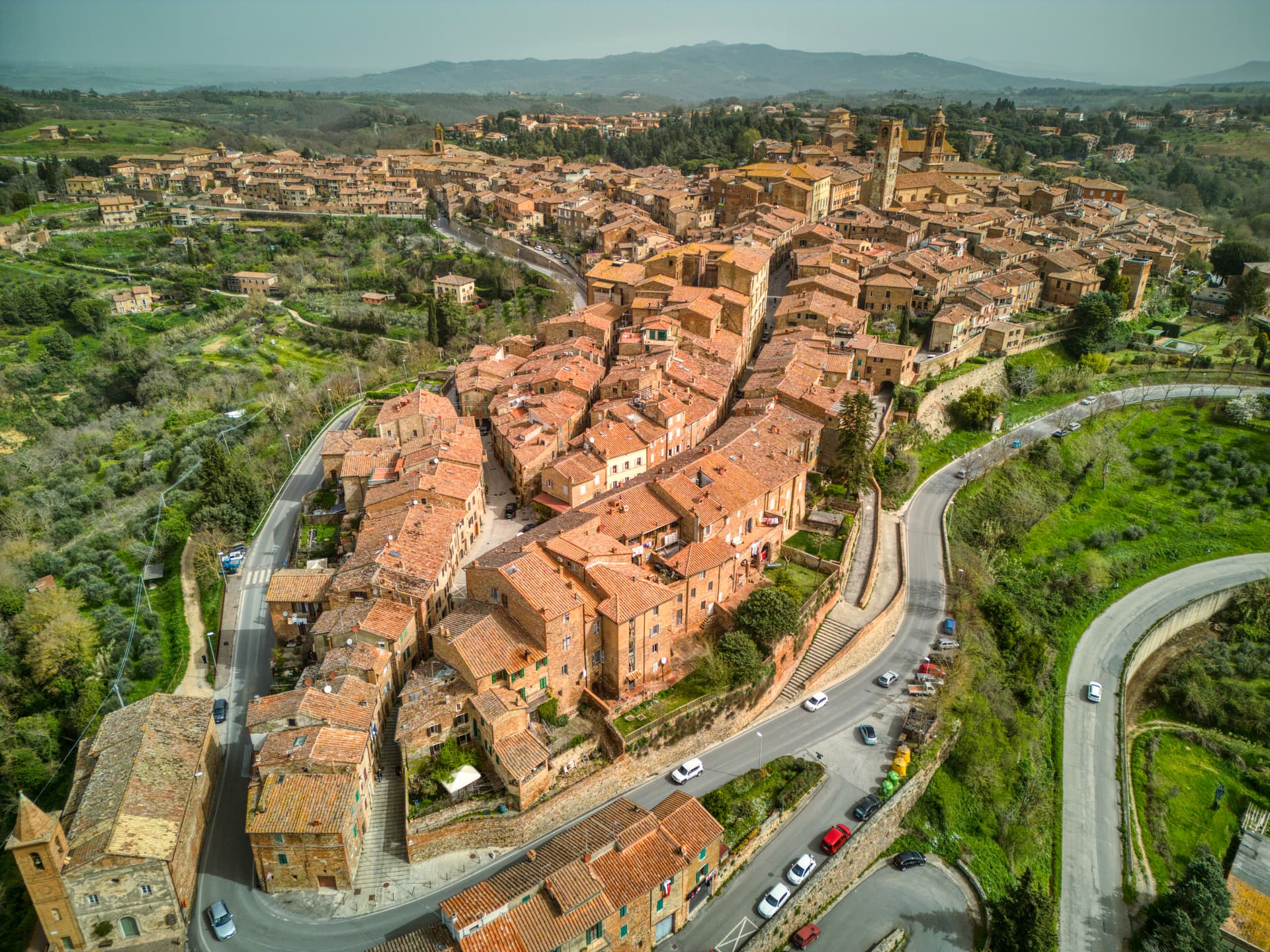
A hill town east of Trasimeno where the Knights Hospitaller built their twelfth-century maison and Machiavelli later foiled the Conspiracy of Magione against Cesare Borgia.
Known for
KNIGHTS OF MALTA
Twelfth-century Hospitaller maison still owned by the Order, the source of the town's name and its medieval economy.
CONSPIRACY OF 1502
Cesare Borgia's captains plotted his overthrow inside the castle; Machiavelli leaked the plan and the conspirators were liquidated.
OLIO TRASIMENO
Città dell'Olio member, olive groves on the hills between the lake's eastern shore and Perugia at 250-350 meters.
When to visit
Best · Apr–Oct
- J
- F
- M
- A
- M
- J
- J
- A
- S
- O
- N
- D
- Best
- Hot or crowded
- Quiet
- Mostly closed
The festa: papa Clemente I, 23 November
Why come
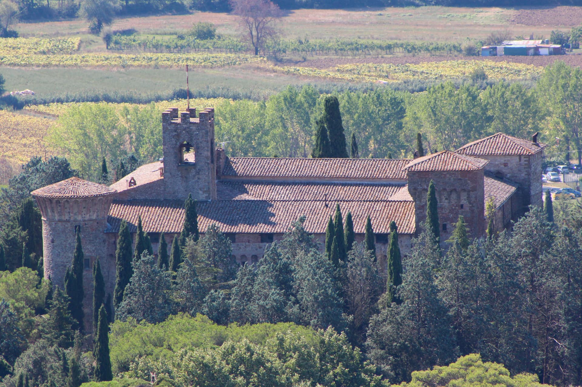
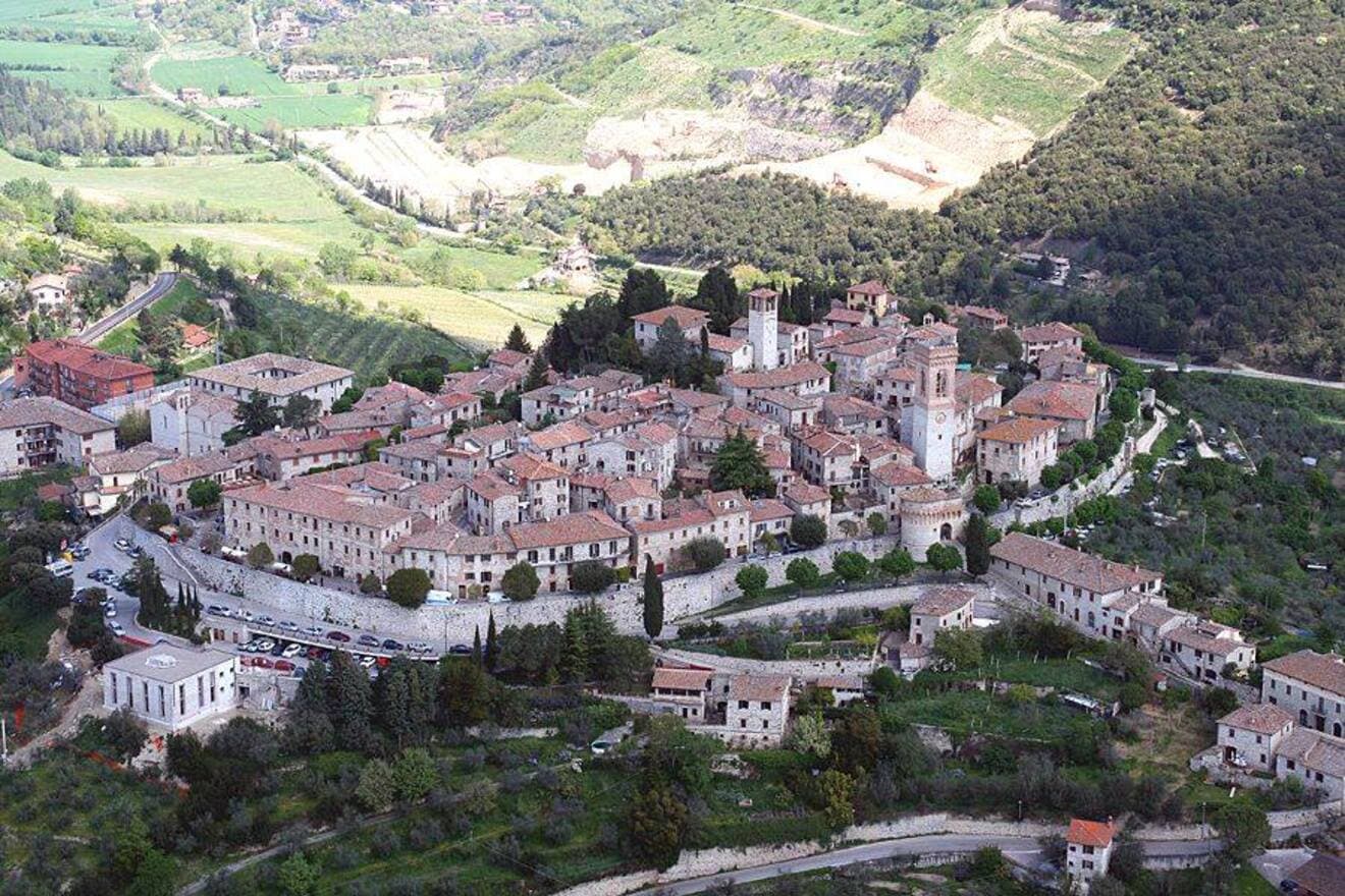
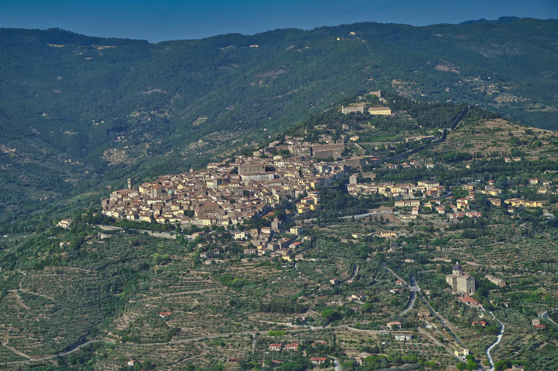
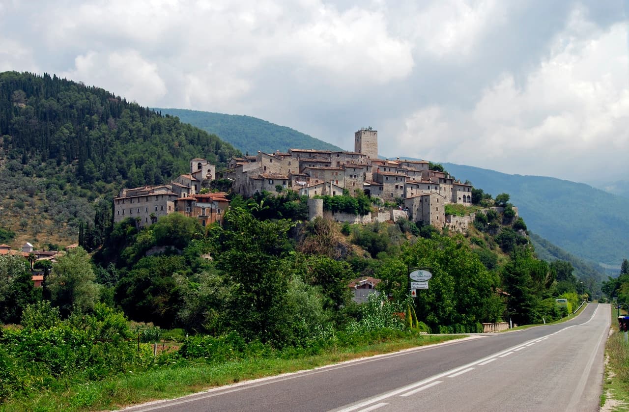
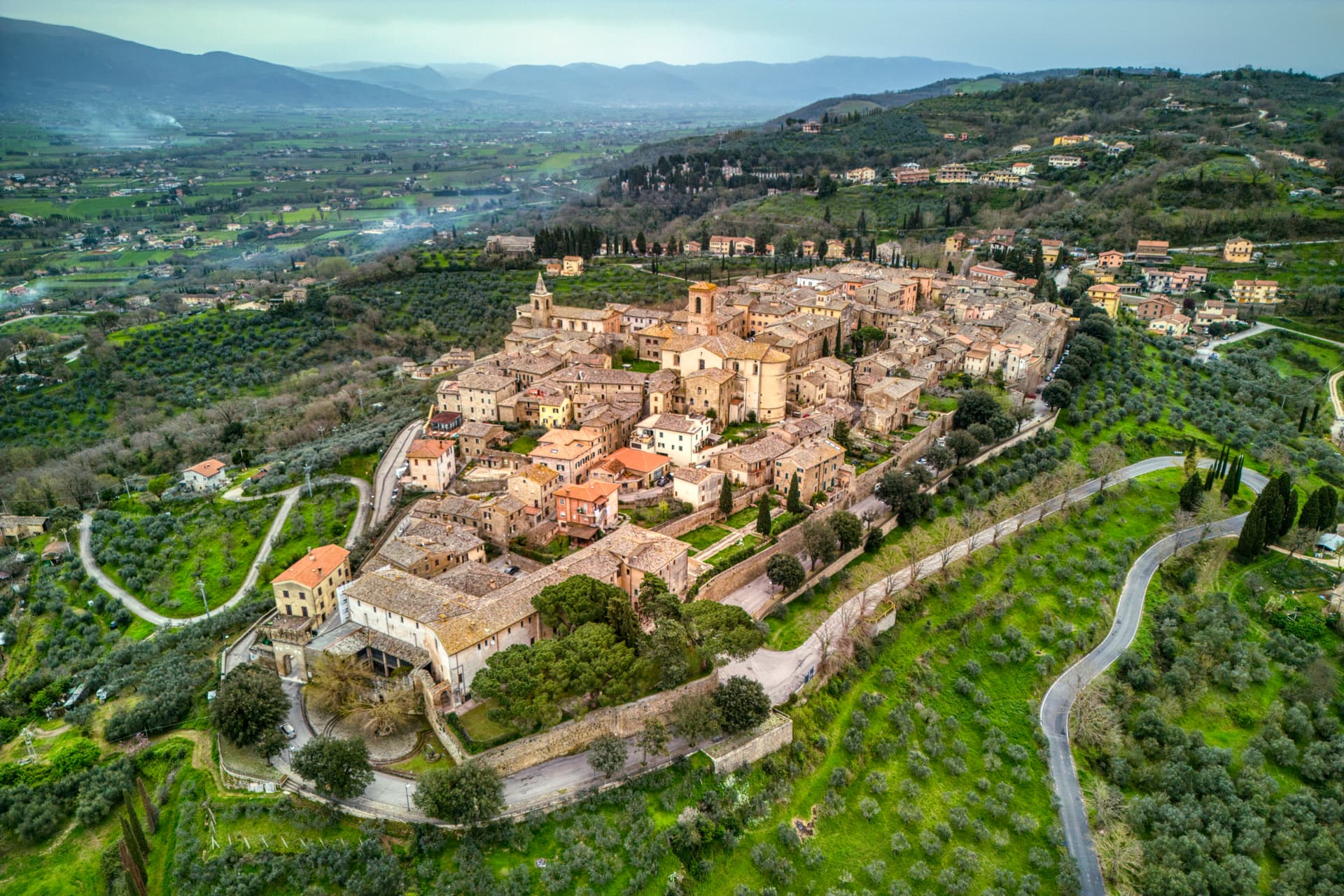
Magione sits on a hill east of Lake Trasimeno, fifteen kilometers from Perugia. The name comes from the Knights Hospitaller, who built a hospital here in the mid-twelfth century dedicated to Saint John the Baptist and called their convent Maison in their own language. The original nucleus stood on the Perugia-Tuscany route and became the Castello dei Cavalieri di Malta, the Order's fortified base that still anchors the town.
In October 1502 the castle hosted what became known as the Conspiracy of Magione: Cesare Borgia's own captains and allies plotted his overthrow inside its walls. Niccolò Machiavelli, on diplomatic mission for Florence, learned the details and passed them to Borgia, who dismantled the conspirators within months. The Torre dei Lambardi, built between the twelfth and thirteenth centuries by the same Gerosolimitani Knights, rises thirty meters above the lower town as a second medieval pole. The vineyards on the surrounding hills lie between 250 and 350 meters above sea level.
The Sunday letter
We haven’t written Magione’s letter yet.
One town every Sunday, with the photo, the food, the festa. Be there when this one comes up. Free, by Peter & Sophia from Pietrasanta.
By subscribing you agree to Substack’s Terms of Use, our Privacy Policy and our Information collection notice.

What to see
Castello dei Cavalieri di Malta
Twelfth-century hospital of the Knights Hospitaller, site of the 1502 Conspiracy of Magione against Cesare Borgia.
Torre dei Lambardi
Thirty-meter quadrangular tower built between the twelfth and thirteenth centuries by the Gerosolimitani Knights, three floors and a summit terrace.
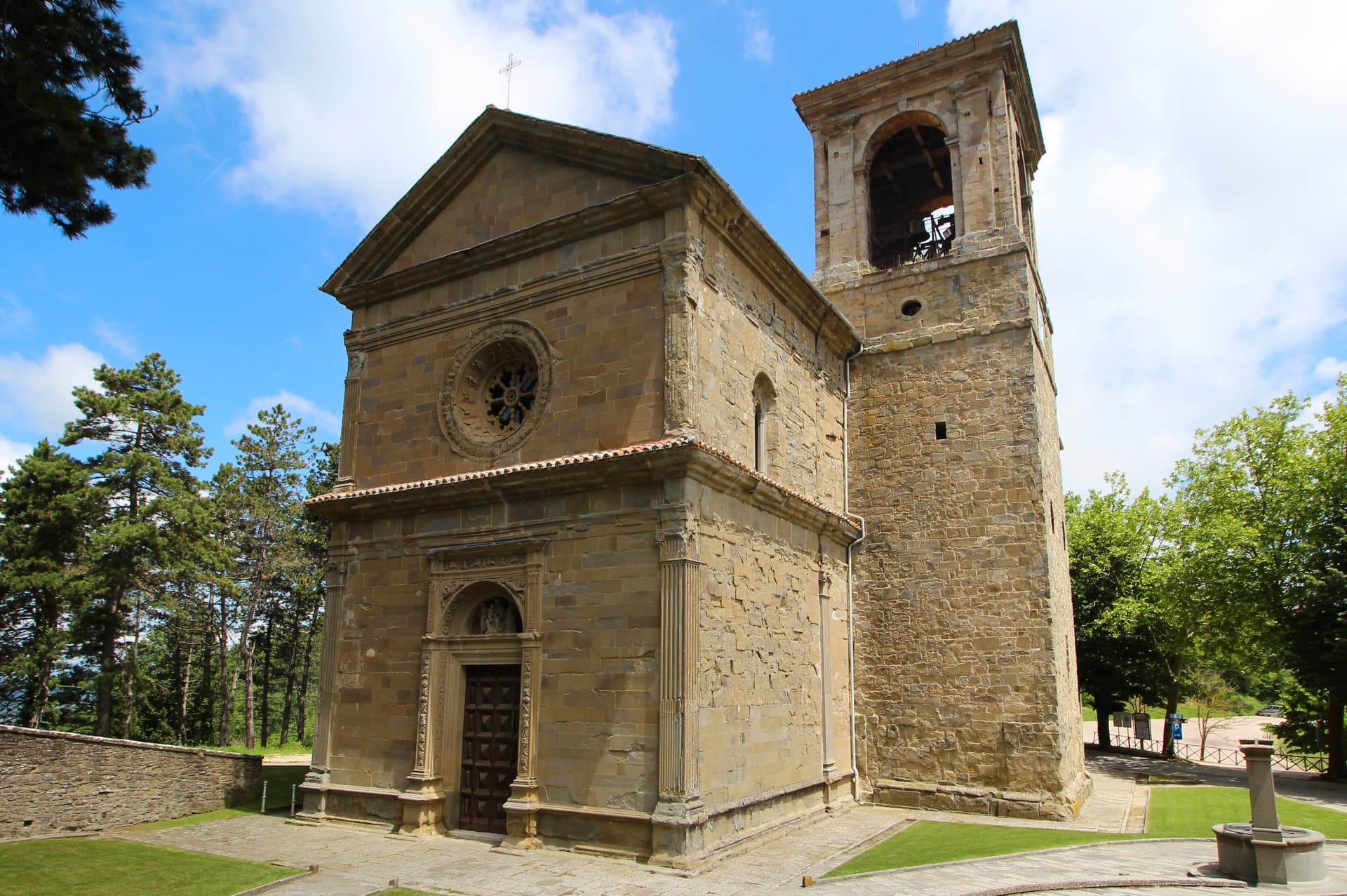
Chiesa di San Giovanni Battista
Parish church inside the Castello complex, dedicated to the saint of the original Hospitaller foundation.
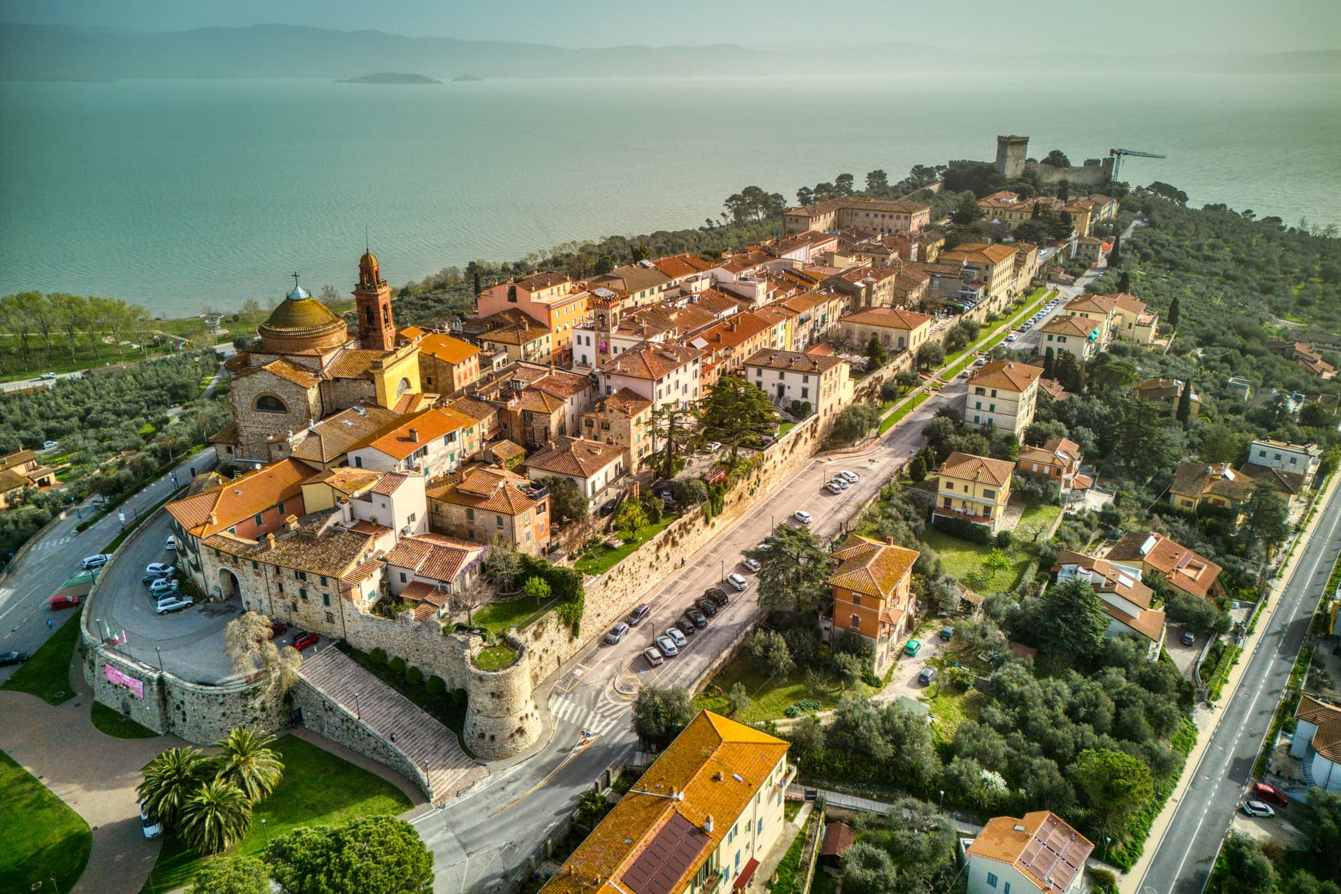
Lago Trasimeno
Magione's territory reaches the eastern shore, with Isola Polvese 4 km offshore reachable from San Feliciano frazione.
The slow-trip planner
Building a trip? Find where Magione fits in a slow Italy circuit.
Answer five questions. We will shape a geographically coherent slow trip from the 1,000 Italian towns most travelers skip. Yours to save and share.
Living here
- Population 14,620
- Commuter belti
- Pharmacy in town
- High school within a 30-minute drive
- Train station in the comune
- Nearest airport Ancona / Pescara, 1 h 54 min drive
- Regional capital Perugia, 20 min drive
Tags & datadesignations · numbers · sources
Recognised as
The numbers
- Elevation: 299 m
- Population: 14,620
- Surface area: 129.73 km²
These figures were compiled from public directories — ISTAT, OpenStreetMap, Wikidata — and from the official listings of the guides named on this page. Town details change; verify with official sources before you travel.
Close by
More towns near Magione
Corciano
Province: Perugia
A walled medieval castello at 408 meters eight kilometers west of Perugia, where Saint Francis stopped on his way back from Isola Maggiore in 1223.
Passignano sul Trasimeno
Province: Perugia
A near-peninsula on the northern shore of Lake Trasimeno, on the road Hannibal closed when he ambushed the Romans in 217 BC.
Deruta
Province: Perugia
A hill town at 218 meters on the left bank of the Tiber, the maiolica capital of central Italy since the late thirteenth century.
Cortona
Province: Arezzo
An Etruscan lucumonia at 494 meters with two kilometers of walls older than Rome, looking down on the Val di Chiana and Lake Trasimeno.

Panicale
Province: Perugia
A walled hill town at 431 meters on Monte Petrarvella, where a 1505 Perugino fresco covers the back wall of San Sebastiano.
🌳 Parco Regionale
More Parco Regionale towns in Umbria
Arrone
Province: Terni
Medieval castle village on the left bank of the Nera at 243 meters, upstream from the largest man-made waterfall in the world.

Assisi
Province: Perugia
A pink limestone town at 424 meters on the western flank of Monte Subasio, the birthplace of Francis and a UNESCO site since 2000.
Bettona
Province: Perugia
A hill town at 353 meters between the Topino and Chiascio rivers, the only Etruscan settlement ever built east of the Tiber.
Castiglione del Lago
Province: Perugia
Trasimeno's western promontory, once the lake's fourth island, fortified by Federico II in 1247 and frescoed by Pomarancio for the Corgna marquises.
Città della Pieve
Province: Perugia
A red-brick hill town at 508 meters above the Valdichiana, the birthplace of Perugino and the home of Italy's narrowest alley.