
Tuscany · Siena
Piancastagnaio
A chestnut-belt borgo at 772 meters on the southern slope of Monte Amiata, where four contrade still race for the Palio delle Contrade each August.
Known for
PALIO DELLE CONTRADE
Costumed race run every 18 August between four contrade through the centro storico, dating to the eighteenth century.
MARRONI
Sweet chestnut harvested across the Monte Amiata slopes, celebrated each All Saints weekend at the Crastatone festival.
MERCURY MINES
Cinnabar and mercury extraction active on Monte Amiata from the Etruscans until 1982, documented in the Sant'Anna museum.
When to visit
Best · May–Oct
- J
- F
- M
- A
- M
- J
- J
- A
- S
- O
- N
- D
- Best
- Hot or crowded
- Quiet
- Mostly closed
Why come
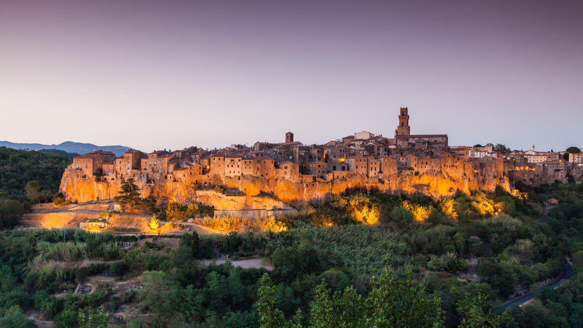
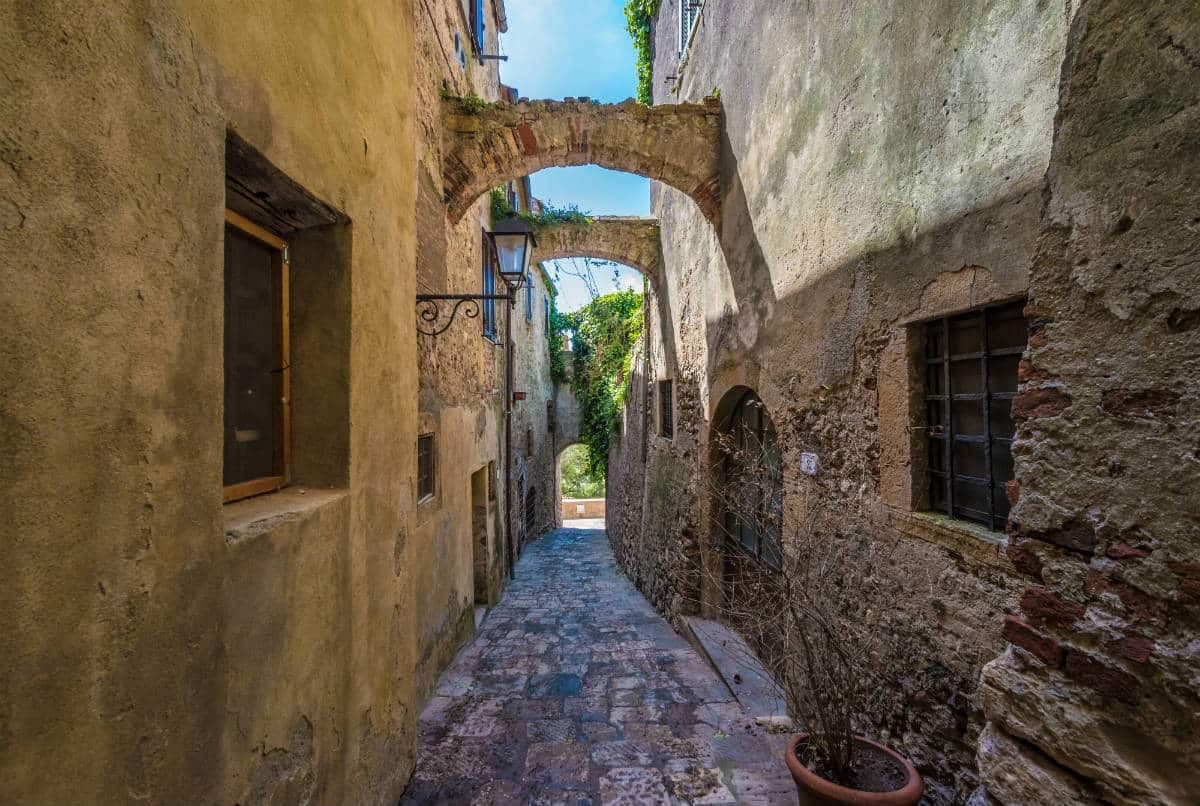
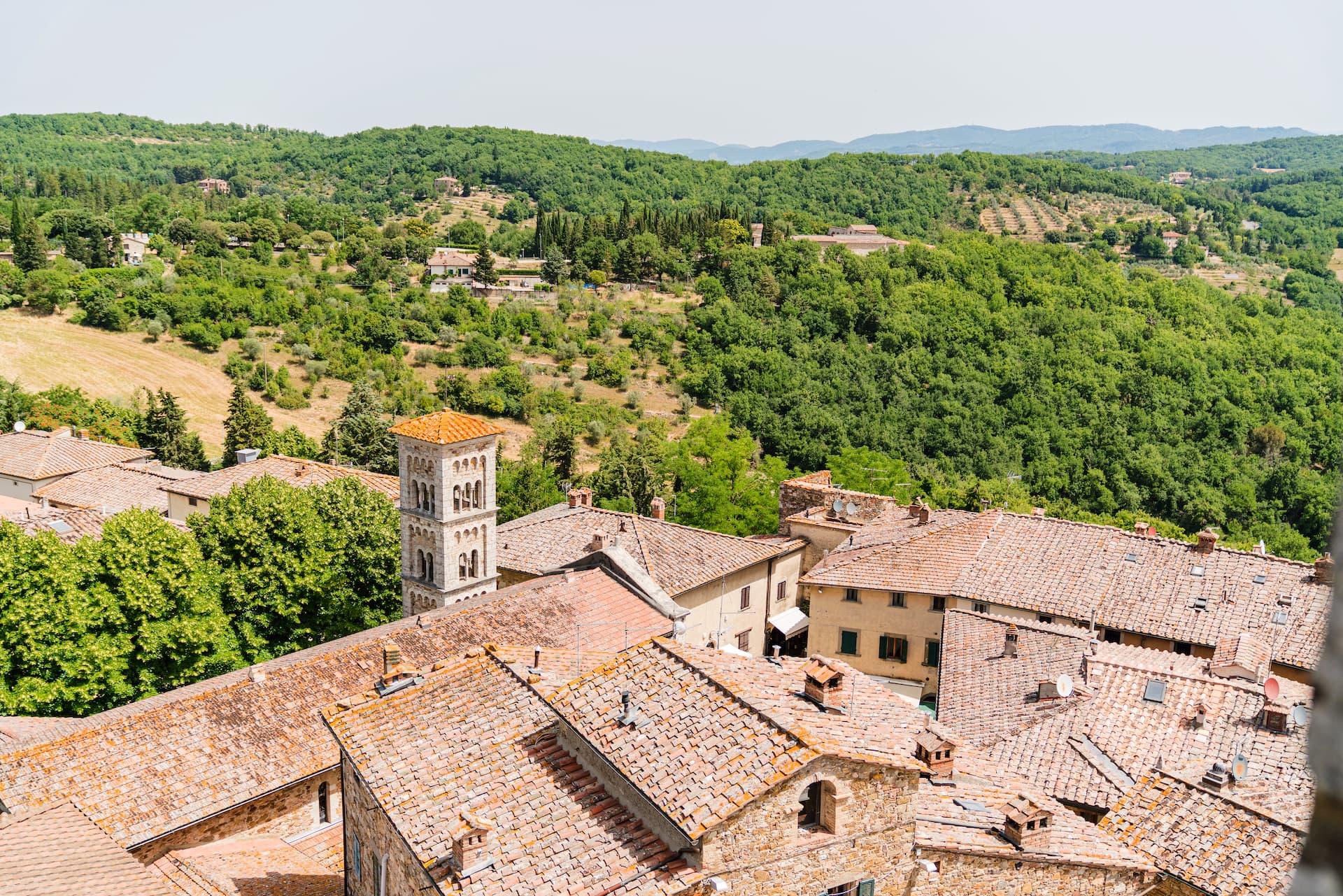
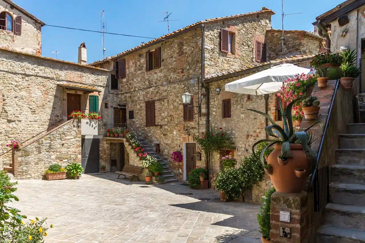
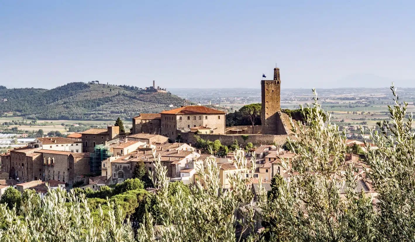
Piancastagnaio sits at 772 meters on the southern slope of Monte Amiata, the extinct volcanic cone that dominates the southern Sienese landscape. The name means plain of the chestnut, and the surrounding forest of sweet chestnut, sessile oak and beech is what fed the town for most of its history. The Aldobrandeschi counts built the rocca that still anchors the centro storico in the twelfth century; it passed to Siena in 1418 and to the Medici in 1559.
The Palio delle Contrade, run every 18 August since the eighteenth century, divides the town into four contrade (Borgo, Castello, Coro, Voltaia) that race in costume through the centro storico. The Sant'Anna Mining Museum documents the cinnabar and mercury extraction that ran on Monte Amiata from Etruscan times until the mine closed in 1982. The Crastatone, the chestnut roasting festival on All Saints weekend, fills the streets with woodsmoke and the smell of roasted marroni.
The Sunday letter
We haven’t written Piancastagnaio’s letter yet.
One town every Sunday, with the photo, the food, the festa. Be there when this one comes up. Free, by Peter & Sophia from Pietrasanta.
By subscribing you agree to Substack’s Terms of Use, our Privacy Policy and our Information collection notice.


What to see
Rocca Aldobrandesca
Twelfth-century Aldobrandeschi keep at the heart of the centro storico, with a square tower and surviving curtain wall.
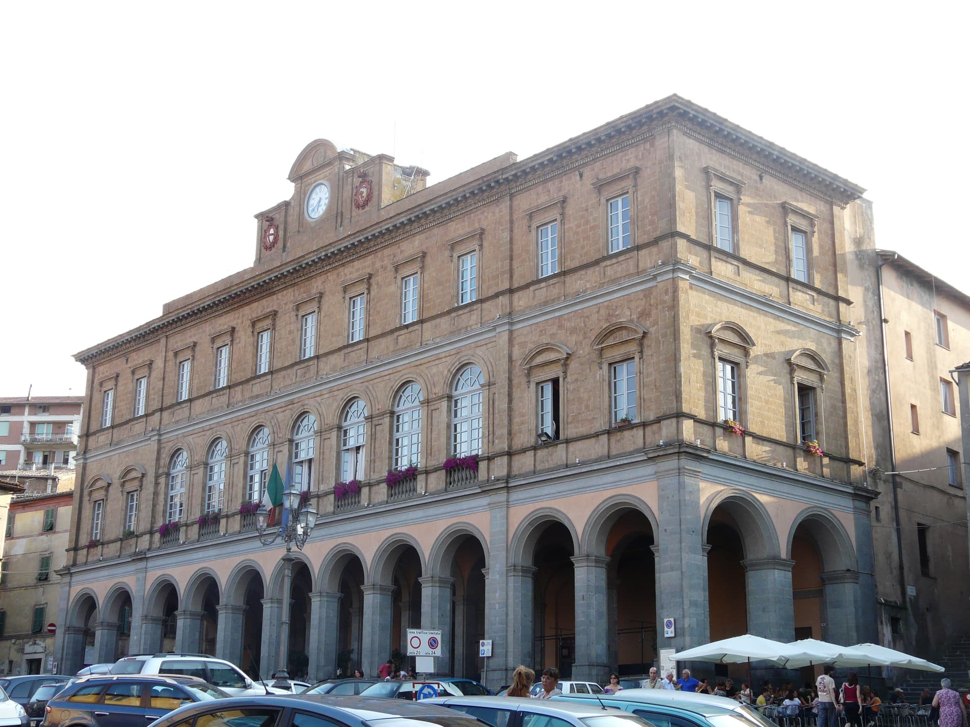
Palazzo Bourbon del Monte
Sixteenth-century Medici-era palazzo built into the medieval defenses, with a courtyard loggia and ceremonial hall.
Museo Minerario di Sant'Anna
Mining museum on the cinnabar and mercury extraction of Monte Amiata, active from the Etruscans until the mine closed in 1982.
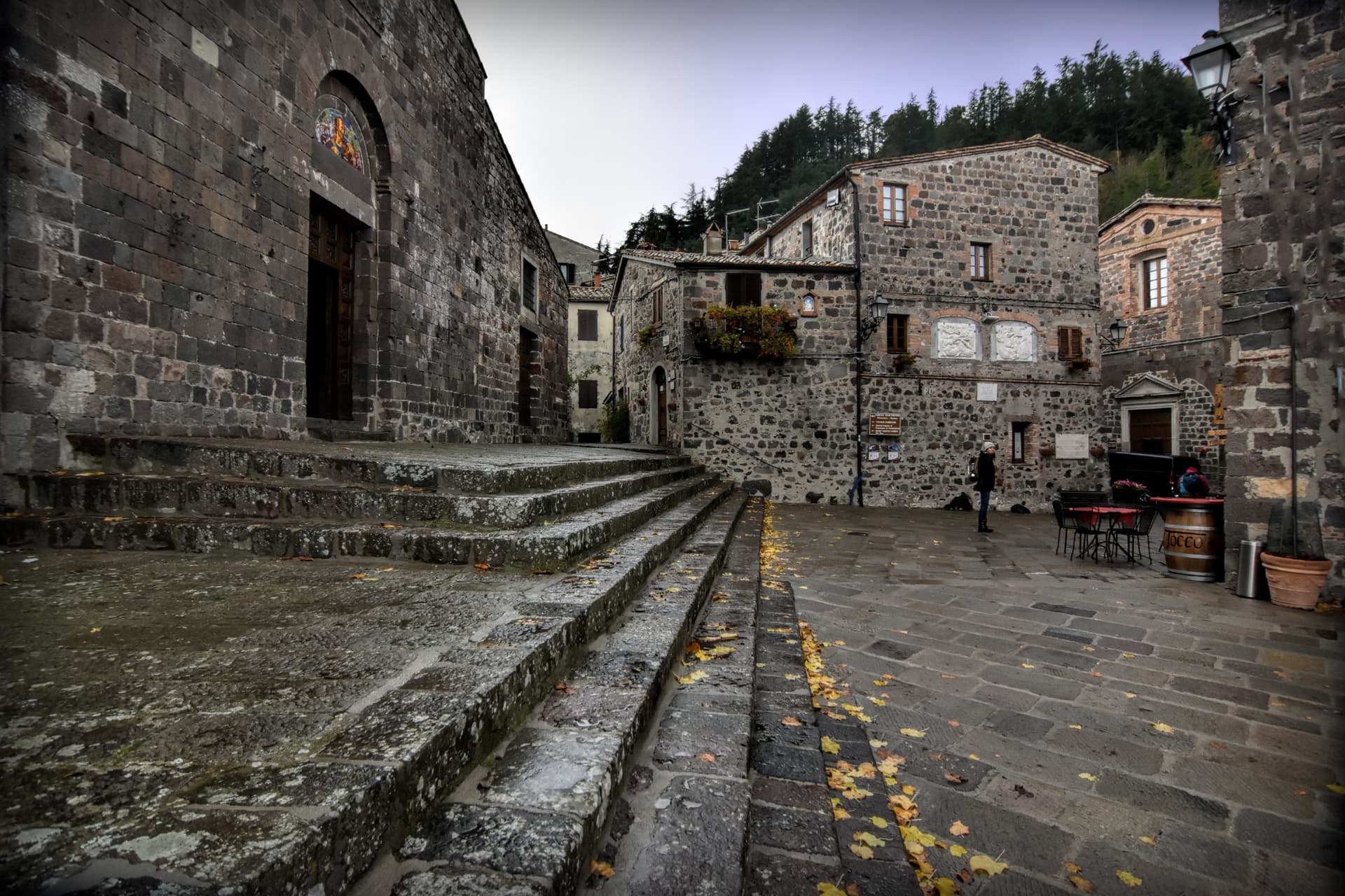
Pieve di Santa Maria Assunta
Romanesque parish church in the centro storico, with a stone façade and later baroque interior.
Bosco del Monte Amiata
Sweet chestnut, sessile oak and beech forest on the southern slope of the volcano, with trails leading to the summit at 1,738 meters.
The slow-trip planner
Building a trip? Find where Piancastagnaio fits in a slow Italy circuit.
Answer five questions. We will shape a geographically coherent slow trip from the 1,000 Italian towns most travelers skip. Yours to save and share.
Living here
- Population 3,871
- Off the beaten pathi
- Pharmacy in town
- Nearest high school over ~30 minutes away
- Nearest airport Rome, 3 h 25 min drive
- Regional capital Firenze, 2 h 49 min drive
Tags & datadesignations · numbers · sources
Recognised as
The numbers
- Elevation: 772 m
- Population: 3,871
- Surface area: 69.63 km²
These figures were compiled from public directories — ISTAT, OpenStreetMap, Wikidata — and from the official listings of the guides named on this page. Town details change; verify with official sources before you travel.
Close by
More towns near Piancastagnaio

Santa Fiora
Province: Grosseto
An Aldobrandeschi and Sforza mountain borgo on Monte Amiata at 687 meters, holding one of the world's largest collections of Della Robbia terracotta.

San Casciano dei Bagni
Province: Siena
A hilltop borgo at 582 meters above 42 hot springs that produced the largest Etruscan bronze hoard of the last fifty years.
Pitigliano
Province: Grosseto
The Little Jerusalem of southern Tuscany, carved into a tuff spur in the Maremma, where the houses, the synagogue and the streets are all cut from the same volcanic rock.
Radicofani
Province: Siena
The Val d'Orcia's basalt watchtower — a 1,060-resident UNESCO-inscribed borgo at 814m on a volcanic basalt outcrop visible across half of southern Tuscany, with the spectacular Rocca di Radicofani (Ghino di Tacco's outlaw fortress, mentioned by Dante in Purgatorio + Boccaccio in the Decameron), the 16th-c Posta Medicea on the Via Francigena, and Bandiera Arancione + UNESCO + Via Francigena triple signal.
Acquapendente
Province: Viterbo
The northernmost town in Lazio on the Via Francigena, at 420 meters above the Paglia, named in 964 for its waterfalls.
🫒 Città dell'Olio
More Città dell'Olio towns in Tuscany
Capalbio
Province: Grosseto
A walled hilltop borgo at 217 meters in the southern Maremma, donated to the Abbey of Tre Fontane by Charlemagne and home of Niki de Saint Phalle's Tarot Garden.

Castagneto Carducci
Province: Livorno
A hilltop borgo at 194 meters above the Costa degli Etruschi, renamed for the poet Carducci in 1907 and the home of Bolgheri and Sassicaia.
Castellina in Chianti
Province: Siena
A Chianti hill town at 578 meters on the watershed between the Arno and the Ombrone, with an Etruscan tumulus, a Brunelleschi-reinforced wall and a covered medieval walkway around its edge.
Castelnuovo Berardenga
Province: Siena
A Chianti Classico commune at 351 meters between the Ombrone and the Crete Senesi, the last castle Siena built against Florence, in 1366.
Castiglion Fiorentino
Province: Arezzo
A walled hill town at 342 meters between Arezzo and Cortona, where Etruscan walls support the medieval Cassero and Vasari's loggia frames the Val di Chiana below.