
Tuscany · Siena
Radicofani
The Val d'Orcia's basalt watchtower — a 1,060-resident UNESCO-inscribed borgo at 814m on a volcanic basalt outcrop visible across half of southern Tuscany, with the spectacular Rocca di Radicofani (Ghino di Tacco's outlaw fortress, mentioned by Dante in Purgatorio + Boccaccio in the Decameron), the 16th-c Posta Medicea on the Via Francigena, and Bandiera Arancione + UNESCO + Via Francigena triple signal.
Known for
GHINO DI TACCO'S ROCCA
The 13th-c outlaw + Ghibelline noble who held Radicofani as a raiding base — Dante (Purgatorio VI) and Boccaccio (Decameron X.2) both wrote about him. The fortress on the basalt summit is the iconic Val d'Orcia silhouette.
VIA FRANCIGENA + POSTA MEDICEA
Single most spectacular Italian stop on the Canterbury-to-Rome pilgrim road. 16th-c stagecoach inn hosted every Grand-Tour traveller 1500-1850.
UNESCO VAL D'ORCIA
Part of the Val d'Orcia World Heritage inscription (2004). Triple-signal town: UNESCO + Bandiera Arancione + Via Francigena.
BASALT OUTCROP
Perfectly conical 814m volcanic outcrop visible from Pienza, Montalcino, Monte Amiata, the Cassia road — the iconic Val d'Orcia silhouette from anywhere in southern Tuscany.
When to visit
Best · May–Sep
- J
- F
- M
- A
- M
- J
- J
- A
- S
- O
- N
- D
- Best
- Hot or crowded
- Quiet
- Mostly closed
The festa: Sant'Agata, 5 February
Why come
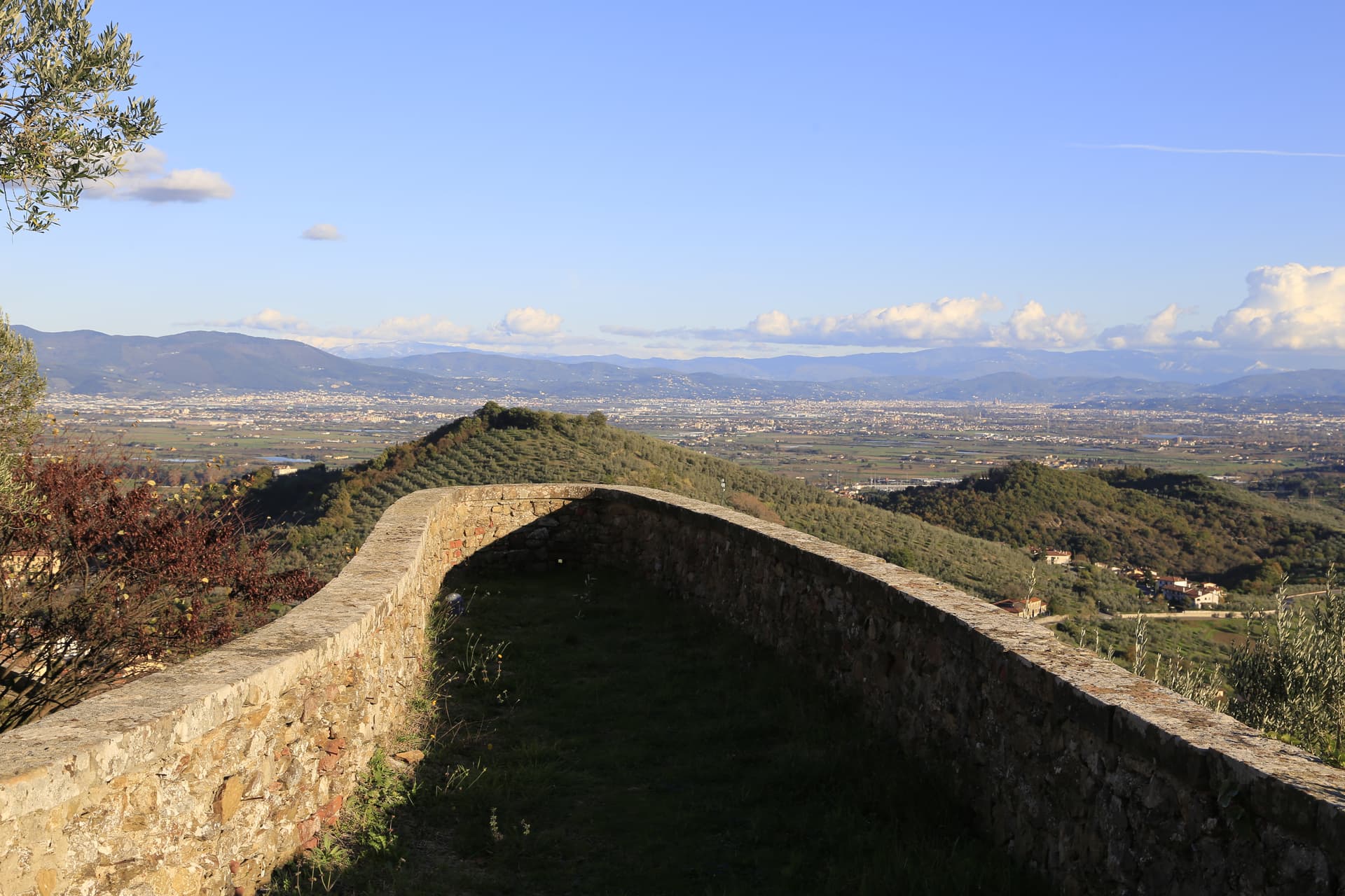
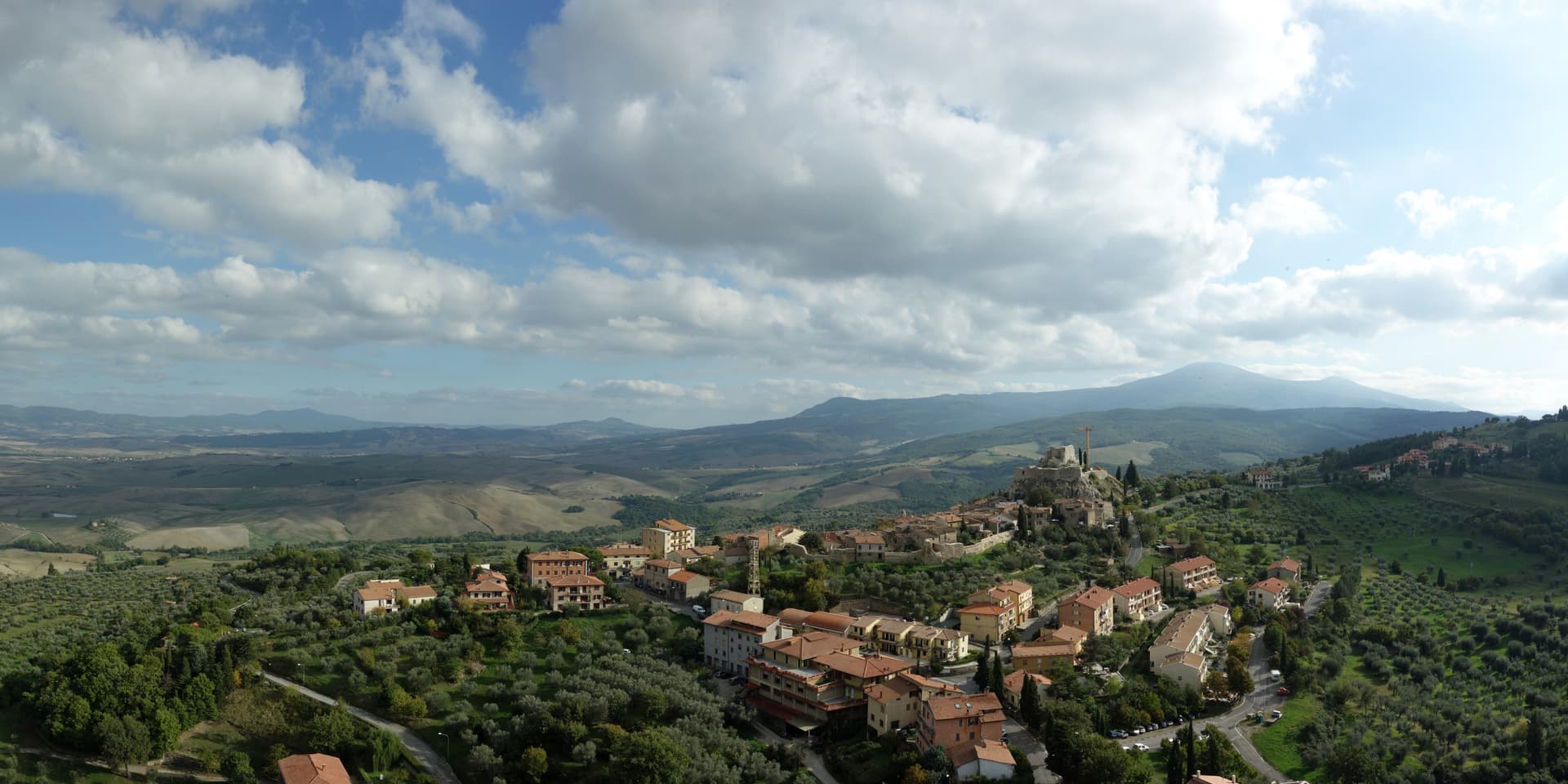
Radicofani is the basalt rock you see from everywhere in southern Tuscany — a perfectly conical 814m volcanic outcrop rising abruptly from the rolling clay hills of the Val d'Orcia, visible from Pienza, Montalcino, Monte Amiata, the Cassia road, and as far as the Lago Trasimeno 60 km away. The Rocca di Radicofani is the fortress on the summit: 12th-c Aldobrandeschi origin, hugely expanded in the 13th c by the legendary outlaw + Ghibelline noble Ghino di Tacco (who held Radicofani as a personal-fief raiding base from 1297 until 1303, robbing pilgrims and high churchmen on the Via Francigena and sending only the most valuable captives back to Pope Boniface VIII with elaborate gallows-humour notes — Dante mentions him as 'l'altro che Pier diventa, vede colei' in Purgatorio VI. 13-15, and Boccaccio dedicates the second novella of the tenth day of the Decameron to Ghino's chivalric robbing of the Abbot of Cluny).
The fortress was further extended by the Sienese (14th c), the Medici (16th c, after Cosimo I bought the territory in 1556), and finally exploded in 1735 when a powder magazine accident destroyed the upper levels. The Renaissance-era surviving lower fortress is restored and visitable, with the panoramic terrace that gives the most expansive single view in southern Tuscany. Beyond the Rocca: Radicofani is on the Via Francigena (the medieval pilgrim road from Canterbury to Rome) at its single most spectacular Italian stop — the 16th-c Posta Medicea (Mediocean stagecoach inn) at the foot of the village hosted Montaigne, Dickens, and pretty much every Grand-Tour traveller heading from Florence to Rome 1500-1850.
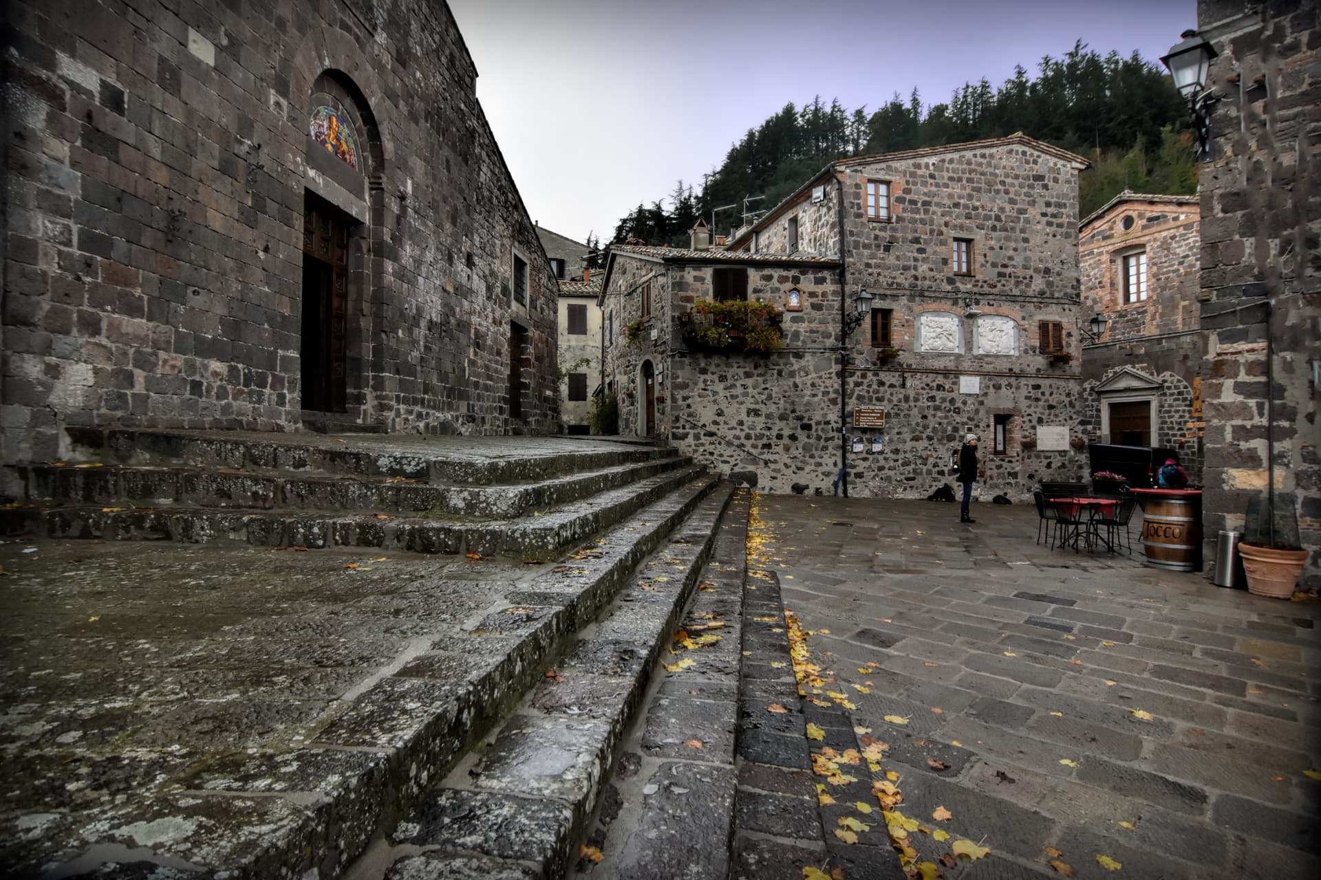
The town is part of the UNESCO Val d'Orcia inscription (2004) and holds the Bandiera Arancione + Via Francigena marks. The 1,060-resident borgo itself is intact medieval — the Pieve di San Pietro (Romanesque), the Chiesa di Sant'Agata (15th-c with Della Robbia altarpiece), the medieval centro climbing in volcanic-basalt stone toward the Rocca. Surroundings: Pienza UNESCO 30 km north, Montalcino 35 km northwest, Monte Amiata (1,738m, extinct volcano) immediately west, the Bagno Vignoni thermal baths 20 km north.
The food is Val d'Orcia Tuscan: pici with hare ragù, pecorino di Pienza, lardo di Colonnata + finocchiona, the Brunello di Montalcino + Vino Nobile di Montepulciano DOCG reds within easy reach. The Festa del Fagiolo (early August) celebrates the local cannellini bean variety; the Festa Medievale (mid-July) recreates Ghino di Tacco's outlaw court. Like all Val d'Orcia hilltop villages, depopulation is heavy — 2,800 in 1951, 1,060 today.

What to see
Rocca di Radicofani
12th-c Aldobrandeschi origin, 13th-c expansion by outlaw Ghino di Tacco (Dante + Boccaccio's bandit), 16th-c Medici extension. 1735 powder-magazine explosion destroyed upper levels. Restored lower fortress + panoramic terrace = the most expansive single view in southern Tuscany.
Via Francigena + Posta Medicea
Single most spectacular Italian stop on the Canterbury-to-Rome pilgrim road. The 16th-c Mediocean stagecoach inn at the foot of the village hosted Montaigne, Dickens, every Grand-Tour traveller 1500-1850.
UNESCO Val d'Orcia centro
Part of the Val d'Orcia UNESCO inscription (2004). Intact medieval centro climbing in volcanic-basalt stone toward the Rocca. Pieve di San Pietro (Romanesque) + Chiesa di Sant'Agata (Della Robbia altarpiece).
Monte Amiata + Bagno Vignoni
Monte Amiata (1,738m extinct volcano) immediately west — chestnut + beech forests, walking trails. Bagno Vignoni thermal baths 20 km north (the unique village built around a thermal pool).
Festa Medievale (mid-July)
Recreates Ghino di Tacco's outlaw court — costumed pageant, archery, falconry. Festa del Fagiolo (early August) celebrates the local cannellini bean variety.
The slow-trip planner
Building a trip? Find where Radicofani fits in a slow Italy circuit.
Answer five questions. We will shape a geographically coherent slow trip from the 1,000 Italian towns most travelers skip. Yours to save and share.
The Sunday letter
Radicofani got its letter. One town every Sunday, free — the photo, the food, the festa.
By subscribing you agree to Substack’s Terms of Use, our Privacy Policy and our Information collection notice.
Living here
- Population 1,060
- Off the beaten pathi
- Pharmacy in town
- High school within a 30-minute drive
- Nearest airport Bologna, 2 h 55 min drive
- Regional capital Firenze, 1 h 56 min drive
Tags & datadesignations · numbers · sources
Recognised as
The numbers
- Elevation: 814 m
- Population: 1,060
- Surface area: 118.1 km²
These figures were compiled from public directories — ISTAT, OpenStreetMap, Wikidata — and from the official listings of the guides named on this page. Town details change; verify with official sources before you travel.
Close by
More towns near Radicofani

San Casciano dei Bagni
Province: Siena
A hilltop borgo at 582 meters above 42 hot springs that produced the largest Etruscan bronze hoard of the last fifty years.
San Quirico d'Orcia
Province: Siena
A walled stop on the Via Francigena at 409 meters in the UNESCO Val d'Orcia, where a twelfth-century Collegiata, a Renaissance garden and the Bagno Vignoni thermal pool sit within fifteen kilometers of each other.
Acquapendente
Province: Viterbo
The northernmost town in Lazio on the Via Francigena, at 420 meters above the Paglia, named in 964 for its waterfalls.
Chiusi
Province: Siena
The Etruscan city of King Porsenna at 398 meters above the Val di Chiana, with one of Italy's major Etruscan museums and tunnels carved beneath the streets.

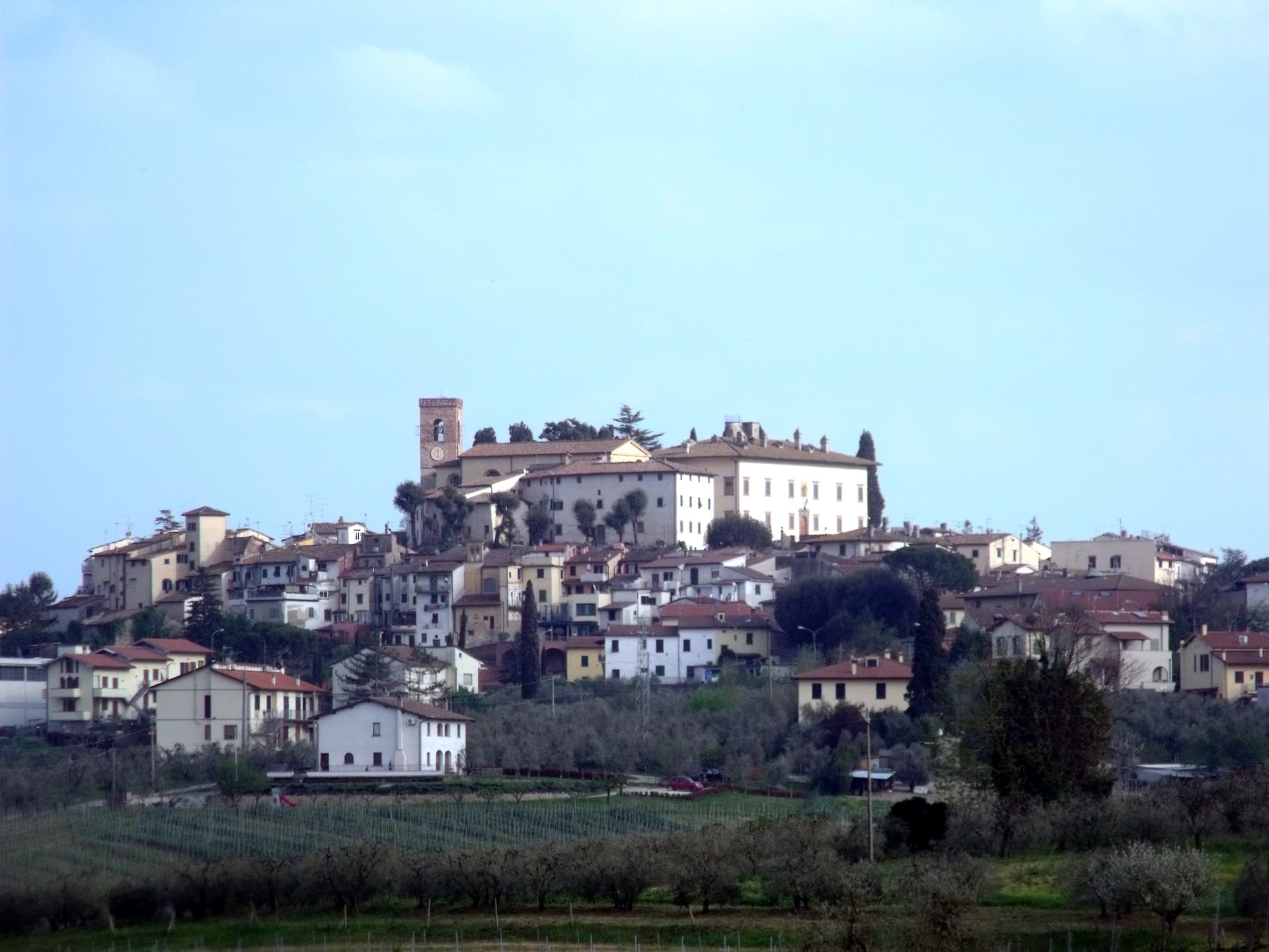
Pienza
Province: Siena
The first Renaissance ideal city, built from 1459 by Bernardo Rossellino for Pope Pius II on the Val d'Orcia ridge.
🏛️ UNESCO
More UNESCO towns in Tuscany
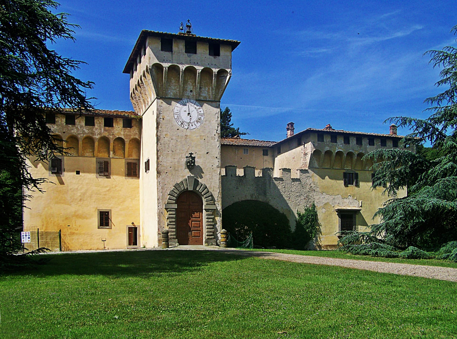
Barberino di Mugello
Province: Firenze
The Mugello gateway at 272 meters where the Medici family kept its first country villas, with Michelozzo's Cafaggiolo and the artificial Lago di Bilancino below.
Carmignano
Province: Prato
A Medici village at 189 meters on the Montalbano slopes, where Pontormo's Visitation hangs in the parish church and Etruscan tumuli sit below the Renaissance villas.
Castiglione d'Orcia
Province: Siena
A stone borgo at 540 meters in the UNESCO Val d'Orcia, first recorded in 714, with two fortresses guarding the road from Amiata to the Via Francigena.
Cerreto Guidi
Province: Firenze
The Medici hunting villa above the Padule di Fucecchio, where Cosimo I sent his court for the marshland game and Buontalenti built four ramps of stairs.
Montalcino
Province: Siena
A walled hill town at 564 meters above the Val d'Orcia, the last fortress to hold out for the Sienese Republic and the birthplace of Brunello.