
Lazio · Latina
Minturno
A coastal comune at the mouth of the Garigliano, built on the Roman colony of Minturnae, five-time Bandiera Blu through Scauri and Marina.
Known for
MINTURNAE
Roman colony founded 296 BC on the Via Appia, with forum, aqueduct, amphitheater and theater preserved at the Garigliano mouth.
BANDIERA BLU x5
Scauri and Marina di Minturno awarded the Bandiera Blu for five consecutive years, the longest run on the southern Pontine coast.
GUSTAV LINE
Garigliano front in 1943-44, when the German defensive line ran straight through the comune; rebuilt around Scauri after the war.
When to visit
Best · May–Sep
- J
- F
- M
- A
- M
- J
- J
- A
- S
- O
- N
- D
- Best
- Hot or crowded
- Quiet
- Mostly closed
Why come
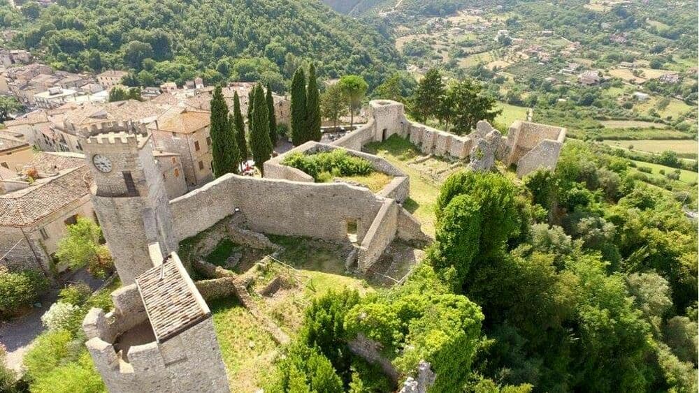
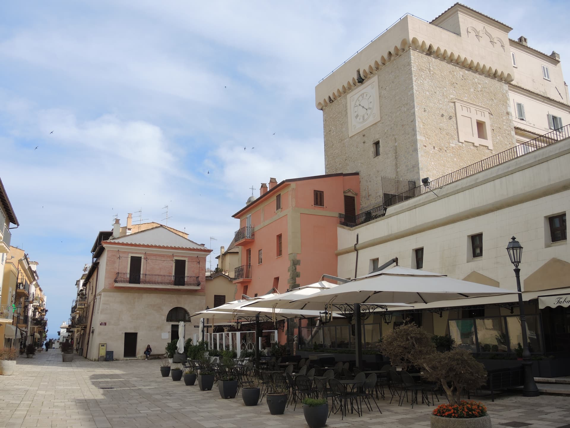
Minturno stands on a hill above the right bank of the Garigliano, with the Scauri and Marina coast running down to the Tyrrhenian. The Romans founded Minturnae as a fort in 296 BC during the Second Samnite War; the colony spread across the lower plain on the Via Appia, with a forum, an aqueduct, an amphitheater and a theater whose remains still stand inside the archaeological park near the river mouth. The medieval town moved uphill for safety after malaria and Saracen raids, and the Castello Baronale at its center carries layers from the ninth century onward.
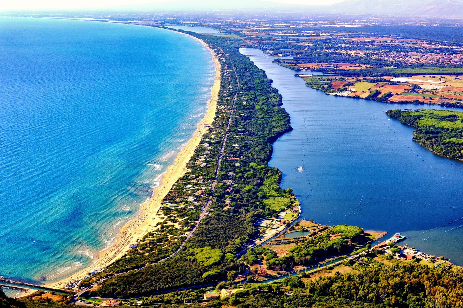
The coast was a Gustav Line battlefield in 1943-44 and was rebuilt around the bathing village of Scauri after the war. The commune has now held the Bandiera Blu five years running for Scauri and Marina di Minturno, the only coastal stretch in the lower Pontine area to consistently keep the recognition. Olive country runs inland; Minturno is a member of the Città dell'Olio network.
The Sunday letter
We haven’t written Minturno’s letter yet.
One town every Sunday, with the photo, the food, the festa. Be there when this one comes up. Free, by Peter & Sophia from Pietrasanta.
By subscribing you agree to Substack’s Terms of Use, our Privacy Policy and our Information collection notice.


What to see
Parco Archeologico di Minturnae
Roman colony at the mouth of the Garigliano, with theater, forum, aqueduct and amphitheater on the lower Via Appia.
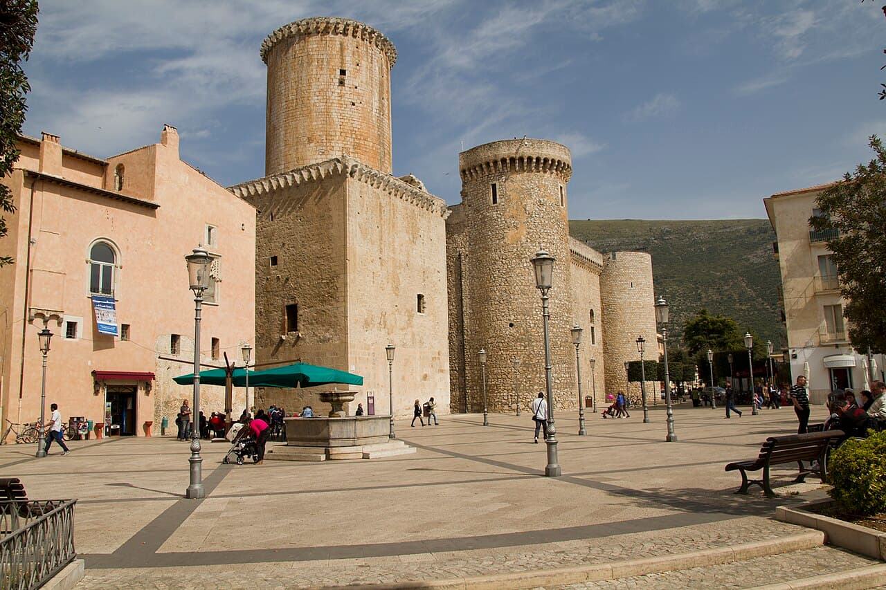
Castello Baronale
Ninth-century castle in the hilltop centro storico, expanded by the Caetani and the Carafa across the medieval period.
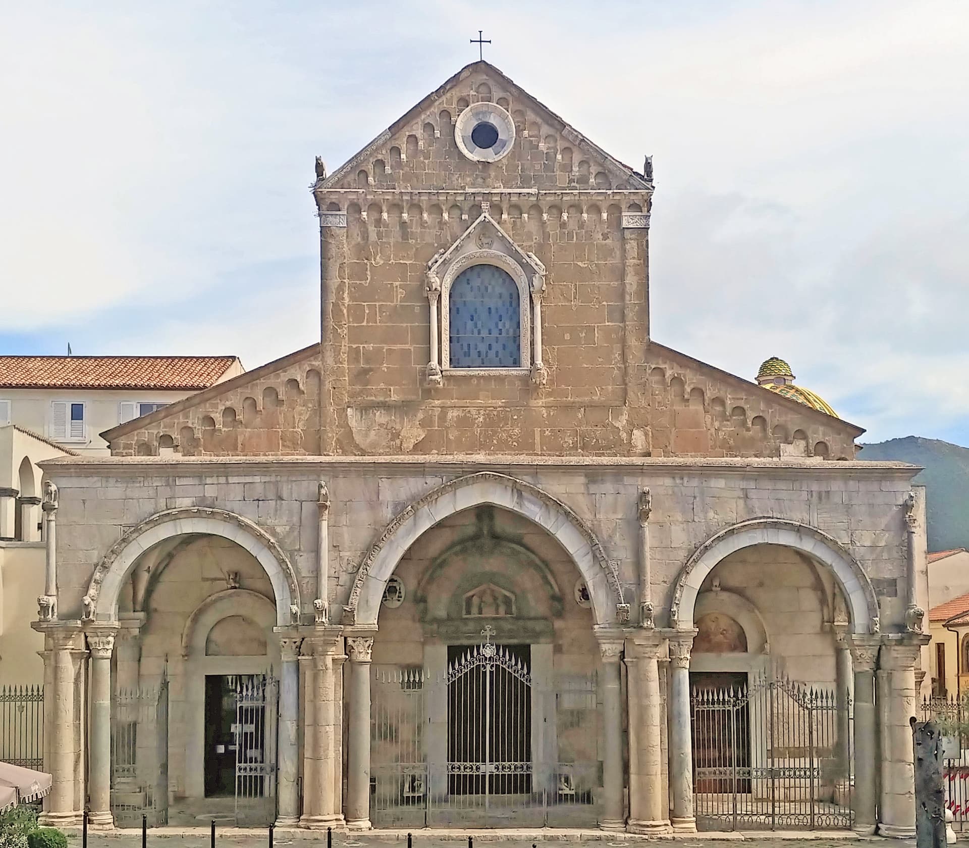
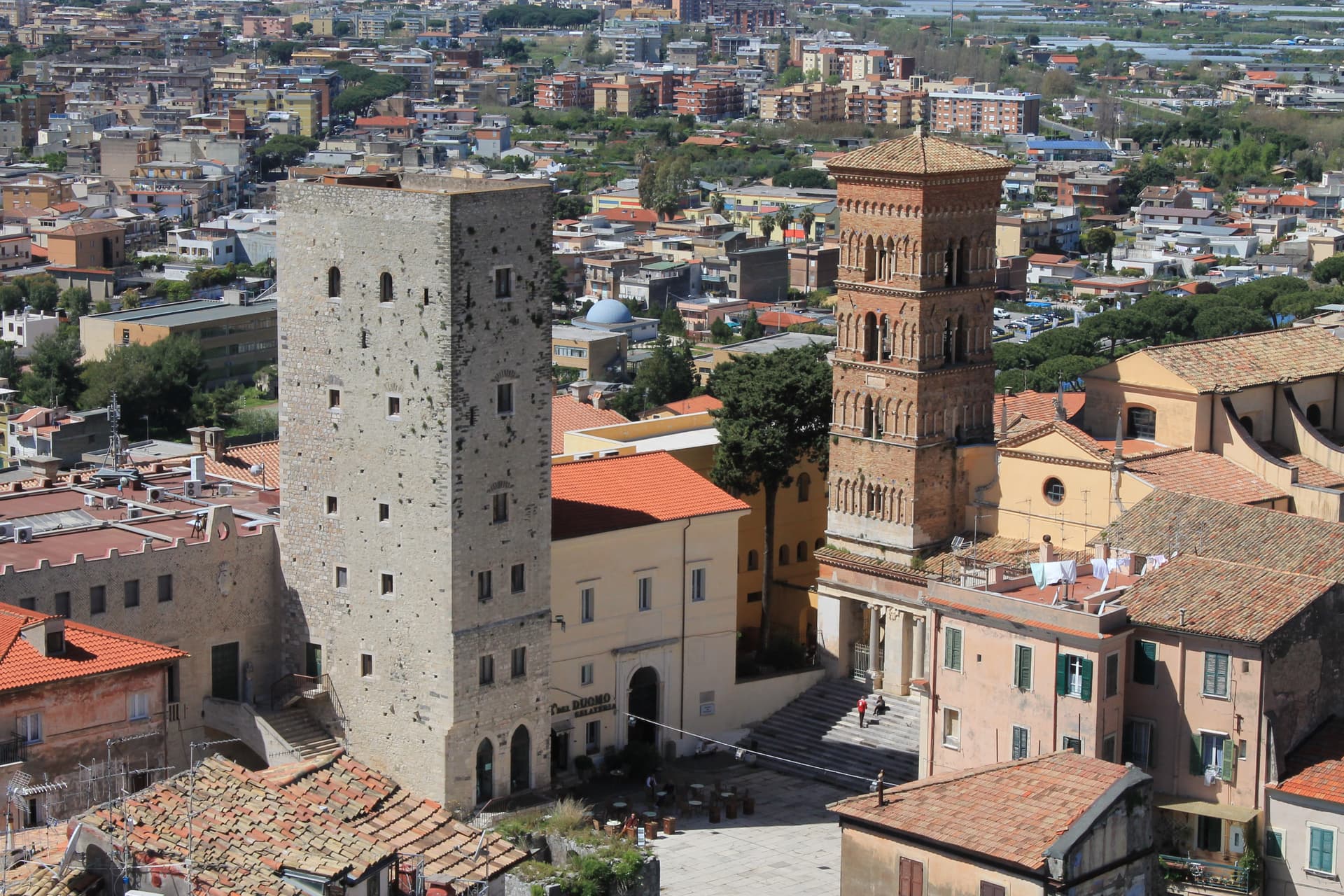
Basilica di San Pietro Apostolo
Medieval basilica in the upper town, with a cosmatesque pulpit and Easter candlestick from the twelfth and thirteenth centuries.
Scauri and Marina di Minturno
Bandiera Blu coast for five consecutive years, with a long pebble-and-sand beach and the Torre di Scauri on the headland.
Via Francigena del Sud
Southern Francigena stage from Roma to Brindisi, crossing the Garigliano at Minturno along the old Via Appia route.
The slow-trip planner
Building a trip? Find where Minturno fits in a slow Italy circuit.
Answer five questions. We will shape a geographically coherent slow trip from the 1,000 Italian towns most travelers skip. Yours to save and share.
Living here
- Population 20,268
- Commuter belti
- Pharmacy in town
- High school within a 30-minute drive
- Train station in the comune
- Nearest airport Naples / Salerno, 1 h 15 min drive
- Regional capital Roma, 2 h 4 min drive
Tags & datadesignations · numbers · sources
The numbers
- Elevation: 140 m
- Population: 20,268
- Surface area: 42.14 km²
These figures were compiled from public directories — ISTAT, OpenStreetMap, Wikidata — and from the official listings of the guides named on this page. Town details change; verify with official sources before you travel.
Close by
More towns near Minturno
Sessa Aurunca
Province: Caserta
Ancient Suessa Aurunca on the south slope of an extinct volcano, with a Romanesque cathedral of Cosmatesque mosaics built in 1103.
Gaeta
Province: Latina
The promontory port where the Bourbon Kingdom of the Two Sicilies fell in February 1861 and the south of Italy stopped existing as a state.
Sperlonga
Province: Latina
A whitewashed cliff town on Monte San Magno halfway between Rome and Naples, built above the sea grotto where Tiberius staged the Odyssey in marble.
Fondi
Province: Latina
The plain town between the Ausoni and Aurunci mountains where the Caetani built a castle in the middle of farmland instead of on a hill.
Pico
Province: Frosinone
Tommaso Landolfi's home town — a 2,634-resident Ciociaria borgo at 220m on the Monti Ausoni between Rome and Naples, with the Castello Baronale dei Boncompagni (now the Casa Museo Tommaso Landolfi for the eccentric 20th-c Italian fantastic-realism writer), a BPB-inscribed medieval centro, and the surrounding Monti Ausoni hiking + wild boar country.
🟦 Bandiera Blu
More Bandiera Blu towns in Lazio
Sabaudia
Province: Latina
A rationalist city built in 253 days on drained Pontine marshland, founded 15 April 1934 between Lago di Paola and the Tyrrhenian dunes.
San Felice Circeo
Province: Latina
A medieval borgo on the flank of Monte Circeo, the 540-meter promontory Homer made the home of Circe in the Odyssey.
Terracina
Province: Latina
The Volscian Anxur on the Via Appia, where Jupiter's temple sits 227 meters above a port Trajan cleared through stone.