Basilicata · Matera
Pisticci
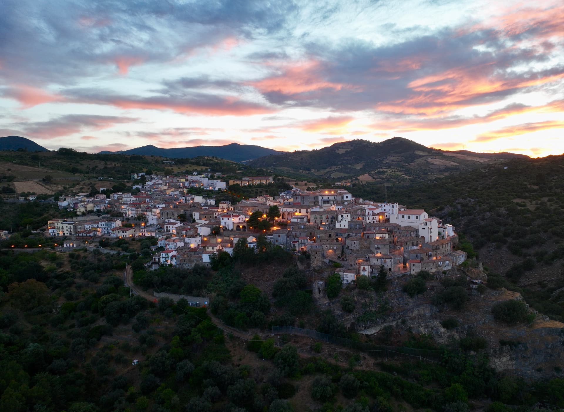
A hill town above the Ionian, rebuilt in three hundred identical white houses after the 1688 landslide killed four hundred.
Known for
DIRUPO
Three hundred identical white houses rebuilt in straight lines after the 1688 landslide, when survivors refused to abandon the hill.
MARINA
Twenty kilometers down to the Ionian, where Marina di Pisticci holds the Bandiera Blu and the pine forest backs onto the sand.
TRUFFLE
Black truffle from the clay hills around the town, anchor of the Città del Tartufo designation and several autumn fairs.
When to visit
Best · Apr–Oct
- J
- F
- M
- A
- M
- J
- J
- A
- S
- O
- N
- D
- Best
- Hot or crowded
- Quiet
- Mostly closed
The festa: San Rocco, 16 August
Why come
Pisticci sits on three eroded clay hills in the southern Matera province, twenty kilometers from the Ionian beach at Marina di Pisticci, and serves as the most populous town in the province after Matera itself. On 9 February 1688, a violent landslide cut the town in half, killing four hundred people and destroying entire districts. The survivors refused to move down to the valley.
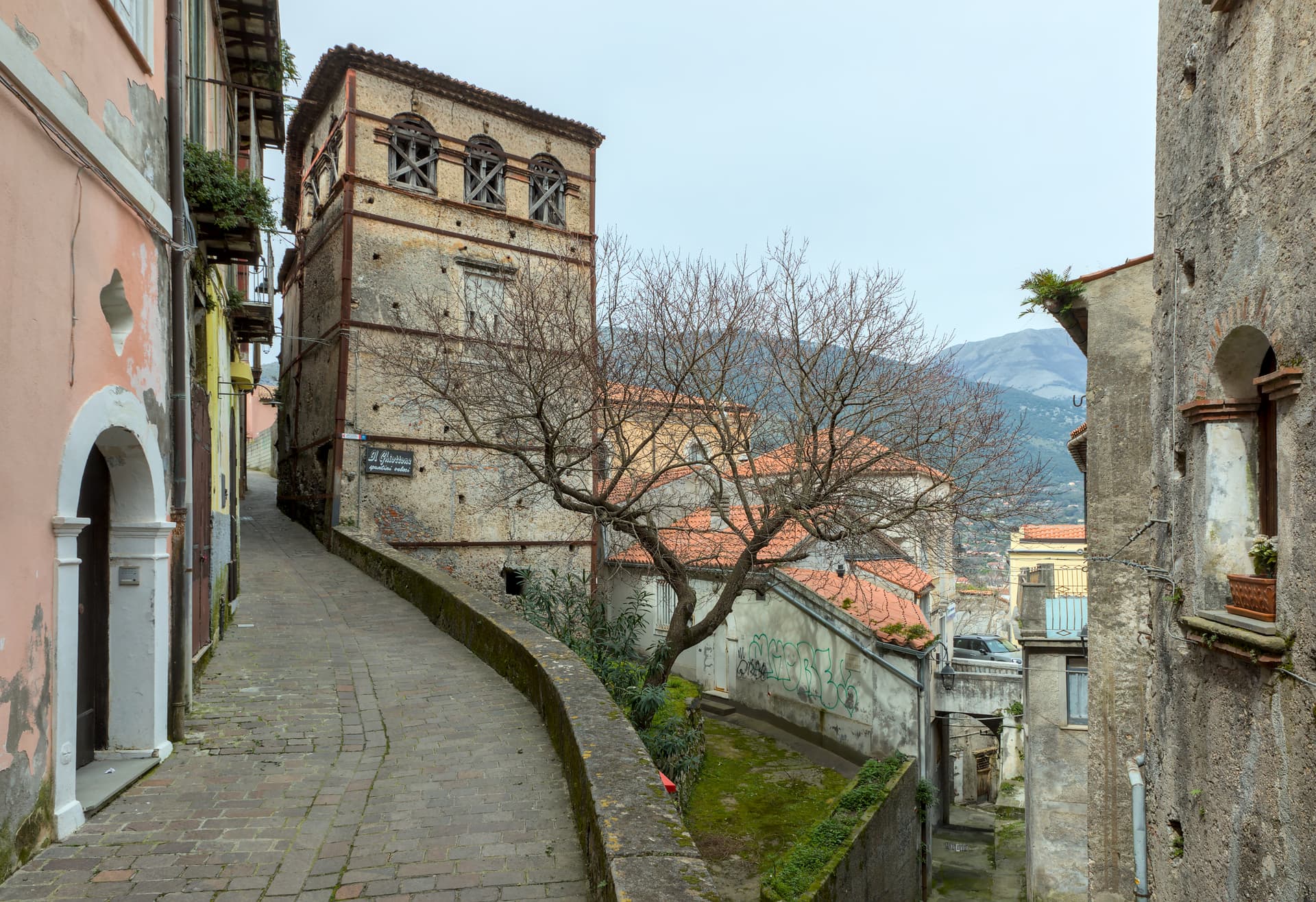
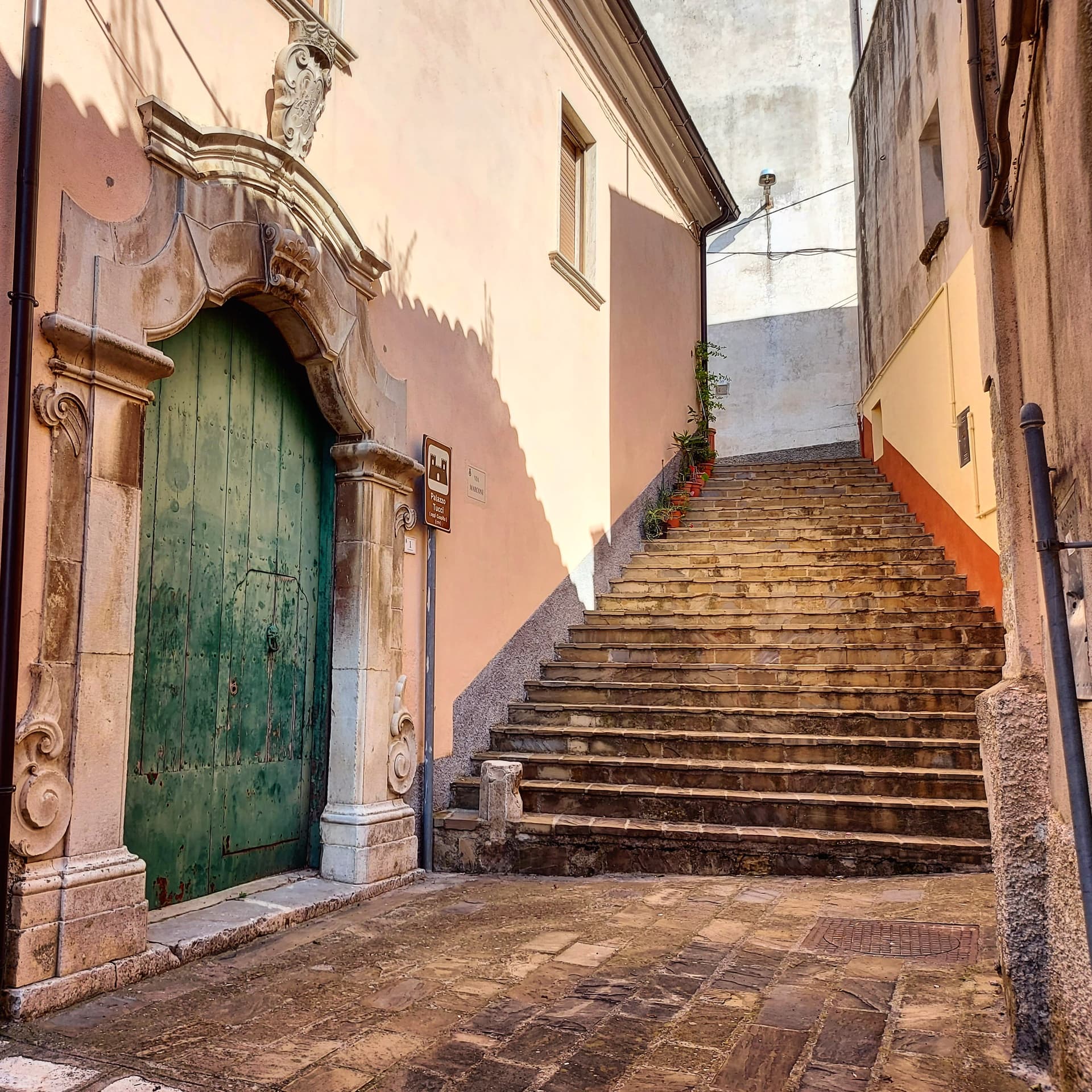
They rebuilt where the landslide had passed, in straight lines of identical low white houses, each two rooms wide with a pitched red tile roof, the rione that came to be called the Dirupo, the cliff. Three hundred of these houses still stand, the visual signature of the town. The older Terravecchia district sits on the highest hilltop, with the square tower of the Norman castle, the medieval gate, and the Chiesa Madre.
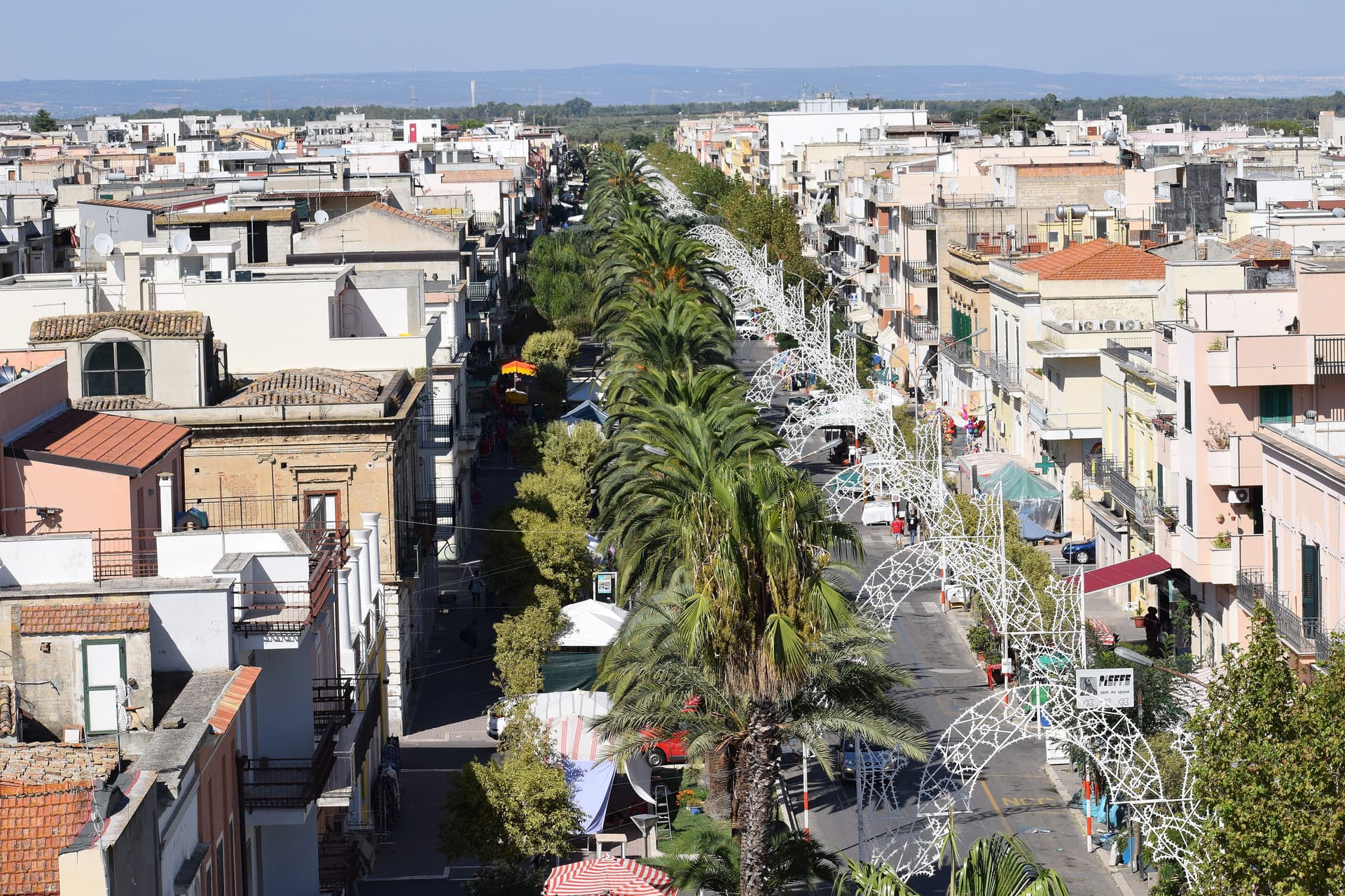
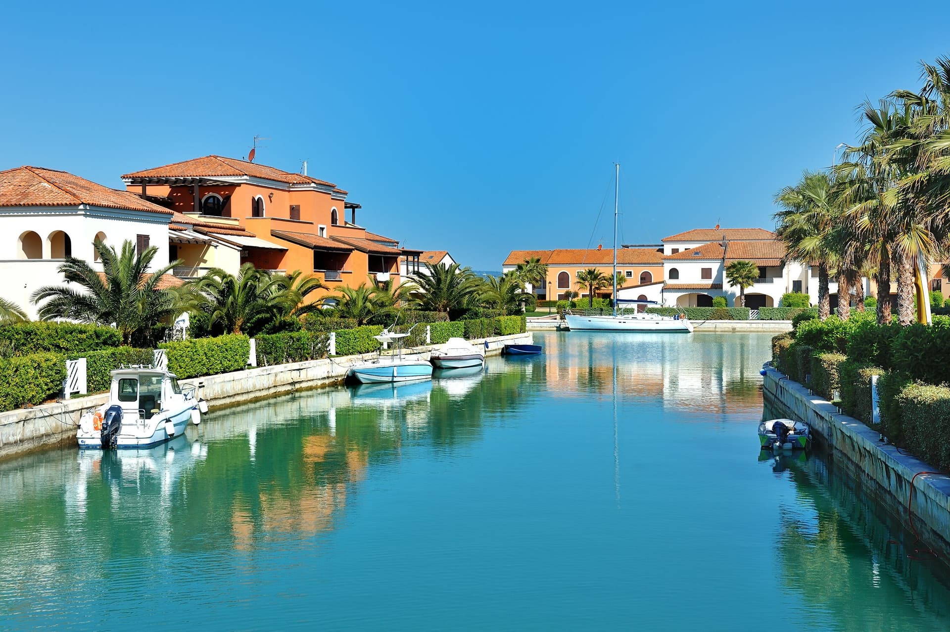
The coastal frazione of Marina di Pisticci holds the Bandiera Blu, and the surrounding clay hills produce truffles that anchor the Città del Tartufo designation. The hamlet of Marconia, named for Guglielmo Marconi, is the modern centre on the plain.
The Sunday letter
We haven’t written Pisticci’s letter yet.
One town every Sunday, with the photo, the food, the festa. Be there when this one comes up. Free, by Peter & Sophia from Pietrasanta.
By subscribing you agree to Substack’s Terms of Use, our Privacy Policy and our Information collection notice.


What to see
Rione Dirupo
About three hundred identical low white houses rebuilt in straight lines after the 1688 landslide, the most photographed and most lived-in district of the town.
Terravecchia
Oldest district on the highest hill, with the square tower of the Norman castle, the medieval gate, the Chiesa Madre and the noble palazzi of the pre-1688 town.
Marina di Pisticci
Coastal frazione on the Ionian, twenty kilometers from the centro storico, a Bandiera Blu beach with pine forest backing the sand.
Chiesa Madre dei Santi Pietro e Paolo
Mother church in the Terravecchia district, rebuilt several times, the highest building of the medieval town and visible from the calanchi below.
Calanchi di Pisticci
Bare clay badlands flanking the town, the same eroded geology that triggered the 1688 collapse, walking trails out from the Dirupo.
The slow-trip planner
Building a trip? Find where Pisticci fits in a slow Italy circuit.
Answer five questions. We will shape a geographically coherent slow trip from the 1,000 Italian towns most travelers skip. Yours to save and share.
Living here
- Population 16,708
- Off the beaten pathi
- Pharmacy in town
- High school within a 30-minute drive
- Train station in the comune
- Nearest airport Bari / Brindisi, 1 h 53 min drive
- Regional capital Potenza, 1 h 35 min drive
Tags & datadesignations · numbers · sources
The numbers
- Elevation: 364 m
- Population: 16,708
- Surface area: 233.67 km²
These figures were compiled from public directories — ISTAT, OpenStreetMap, Wikidata — and from the official listings of the guides named on this page. Town details change; verify with official sources before you travel.
Close by
More towns near Pisticci
Bernalda
Province: Matera
A 127-meter hill town between the Bradano and Basento, Francis Ford Coppola's ancestral home, holding the Magna Graecia columns of the Tavole Palatine.
Policoro
Province: Matera
A Ionian-coast town on the Gulf of Taranto built on the ruins of the Greek polis of Heraclea — birthplace of the Tavole di Eraclea bronze inscriptions and home to one of the region's most-visited Bandiera Blu beaches and the National Museum of the Siritide.
Craco
Province: Matera
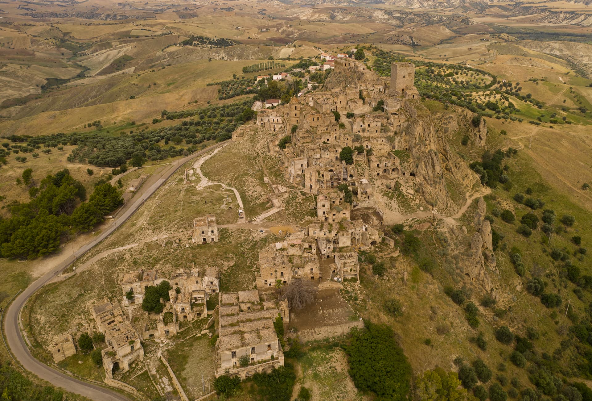
A medieval ghost town on a 391-meter clay cliff, abandoned after the 1963 landslide and the 1980 Irpinia earthquake, filming location of Gibson and Bond.
Nova Siri
Province: Matera
A 350-meter Ionian hill town with a Blue Flag beach nine kilometers below, near the site of the ancient Greek colony of Siris.
Rotondella
Province: Matera
The 'Balcony of the Ionian' — a 2,400-resident Lucanian borgo on a 576m hilltop overlooking the Metapontino plain and the Ionian Sea, with intact medieval streets, the Chiesa di Santa Maria della Neve, and a high-quality DOP olive oil from the surrounding terraced groves.
🟦 Bandiera Blu