
Umbria · Terni
Terni
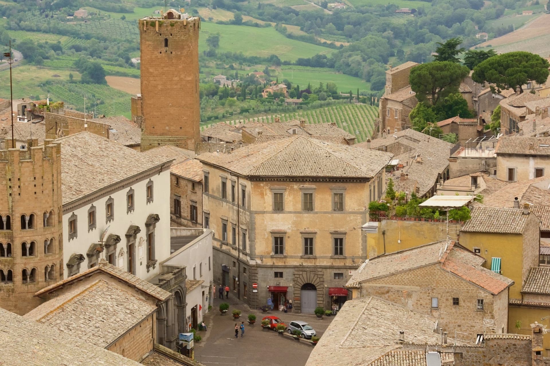
Umbria's second city, rebuilt around its steelworks, home of Saint Valentine and seven kilometers from the Cascata delle Marmore.
By Peter Benei
Written about. No. 88.
The letter
Terni got its letter. One town at a time, free. The photo, the food, the festa.
Visiting
- Best time
- Apr–Oct
- By car
- 1 h 7 min from Perugia
- By train
- Station in the comune
- Population
- 106,310
- J12°
- F14°
- M16°
- A19°
- M24°
- J30°
- J35°
- A34°
- S27°
- O22°
- N17°
- D13°
- Best
- Hot or crowded
- Quiet
- Mostly closed
Daytime air temperature, averages for 2020–2024. Weather data by Open-Meteo.com.
Why come
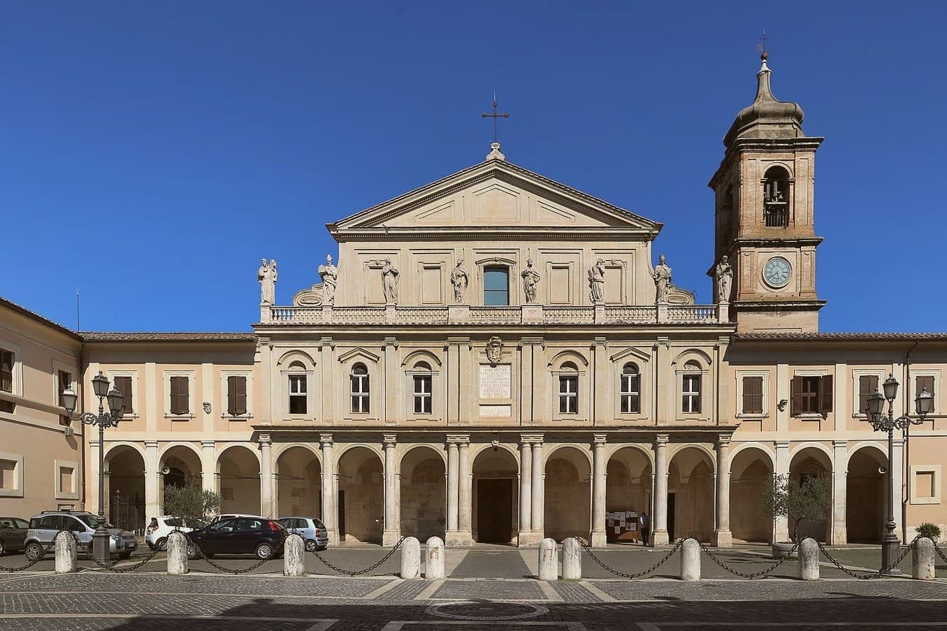
Terni is the Roman Interamna, the town between two rivers, and it shows its history in layers. The Anfiteatro Fausto of 32 AD sits in the city park, the Duomo keeps a sixth-century crypt, and Palazzo Spada, the town hall, may be the last work of Antonio da Sangallo the Younger. From the nineteenth century the water of the Nera drove steelworks, arms factories and jute mills, and that made Terni a target: Allied raids from August 1943 destroyed or damaged 40 percent of its buildings.
The 12,000-ton steel press in Piazza Dante is the city's own monument to that past. Terni is also the city of Saint Valentine, its third-century bishop, whose basilica on the edge of town holds his remains. Seven kilometers up the Valnerina, the Romans cut a channel through the cliff at Marmore in the third century BC and made a waterfall of 165 meters. Lake Piediluco lies just beyond it, and the ruins of Carsulae sit on the Via Flaminia to the north.
How to get there
From Rome Fiumicino (FCO), about 1 h 32 min by car.
Ancona (AOI) is about 2 h 27 min away.
By car from the center of Perugia 1 h 7 min or Siena 2 h 16 min.
There is a railway station in the comune, so you can arrive without a car.
Coming from Rome?
Coming by train into Perugia? Terni is about 1 h 7 min away by road.
Every town within reach of Rome Fiumicino airport.
First time driving in Italy? Read our complete manual.
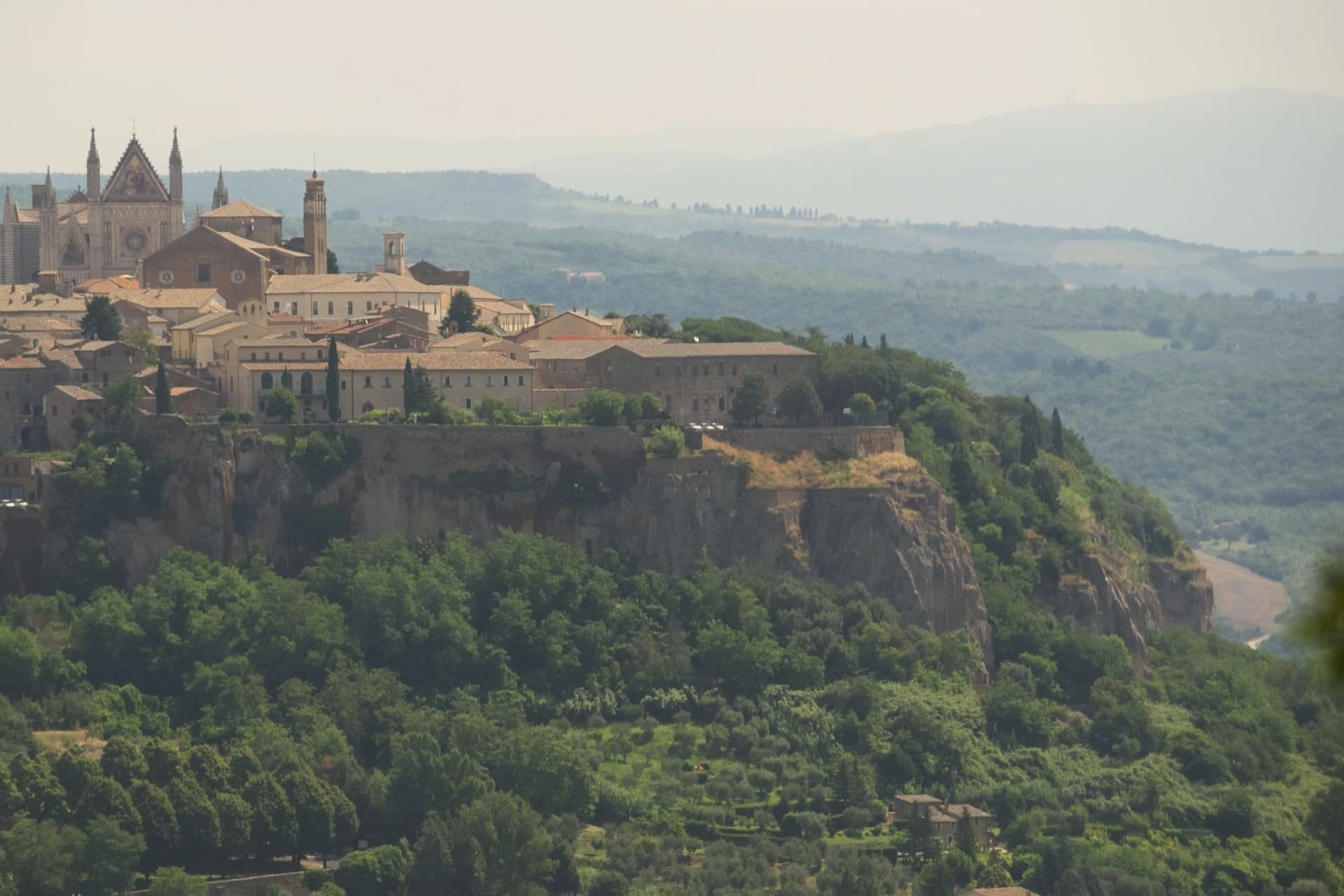
What to see
Cascata delle Marmore
Falls of 165 meters made by the Romans to drain the Rieti plain. The water is released on a timetable, so check the opening hours before going.
Basilica di San Valentino
Built on the hill where followers buried the town's bishop after his martyrdom in 273; the present church dates from 1618 and keeps his remains.
Anfiteatro Fausto
Roman amphitheater of 32 AD in the park of La Passeggiata, with walls of two-tone reticulated stonework.
Palazzo Spada
The town hall on Corso Vecchio, finished in 1576 to a design by Antonio da Sangallo the Younger.
Carsulae
Ruins of a Roman town north of the city, with the Arco di San Damiano and a stretch of the original Via Flaminia.
From the guides
Where to eat
Not our picks, but places the guides put their name to: a Michelin star, a Gambero Rosso fork, a Slow Food snail, a Michelin Key for the hotels. Worth a table, a counter, or a night when you pass through.
Lillero Trattoria ModernaTrattoria
Lillero Trattoria Moderna has two Gambero Rosso prawns and a Slow Food snail.
Oste della Mal'OraWine Bar
Oste della Mal'Ora holds two Gambero Rosso bottles.
Before you sit down: how to order at a restaurant, how to spot a tourist trap, what aperitivo is and how the Italian bar works.
Living here
Could you live here?
Terni is a city.
- A city of 106,310 people, and a provincial capital: the services are here, not a drive away.
- A station of its own, so the rest of Italy is a train ride away.
The rules come from our series Where to Move in Italy, written from the places we have lived: Part 1, The End of the Road · Part 2, The Small Town · Part 3, The City · Part 4, The Postcard · Part 5, The Other Half. The towns we would pick are in Part 6, The Best Towns.
- Population 106,310, down 4.6% since 2015
- Train station in the comune
- A national health service hospital in the comune · how healthcare works in Italy
- Homes in the center: €950 to €1,800 per m² to buy, €4.70 to €8.40 per m² a month to rent
All the numbers Common questions, designations, lists and sources.
More about living here
- A local hub
- Pharmacy in town
- High school within a 30-minute drive
- Full fibre reaches 85% of homes
- Primary school in the comune
- Earthquake zone 2, medium hazard
- Perugia airport (PEG), 1 h 5 min drive, the nearest with scheduled flights
- Regional capital Perugia, 1 h 7 min drive
If you are moving here
Who lives here
13% of residents are foreign citizens, most often from Romania, Albania and Ukraine, against 9% across Italy. 122 of them come from English-speaking countries or western and northern Europe, mostly France, the United Kingdom and Germany. There are 276 people over 65 for every 100 children under 15, against 216 across Italy. 16% of homes have no resident, holiday homes and empty ones counted together, against 27% across Italy. Terni province ranks 48th of 107 in Il Sole 24 Ore's quality of life ranking for 2025.
Health and schools
There is a major emergency department in the comune. The nearest IB school is Viterbo International School, 47 km as the crow flies.
Information, not medical advice. Confirm with a professional.
Working from here
Poste Italiane has finished a coworking room in the comune, on its register of 30 September 2026. Check that it is open on Poste's booking site before you count on it.
Taxes
A home that is not your main one pays 1.06% a year in property tax, charged on the cadastral value rather than the price. A main home pays none unless it is in a luxury category. The town adds 0.8% to your income tax, with nothing due on income under €12,500. 7% pensioner tax: this town is not in a qualifying area.
Information, not tax advice. Confirm with a professional.
What it costs
The average household in Umbria spends about €2,310 a month, €550 of it on food, against about €2,170 across Italy. A family of three pays about €677 a year for water, on the Umbria average. In Terni, the provincial capital, in September 2026, an espresso cost €1.22, a meal in a pizzeria €12.97 and a man's haircut €22.65.
Climate and risk
It is in climate zone D, on a scale from A, the warmest, to F, the coldest, and heating may run from November 1 to April 15, up to 12 hours a day, unless the mayor changes it. 6% of residents live in a zone the national maps rate high for floods, 10% in a high or medium one. Under 1% live in a zone rated high or very high for landslides.
These shares cover the whole comune, not any one street. Check an address on IdroGEO.
Moving from abroad? Which visa you need. Sources: ISTAT, the Ministry of Health, ISPRA, the Finance Ministry, the Ministry of Enterprise, Poste Italiane, the comuni, the IB, International Schools Database, Il Sole 24 Ore, Cittadinanzattiva.
Known for
SAN VALENTINO
Terni's third-century bishop and patron saint; the city keeps his feast on 14 February and calls itself the City of Lovers.
STEEL CITY
Steel has been made here since the nineteenth century, and the stainless steel works on the east side of town still run.
MARMORE
The waterfall the Romans made in the third century BC, at 165 meters among the highest in Europe.
Common questions
- What is Terni known for?
- Umbria's second city, rebuilt around its steelworks, home of Saint Valentine and seven kilometers from the Cascata delle Marmore.
- Where is Terni?
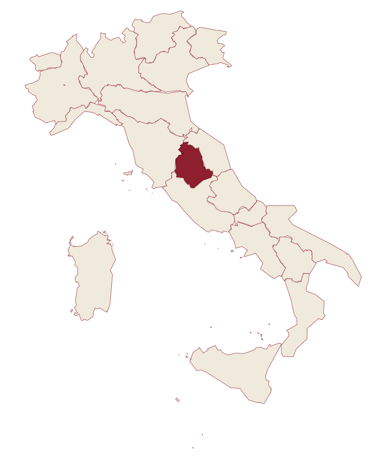
- Terni is a comune in the province of Terni, in Umbria, at 130 meters above sea level.
- What is the nearest airport to Terni?
- The nearest airport with scheduled flights is Perugia (PEG), about 1 h 5 min by car.
- Can you get to Terni without a car?
- Yes. There is a railway station in the comune, so you can arrive by train.
- How long is the drive from Perugia to Terni?
- About 1 h 7 min by car.
- When is the best time to visit Terni?
- Best in Apr–Oct. July is the warmest month, averaging 35 degrees, and December the wettest, with about 13 rain days.
- Which other towns are like Terni?
- Trento, Lucca and Ascoli Piceno.
- How many people live in Terni?
- 106,310 residents, by ISTAT's count on 1 January 2025.
- Is Terni a good place to live?
- Terni is a city of 106,310 people, the kind of place Part 3 of our Where to Move in Italy series is about. There is a national health service hospital in the comune. Full fibre reaches 85% of homes.
Tags & data designations · numbers · sources
Recognized as
The numbers
- Elevation: 130 m
- Population: 106,310
- Surface area: 212.43 km²
These figures were compiled from public directories: ISTAT, OpenStreetMap and Wikidata, and from the official listings of the guides named on this page. Town details change; verify with official sources before you travel.
The ranked lists
Lists Terni appears in
- The 7 best towns on a walking route that sit inside a nature park in UmbriaUmbriainside a parkon a walking route7 towns · smallest 2,493 residents
- The 8 best towns on a walking route that you can reach by train in UmbriaUmbriaon a walking routeby train8 towns · smallest 7,927 residents
- The best towns on a walking route that eat well within 90 minutes of PerugiaNear Perugiaon a walking routewithin 90 mineats well8 towns · smallest 1,421 residents · closest 33 min away
- The best hill towns on a walking route within 90 minutes of PerugiaNear Perugiahill townon a walking routewithin 90 min9 towns · smallest 2,014 residents · closest 33 min away
- The best hill towns in the province of TerniTerni provincehill town10 towns · smallest 1,396 residents
Near here, with a letter
- Written about. No. 82.
Narni
Province: Terni
Narni is a hilltop town on a travertine outcrop above the Nera valley whose Latin name, Narnia, gave C.S. Lewis a word for a fictional kingdom he never set foot in.
19 min by car
- Written about. No. 73.
Acquasparta
Province: Terni
A hill town at 350 meters above the Naia valley, where a Renaissance duchy briefly became the seat of Europe's first scientific academy.
22 min by car
- Written about. No. 75.
Amelia
Province: Terni
A pre-Roman hilltown ringed by polygonal walls, with ten barrel-vaulted Roman cisterns beneath its main square.
18 km away
The letter
Terni got its letter. One town at a time, free. The photo, the food, the festa.
Paid plans, the moving year and the books are on the membership page.