
The 10 best high-altitude villages within 90 minutes of Bolzano
Ten villages: what each is best for, what a home costs, and the catch. A square meter runs from €1,900 in Falcade to €9,500 in St. Ulrich.
From the 1,000 towns picked by Peter Benei.
93 towns written about, 907 to go. Follow along, free: Subscribe on Substack
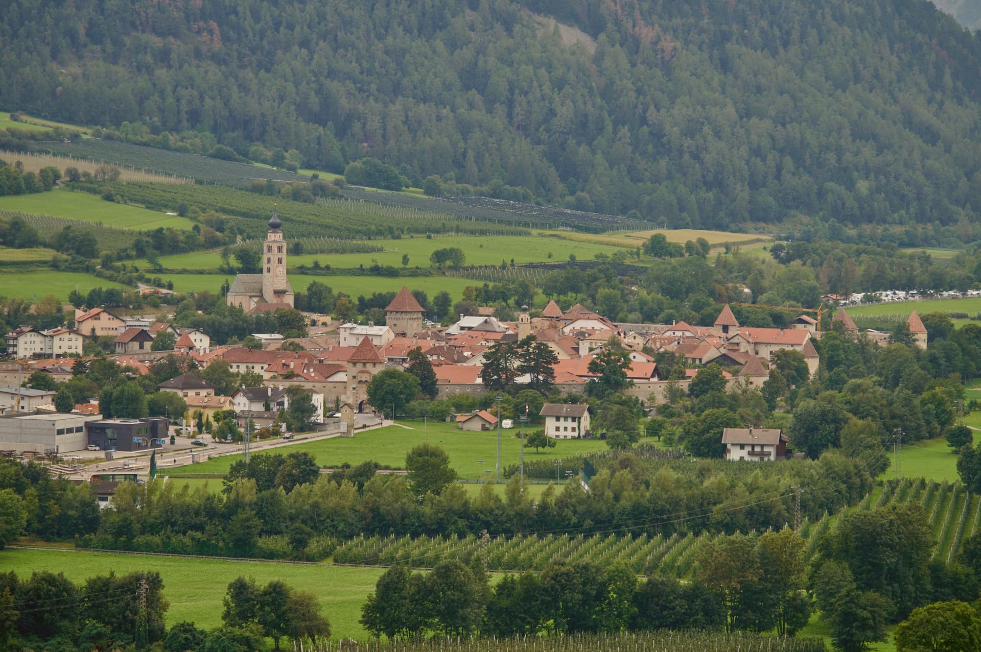
Altitude changes everything in South Tyrol. Above the vineyards and apple orchards of the Adige valley the air thins, the pasture opens out, and the buildings turn to weathered larch above whitewashed stone, with hay barns standing in fields that go green and then gold across a short summer. The food follows the height: speck cut thick, canederli in broth, barley soup, cheese from mountain dairies, apple strudel eaten at four in the afternoon. Winter brings snow that stays, and menus in German, Italian and Ladin on the same wall.
paragraphs are lost on the crowd at Lago di Braies, where the queue for the boathouse photograph starts before breakfast and the car parks fill by mid-morning. Cortina d'Ampezzo takes a similar load from the other side, its main street busy with people who came for the name rather than the mountain. Both are good places. Both are also where the coaches stop, which means the same view costs an hour of patience and a parking fee.
The Dolomites do not end at the famous lake, and the high valleys that feed into Bolzano carry villages that live off farming and skiing rather than day-trippers. These are places set high on the slope, in the Gardena, Badia, Fassa and Pusteria valleys and up toward the Brenner, where the church bell still organises the day and the ski lift is a local service before it is an attraction. Fewer people go, and the walking starts from the door.
Of the 14 communes we have mapped within 90 minutes of Bolzano, 10 qualify as high-altitude villages: each sits at 800 metres or higher. The smallest, Glurns, has 933 residents.
Elsewhere in the catalogue: The best small mountain towns within 90 minutes of Bolzano and The 9 best small high-altitude villages that eat well in Trentino-Alto Adige.
All the towns within a day trip: day trips from Bolzano.
1. Glurns
Best for walks in a national park. Part of the comune lies in a national park.
1 h 25 min from Bolzano · homes €2,400 to €2,700 a m² in the center · 933 people
Why visit Glurns
The town sits at 907 meters in the upper valley, twenty minutes by car from both the Austrian and Swiss borders, on the Adige river at the southern entrance to the national park. City status was awarded by Emperor Henry of Bohemia in 1304, an honor that has stayed attached to the place ever since even as the population inside the walls stayed under a thousand.
After the Battle of Calven in 1499, the Habsburgs under Emperor Maximilian I rebuilt the town as a bulwark against the forces of the Three Leagues of Graubünden, and it is that rebuilding which produced the fortification standing today. The walled core and the church outside it mark the two halves of the town: the streets and Lauben arcades, paved in cobble, enclosed within the ring of walls, and the parish church standing apart on the riverbank, holding its own late Gothic frescoes away from the defended center.
A city built for defense against the Three Leagues of Graubünden still reads, in its layout, as a place organized entirely around the line where the walls stand and the ground just beyond them: the guarded interior on one side, the river and the open approach to the mountains on the other.
The village sits at 907 meters.
The catch: The nearest airport, Verona, is 3 h 2 min away by road.
What to see in Glurns
- Mura cittadine. Walls built under Emperor Maximilian I after 1499, following the Battle of Calven, as a bulwark against the forces of the Three Leagues of Graubünden. The patrol path still runs continuous along the inside face.
- Centro storico. Walled core of unbroken three-storey Lauben arcades along the two main streets, paved in stone and listed on the Borghi più belli d'Italia.
- Chiesa di San Pancrazio. Parish church just outside the walls on the bank of the Adige, with a Gothic nave and a series of late medieval wall frescoes inside.
How to get to Glurns
Bolzano is about 1 h 25 min away by road.
Our tip
May through October is the open season in the upper Val Venosta. Late May brings green on the valley floor and the start of the Stelvio Park hiking calendar from Glorenza north. June through September is the busiest period, with the Stelvio passes open, the Adige cycle path running from Resia south, and Glorenza markets under the arcades on Tuesdays and Fridays.
2. Corvara in Badia
Best for a small town. 1,446 people live here.
1 h 15 min from Bolzano · homes €4,200 to €8,300 a m² in the center · 1,446 people
Why visit Corvara in Badia
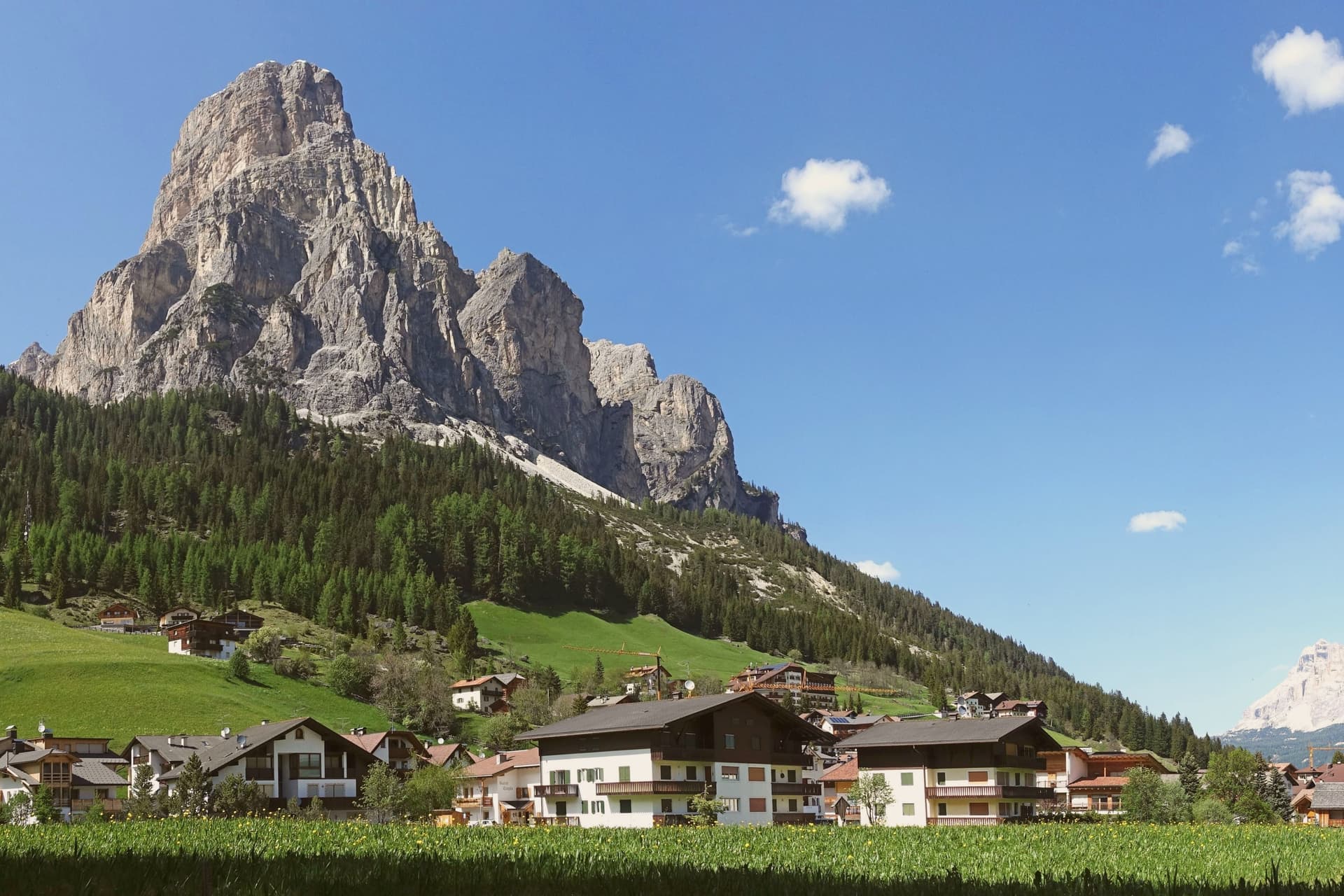
Corvara sits at 1,568 meters in a wide basin at the head of the Val Badia, below the rock spire of the Sassongher and inside the Dolomites UNESCO area. Ladin is the everyday language: in the 2024 census 87 percent of residents named it as their first tongue, with Italian and German distant second and third.
The settlement was a scattered group of farms until tourism arrived in the early twentieth century, and Corvara is considered the birthplace of organized Alpine tourism in the Val Badia. The village is one of four bases on the Sellaronda, the forty-kilometre ski circuit that loops the Sella massif through Corvara, Arabba, Canazei and Selva di Val Gardena on a single lift pass.
Above the village, the Pralongià plateau opens a long view to the Marmolada glacier. The Gran Risa piste at the next hamlet of La Villa hosts the men's giant slalom on the World Cup tour each December.
The village sits at 1568 meters.
The catch: January nights average 10 degrees below zero.
What to see in Corvara in Badia
- Chiesa di Santa Caterina. Late Gothic church first documented in 1347 and consecrated to Saint Catherine in 1452, holding the only well-preserved winged altar in Val Badia, dated 1520.
- Sassongher. Rock peak at 2,665 meters above the village, the signature silhouette of Corvara and a classic via ferrata climb on the eastern flank.
- Altopiano di Pralongià. Grassy plateau above the village reached by cable car, with open views to the Marmolada glacier and the surrounding Dolomite groups.
How to get to Corvara in Badia
Bolzano is about 1 h 15 min away by road.
Our tip
December through March is the ski season, the village at full capacity around the Sellaronda lifts, with the men's World Cup giant slalom on the Gran Risa each December at La Villa next door. June through September is the summer Dolomite season, cool even in July at 1,568 meters, with hiking, via ferrata and gravel cycling across the Pralongià plateau and the Puez-Odle park. April and May are quiet shoulder months, snow gone from the village but lifts mostly closed and hotels shut between seasons.
3. Falcade
Best for a ski week. There is a mapped ski area in the comune.
1 h 17 min from Bolzano · homes €1,900 to €2,800 a m² in the center · 1,746 people
Why visit Falcade
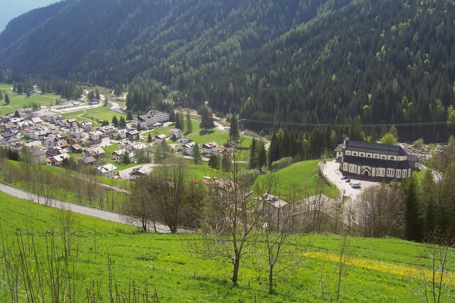
Falcade sits at 1,148 meters in the upper Biois valley, the southwestern corner of the Agordino, ringed by the Focobon group, the Pale di San Martino, the Marmolada and the Civetta. First settlers arrived between the tenth and eleventh centuries, and trade with the neighboring Fassa and Fiemme valleys built through the medieval period, carried over the col that still connects the Agordino to Trentino.
The village works as a hinge between two mountain worlds: the sharp Focobon spires of the Pale di San Martino rise to the south and the Marmolada group to the north, with the pass threading west between them as it has since travelers first needed shelter there. Summer walkers follow the Alta Via 2 through this gap, between peaks that were shaped by the same geology the UNESCO listing recognizes.
The valley's long function as a crossing point, medieval trade route, refuge, ski link, explains why a settlement this size sits exactly where the Agordino gives way to Trentino.
The village sits at 1148 meters.
The catch: January nights average 7 degrees below zero.
What to see in Falcade
- Focobon group. The massif rises directly south of the village, its spires visible from the valley floor. The Alta Via 2 threads past it toward the Forcella delle Comelle.
- Trevalli ski area. Linked ski domain across the Falcade-Le Buse and Passo San Pellegrino-Alpe Lusia areas, slopes up to 2,500 meters.
- Passo San Pellegrino. 1,918-meter col into the Val di Fassa, with a travelers' hospice documented from 1358 and now a working ski station.
How to get to Falcade
Bolzano is about 1 h 17 min away by road.
Our tip
December through March is the working winter: the Trevalli lifts open, the San Pellegrino pass runs as a ski station, and the village fills to capacity over Christmas and Carnival. June through September is the summer half, with walking on the Alta Via 2, the Forcella delle Comelle traverse to the Pale di San Martino, and refuge dinners on the Mulaz and the Bottari. April, May, October and November are the dead months.
4. Canazei
Best for a long lunch. Food guides list four tables here.
1 h 4 min from Bolzano · homes €4,400 to €5,300 a m² in the center · 1,915 people
Why visit Canazei
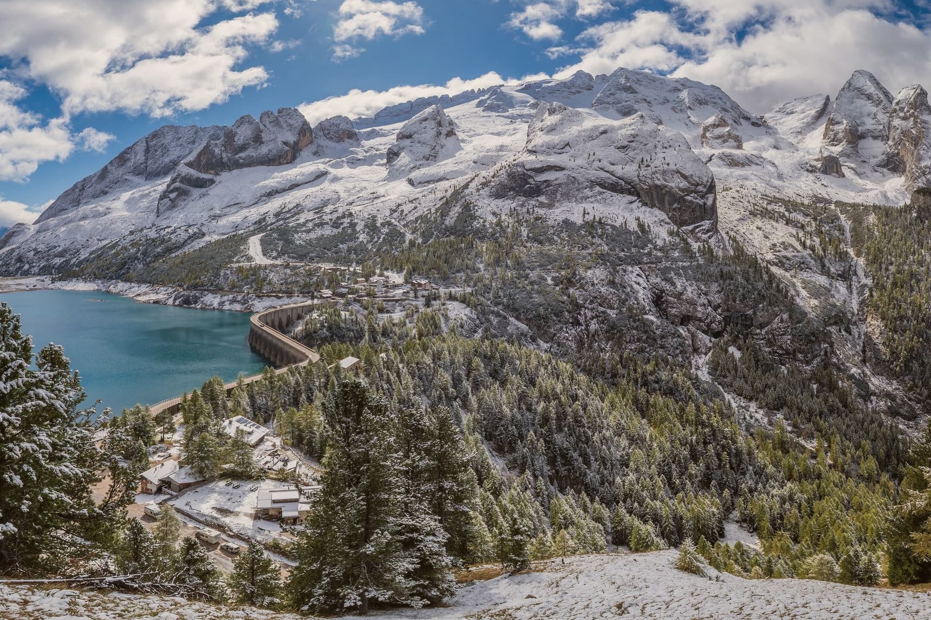
Canazei sits at 1,465 meters at the head of the Val di Fassa, one of the thirty highest towns in Italy, ringed by the Marmolada, the Sella Group and the Sassolungo. The commune includes the hamlets of Alba, Gries and Penia, which run together with the central village along the upper Avisio river.
Eight in ten residents speak Ladin as their first language, part of the small Dolomitic minority recognized by the autonomous statute, and the local Folk Group preserves the costumes, music and language traditions of the valley. The Belvedere and Ciampac lifts leave from the village itself, Col Rodella rises from neighbouring Campitello, and the Marmolada cable car runs from Malga Ciapèla beyond the Fedaia Pass, all within the Dolomiti Superski circuit.
The Pordoi cable car climbs to the Terrazza delle Dolomiti at 2,950 meters for a full view of the surrounding peaks, including the Marmolada at 3,343 meters, the highest summit in the Dolomites and a UNESCO World Heritage site since 2009.
The village sits at 1465 meters.
The catch: The nearest airport, Venice Marco Polo, is 2 h 35 min away by road.
What to see in Canazei
- Marmolada. Highest summit in the Dolomites at 3,343 meters, reached by cable car from Malga Ciapèla beyond the Fedaia Pass, with the largest glacier in the Dolomites on its northern face.
- Passo Pordoi. Dolomite road pass at 2,239 meters with a cable car to Sass Pordoi at 2,950 meters, called the Terrazza delle Dolomiti for its 360-degree view.
- Belvedere Ski Area. Main winter base of Canazei, gondola-linked to the Sellaronda circuit and the lift system across the four Ladin valleys of the Sella group.
How to get to Canazei
Bolzano is about 1 h 4 min away by road.
Our tip
December through March is the ski season, the village's busiest months, with the Sellaronda circuit running from the Belvedere base and snow held above 1,500 meters into early April. June through September is the summer alpine season, with the Pordoi cable car running to the Terrazza delle Dolomiti and a full network of hiking and via ferrata routes on the Marmolada, Sassolungo and Sella. July and August are the peak months, with refuges full and bookings tight on the Fedaia and Pordoi passes.
5. Moena
Best for a long lunch. Food guides list six tables here.
1 h 5 min from Bolzano · homes €3,400 to €4,400 a m² in the center · 2,571 people
Why visit Moena
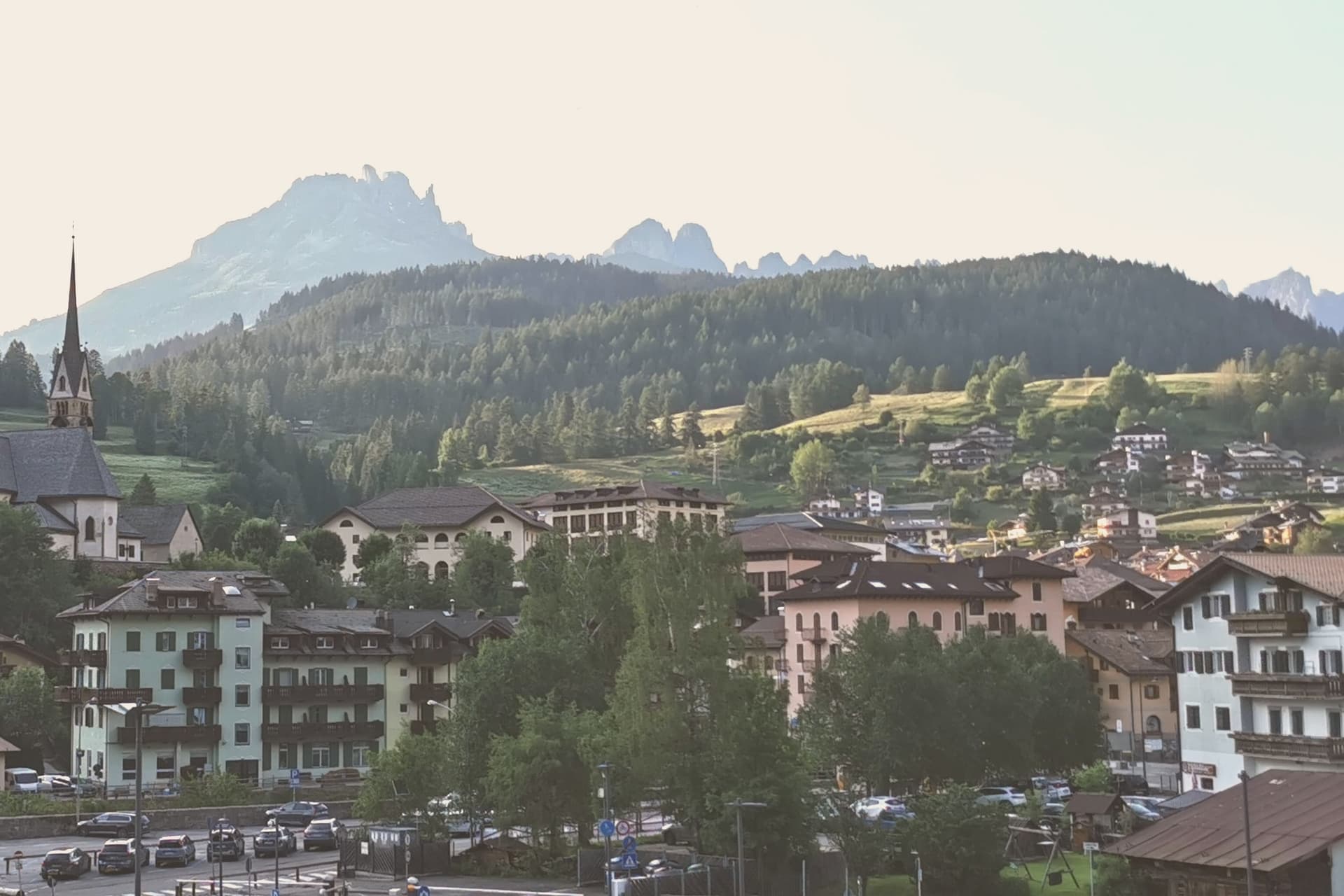
Moena sits at 1,184 meters at the entrance to Val di Fassa, which climbs north toward Canazei and the Sella massif. To the southeast a side valley rises toward the Passo San Pellegrino and the Marmolada group, while a plateau above the village, reached by cable car, opens onto the Catinaccio, Latemar and Pale di San Martino to the south.
The village is the largest in the valley and functions as its entrance point, with the high peaks visible on three sides and the pastures of San Pellegrino working land rather than backdrop. What holds the place together is less the geography than what the two festivals and the church commemorate: a language kept alive as an everyday tongue, a costume festival built around a foreign soldier's arrival, and a painter who left and came back.
Moena reads less like a single Alpine village and more like a crossing point, between valleys, and between a local story and the outside events that keep getting folded into it.
The village sits at 1184 meters.
The catch: The nearest airport, Treviso, is 2 h 30 min away by road.
What to see in Moena
- Chiesa di San Vigilio. Parish church rebuilt across the centuries, with a gilded wooden altar by Valentino Poschiavin and 18th-century paintings by Valentino Rovisi. It also holds work by Domenico Chiocchetti.
- Chiesa di San Volfango. Small Romanesque church next to the parish, with 15th-century frescoes and a wooden Baroque ceiling carved by Giovanni Guadagnini in the 17th century.
- Museo Ladin de Fascia (sezione Moena). The Ladin cultural museum network with a Moena exhibit on local language, costume and rural life in the lower Val di Fassa.
How to get to Moena
Bolzano is about 1 h 5 min away by road.
Our tip
June through September brings the green Dolomite season: alpine pastures open, the Catinaccio and Latemar are walkable from the cable cars above town, and the August Turchia festival fills the streets for three days. December through March is the ski half of the year, with lifts running on Alpe Lusia and over the Passo San Pellegrino into the Tre Valli circuit. April, May, October and November are quiet, between seasons.
6. Cavalese
Best for everyday life on foot. Eight of the ten everyday services we look for are mapped within 500 meters of the center.
48 min from Bolzano · homes €2,500 to €3,100 a m² in the center · 4,010 people
Why visit Cavalese
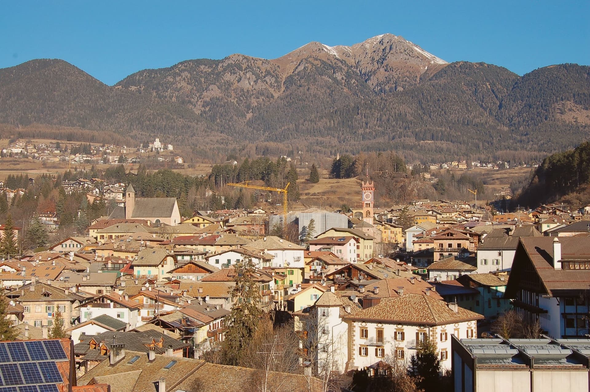
Cavalese sits at 1,000 meters on a south-facing terrace above the Avisio, forty kilometers northeast of Trento, the main town of the Val di Fiemme. The valley's eleven communes held their forest commons in common under the Magnifica Comunità, the self-governing body founded by the founding charter of 1111, and Cavalese has kept its seat through the Bavarian abolition of 1807 and every legal change since.
The valley floor carries the working memory of that governance: the archive of parchments, the frescoed council chambers, the bench in the open air where disputes were once judged. Above the town, the cableway to the Alpe Cermis climbs to about 2,000 meters, and the cycle path along the Avisio ties Cavalese to the other Fiemme communes strung along the valley floor from Molina up to Predazzo and on into Fassa.
Nine centuries of continuous self-rule and a valley of communes bound by a single river explain why Cavalese reads less like a single town than like the administrative floor of the whole valley.
The village sits at 1000 meters.
The catch: January nights average 4 degrees below zero.
What to see in Cavalese
- Palazzo della Magnifica Comunità di Fiemme. Medieval bishop's residence enlarged in the Renaissance, seat of the community since 1810, with a picture gallery and an archive of parchments from the thirteenth to eighteenth centuries.
- Pieve di Santa Maria Assunta. Parish church of Cavalese, consecrated in 1134 on an older foundation, standing beside the park where the valley's representatives once sat in judgment.
- Banco della Reson. Stone bench in the Parco della Pieve where the Scario and the Regolani of the valley communes met as an open-air assembly to judge valley disputes until 1808.
How to get to Cavalese
Bolzano is about 48 min away by road.
Our tip
June through September is the high-valley season: meadows open above 1,000 meters, the Latemar and the Lagorai are reachable on day walks from the town, and the cycle path along the Avisio fills with day-trippers. December through March is the ski season on Alpe Cermis and the Lavazè plateau, with snow held above 1,000 meters into early April and the Tour de Ski final climb up the Cermis slope each January. April, May, October and November are the quiet shoulder months between the seasons, when the cable car runs reduced schedules and the valley returns to its residents.
7. St. Ulrich
Best for a ski week. There is a mapped ski area in the comune.
43 min from Bolzano · homes €5,400 to €9,500 a m² in the center · 4,724 people
Why visit St. Ulrich
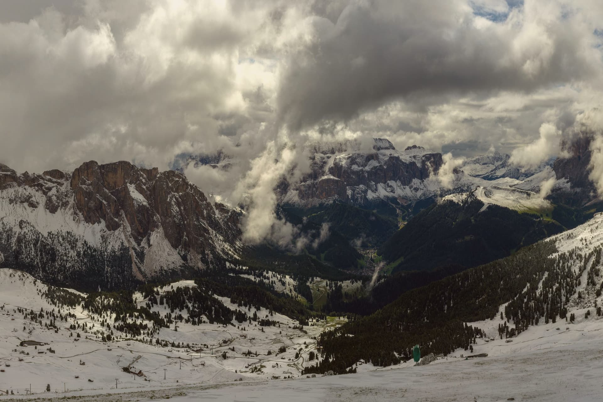
The valley climbs east from the Eisack toward the Sella and the Sassolungo, and the town sits at its middle point. Almost all residents speak Ladin at home, and signage runs trilingual in Ladin, German and Italian.
Three lifts leave the village in three directions: one to the northwest onto a plateau, one north onto a long ridge below the Odle, and one south onto a high meadow that forms the valley's southern edge. The museum inside the Cësa di Ladins holds the record of the valley's carving tradition alongside fossils from the surrounding peaks and material on Luis Trenker, the mountaineer-actor-director who came from here.
The layout, a village hemmed by three lifts and named for the saint of its own parish church, reads as a place organized entirely around the ground it sits on: craft below, peaks and plateaus in every direction above.
The village sits at 1236 meters.
The catch: January nights average 6 degrees below zero.
What to see in St. Ulrich
- Parish church (St. Ulrich/San Udalrico). Neoclassical church with Baroque elements, rebuilt in the late 18th century, dedicated to the Epiphany and to St. Ulrich, the patron saint who gives the town its German name.
- Museum Gherdëina. Local-heritage museum inside the Cësa di Ladins documenting four centuries of woodcarving, wooden toys, sacred sculpture, Dolomite fossils and the Trenker family archive.
- Seceda. Long limestone ridge reached by cable car from the village, with the Odle/Geisler peaks rising sharply to the north and high meadows dropping toward the valley.
How to get to St. Ulrich
Bolzano is about 43 min away by road.
Our tip
June through September is the green Dolomite season: the Alpe di Siusi opens fully, the Seceda ridge is walkable from the cable car, and the rifugi of the Odle and Sassolungo run their full summer programs. December through March is the ski half of the year, with the Sellaronda circuit accessed directly from Ortisei. April, May and November are the closure months.
8. Sterzing
Best for a slow weekend. The Touring Club gives it its orange flag for small inland towns.
1 h 8 min from Bolzano · homes €2,500 to €3,200 a m² in the center · 7,032 people
Why visit Sterzing
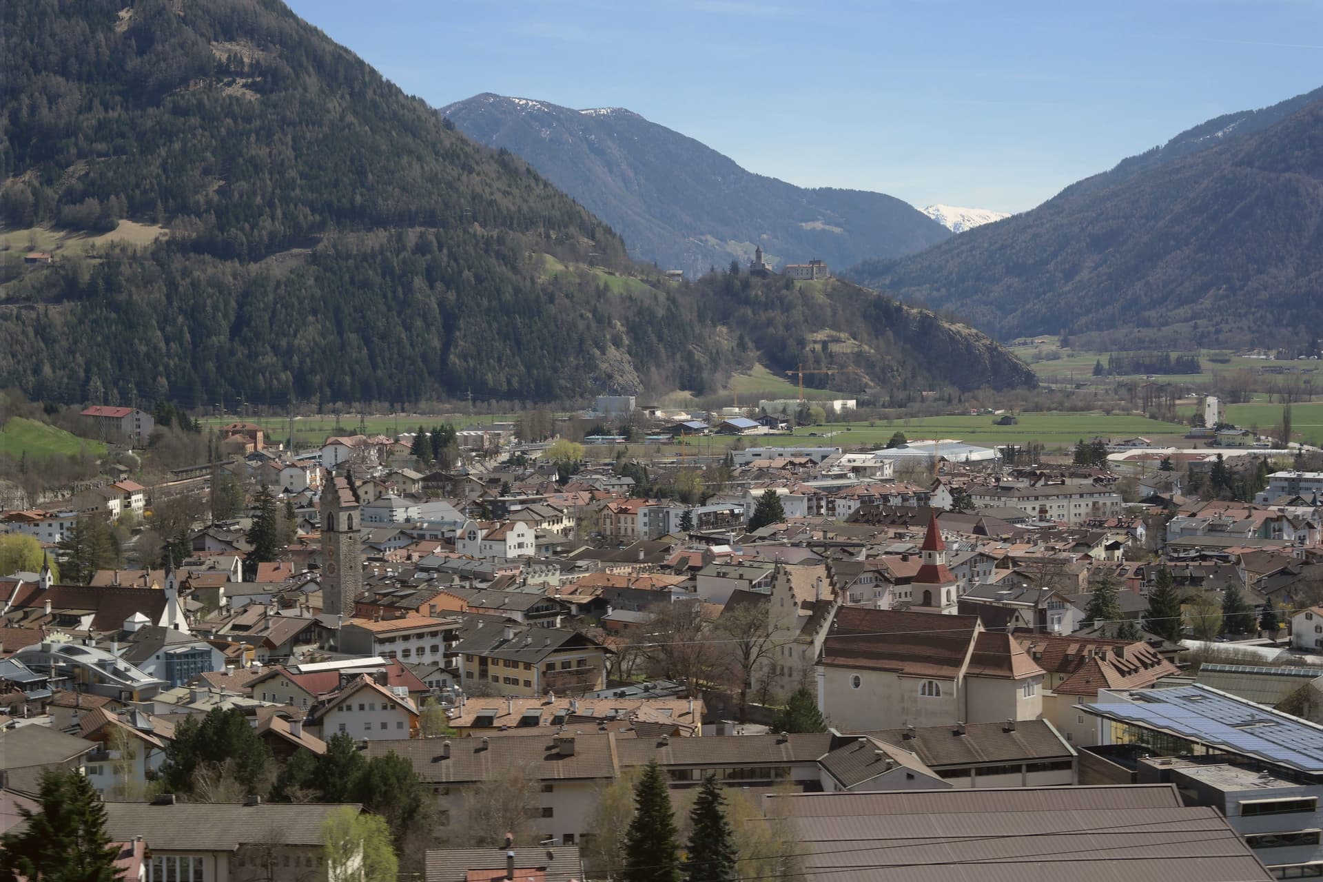
Vipiteno sits at 948 meters in the upper Wipptal, twelve kilometers south of the Brenner Pass and the Austrian border, with the Eisack river running through the medieval town and the Stubai Alps rising on three sides. The German-speaking population calls it Sterzing and outnumbers the Italian speakers by roughly three to one.
The town grew rich in the late fifteenth century from silver and lead mined in the Schneeberg deposits of the Ridnaun and Pflersch valleys to the west, and from its position on the Brenner trade route. The mines belonged to the Fuggers of Augsburg, the banking family who financed Habsburg emperors; Vipiteno is still sometimes called Fuggerstadt.
The Zwölferturm, a forty-six meter tower built in 1472, stands at the center of Piazza Città and divides the Altstadt from the Neustadt, the two halves of the medieval town. Both halves are lined with painted facades, oriel windows and stepped gables built when the silver flowed.
The village sits at 948 meters.
The catch: The nearest airport, Verona, is 2 h 47 min away by road.
What to see in Sterzing
- Zwölferturm. Forty-six meter tower built in 1472 at the center of Piazza Città, dividing the Altstadt from the Neustadt and serving as the town's symbol.
- Altstadt and Neustadt. Two halves of the medieval town on either side of the Zwölferturm, lined with painted facades, oriel windows and stepped gables from the silver-mining century.
- Schneeberg mining museum. Provincial mining museum in the Ridnaun valley west of Vipiteno, on the site of the Fugger-era silver and lead workings that funded the town's wealth.
How to get to Sterzing
Bolzano is about 1 h 8 min away by road.
Our tip
May through October is the open season, with the Altstadt streets free of snow, hiking running from the town floor up into the Stubai Alps and the Brenner road clear. June and September are the most comfortable months, mid-twenties by day, cool nights at 948 meters. July and August are the busiest, with German and Austrian visitors stopping on the way south and the Vipiteno yoghurt festival drawing crowds in early July.
9. Kastelruth
Best for a walk through the old town. It is on the list of Italy's most beautiful villages.
44 min from Bolzano · homes €3,000 to €5,000 a m² in the center · 7,053 people
Why visit Kastelruth
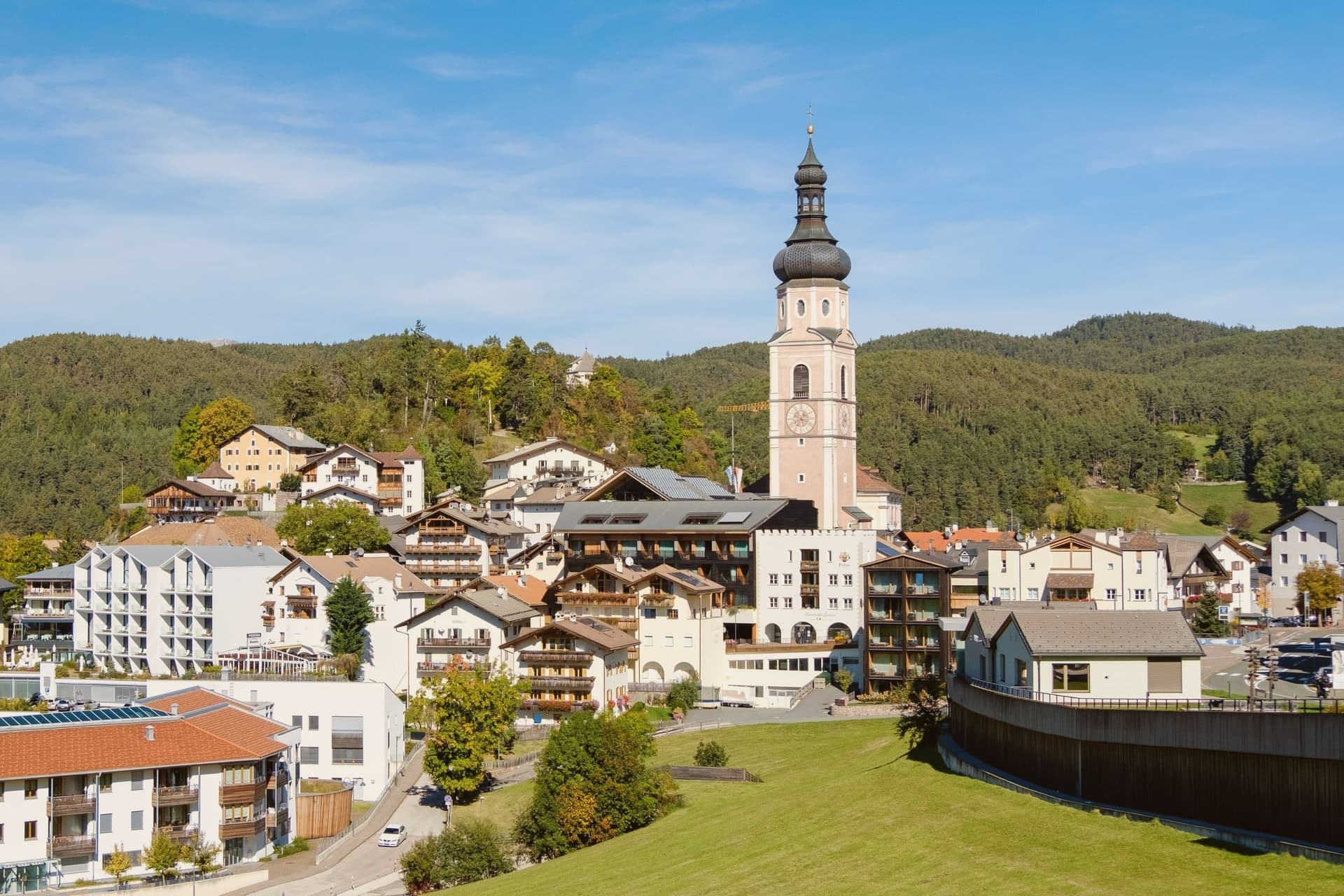
Castelrotto, in German Kastelruth and in Ladin Ciastel, sits at 1,060 meters on a shelf below the Sciliar, twenty kilometers northeast of Bolzano. The commune's territory rises from 720 meters at San Vigilio to over 2,400 meters on the Sciliar massif, with the Alpe di Siusi reached from within that territory.
The name first appears in the tenth century and goes back to the Castellum Ruptum, a destroyed castle on the Calvary hill above the village, so the hill above the square and the name on the map are the same story told twice. Of around 6,500 residents, 82 per cent speak German as their first language, 15 per cent Ladin and 3 per cent Italian.
That balance, and the position on a shelf between the valley floor and the high meadow above it, is what gives the village its Tyrolean character rather than an Italian one: a settlement whose center, church tower, and surrounding pasture all sit within sight of each other, with the mountain doing most of the work of orientation.
The village sits at 1060 meters.
The catch: January nights average 7 degrees below zero.
What to see in Kastelruth
- Campanile della Parrocchiale. Standing apart from the parish church of Saints Peter and Paul, the tower is visible from the surrounding pastures long before the village itself comes into view.
- Chiesa Parrocchiale dei Santi Pietro e Paolo. Neoclassical church of 1846-49 beside the detached tower, on the site of a parish recorded since about 1191.
- Alpe di Siusi/Seiser Alm. Reached by cable car from Siusi, the meadow opens out with the Sciliar and Sassolungo on either side, a scale that is hard to read from photographs alone.
How to get to Kastelruth
Bolzano is about 44 min away by road.
Our tip
June through September is the high-meadow season on the Alpe di Siusi, with the Seiser Alm pastures green, the chairlifts running and hiking and biking routes open from the village to the Sciliar. December through March is the ski season: the Seiser Alm has fifty-six kilometers of slopes, mostly red and blue, and connects by the Saltria-Mont Sëuc gondola to the rest of the Dolomiti Superski. Late June brings the Oswald von Wolkenstein Riding Tournament, the historical equestrian event held in the meadows around the village.
10. Brunico
Best for a trip without a car. The train stops in the commune.
1 h 10 min from Bolzano · homes €2,600 to €3,000 a m² in the center · 17,157 people
Why visit Brunico
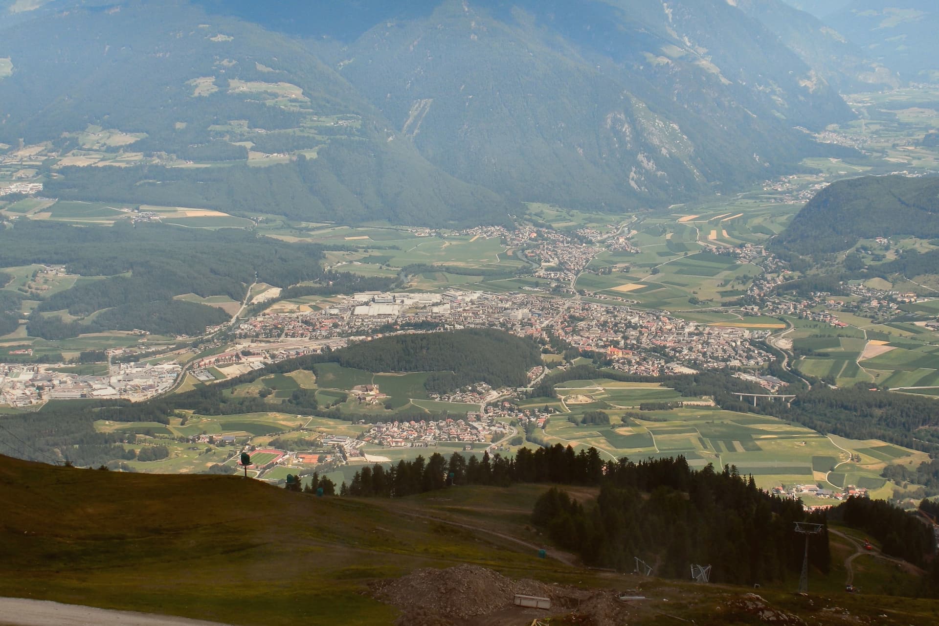
Brunico, Bruneck in German, sits at 838 meters in the eastern Alto Adige, in the Val Pusteria. The name comes from the castle built above the settlement, and the town below grew up around it rather than the other way round.
First documented as Bruneke in 1256, it received weekly market rights and the privilege of high justice, and grew rich in the fourteenth and fifteenth centuries on the Augsburg-Venice trade that ran across the valley, the same trade that filled the Stadtgasse with merchant houses. The town has three distinct layers that sit close together but answer different purposes: the castle above holding the seat of the former prince-bishops, the walled Stadtgasse below as the commercial spine between the four gates, and Teodone at the edge of town, where the Mair am Hof Residence and its rebuilt farmhouses preserve a rural way of life that the town center does not.
The mountain above the valley, reached from the town, adds a fourth register entirely, modern and built for a single striking structure rather than for defence or trade. Together these layers show a town shaped by three different economies in three different eras: episcopal power, alpine commerce, and now winter tourism, each leaving its own mark rather than replacing what came before.
The village sits at 838 meters.
The catch: The nearest airport, Treviso, is 2 h 46 min away by road.
What to see in Brunico
- Castello di Brunico. The castle sits above the town as the former summer residence of the Brixen bishops. The museum inside occupies rooms that still read as a bishop's seat rather than a purpose-built gallery.
- Stadtgasse. Pedestrian street between the four gates, its townhouses carrying bay windows and ornate shop signs at close range, the kind of detail that only shows up on foot.
- Museo Etnografico Sudtirolese. South Tyrolean Folklore Museum in the Mair am Hof Residence at Teodone, built 1690-1700, with twenty-four rebuilt farmhouses from across the province in its open-air section.
How to get to Brunico
It has its own railway station. Bolzano is about 1 h 10 min away by road.
Our tip
May through October brings the warm months in the Pustertal, with the Stadtgasse and the castle terrace usable from early afternoon and Plan de Corones open for hiking and biking from late June. June and July are the cool alpine months, with long evenings in the historic center and the cable cars running up from the south side of town. September and October bring the autumn colors and the start of Törggelen, the South Tyrolean chestnut-and-new-wine season.
If you only pick one
Which town is yours
One town for each kind of trip, and the reason in a line.
Without a car
Brunico
The train stops in the commune, so you can arrive and leave without a car.
For everyday life on foot
Cavalese
Eight of the ten everyday services we look for, from a grocer to a pharmacy, are on the map within 500 meters of the center.
For a short trip
St. Ulrich
43 min by car from Bolzano, the shortest drive from a city on this list.
For a small town
Glurns
933 people, the smallest town on this list.
Read a sample letter
Treviso | The best town in Italy
Why this small Venetian city is perfect for travelers and expats alike
Letters from the towns we visit. Free.
More from Anywhere Italy
- The best small mountain towns within 90 minutes of BolzanoNear Bolzanomountainwithin 90 minsmall9 towns · smallest 933 residents · closest 41 min away
- The 9 best small high-altitude villages that eat well in Trentino-Alto AdigeTrentino-Alto Adigeabove 800 meats wellsmall9 towns · smallest 266 residents
- The best mountain towns in the province of Bolzano/BozenBolzano provincemountain10 towns · smallest 933 residents
- The best high-altitude villages with a serious restaurant in Trentino-Alto AdigeTrentino-Alto Adigeabove 800 mserious restaurant6 towns · smallest 820 residents
- The best ski towns that eat well in the province of BolzanoBolzano provinceski areaeats well7 towns · smallest 1,446 residents
- The best ski towns with a serious restaurant in Trentino-Alto AdigeTrentino-Alto Adigeski areaserious restaurant9 towns · smallest 1,446 residents