
Aosta Valley · Aosta Valley
Courmayeur
The Italian base of Mont Blanc, a Roman waystation on the Via delle Gallie that became the country's highest commune and its best-known ski address.
Known for
MONT BLANC
Italian base of the 4,810-meter peak, shared with Saint-Gervais-les-Bains across the French border and linked to Chamonix by the 1965 tunnel.
SKYWAY
The 110-million-euro cable car opened in 2015, lifting visitors from 1,300 to 3,466 meters in rotating cabins.
SKI RESORT
One hundred kilometers of pistes spread across Plan Chécrouit and Val Veny, a year-round mountaineering and ski capital since the early twentieth century.
When to visit
Best · Jun–Sep, Dec–Mar
- J
- F
- M
- A
- M
- J
- J
- A
- S
- O
- N
- D
- Best
- Hot or crowded
- Quiet
- Mostly closed
The festa: Pantaleone di Nicomedia, 27 July
Why come
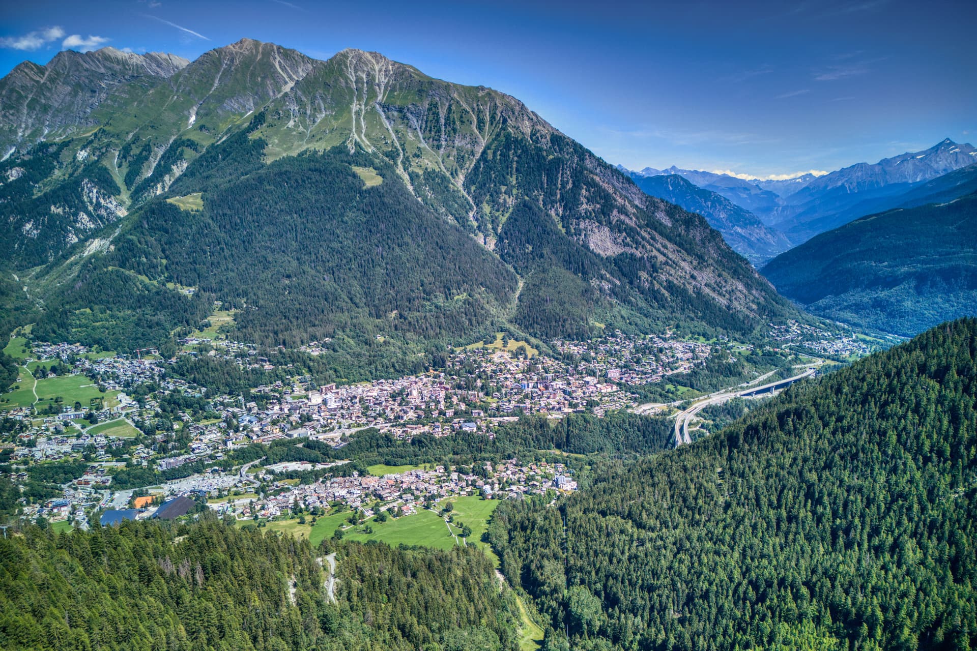
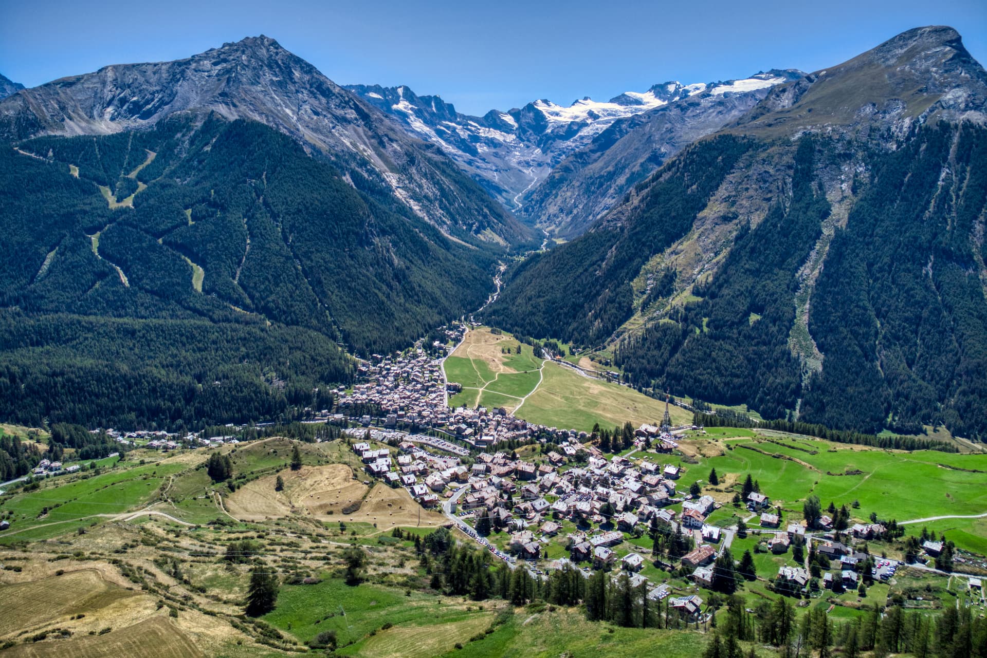
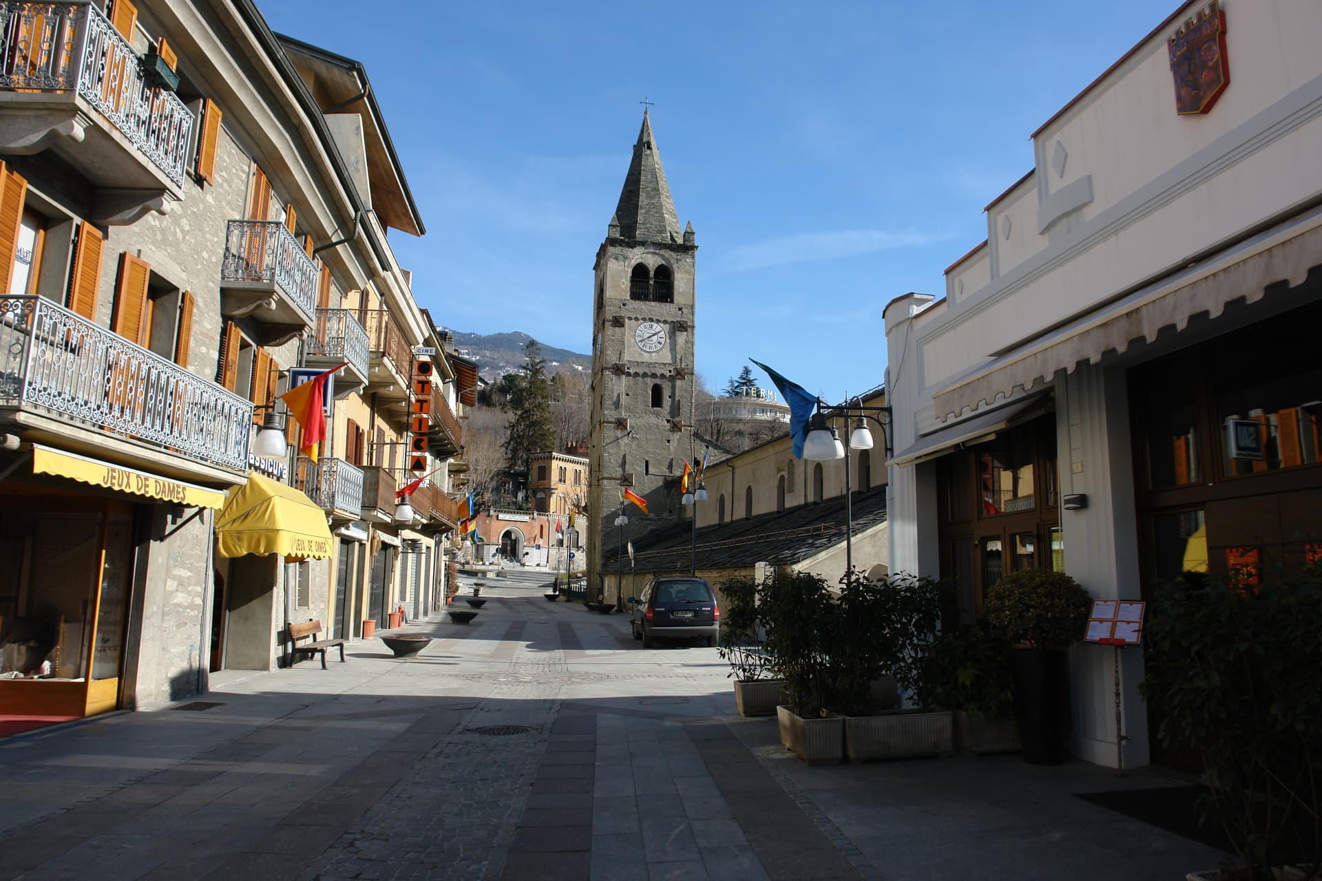
Courmayeur sits at 1,224 meters at the foot of the southern face of Mont Blanc, the 4,810-meter peak the town shares with Saint-Gervais-les-Bains in France. The Romans called the place Curia Major and used it as a stop on the Via delle Gallie running over the Little Saint Bernard. The Mont Blanc Tunnel opened in 1965, eleven kilometers of road link to Chamonix that turned a remote valley head into a year-round border town.
The Skyway Monte Bianco cable car, completed in 2015 at a cost of 110 million euros, lifts visitors from Pontal d'Entrèves at 1,300 meters to Punta Helbronner at 3,466 meters in two stages, with rotating cabins. Val Ferret and Val Veny, the two side valleys that open above the village, hold the Italian sections of the Tour du Mont Blanc and the Tor des Géants. Via Roma still runs the old pilgrim line through the center, lined with cafés, hotels, the Chiesa di San Pantaleone and the medieval Tour Malloquin.
The Sunday letter
We haven’t written Courmayeur’s letter yet.
One town every Sunday, with the photo, the food, the festa. Be there when this one comes up. Free, by Peter & Sophia from Pietrasanta.
By subscribing you agree to Substack’s Terms of Use, our Privacy Policy and our Information collection notice.

What to see
Skyway Monte Bianco
Cable car opened in 2015 from Pontal d'Entrèves (1,300m) to Punta Helbronner (3,466m), with rotating cabins and a panoramic terrace on the Mont Blanc massif.
Val Ferret
Side valley running northeast from Courmayeur along the Italian flank of Mont Blanc, traversed by the Tour du Mont Blanc and Tor des Géants.
Val Veny
Parallel side valley below the Brenva and Miage glaciers, with road access in summer and the Notre-Dame de Guérison sanctuary.
Chiesa di San Pantaleone
Parish church on Via Roma in the centro storico, dedicated to the town's patron.
Tour Malloquin
Medieval residential tower on Via Roma, surviving fragment of the village's pre-resort fabric.
Giardino Botanico Saussurea
Alpine botanical garden at the Pavillon du Mont Fréty station (2,200m) on the Skyway, one of the highest in Europe with around 800 species.
The slow-trip planner
Building a trip? Find where Courmayeur fits in a slow Italy circuit.
Answer five questions. We will shape a geographically coherent slow trip from the 1,000 Italian towns most travelers skip. Yours to save and share.
We recommend
Where to eat and stay
Not our picks, but places the guides put their name to — a Michelin star, a Gambero Rosso fork, a Slow Food snail, a Michelin Key for the hotels. Worth a table, a counter, or a night when you pass through.
Pierre Alexis 1877Ristorante
Two Gambero Rosso forks (80/100) for Pierre Alexis 1877, and a spot in the Michelin Guide.
Aubergine Restaurant de l'Auberge de La MaisonRistorante
Aubergine Restaurant de l'Auberge de La Maison carries one Gambero Rosso fork (79/100).
Bistrot RoyalRistorante
Bistrot Royal holds a spot in the Michelin Guide.
Caffè della postaCaffè
Caffè della posta carries a place on Italy's historic-locali register.
Crème et ChocolatGelateria
Crème et Chocolat carries a Gambero Rosso listing.
Enoteca L'ArmadilloRistorante
Enoteca L'Armadillo carries a spot in the Michelin Guide.
L'ArmadilloRistorante
L'Armadillo holds one Gambero Rosso fork (79/100).
Grand Hotel Courmayeur Mont BlancHotel
Grand Hotel Courmayeur Mont Blanc holds a place in the Michelin hotel guide.
Le Massif Hotel & LodgeHotel
A Leading Hotels of the World listing, at Le Massif Hotel & Lodge.
Living here
- Population 2,602
- In-betweeni
- Pharmacy in town
- Nearest airport Turin, 1 h 58 min drive
- Regional capital Aosta, 42 min drive
Tags & datadesignations · numbers · sources
Recognised as
The numbers
- Elevation: 1224 m
- Population: 2,602
- Surface area: 209.61 km²
These figures were compiled from public directories — ISTAT, OpenStreetMap, Wikidata — and from the official listings of the guides named on this page. Town details change; verify with official sources before you travel.
Featured on
Courmayeur appears on this themed pick from our Collections:
Close by
More towns near Courmayeur
Aymavilles
Province: Aosta Valley
Gateway to the Gran Paradiso at 646 metres, with a four-towered Challant castle and a 3 BC Roman aqueduct above the Grand'Eyvia.
Cogne
Province: Aosta Valley
The mining town turned capital of the Gran Paradiso, the Aosta Valley's largest commune with 95 percent of its land inside Italy's oldest park.
Châtillon
Province: Aosta Valley
The Aosta Valley's three-castle commune — a 4,358-resident town at 549m at the mouth of the Valtournenche where it meets the main valley, with the Castello Gamba (now the Valle d'Aosta regional contemporary art museum), the medieval Castello di Ussel + the Renaissance Castello Passerin d'Entrèves, and direct access up the road to the Cervino/Matterhorn at Cervinia 26 km north.

La Thuile
Province: Aosta Valley
Italy's gateway to the Petit Saint-Bernard pass — a 1,441m alpine village under Mont Blanc with the Espace San Bernardo ski domain straddling the French border (152 km of pistes shared with La Rosière), the Rutor glacier and its tiered waterfalls behind it, and a Roman-Salassi history that goes back two millennia.
Saint-Vincent
Province: Aosta Valley
The Aosta Valley's belle-époque thermal town — a 4,400-resident commune on a sunny south-facing terrace at 575m with the Fonte Salée mineral spring (in use since 1770), the Casinò de la Vallée (Italy's second-largest legal casino since 1947), and the Matterhorn peak visible north of town.
⛷️ Ski Area
More Ski Area towns in Aosta Valley

Ayas
Province: Aosta Valley
A scattered upper-valley commune of three villages under the Monte Rosa, where Walser settlers and Romance-speaking herders share the slopes below Castor and Pollux.
Gressoney-Saint-Jean
Province: Aosta Valley
A Walser village in the Lys valley where Titsch is still spoken, Queen Margherita summered, and the Lyskamm glacier closes the view.