
Aosta Valley · Aosta Valley
Valtournenche
The valley under the Cervino, home of the guides who raced Whymper up the mountain in 1865 and the resort of Breuil-Cervinia at its head.
Known for
CERVINO
The Italian face of the Matterhorn, 4,478 meters, climbed first from this side by Jean-Antoine Carrel in July 1865.
MATTERHORN GUIDES
Valtournenche produced the Carrel, Maquignaz and Gorret families who dominated late-nineteenth-century alpinism on the Italian face.
BREUIL-CERVINIA
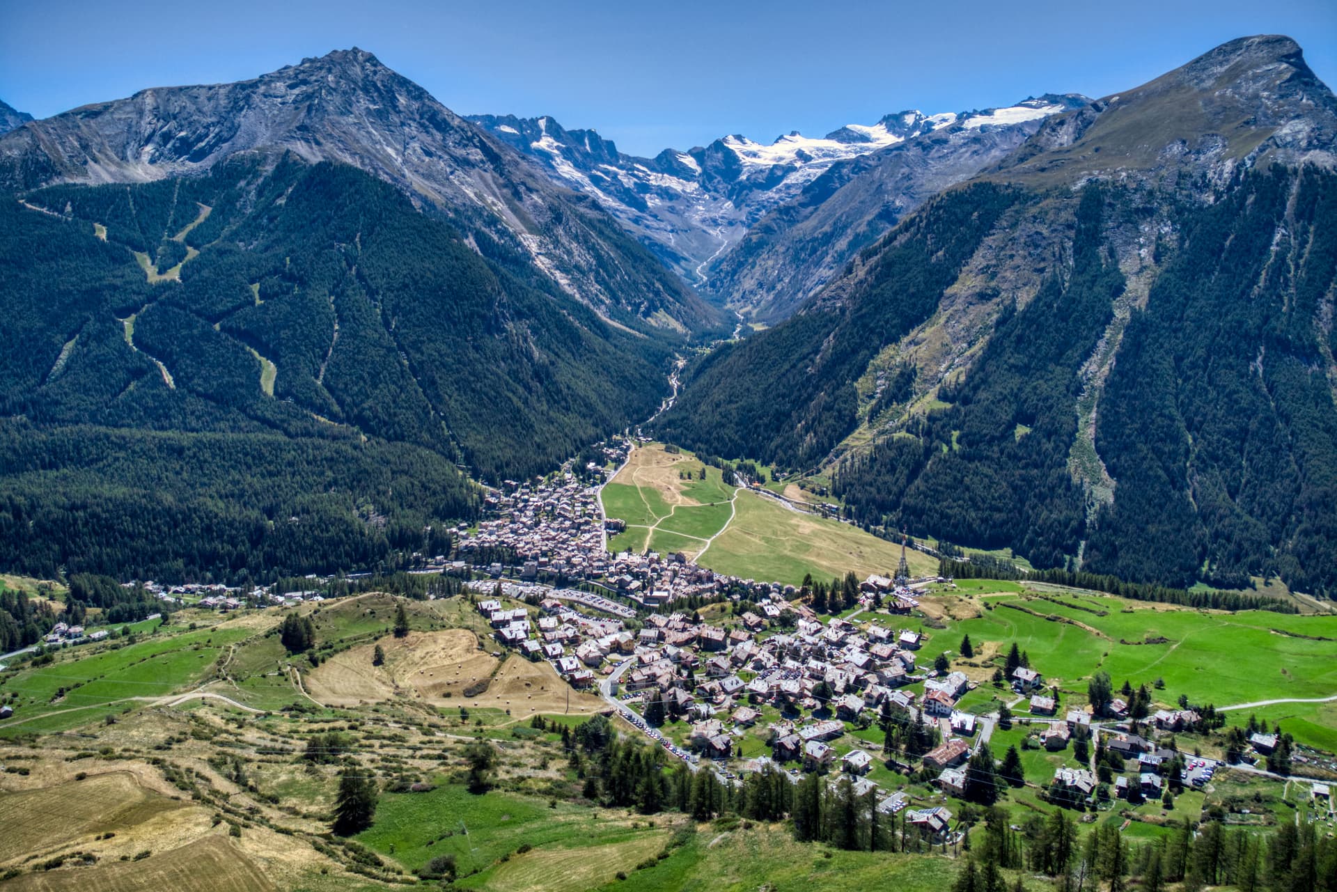
Resort head of the valley at 2,050 meters, lift-linked across the Theodul Pass to Zermatt, with summer skiing on the Plateau Rosa glacier.
When to visit
Best · Jun–Sep, Dec–Mar
- J
- F
- M
- A
- M
- J
- J
- A
- S
- O
- N
- D
- Best
- Hot or crowded
- Quiet
- Mostly closed
The festa: Antonio abate, 17 January
Why come
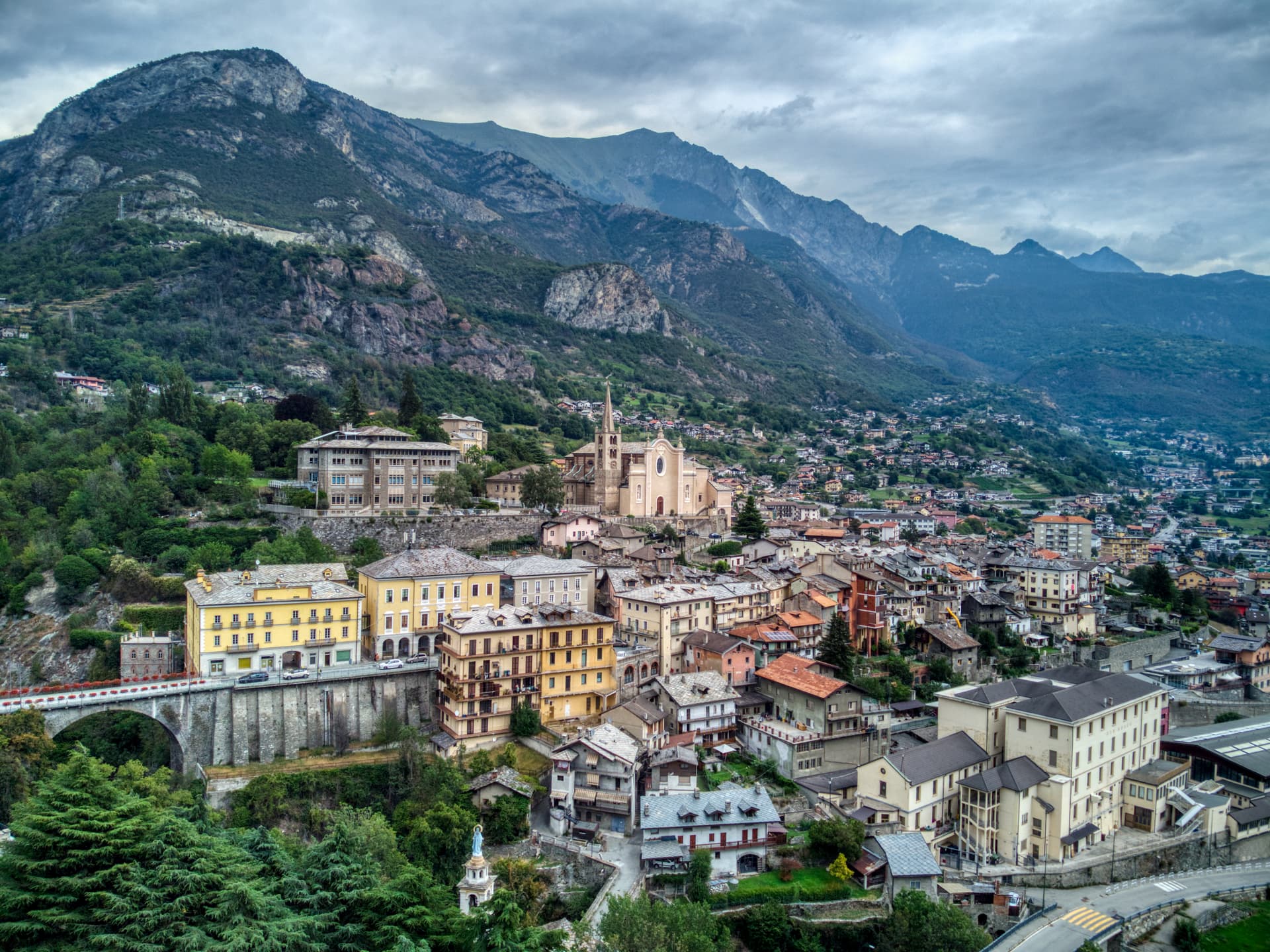
Valtournenche sits at 1,524 meters along the Marmore torrent, a long upper-valley commune that runs from Châtillon up to the Italian foot of the Cervino, the 4,478-meter peak the Swiss call the Matterhorn. The frazione of Breuil-Cervinia at the valley head, at 2,050 meters, is the main resort: roughly 150 kilometers of pistes linked by lift across the border to Zermatt, including summer skiing on the Plateau Rosa glacier. The village itself is the older story.
Jean-Antoine Carrel was born here in 1829, led the Italian race for the Matterhorn against Edward Whymper, and reached the summit from the southwest ridge on 17 July 1865, three days after the British party arrived from the Swiss side. A plaque in the main square lists the names of the Cervino guides who followed him. The road up from Châtillon climbs 1,000 meters in 27 kilometers and ends at the glacier.
The Sunday letter
We haven’t written Valtournenche’s letter yet.
One town every Sunday, with the photo, the food, the festa. Be there when this one comes up. Free, by Peter & Sophia from Pietrasanta.
By subscribing you agree to Substack’s Terms of Use, our Privacy Policy and our Information collection notice.


What to see
Il Cervino
The 4,478-meter pyramidal peak that closes the valley head, climbed first from the Italian side on 17 July 1865 by Jean-Antoine Carrel of Valtournenche.
Breuil-Cervinia
Resort frazione at 2,050 meters with around 150 kilometers of pistes linked across the border to Zermatt, including summer skiing on the Plateau Rosa glacier.
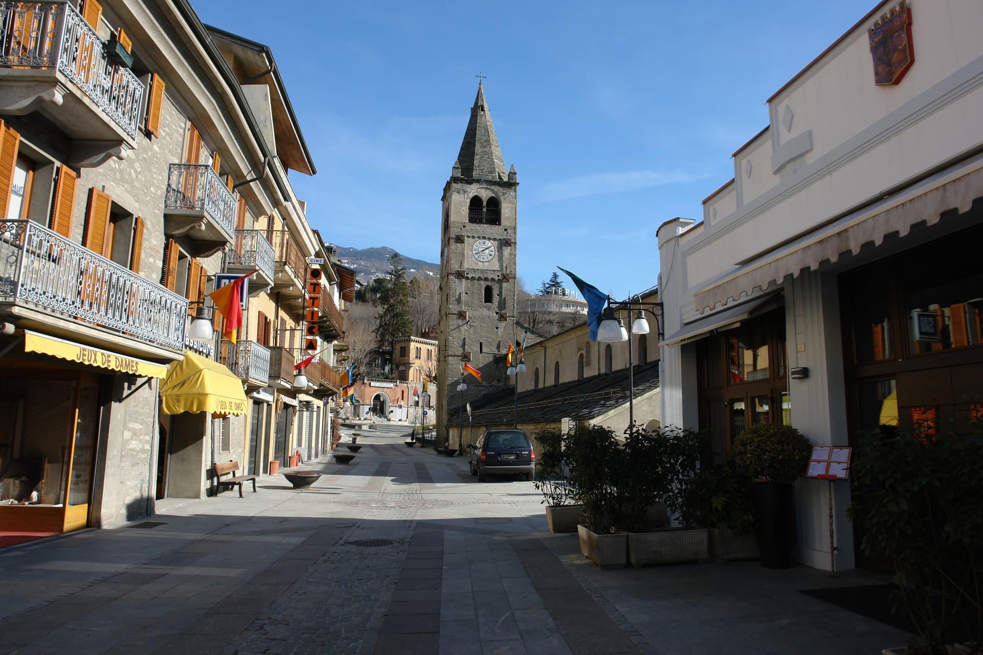
Piazza delle Guide
Main square of Valtournenche village, with a plaque listing the names of the Matterhorn guides born in the valley.
Chiesa parrocchiale di Sant'Antonio
Parish church in the centro storico of Valtournenche village.
Gouffre des Busserailles
Narrow gorge on the Marmore torrent below Breuil-Cervinia, opened to visitors in 1865 by Jean-Antoine Carrel with bridges and walkways.
Lago Goillet
Reservoir lake at 2,526 meters above Breuil-Cervinia, holding water for the Hydroelectric system in the Marmore valley.
The slow-trip planner
Building a trip? Find where Valtournenche fits in a slow Italy circuit.
Answer five questions. We will shape a geographically coherent slow trip from the 1,000 Italian towns most travelers skip. Yours to save and share.
We recommend
Where to eat and stay
Not our picks, but places the guides put their name to — a Michelin star, a Gambero Rosso fork, a Slow Food snail, a Michelin Key for the hotels. Worth a table, a counter, or a night when you pass through.
WoodRistorante
Wood carries one Michelin star, plus two Gambero Rosso forks (80/100).
La Chandelle dell'Hotel HermitageRistorante
Two Gambero Rosso forks (81/100), at La Chandelle dell'Hotel Hermitage.
Saint Hubertus del Saint Hubertus ResortRistorante
Saint Hubertus del Saint Hubertus Resort has one Gambero Rosso fork (79/100) to its name.
Living here
- Population 2,178
- Off the beaten pathi
- Pharmacy in town
- Nearest airport Turin, 2 h 35 min drive
- Regional capital Aosta, 1 h 49 min drive
Tags & datadesignations · numbers · sources
Recognised as
The numbers
- Elevation: 1524 m
- Population: 2,178
- Surface area: 116.15 km²
These figures were compiled from public directories — ISTAT, OpenStreetMap, Wikidata — and from the official listings of the guides named on this page. Town details change; verify with official sources before you travel.
Close by
More towns near Valtournenche
Châtillon
Province: Aosta Valley
The Aosta Valley's three-castle commune — a 4,358-resident town at 549m at the mouth of the Valtournenche where it meets the main valley, with the Castello Gamba (now the Valle d'Aosta regional contemporary art museum), the medieval Castello di Ussel + the Renaissance Castello Passerin d'Entrèves, and direct access up the road to the Cervino/Matterhorn at Cervinia 26 km north.
Saint-Vincent
Province: Aosta Valley
The Aosta Valley's belle-époque thermal town — a 4,400-resident commune on a sunny south-facing terrace at 575m with the Fonte Salée mineral spring (in use since 1770), the Casinò de la Vallée (Italy's second-largest legal casino since 1947), and the Matterhorn peak visible north of town.
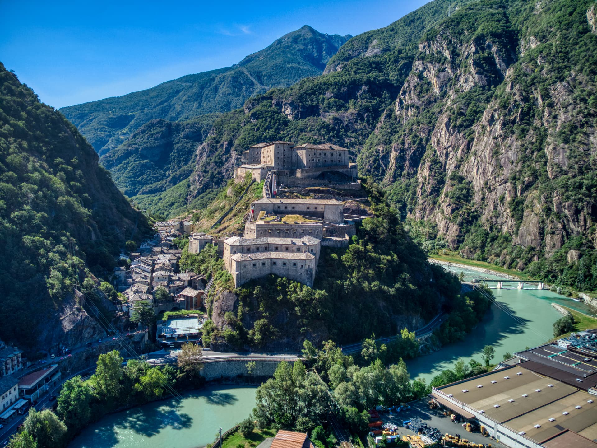
Bard
Province: Aosta Valley
A 108-person village under the largest Savoy fortress in the Alps, where 400 soldiers held off Napoleon's 40,000 for two weeks in 1800.
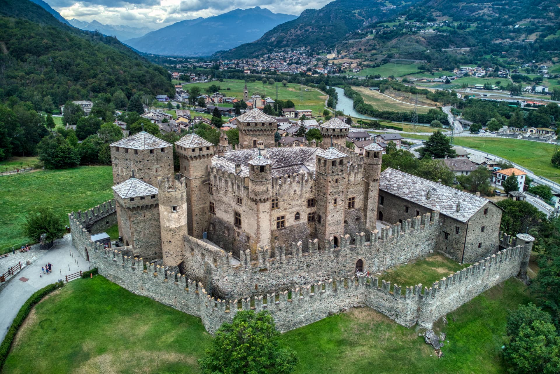
Fénis
Province: Aosta Valley
Italy's most photographed medieval castle — the Castello di Fénis (14th-c, Challant family) with its double-ring of crenellated walls, eight cylindrical towers, and frescoed inner courtyard sits at the centre of a 1,770-resident Aostan commune 18 km east of Aosta, with the Valle di Clavalité Apennine reserve climbing south to 3,000m.
Aymavilles
Province: Aosta Valley
Gateway to the Gran Paradiso at 646 metres, with a four-towered Challant castle and a 3 BC Roman aqueduct above the Grand'Eyvia.
⛷️ Ski Area
More Ski Area towns in Aosta Valley

Ayas
Province: Aosta Valley
A scattered upper-valley commune of three villages under the Monte Rosa, where Walser settlers and Romance-speaking herders share the slopes below Castor and Pollux.
Cogne
Province: Aosta Valley
The mining town turned capital of the Gran Paradiso, the Aosta Valley's largest commune with 95 percent of its land inside Italy's oldest park.
Courmayeur
Province: Aosta Valley
The Italian base of Mont Blanc, a Roman waystation on the Via delle Gallie that became the country's highest commune and its best-known ski address.
Gressoney-Saint-Jean
Province: Aosta Valley
A Walser village in the Lys valley where Titsch is still spoken, Queen Margherita summered, and the Lyskamm glacier closes the view.

La Thuile
Province: Aosta Valley
Italy's gateway to the Petit Saint-Bernard pass — a 1,441m alpine village under Mont Blanc with the Espace San Bernardo ski domain straddling the French border (152 km of pistes shared with La Rosière), the Rutor glacier and its tiered waterfalls behind it, and a Roman-Salassi history that goes back two millennia.