
Veneto · Belluno
Cortina d'Ampezzo
The Queen of the Dolomites at 1,224 meters, host of the 1956 Winter Olympics and co-host of Milano-Cortina 2026.
Known for
QUEEN OF THE DOLOMITES
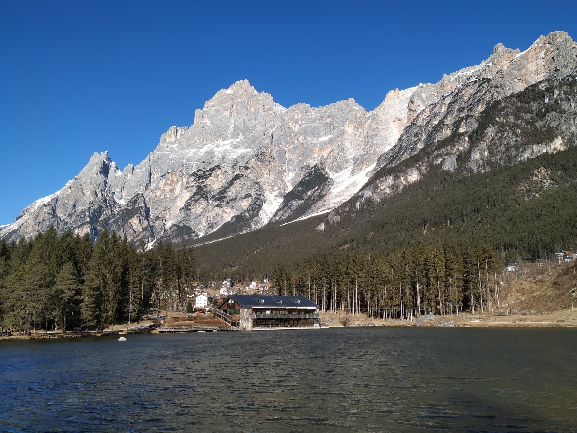
Ringed by Tofane, Cristallo, Sorapiss and Cinque Torri, with Tofana di Mezzo at 3,244 meters reached by cable car from town.
1956 AND 2026
Host of the seventh Winter Olympic Games in 1956 and co-host of Milano-Cortina 2026 with the Eugenio Monti sliding center rebuilt.
AMPEZZANI
Ladin-speaking community that kept its Regole assembly through Habsburg and Italian rule, joining Italy only in 1919.
When to visit
Best · Jun–Sep, Dec–Mar
- J
- F
- M
- A
- M
- J
- J
- A
- S
- O
- N
- D
- Best
- Hot or crowded
- Quiet
- Mostly closed
Why come
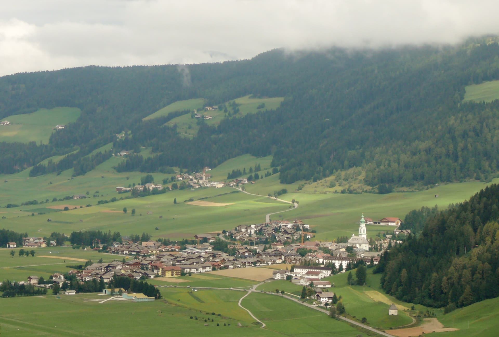
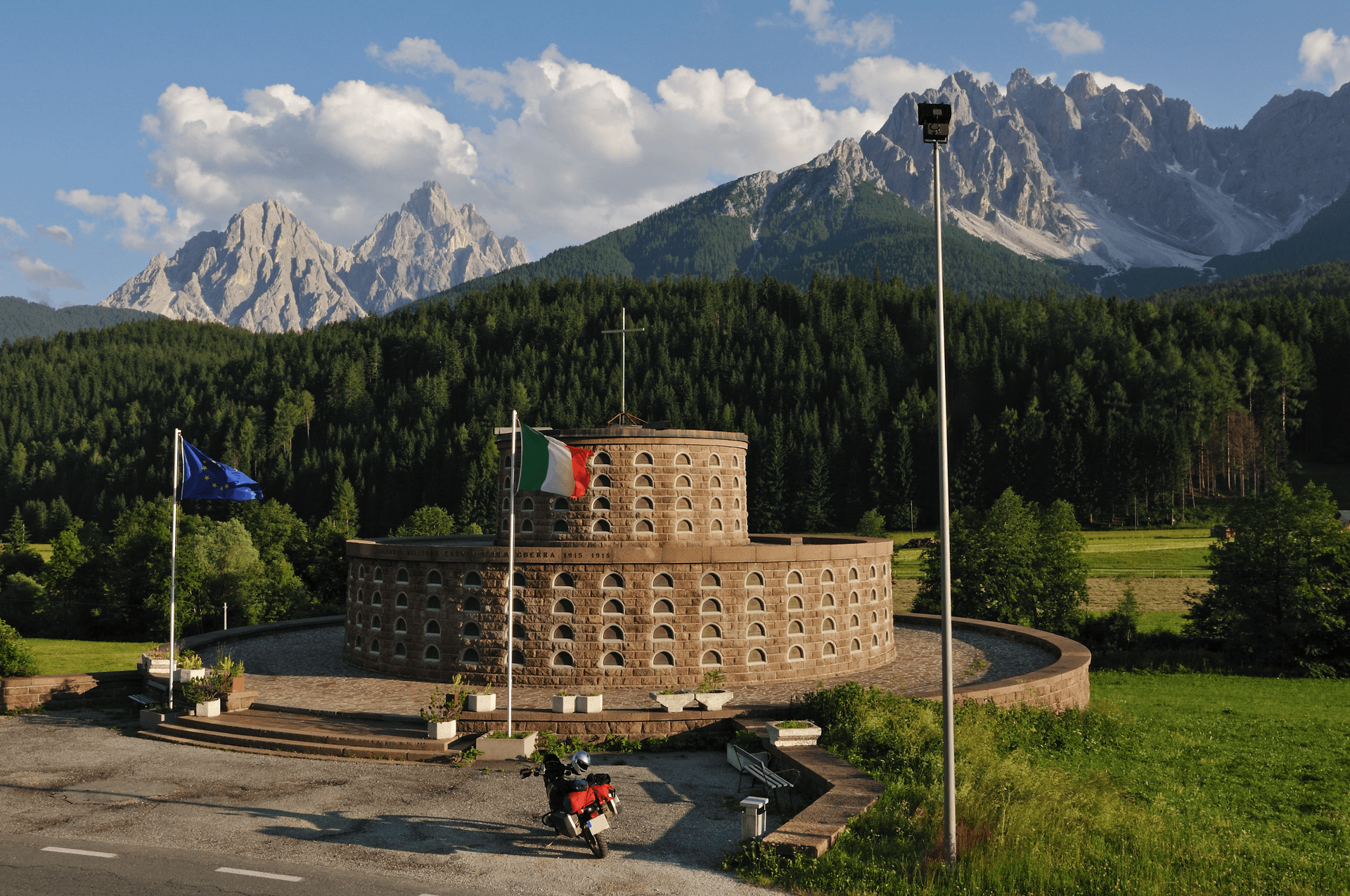
Cortina sits at 1,224 meters in the Ampezzo valley, ringed by the Tofane to the west, Pomagagnon to the north, Cristallo to the northeast, Faloria and Sorapiss to the east, and Croda da Lago and Cinque Torri to the south. The Ampezzani spoke Ladin, kept their assembly the Regole intact through Habsburg and Italian rule, and only joined Italy after the First World War in 1919. The town hosted the seventh Winter Olympic Games in 1956 and returns as co-host of Milano-Cortina 2026, with the Olympia delle Tofane bobsleigh track and the Eugenio Monti sliding center rebuilt for the event.
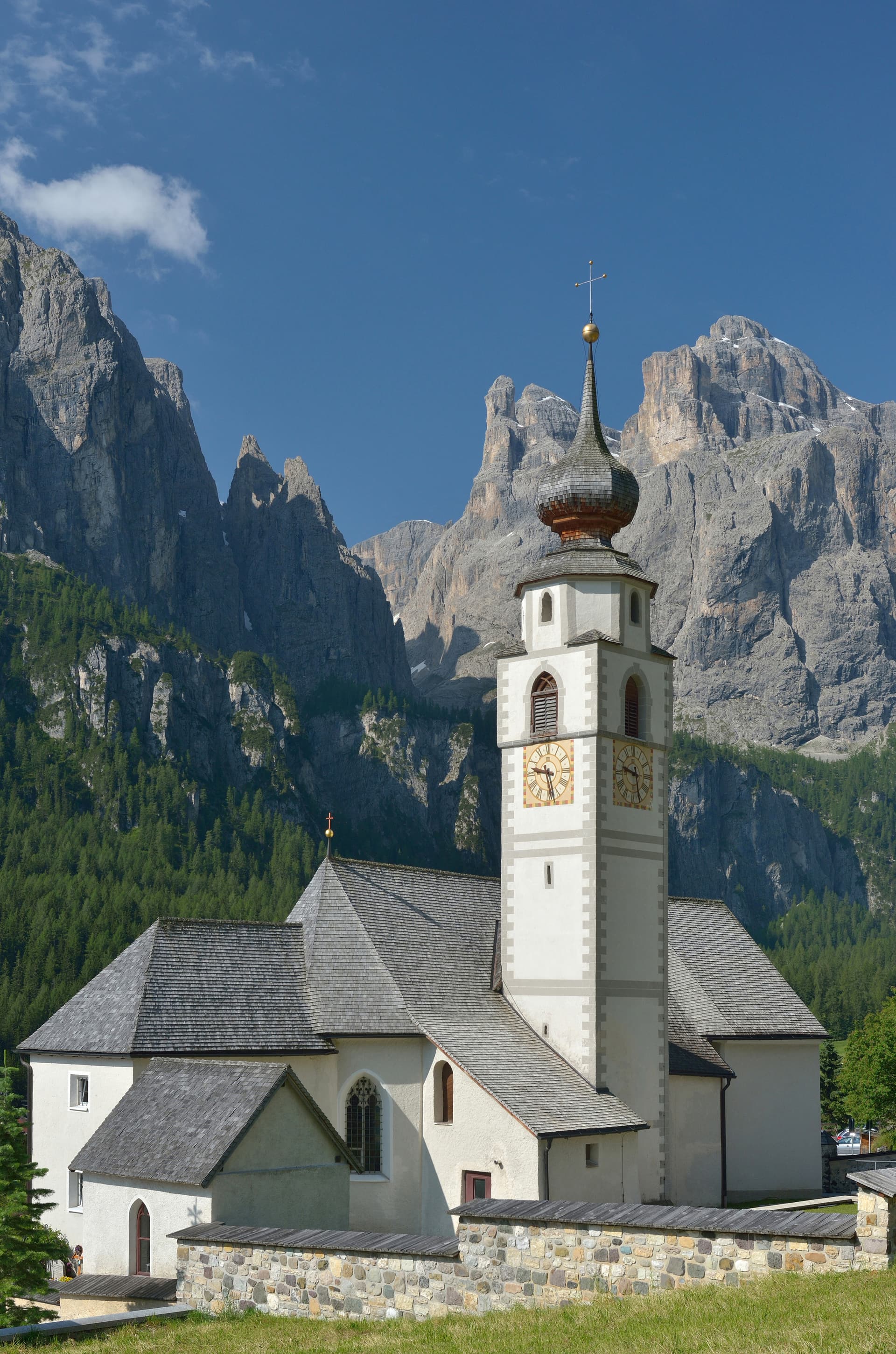
The Dolomiti Superski circuit puts 1,200 kilometers of slopes on a single pass, with Tofana di Mezzo at 3,244 meters reached by the Freccia nel Cielo cable car from the town. The Basilica dei Santi Filippo e Giacomo on Corso Italia, with its 1858 façade and 1860 campanile, anchors the pedestrian centro storico. Cortina is also a summer base for the Alta Via 1 to Belluno and the Tre Cime loop to the east.
The Sunday letter
We haven’t written Cortina d'Ampezzo’s letter yet.
One town every Sunday, with the photo, the food, the festa. Be there when this one comes up. Free, by Peter & Sophia from Pietrasanta.
By subscribing you agree to Substack’s Terms of Use, our Privacy Policy and our Information collection notice.


What to see
Tofana di Mezzo
3,244-meter peak west of the town, reached by the Freccia nel Cielo cable car from Corso Italia in three sections via Pomedes and Ra Valles.
Basilica dei Santi Filippo e Giacomo
Parish church on Corso Italia with an 1858 façade and an 1860 campanile, the centro storico's principal monument.
Cinque Torri
Five rock towers south of Cortina at 2,361 meters, a climbing area with First World War open-air trenches restored as a free museum.
Dolomiti Superski
1,200 km of linked slopes on a single pass across the Dolomites; Cortina is one of the twelve resort hubs of the circuit.
Cristallo and Faloria
Northeastern and eastern peaks above the valley, with the Faloria cable car from Cortina and a network of via ferrate to the summits.
Lunga Via delle Dolomiti
Sixty-four-kilometer Greenway from Calalzo to Dobbiaco on the disused Ferrovia delle Dolomiti, crossing Cortina at the former station.
The slow-trip planner
Building a trip? Find where Cortina d'Ampezzo fits in a slow Italy circuit.
Answer five questions. We will shape a geographically coherent slow trip from the 1,000 Italian towns most travelers skip. Yours to save and share.
We recommend
Where to eat and stay
Not our picks, but places the guides put their name to — a Michelin star, a Gambero Rosso fork, a Slow Food snail, a Michelin Key for the hotels. Worth a table, a counter, or a night when you pass through.
TivoliRistorante
Tivoli carries one Michelin star, two Gambero Rosso forks (86/100), plus a place in L'Espresso's Top 300.
Al CaminRistorante
Two Gambero Rosso forks (81/100) for Al Camin, and a spot in the Michelin Guide.
Alajmo CortinaRistorante
Alajmo Cortina carries two Gambero Rosso forks (84/100), plus a spot in the Michelin Guide.
Baita Piè TofanaRistorante
Two Gambero Rosso forks (83/100) for Baita Piè Tofana, and a place in L'Espresso's Top 300.
SanBriteRistorante
SanBrite has one Michelin star and two Gambero Rosso forks (87/100).
Baita FrainaRistorante
Baita Fraina carries a spot in the Michelin Guide.
El Brite de LarietoRistorante
El Brite de Larieto carries a spot in the Michelin Guide.
Rifugio OspitaleRistorante
Rifugio Ospitale carries one Gambero Rosso fork (77/100).
Ristorante de LENRistorante
Ristorante de LEN holds a spot in the Michelin Guide.
Villa OrettaRistorante
Villa Oretta holds one Gambero Rosso fork (78/100).
Albergo MenardiHotel
Albergo Menardi carries a place on Italy's historic-locali register.
Ancora CortinaHotel
A Leading Hotels of the World listing, at Ancora Cortina.
Eight CortinaHotel
Eight Cortina holds a place in the Michelin hotel guide.
Faloria Mountain Spa ResortHotel
Faloria Mountain Spa Resort carries a place in the Michelin hotel guide.
Hotel De la PosteHotel
Hotel De la Poste holds a place on Italy's historic-locali register.
Le Graal CortinaHotel
Le Graal Cortina carries a Leading Hotels of the World listing.
Living here
- Population 5,546
- Very remotei
- Pharmacy in town
- High school within a 30-minute drive
- Nearest airport Venice, 1 h 54 min drive
- Regional capital Venezia, 2 h 3 min drive
Tags & datadesignations · numbers · sources
Recognised as
The numbers
- Elevation: 1224 m
- Population: 5,546
- Surface area: 252.81 km²
These figures were compiled from public directories — ISTAT, OpenStreetMap, Wikidata — and from the official listings of the guides named on this page. Town details change; verify with official sources before you travel.
Close by
More towns near Cortina d'Ampezzo
Toblach
Province: Bolzano
The Val Pusteria gateway to the Tre Cime di Lavaredo, where Mahler wrote his last three symphonies in a cabin behind town.
San Vito di Cadore
Province: Belluno
A Cadore valley village at 1,011 meters between the Antelao and the Pelmo, ten kilometers south of Cortina and built around a fifteenth-century frescoed chapel.
Corvara in Badia
Province: Bolzano
The Ladin centre of Alta Badia at 1,568 metres, at the foot of the Sassongher, on the four-pass Sellaronda ski circuit.
Innichen
Province: Bolzano
An Alta Pusteria town at 1,175 metres on the Austrian border, with the most important Romanesque church in the Eastern Alps and the Drei Zinnen rising thirty kilometres south.
Rocca Pietore
Province: Belluno
An Agordino borgo at 1,143 meters under the Marmolada, where the Pettorina cuts a two-kilometer gorge through 100-meter rock walls.
🌳 Parco Regionale
More Parco Regionale towns in Veneto
Abano Terme
Province: Padova
Europe's oldest thermal town on the Euganean Hills' eastern slope, where 80°C bromo-iodine springs have been drawing bathers since the eighth century BC.
Arquà Petrarca
Province: Padova
The Euganean Hills village where Francesco Petrarca spent his last four years and died in 1374, renamed in his honor in 1868.
Bassano del Grappa
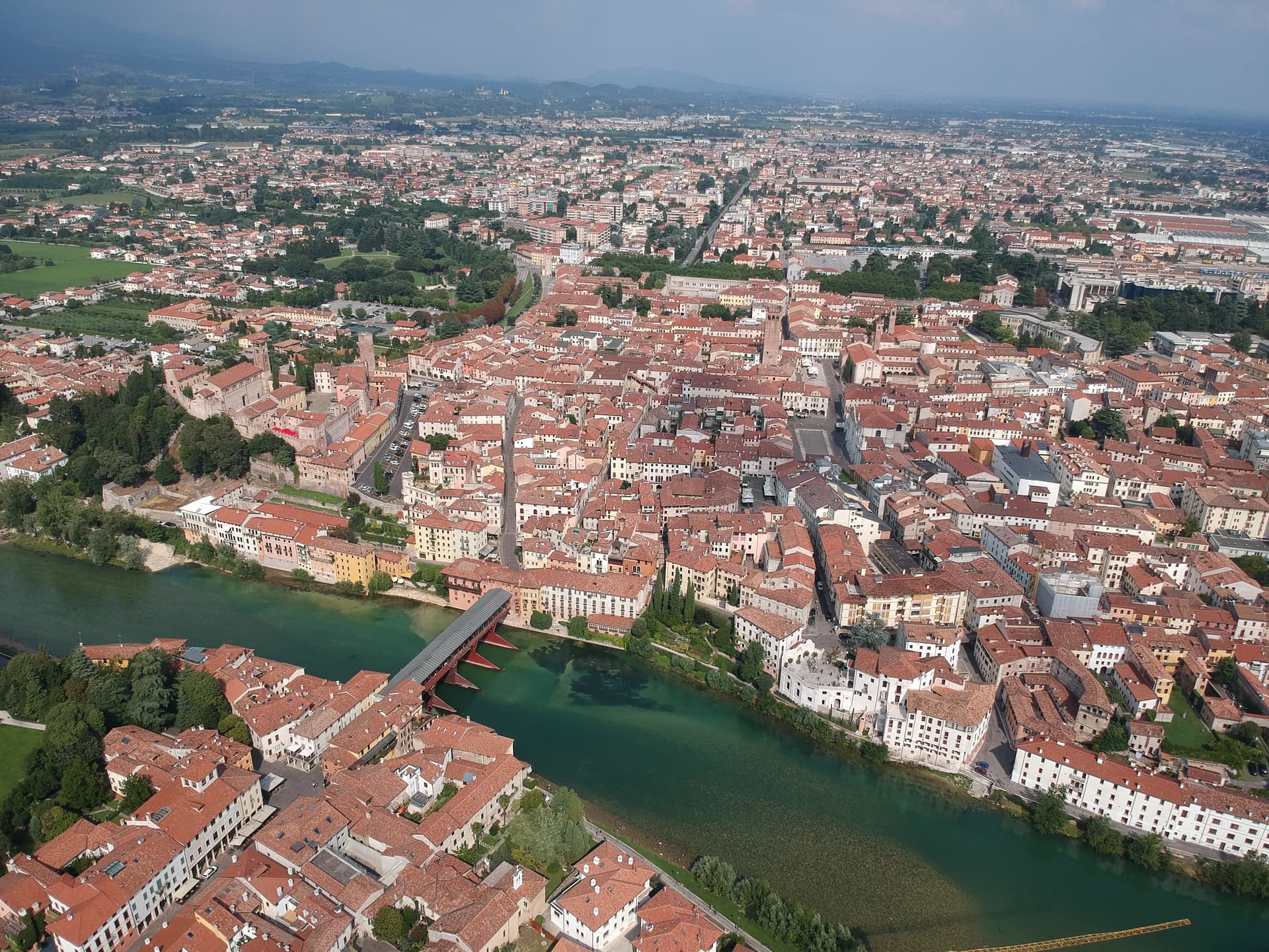
Province: Vicenza
The Brenta River town at 129 meters where Palladio drew the covered bridge in 1569 and Nardini has been distilling grappa since 1779.
Battaglia Terme
Province: Padova
A barge village at the foot of the Euganean Hills, built around the 1201 canal and Italy's only river navigation museum.

Rosolina
Province: Rovigo
A reclaimed Po Delta commune where a nine-kilometer beach and a maritime pine forest sit between the Adige mouth and the Adriatic.