
Veneto · Rovigo
Rosolina
A reclaimed Po Delta commune where a nine-kilometer beach and a maritime pine forest sit between the Adige mouth and the Adriatic.
Known for
ROSOLINA MARE
Nine-kilometer beach between the Adige and the Po di Levante, with a maritime pine forest replanted as a windbreak in the 1950s.
PO DELTA
Northern edge of the delta park, with lagoons, sandbanks and the dune-and-pine landscape that defines the upper coast.
ALBARELLA
Private island resort five kilometers long, gated, with pine woods, golf course and beach for residents and guests only.
When to visit
Best · May–Sep
- J
- F
- M
- A
- M
- J
- J
- A
- S
- O
- N
- D
- Best
- Hot or crowded
- Quiet
- Mostly closed
Why come
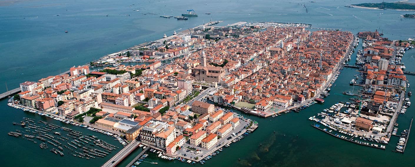
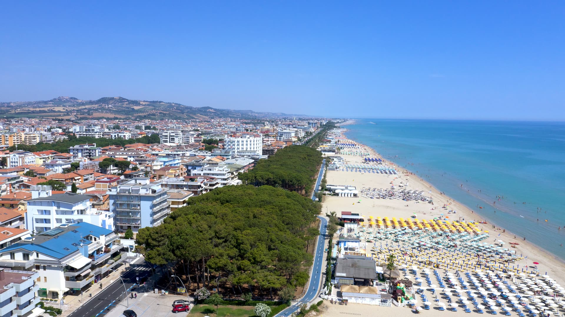
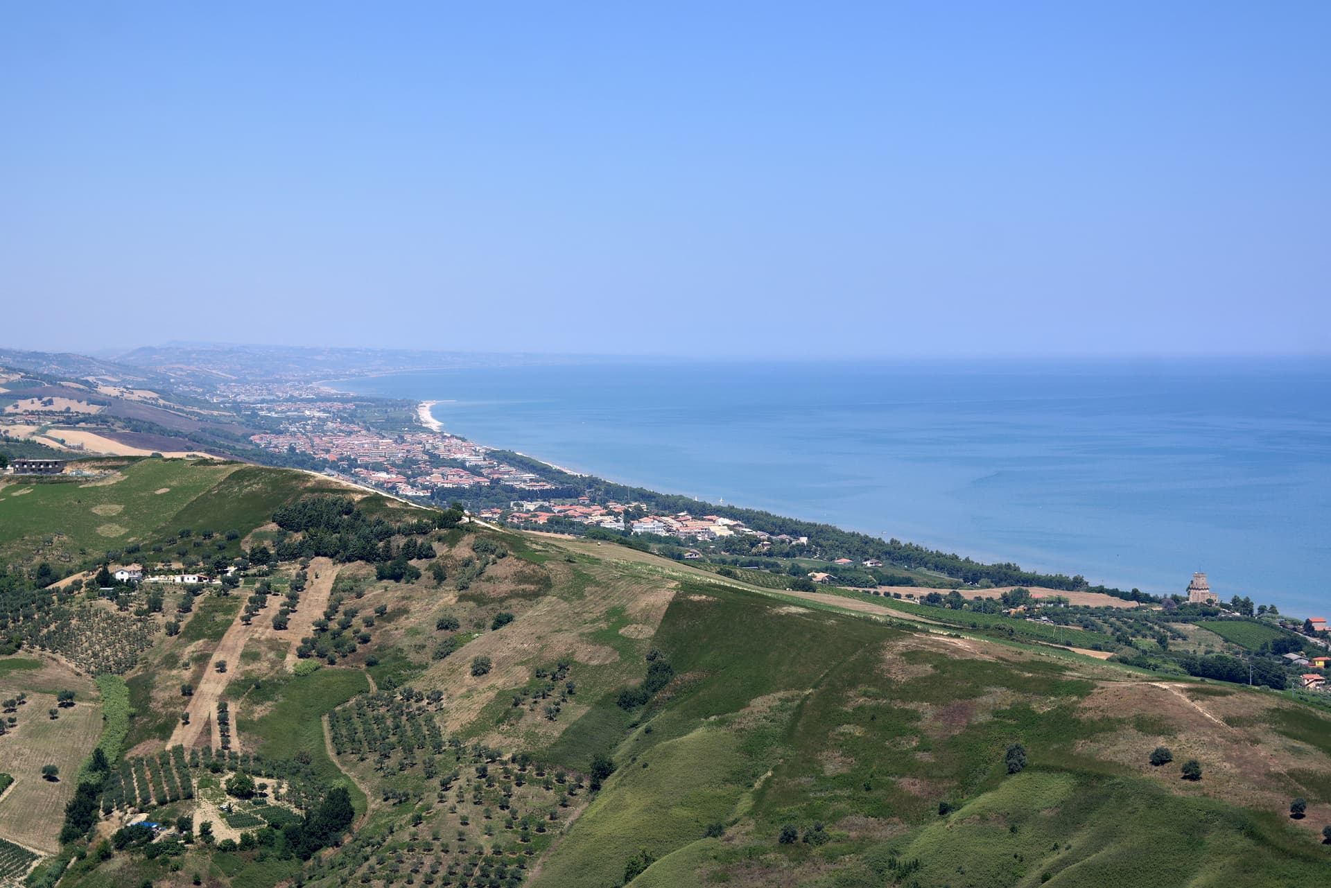
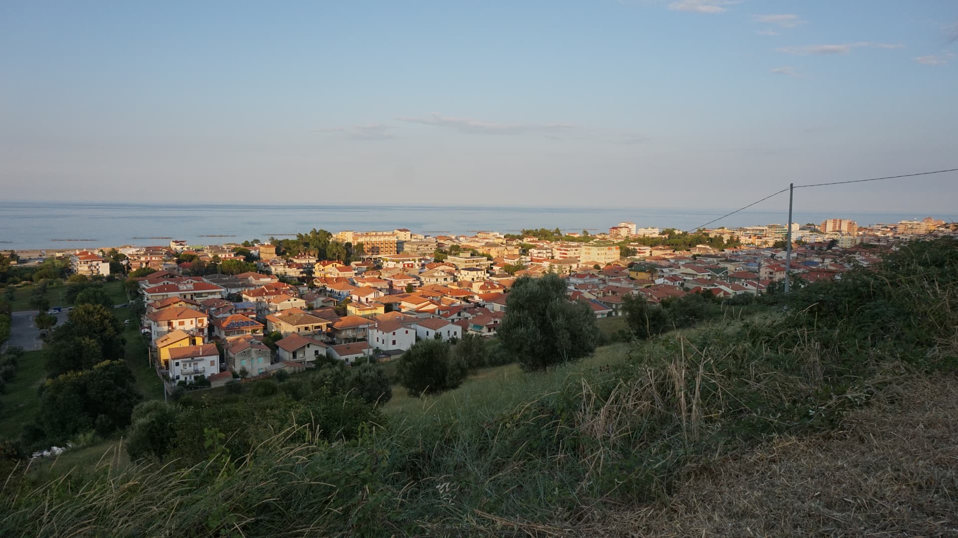
Rosolina sits at three meters above sea level at the northern edge of the Po Delta, forty kilometers south of Venice, between the Adige to the north and the Po di Levante to the south. The commune is recent: it was drained and made habitable through twentieth-century land reclamation that built channels, raised banks and pulled the land out of the lagoon. The frazione of Rosolina Mare runs nine kilometers along the Adriatic, a wide ribbon of fine sand backed by a maritime pine forest replanted in the 1950s as a windbreak.
The pines have since matured into dense woodland and the beach earned the Bandiera Blu through repeated cycles. The Isola di Albarella, five kilometers long by 1. 5 kilometers wide, is a private island bought in the 1960s and developed as a closed resort with one entry road. The Coastal Botanical Gardens and the Ca' Vendramin drainage pump museum, both classified as Sites of European Significance, document the reclamation that built the territory.
The Sunday letter
We haven’t written Rosolina’s letter yet.
One town every Sunday, with the photo, the food, the festa. Be there when this one comes up. Free, by Peter & Sophia from Pietrasanta.
By subscribing you agree to Substack’s Terms of Use, our Privacy Policy and our Information collection notice.


What to see
Rosolina Mare
Nine-kilometer Adriatic beach with fine sand and a maritime pine forest replanted in the 1950s, carrying the Bandiera Blu.
Parco regionale veneto del Delta del Po
Regional park covering nine communes from the Adige to the Po di Goro, with lagoons, valleys and bird colonies.
Giardino Botanico Litoraneo
Coastal botanical garden on the dune system, classified as a Site of European Significance for its dune and lagoon flora.
Isola di Albarella
Private island, five kilometers by 1.5, developed as a closed resort with pine woods, golf course and one gated entry road.
Museo della Bonifica Ca' Vendramin
Twentieth-century drainage pump station converted to a museum of the Po Delta reclamation, near the commune border.
The slow-trip planner
Building a trip? Find where Rosolina fits in a slow Italy circuit.
Answer five questions. We will shape a geographically coherent slow trip from the 1,000 Italian towns most travelers skip. Yours to save and share.
Living here
- Population 6,189
- Off the beaten pathi
- Pharmacy in town
- Nearest high school over ~30 minutes away
- Nearest airport Venice, 1 h 43 min drive
- Regional capital Venezia, 1 h 19 min drive
Tags & datadesignations · numbers · sources
Recognised as
The numbers
- Elevation: 3 m
- Population: 6,189
- Surface area: 74.69 km²
These figures were compiled from public directories — ISTAT, OpenStreetMap, Wikidata — and from the official listings of the guides named on this page. Town details change; verify with official sources before you travel.
Close by
More towns near Rosolina
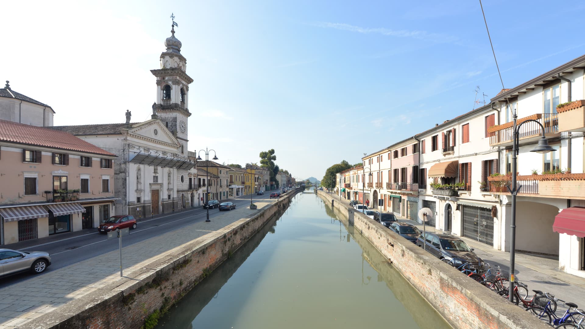
Chioggia
Province: Venezia
Italy's second fishing port, on an island at the south end of the Venetian Lagoon, called Little Venice for the Canale Vena.

Comacchio
Province: Ferrara
A canal town on thirteen islets at the edge of the Po Delta, with brackish lagoons that hold three hundred bird species.

Padova
Province: Padova
The university town that gave Giotto a chapel and the world a science of plants — TWO UNESCO inscriptions inside one city (Padua's 14th-century fresco cycles + the 1545 Orto Botanico, the world's first), plus Prato della Valle, Italy's largest piazza, and Galileo's old lecture hall.
Battaglia Terme
Province: Padova
A barge village at the foot of the Euganean Hills, built around the 1201 canal and Italy's only river navigation museum.
Abano Terme
Province: Padova
Europe's oldest thermal town on the Euganean Hills' eastern slope, where 80°C bromo-iodine springs have been drawing bathers since the eighth century BC.
🟦 Bandiera Blu
More Bandiera Blu towns
Alba Adriatica
Province: Teramo
The northernmost of the Teramo coast's seven sisters, a 1956 spin-off from Tortoreto with a fine-sand beach known as the Spiaggia d'Argento.
Giulianova
Province: Teramo
Coastal town split between hilltop Paese at 68 meters and the lido, rebuilt in 1471 as a Renaissance ideal city by Giulio Antonio Acquaviva.
Pineto
Province: Teramo
A planned twentieth-century beach town named for D'Annunzio's poem, with the sixteenth-century Cerrano tower anchoring Abruzzo's first marine protected area.
Roseto degli Abruzzi
Province: Teramo
An Adriatic beach town of 25,500 with ten kilometers of low-rise sand, a hilltop frazione at 285 meters, and Blue Flags since 1995.
Scanno
Province: L'Aquila
A 1,057-meter Sagittario valley village photographed by Cartier-Bresson and Giacomelli, where women in black still walk the same alleys as the 1957 series.