
Umbria · Perugia
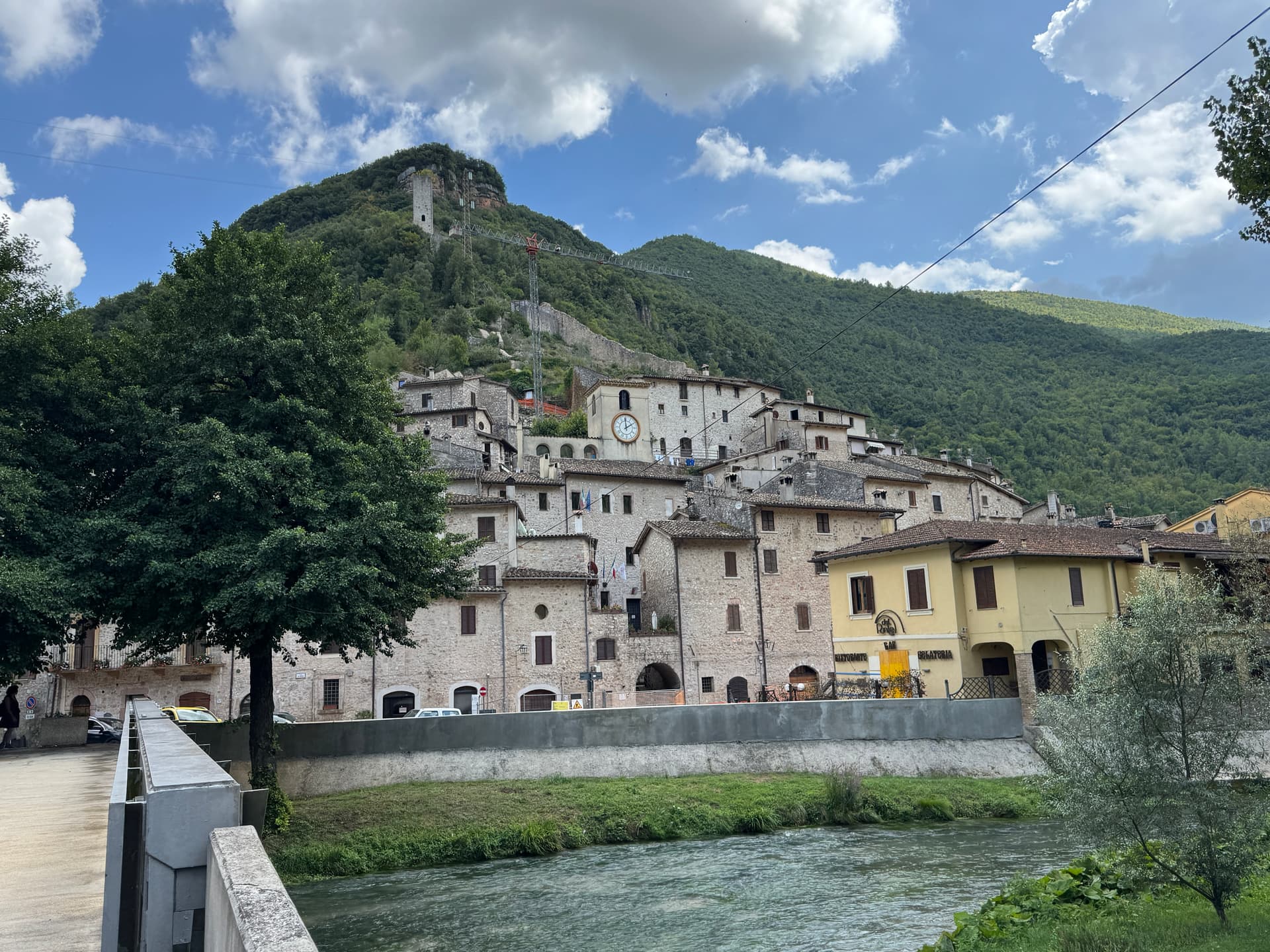
Pietralunga
A pre-Apennine hill town at 566 meters on the northeast Tiber ridge, ringed by truffle woods and white-potato fields.
Known for
TARTUFO BIANCO
Pietralunga sits in one of the densest white-truffle districts in Umbria; the October fair is the year's biggest event.
PATATA BIANCA
Pietralunga white potato grown on the upper slopes has its own consortium and is one of the products keeping local smallholders working.
ROCCA LONGOBARDA
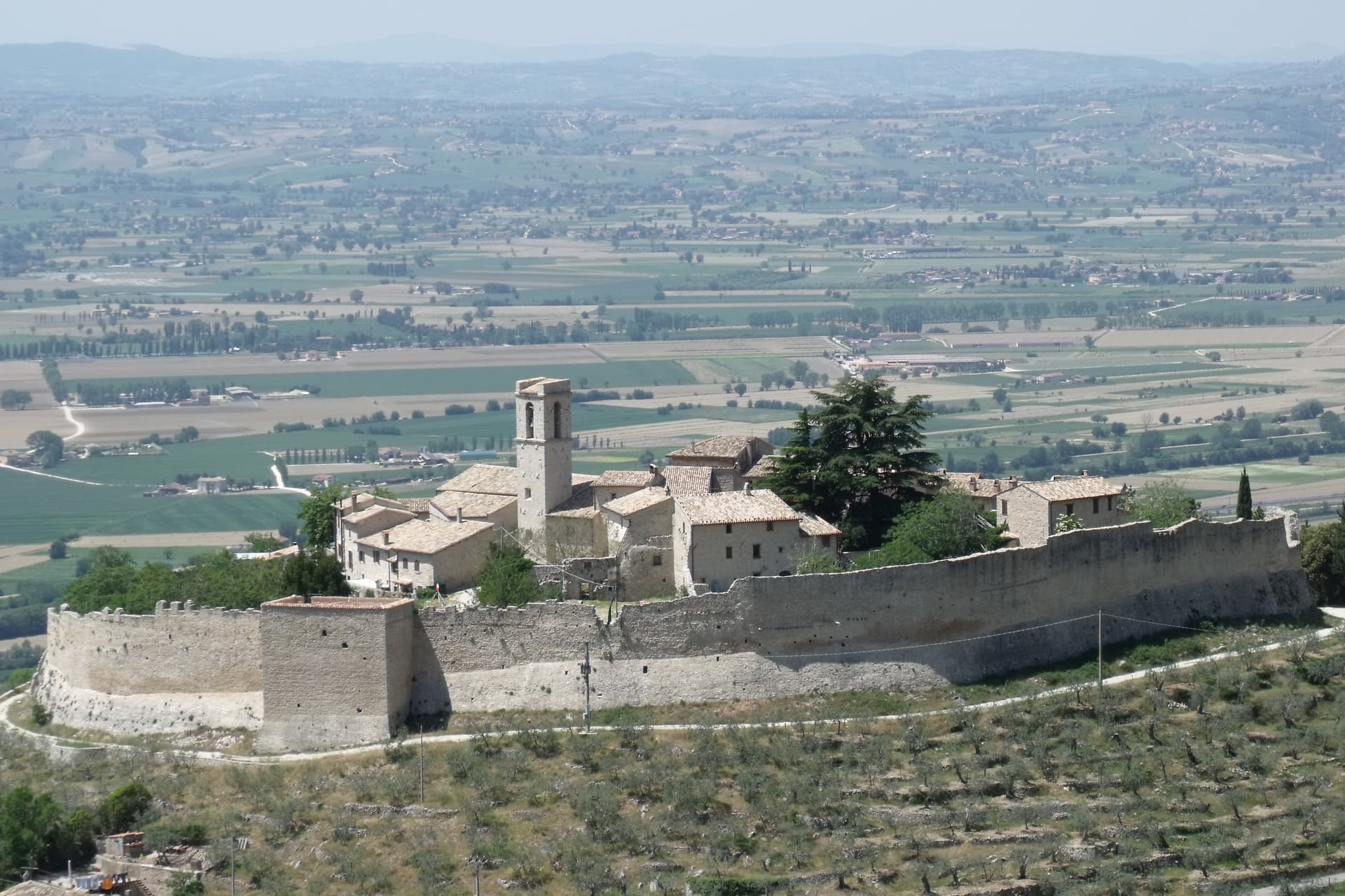
Eighth-century Lombard fortress on the highest point of the ridge, the dominating feature of the borgo since its earliest reconstruction.
When to visit
Best · Apr–Oct
- J
- F
- M
- A
- M
- J
- J
- A
- S
- O
- N
- D
- Best
- Hot or crowded
- Quiet
- Mostly closed
Why come
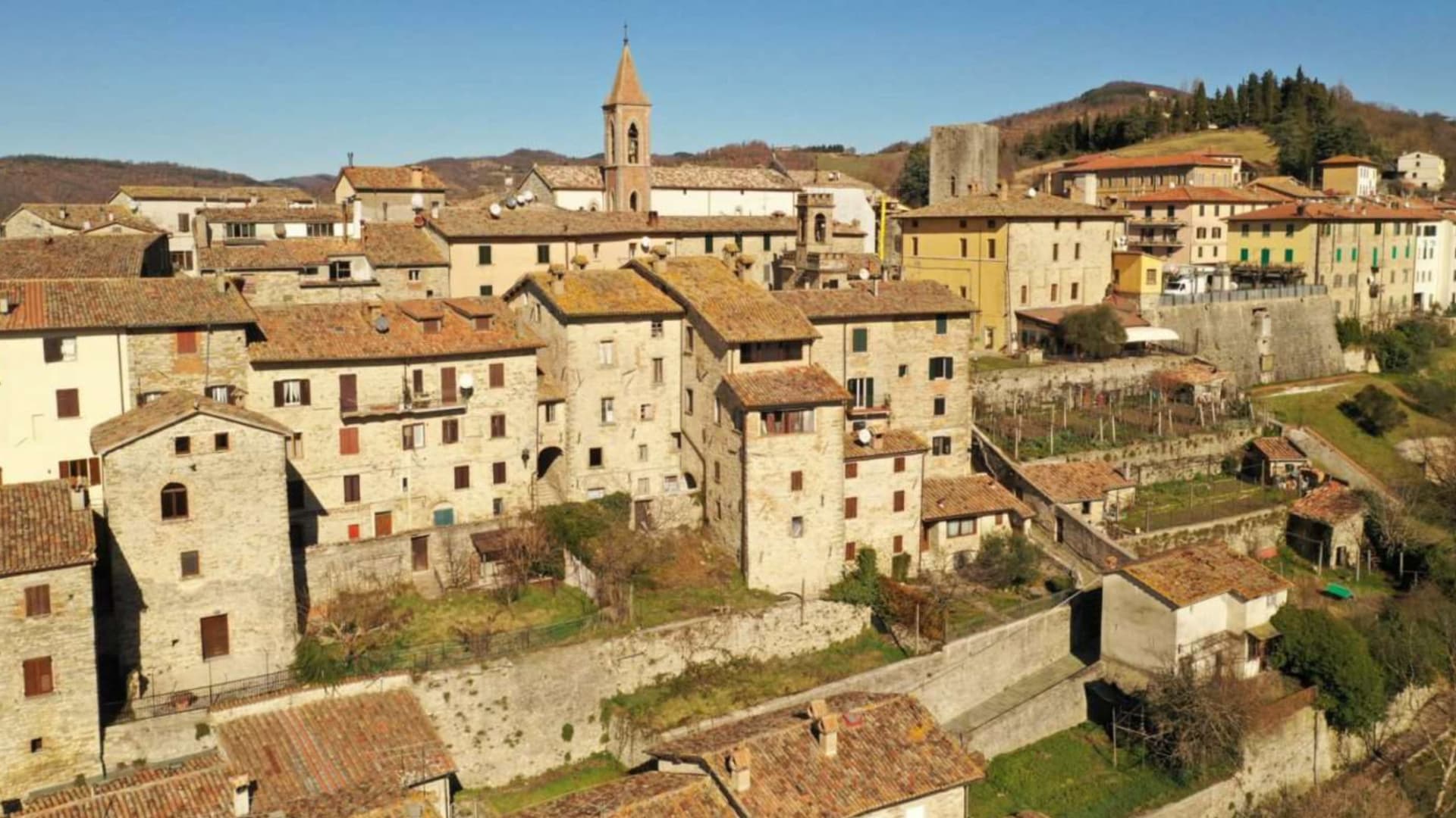
Pietralunga sits at 566 meters on a hilly ridge near the Umbria-Marche Apennines, on the northeast side of the upper Tiber. The Umbrian people founded the original settlement in the period of the Eugubine Tablets, between the second and first centuries BC. The Lombards rebuilt it as a fortified hilltop village between the sixth and eighth centuries, and the Rocca Longobarda from that era still dominates the ridge.
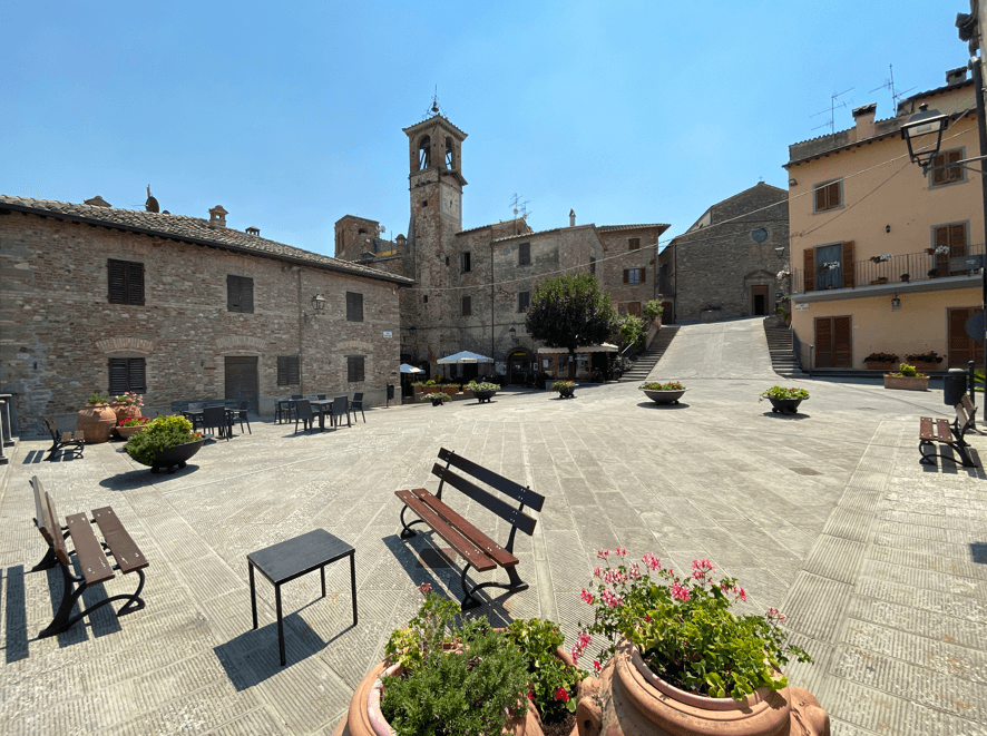
The Pieve di Santa Maria on Piazza Fiorucci dates from the seventh or eighth century in foundation, with an irregular single-nave plan and a Romanesque portal added later. The territory is one of the densest truffle districts in Umbria, with documented tartufaie in the surrounding woods and a tartufo bianco fair every October. The Pietralunga white potato, grown on the upper slopes, has its own consortium and is one of the products that have kept the smallholders in the area working.
The Sunday letter
We haven’t written Pietralunga’s letter yet.
One town every Sunday, with the photo, the food, the festa. Be there when this one comes up. Free, by Peter & Sophia from Pietrasanta.
By subscribing you agree to Substack’s Terms of Use, our Privacy Policy and our Information collection notice.

What to see
Rocca Longobarda
Eighth-century Lombard fortress dominating the borgo; the original triangular plan and central keep survive on the highest point of the ridge.
Pieve di Santa Maria
Parish church on Piazza Fiorucci with 7th-8th century foundation and a 13th-century Romanesque portal, single nave with ogive vaults inside.
Centro storico medievale
Walled Lombard core organized around the Rocca, narrow streets and stone houses radiating from Piazza Fiorucci.
Tartufaie del territorio
Truffle grounds in the woods between Pietralunga and Gubbio, producing tartufo bianco and recognized by the Città del Tartufo network.
The slow-trip planner
Building a trip? Find where Pietralunga fits in a slow Italy circuit.
Answer five questions. We will shape a geographically coherent slow trip from the 1,000 Italian towns most travelers skip. Yours to save and share.
Living here
- Population 1,984
- Off the beaten pathi
- Pharmacy in town
- Nearest high school over ~30 minutes away
- Nearest airport Ancona / Pescara, 1 h 55 min drive
- Regional capital Perugia, 1 h 0 min drive
Tags & datadesignations · numbers · sources
The numbers
- Elevation: 566 m
- Population: 1,984
- Surface area: 140.42 km²
These figures were compiled from public directories — ISTAT, OpenStreetMap, Wikidata — and from the official listings of the guides named on this page. Town details change; verify with official sources before you travel.
Close by
More towns near Pietralunga
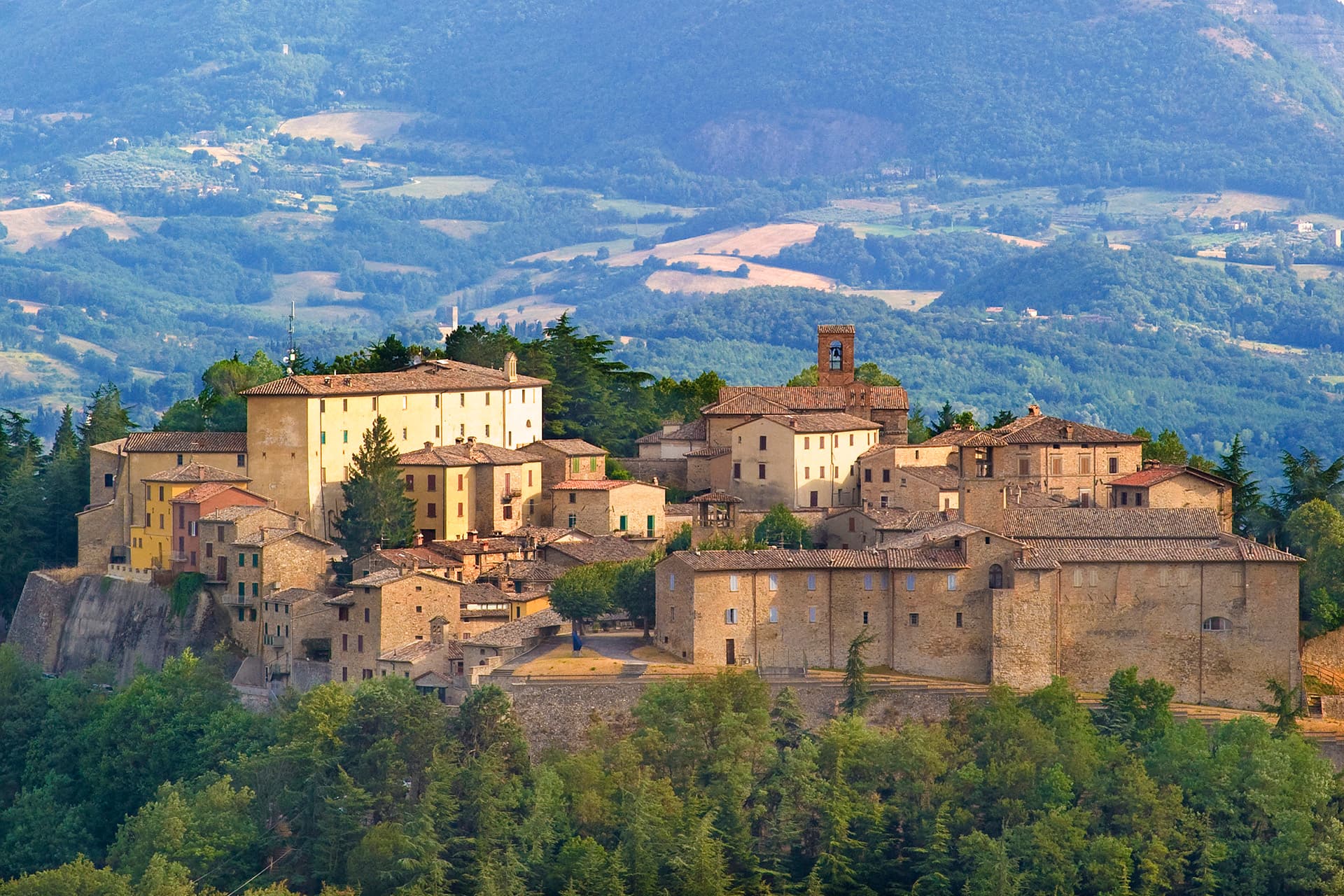
Montone
Province: Perugia
A walled medieval hill town at 482 meters above the upper Tiber, birthplace of the condottiero Braccio Fortebracci.

Città di Castello
Province: Perugia
The upper Tiber valley's Renaissance + 20th-c art capital — 38,000-resident walled town in the Alta Valtiberina where Raphael painted his first independent commissions, where Alberto Burri (1915-95) founded the Fondazione that now occupies the 14th-c Ex Seccatoi del Tabacco + the Palazzo Albizzini, and where the white truffle season + the Mostra del Tartufo in November are the year's headline food event.
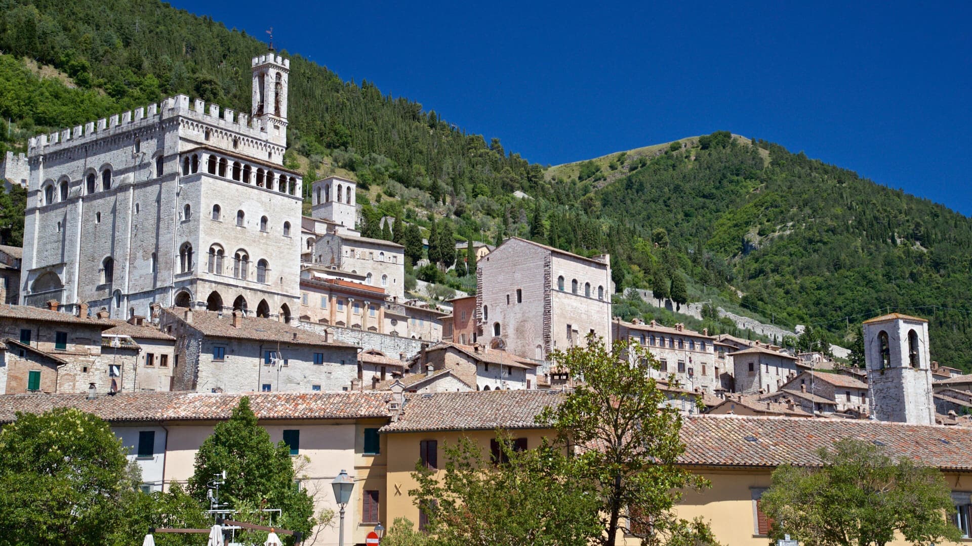
Gubbio
Province: Perugia
Pre-Roman Ikuvium of the Umbri at the foot of Monte Ingino, where seven bronze tablets carry the longest text of the Umbrian language.
Cantiano
Province: Pesaro e Urbino
A border borgo at 374 meters under Monte Catria on the old Via Flaminia, known for the Good Friday Turba and the sour-cherry visciola harvest.
Citerna
Province: Perugia
A medieval borgo at 480 meters above the upper Tiber valley, holding the only sculpture by Donatello in Umbria.
🍄 Città del Tartufo
More Città del Tartufo towns in Umbria
Campello sul Clitunno
Province: Perugia
Springs of the Clitunno and the Lombard Tempietto on the valley floor at 290 meters, the temple inscribed by UNESCO in 2011.
Cascia
Province: Perugia
Santa Rita's town at 653 meters in the upper Valnerina, in the seismic corner of Umbria that the 2016 earthquake reopened.
Norcia
Province: Perugia
Birthplace of San Benedetto at 604 meters on a Sibillini plateau, leveled by the 2016 earthquake and rebuilt stone by stone.
Scheggino
Province: Perugia
Triangular castle village on the banks of the Nera at 280 meters, where the first commercial Italian truffle company was founded in 1928.