
Sicily · Catania
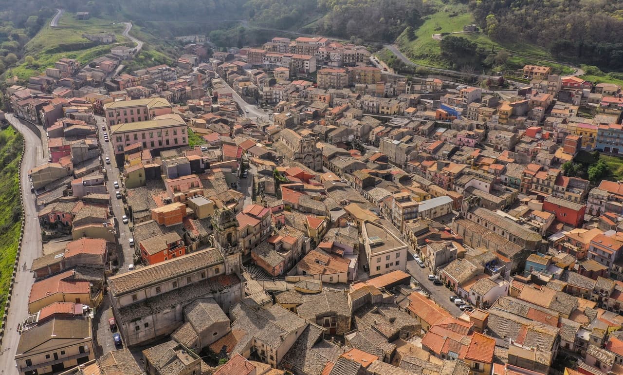
Caltagirone
Sicily's ceramic capital at 611 meters on the Erei ridge, 142 majolica-tiled steps to Santa Maria del Monte and a Val di Noto UNESCO baroque rebuild.
Known for
MAJOLICA
Sicily's first majolica center, established by Arab artisans in the tenth century; the trade survives in active workshops throughout the centro storico.
LA SCALA
142 steps from 1606, majolica-tiled in 1956; lit by four thousand oil lamps for the patron San Giacomo on 24-25 July each year.
VAL DI NOTO
Joined the UNESCO Late Baroque Towns of Val di Noto inscription in 2002 for its post-1693 reconstruction in Sicilian late-baroque style.
When to visit
Best · Apr–Jun, Sep–Nov
- J
- F
- M
- A
- M
- J
- J
- A
- S
- O
- N
- D
- Best
- Hot or crowded
- Quiet
- Mostly closed
Why come
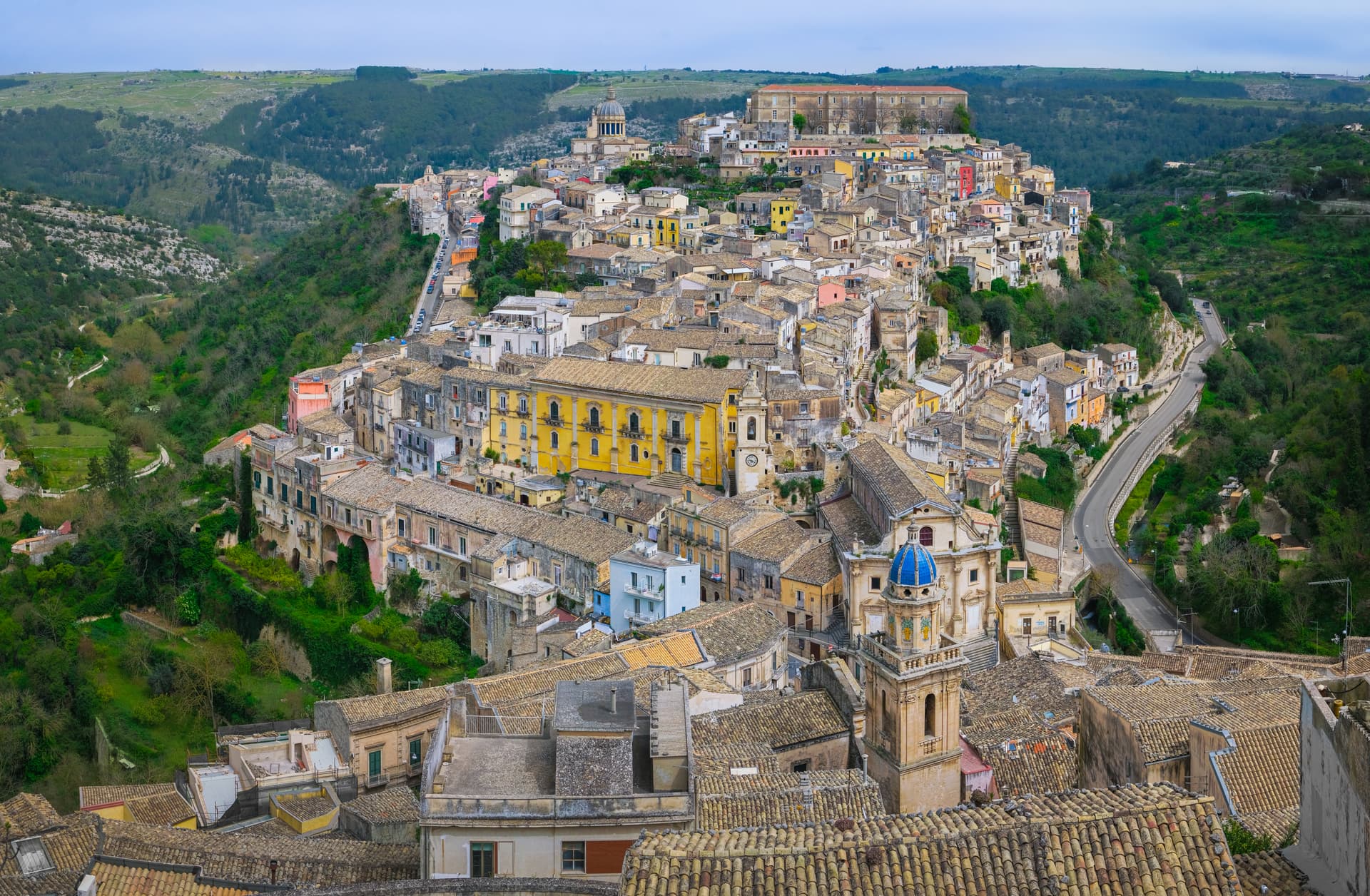
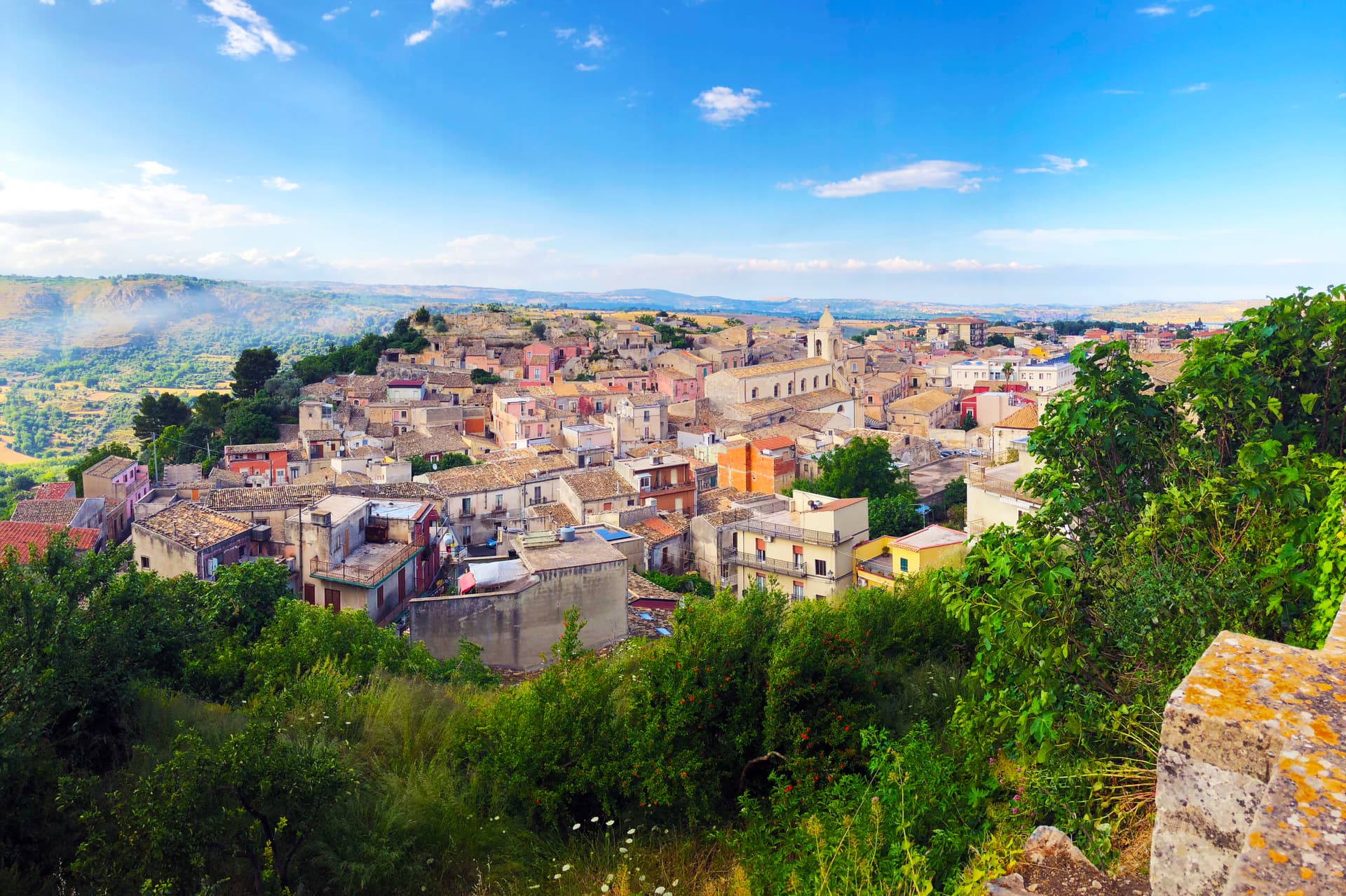
Caltagirone sits at 611 meters on the Monti Erei between the plains of Catania and Gela, sixty kilometers inland from the coast. The Arabs took the town in the tenth century and brought the glazing technique that turned local terracotta into majolica; Caltagirone became the first majolica center the North Africans established in Sicily, and the trade survived under Norman, Hohenstaufen and Aragonese rule. The 1693 Val di Noto earthquake destroyed the city.
The rebuild produced the late-baroque centro storico that joined the UNESCO Val di Noto inscription in 2002, alongside Noto, Modica, Ragusa, Scicli and three others. The 142-step Scala di Santa Maria del Monte, cut in 1606, was tiled in 1956 with majolica risers, each band a different pattern from Sicilian, Arab, Norman and Spanish design traditions. For three days every July, four thousand oil lamps line the steps for the patron San Giacomo. Ceramic workshops still operate in the old town, the trade unbroken since the Arabs.
The Sunday letter
We haven’t written Caltagirone’s letter yet.
One town every Sunday, with the photo, the food, the festa. Be there when this one comes up. Free, by Peter & Sophia from Pietrasanta.
By subscribing you agree to Substack’s Terms of Use, our Privacy Policy and our Information collection notice.

What to see
Scala di Santa Maria del Monte
142 baroque steps cut in 1606 connecting lower and upper town, tiled in 1956 with majolica risers, each band a different pattern from the city's ceramic tradition.
Cattedrale di San Giuliano
Eighteenth-century rebuild of the medieval cathedral destroyed in the 1693 earthquake; neo-baroque façade and bell tower added in the early twentieth century.
Museo della Ceramica
Regional ceramics museum at the Giardino Pubblico, tracing Caltagirone production from the prehistoric era through medieval Arab glazes to twentieth-century studios.
Palazzo Senatorio
Eighteenth-century town hall on Piazza dell'Università, central monument of the baroque rebuild after the 1693 quake.
Villa Comunale
Nineteenth-century public garden with a teatrino and majolica-tiled bandstand, designed by Giovan Battista Filippo Basile, father of Ernesto Basile.
The slow-trip planner
Building a trip? Find where Caltagirone fits in a slow Italy circuit.
Answer five questions. We will shape a geographically coherent slow trip from the 1,000 Italian towns most travelers skip. Yours to save and share.
Living here
- Population 35,765
- Off the beaten pathi
- Pharmacy in town
- High school within a 30-minute drive
- Train station in the comune
- Nearest airport Sicily, 1 h 12 min drive
- Regional capital Palermo, 2 h 49 min drive
Tags & datadesignations · numbers · sources
Recognised as
The numbers
- Elevation: 611 m
- Population: 35,765
- Surface area: 383.38 km²
These figures were compiled from public directories — ISTAT, OpenStreetMap, Wikidata — and from the official listings of the guides named on this page. Town details change; verify with official sources before you travel.
Featured on
Caltagirone appears on this themed pick from our Collections:
Close by
More towns near Caltagirone

Ferla
Province: Siracusa
A baroque village at 500 meters on the Monte Lauro slopes, the western gateway to the UNESCO necropolis of Pantalica eleven kilometers downhill.
Ragusa
Province: Ragusa
Two cities in one on a Hyblean plateau at 502 meters, Ragusa Ibla and Ragusa Superiore split by a ravine after 1693, both UNESCO Baroque.
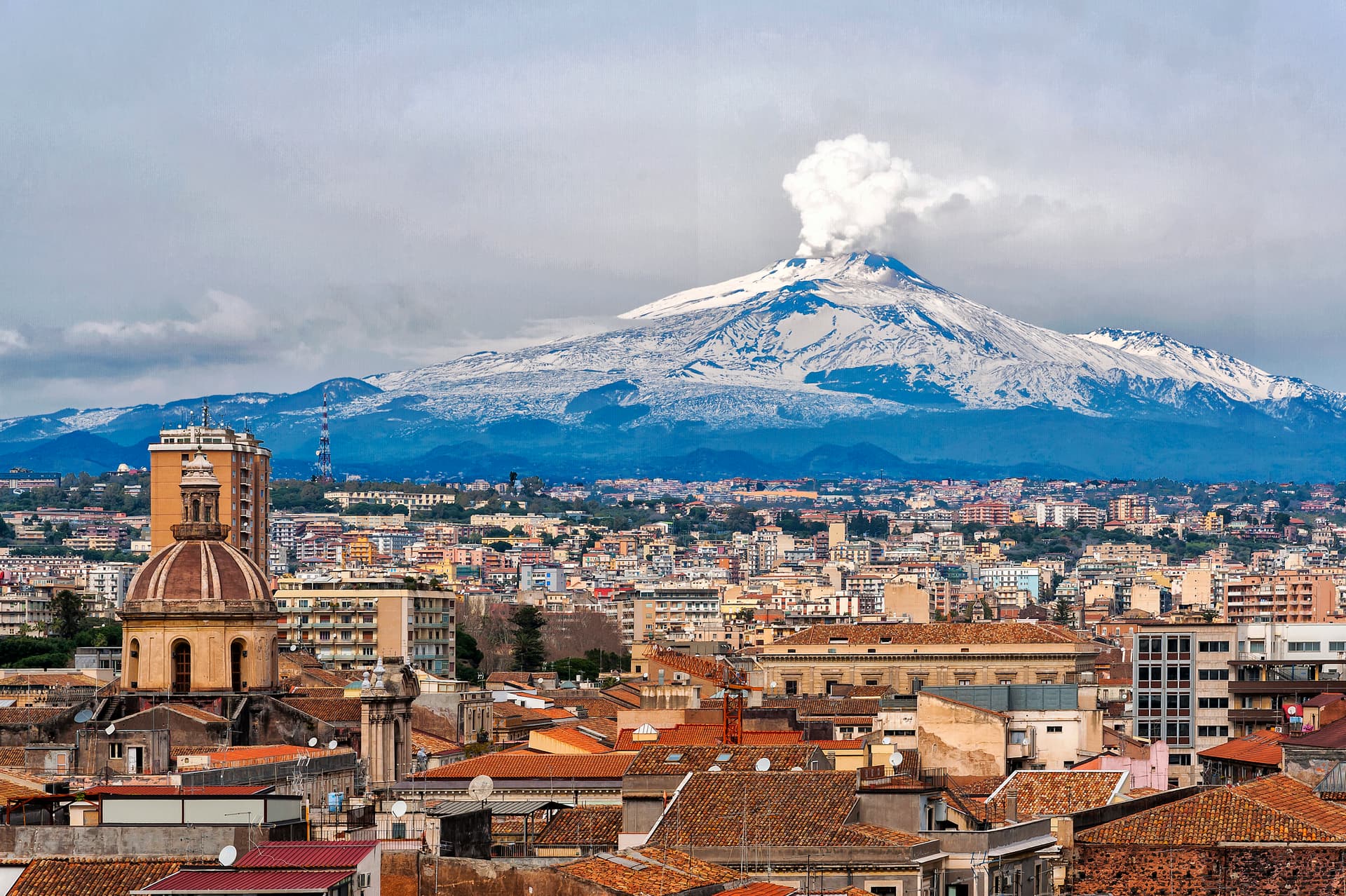
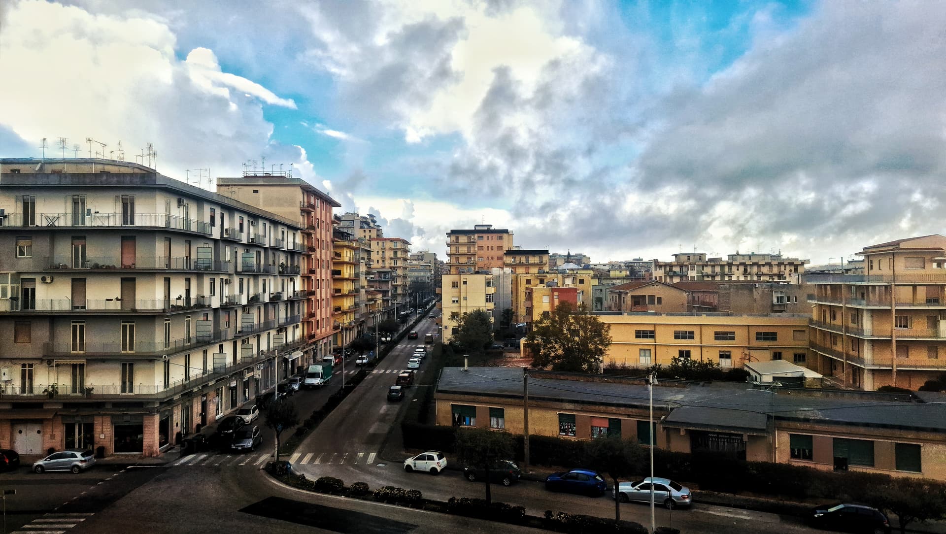
Catania
Province: Catania
Sicily's second city and the cultural anchor of the Ionian coast — a UNESCO late-Baroque centro storico rebuilt in lava-black stone after the 1693 earthquake, sitting at the foot of Etna with a 17th-century elephant fountain (U Liotru) as its civic symbol.
Palazzolo Acreide
Province: Siracusa
The Iblei plateau's UNESCO Baroque + Greek twin — 8,000-resident hilltop town at 670m, founded over the Greek Akrai colony (664 BC), rebuilt entirely in late Baroque after the 1693 earthquake (inscribed on the Val di Noto UNESCO listing 2002), with the original Greek theatre + the unique Santoni rock carvings of Cybele just outside the modern centro.
Buccheri
Province: Siracusa
The highest village in the province of Syracuse at 820 meters on Monte Lauro, world capital of Tonda Iblea olive oil at the 2015 Sol d'Oro.
🏛️ UNESCO
More UNESCO towns in Sicily
Cefalù
Province: Palermo
A Norman cathedral at the foot of a 270-meter rock on the Tyrrhenian coast, founded by Roger II in 1131 and on the UNESCO Arab-Norman list since 2015.
Lipari
Province: Messina
The largest Aeolian island and the only municipality that administers six of the seven, with a clifftop castle citadel rising above two harbors.
Modica
Province: Ragusa
A vertical Baroque city in the Hyblean Mountains, rebuilt from the 1693 earthquake and home to a chocolate recipe brought from Aztec Mexico.
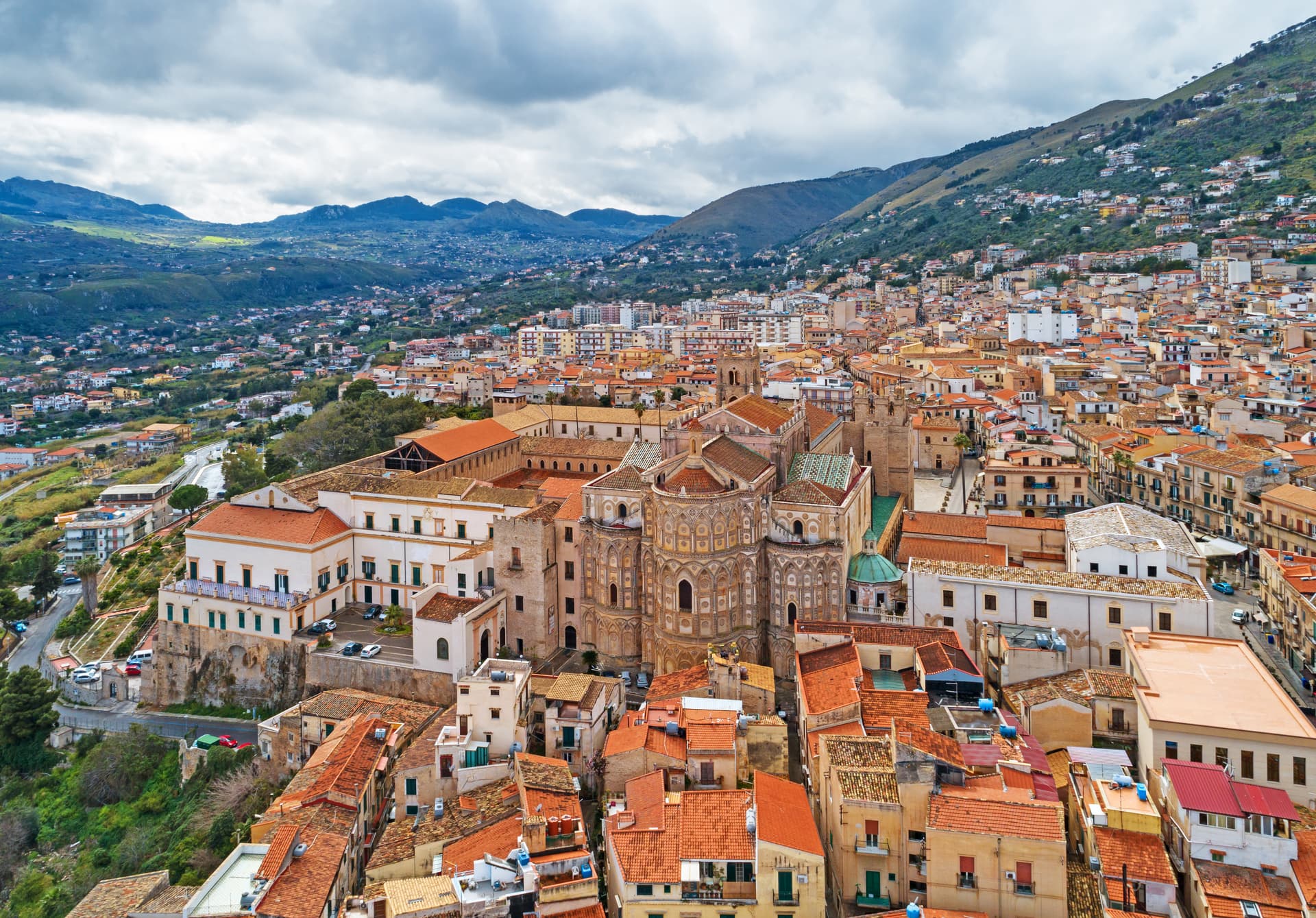
Monreale
Province: Palermo
Above the Conca d'Oro at 310 meters, the cathedral William II built between 1174 and 1182 holds 6,340 square meters of Norman mosaics.
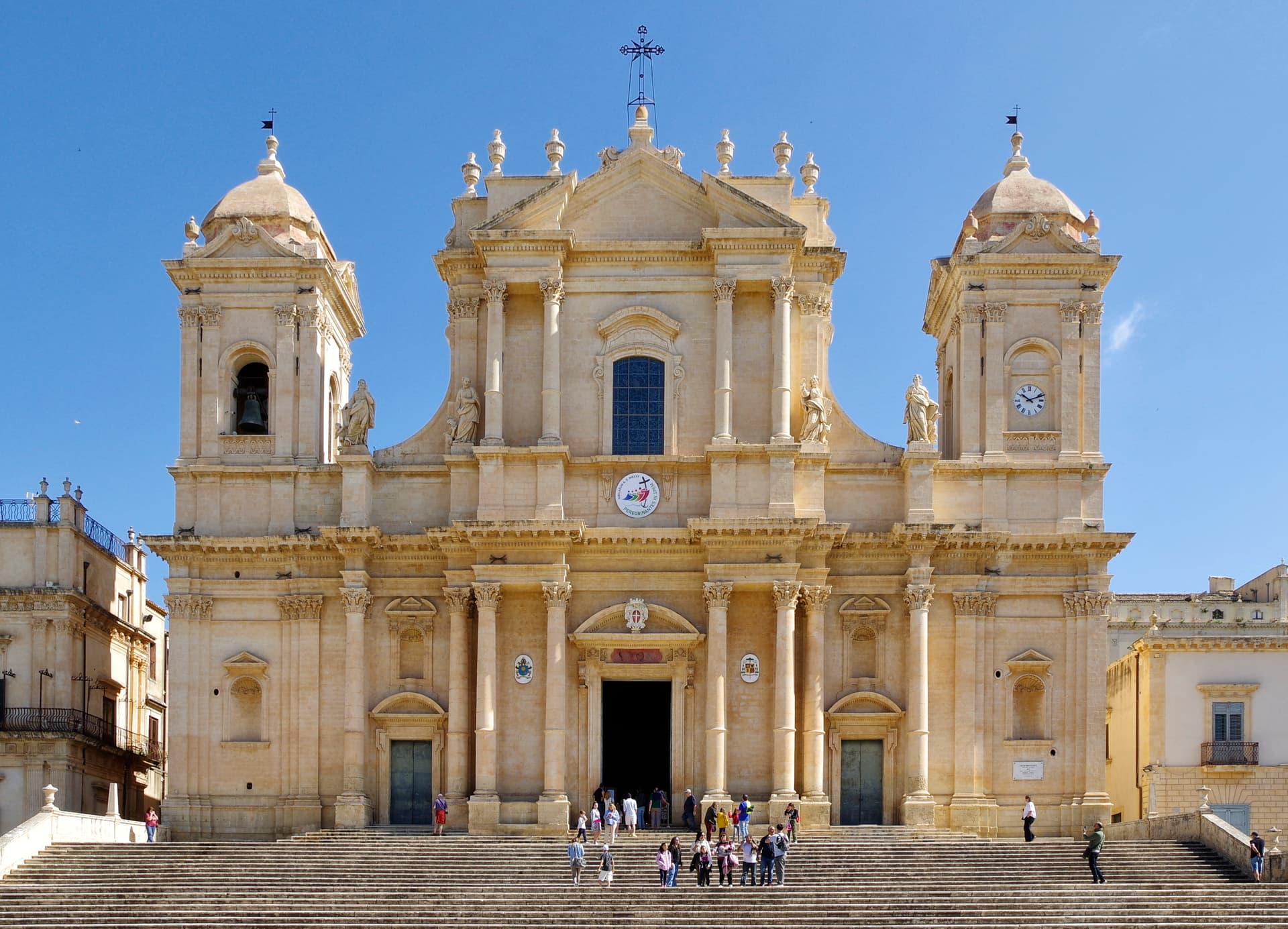
Noto
Province: Siracusa
The capital of Sicilian Baroque, rebuilt in golden limestone after 1693 and the UNESCO showcase for the Late Baroque Towns of the Val di Noto.