
To eat well
Where to eat well in Umbria
28 towns
Towns holding at least one place a guide put its name to. The ones several guides agree on come first.
The towns
- Written about. No. 83.
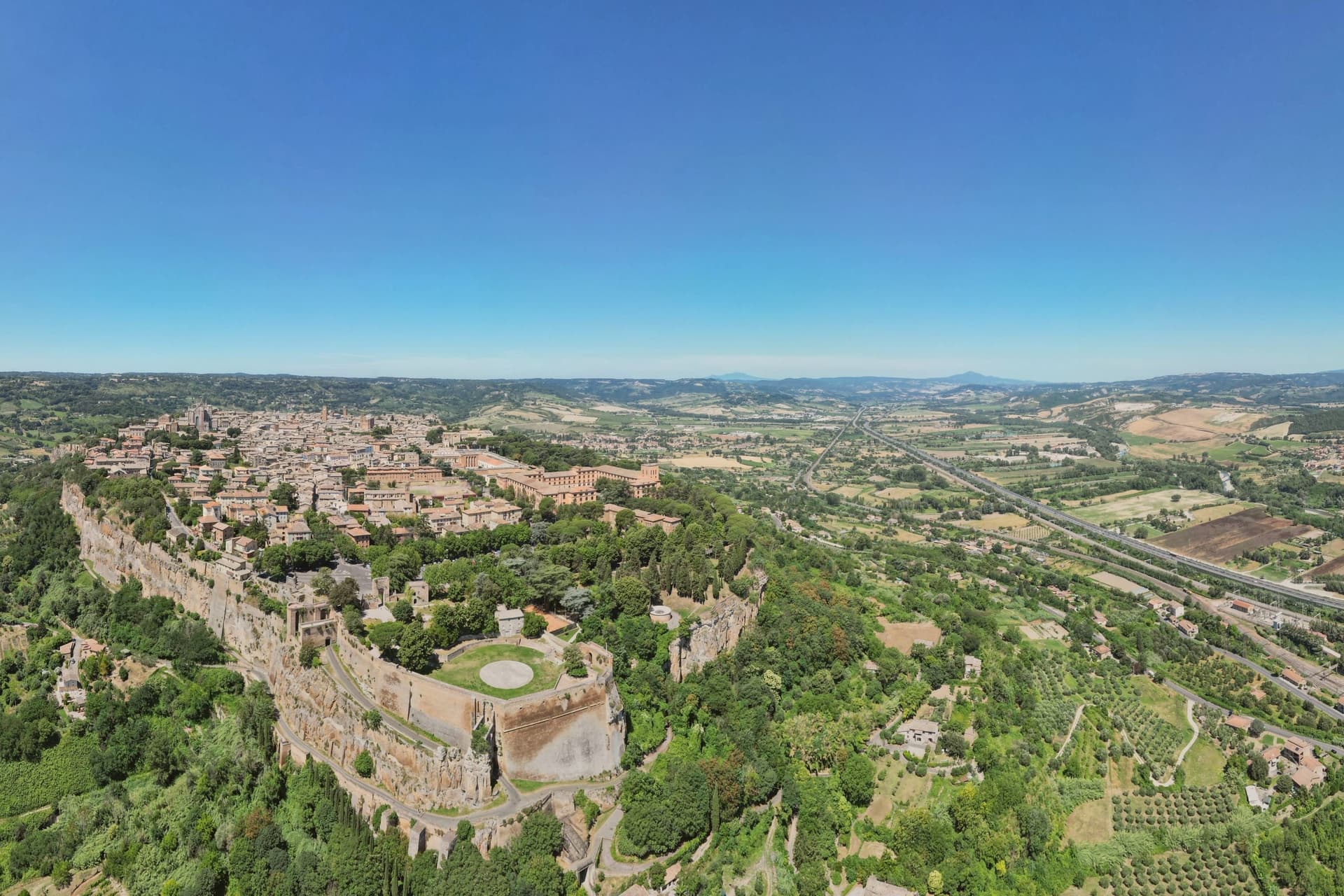
Orvieto
Province: Terni · 325 m
Etruscan Velzna on a 325-meter tufa butte, later a medieval refuge of popes.
- Written about. No. 87.
Spoleto
Province: Perugia · 396 m
Lombard ducal capital at 396 meters under the Rocca Albornoziana, where a 230-meter aqueduct bridge crosses to Monteluco and Menotti founded the Festival in 1958.
- Written about. No. 79.
Foligno
Province: Perugia · 235 m
A valley town at 235 meters on the Topino, where Dante's Divine Comedy was first printed in 1472.
Norcia
Province: Perugia · 604 m
Birthplace of San Benedetto at 604 meters on a Sibillini plateau, leveled by the 2016 earthquake and rebuilt stone by stone.
Bevagna
Province: Perugia · 225 m
Roman Mevania on the Umbrian plain at 225 meters, four medieval quarters that compete every June in a reconstructed market of the 13th century.
Montone
Province: Perugia · 482 m
A walled medieval hill town at 482 meters above the upper Tiber, birthplace of the condottiero Braccio Fortebracci.
- Written about. No. 81.
Montefalco
Province: Perugia · 472 m
The hilltop wine capital of Umbria at 472 meters, where Sagrantino is grown almost nowhere else.
- Written about. No. 91.
Gubbio
Province: Perugia · 522 m
Pre-Roman Ikuvium of the Umbri, where seven bronze tablets carry the longest text of the Umbrian language.
- Written about. No. 62.
Assisi
Province: Perugia · 424 m
A pink limestone town at 424 meters on the western flank of a mountain above the plain, the birthplace of Francis and a UNESCO site since 2000.
Corciano
Province: Perugia · 408 m
A walled medieval castello at 408 meters eight kilometers west of Perugia, where, by tradition, Saint Francis stopped on his way back from a Lent spent fasting on Isola Maggiore.
- Written about. No. 61.
Passignano sul Trasimeno
Province: Perugia · 289 m
A near-peninsula on the northern shore of Lake Trasimeno, on the road Hannibal closed when he ambushed the Romans in 217 BC.
- Written about. No. 88.
Terni
Province: Terni · 130 m
Umbria's second city, rebuilt around its steelworks, home of Saint Valentine and seven kilometers from the Cascata delle Marmore.
- Written about. No. 89.
Torgiano
Province: Perugia · 219 m
A walled river town at 219 meters at the confluence of the Tiber and the Chiascio, the first DOC and DOCG zone in Umbria.
- Written about. No. 59.
Castiglione del Lago
Province: Perugia · 304 m
Trasimeno's western promontory, once the lake's fourth island, fortified in 1247 and later frescoed for a marquis of Corgna.
- Written about. No. 85.
Panicale
Province: Perugia · 431 m
A walled hill town at 431 meters on Monte Petrarvella, where a 1505 Perugino fresco covers the back wall of San Sebastiano.
- Written about. No. 75.
Amelia
Province: Terni · 406 m
A pre-Roman hilltown ringed by polygonal walls, with ten barrel-vaulted Roman cisterns beneath its main square.
Arrone
Province: Terni · 243 m
Medieval castle village on the left bank of the Nera at 243 meters, upstream from the largest man-made waterfall in the world.
Città di Castello
Province: Perugia · 288 m
A walled town of 38,000 in the upper Tiber valley where Raphael painted his first independent commissions and the white truffle season is the year's headline food event.
Deruta
Province: Perugia · 218 m
A hill town at 218 meters on the left bank of the Tiber, the maiolica capital of central Italy since the late thirteenth century.
- Written about. No. 60.
Magione
Province: Perugia · 299 m
A hill town east of Trasimeno built around a medieval Order's fortified base.
Massa Martana
Province: Perugia · 351 m
One of the Borghi più belli d'Italia on the Via Flaminia, a 3,577-resident borgo on the original Roman consular road between Rome and Rimini, with the intact 9th-c Abbazia dei Santi Fidenzio e Terenzio above town, a network of Roman-era catacombe Cristiane (Catacombe di Villa San Faustino, the only ones in Umbria), and the Borghi più belli inscription restored after the 1997 Marche-Umbria earthquake.
Preci
Province: Perugia · 596 m
A walled Valnerina village at 596 meters that ran Europe's leading school of surgery for three centuries until the 2016 quake brought the borgo down.
San Gemini
Province: Terni · 337 m
A medieval borgo at 337 meters above ancient Roman paving, four kilometers below the ruins of Carsulae.
Sellano
Province: Perugia · 641 m
A medieval village in the upper Valnerina at 641 meters, twice flattened by earthquakes, now linked to Montesanto by Europe's highest pedestrian suspension bridge.
Spello
Province: Perugia · 280 m
Augustan Hispellum sits at 280 meters on Monte Subasio, its Roman gates still standing over streets that Pinturicchio once painted a chapel for.
Stroncone
Province: Terni · 451 m
A walled medieval borgo at 451 meters eight kilometers south of Terni, with a Franciscan convent traditionally founded by Francis himself in 1213.
- Written about. No. 72.
Todi
Province: Perugia · 398 m
A walled hill town at 398 meters on the Tiber, with Etruscan, Roman, and medieval rings stacked one above the other.
- Written about. No. 90.
Trevi
Province: Perugia · 412 m
A walled town at 412 meters above the Spoleto valley, ringed by 200,000 olive trees that make it the Umbrian capital of olive oil.
From elsewhere in Italy
Five more towns
Oria
Province: Brindisi
A Messapian acropolis between Taranto and Brindisi crowned by Frederick II's triangular castle, home to one of medieval Europe's oldest Jewish communities.
Lucignano
Province: Arezzo
A walled elliptical hill town at 400 meters between Siena and Arezzo, planned in medieval concentric rings around the goldsmith's reliquary called the Tree of Life.
Lampedusa e Linosa
Province: Agrigento
Italy's southernmost comune, three islands on the African continental shelf, closer to Tunisia than to Sicily.
Casale Monferrato
Province: Alessandria
The historic capital of the Marchesato del Monferrato at 116 meters on the Po, where the Paleologi castle and the Baroque synagogue still stand.
Murlo
Province: Siena
A medieval bishops' fief twenty kilometers south of Siena, with an Etruscan princely palace on Poggio Civitate and the Cappellone statue as its symbol.